Dr Rajiv Desai
An Educational Blog
DRONE
DRONE:
_
Section-1
Prologue:
The term “Drone” has been massively overused; most of you have surely seen it time and time again in news and media articles. This term can range from small and cheap hobby aircraft available at Amazon all the way to multimillion weapons systems used on battlefields. Drone is a general term, not a technical one. They are generally equated with unmanned aerial vehicles (UAVs). UAVs can be controlled remotely or autonomously. When we speak about drones, we think about a battlefield, destruction, and death. This is because of the fact that the drones have been conventionally used by the armed forces to drop bombs and destroy enemy targets. These are called the military drones. According to the Bureau of Investigative Journalism, there have been at least 14,040 confirmed drone strikes between Jan. 2002 and Jan. 2019. UAVs are an emerging technology known for their role in military applications. While U.S. drone strikes in Afghanistan have captured public attention, the United States does not have a monopoly on drones. Today, over 90 nations and non-state groups are known to operate drones, including at least 30 countries that either operate or are developing armed drones. As this technology continues to proliferate, simple weaponized drones carrying explosives or chemical or biological agents will be increasingly within the reach of virtually any state, non-state actor, or individual. If used in large numbers, these systems could potentially enable states, non-state groups, and individuals to achieve overmatch against a significantly more capable adversary. The drone attack claimed by Yemeni rebels on key Saudi Arabian oil refineries that took place on September 14, 2019 has disrupted roughly 5% of the world’s oil supply and contributed to the overarching negative connotations the word “drone” conjures.
An unmanned aerial vehicle (UAV), commonly known as a drone, is an aircraft without any human pilot, crew or passengers on board. UAVs are a component of an unmanned aircraft system (UAS), which include additionally a ground-based controller and a system of communications with the UAV. The flight of UAVs may operate under remote control by a human operator or with various degrees of autonomy, such as autopilot assistance, up to fully autonomous aircraft that have no provision for human intervention. A UAV is capable of controlled, sustained level flight and is powered by a jet, reciprocating, or electric engine. Autonomous or remotely controlled flight in confined spaces presents great scientific and technical challenges owing to the energetic cost of staying airborne and to the perceptual intelligence required to negotiate complex environments. In the twenty first century technology reached a point of sophistication that the UAV is now being given a greatly expanded role in many areas of aviation. A UAV differs from a cruise missile in that a UAV is intended to be recovered after its mission, while a cruise missile impacts its target. A military UAV may carry and fire munitions on board, while a cruise missile is a munition.
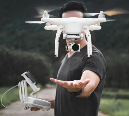
Drone carrying camera units inside them are more useful for commercial as well as military applications and they are being developed by almost all top companies in the world. It is a combination of all advanced technologies like micro controllers, GPS, Wi-Fi and sensor units- they all work in perfect coherence to deliver awesome performance for different applications. The different types of drones can be differentiated in terms of the type (fixed-wing, multirotor, etc.), the degree of autonomy, the size and weight, and the power source. These specifications are important, for example for the drone’s cruising range, the maximum flight duration, and the loading capacity. Aside from the drone itself (i.e., the ‘platform’) various types of payloads can be distinguished, including freight (e.g., mail parcels, medicines, fire extinguishing material, flyers, etc.) and different types of sensors (e.g., cameras, sniffers, meteorological sensors, etc.). In order to perform a flight, drones have a need for (a certain amount of) wireless communication with a pilot on the ground. In addition, in most cases there is a need for communication with a payload, like a camera or a sensor. To allow this communication to take place frequency spectrum is required. The requirements for frequency spectrum depend on the type of drone, the flight characteristics, and the payload. Since frequency spectrum does not end at national borders, international coordination on the use of frequency spectrum is required. The trend is for drones to become smaller, lighter, more efficient, and cheaper. As a result, drones are increasingly available to the public at large and will be used for an increasing range of purposes. Drones have become increasingly autonomous and also more capable of operating in swarms.
More recently, the potential use of UAVs as tools in civilian environments has gained significant attention in domains such as agriculture, forestry, archaeology, architecture, mapping, commerce. communication, surveillance, medical supply, disaster mitigation, law enforcement, environment and construction. They are increasingly being used for civilian and commercial purposes for the delivery of smaller items to locations with difficult access. On October 4, 2021, for the first time in India and South East Asia, an Indian-made drone delivered a Covid vaccine shot to the remote Karang island inside the Loktat lake in Manipur. Made by Helicam India, the helicopter drone covered an aerial distance of over 15 kms from Bishnupur district hospital to the Karang island in 15 minutes. China built a hospital in record time, using drones to light up the areas where construction was happening 24×7. Drone images captured on December 11, 2021 showed widespread destruction after tornadoes swept United States. The West Bengal CID is using drones to spot areas in the state where cannabis and poppy seeds are being grown illegally, mostly in districts having international borders, to end the cultivation of narcotics in West Bengal. Recreational or hobbyist uses of drones includes flying for enjoyment or educational use (class project, for example). Inevitably, such a wide spread use of drones can bring alarming concerns, such as privacy, security, safety, insurance liability, and accountability where drones are misused. These key concerns must be addressed to as soon as possible, otherwise their illegal and malicious uses will rise in the absence of exhaustive regulation.
_____
_____
Note:
Physics of flight is discussed in detail in the article ‘Plane Crash’ and therefore not discussed here.
______
______
Abbreviations, synonyms and glossary:
ARNS = Aeronautical radio navigation service
ARNSS = Aeronautical radio navigation satellite service
ATC = Air traffic control
ATM = Air traffic management
ATS = Air traffic services
CAA= Civil Aviation Authority
CPDLC = Controller-pilot data link communications
EASA = European Aviation Safety Agency
EUROCAE = European Organisation for Civil Aviation Equipment
ICAO = International Civil Aviation Organization
ITU = International Telecommunication Union
SATCOM = Satellite communication
GCS = Ground Control Station
HTOL = Horizontal Take-Off and Landing
HALE = High altitude, long endurance
LEMV = Long Endurance Multi-Intelligence Vehicle
FAA = Federal Aviation Administration
MALE = Medium Altitude Long Endurance
COTS = Commercial off-the-shelf
IED = Improvised explosive device
UGV = Unmanned ground vehicle
UUV = Unmanned underwater vehicles
LiDAR = Light Detection and Ranging
DARPA = Defense Advanced Research Projects Agency
UCAV = Unmanned combat aerial vehicles
LAWs = Lethal autonomous weapon system
CUAS = Counter-UAS
s-UAS Small unmanned aircraft systems
RTK = Real-Time Kinematic
UAV = Unmanned aerial vehicle = A remotely controlled plane, multicopter, helicopter, Zeppelin, or blimp.
UA = Unmanned aircraft = An aircraft which is intended to operate with no pilot on board = UAV
UAS = Unmanned aircraft system = An unmanned aircraft system includes a UAV, ground control stations, data links, and other support equipment.
Remote pilot = The person who manipulates the flight controls of a remotely-piloted aircraft during flight time.
Remote pilot station = The station at which the remote pilot manages the flight of an unmanned aircraft.
Remotely-piloted = Control of an aircraft from a pilot station which is not on board the aircraft.
RC aircraft = A radio-controlled aircraft (often called RC aircraft or RC plane). The key difference between radio controlled and remote controlled toy is that remote controlled toys have a wire connecting the controller and the toy, while radio control is always wireless.
RPA = Remotely-piloted aircraft = An aircraft where the flying pilot is not on board the aircraft.
RPAS = Remotely-piloted aircraft system = A set of configurable elements consisting of a remotely-piloted aircraft, its associated remote pilot station(s), the required command and control links and any other system elements as may be required, at any point during flight operation.
RPA observer = A remote crew member who, by visual observation of the remotely-piloted aircraft, assists the remote pilot in the safe conduct of the flight.
C2 = Command and control
C3 = Command, control and communications
Segregated airspace = Airspace of specified dimensions allocated for exclusive use to a specific user(s).
VLOS = Visual line-of-sight operation = An operation in which the remote crew maintains direct visual contact with the aircraft to manage its flight and meet separation and collision avoidance responsibilities.
BVLOS = beyond visual line of sight
BEC = Flight controllers can be powered directly by a battery using an inbuilt voltage regulator known as a battery eliminator circuit.
Blimp = A non-rigid airship that has no internal structure, like a zeppelin. The lifting gas (usually helium) contains pressure inside the envelope. The envelope itself and the lifting gas build the shape and ensure stability.
ESC = The motors onboard a UAV are controlled by an electronic speed controller.
FailSafe = The FailSafe is a mechanism to control the UAV in the event of a connection crash or if the battery reaches a critical voltage.
FC = The flight controller is the heart of every UAV and includes a microprocessor and an array of sensors to control most of the electrical onboard components.
FPV = The first-person view is a method used to control a UAV from the pilot’s point of view using a camera system and a live datalink of the video signal. When it comes to flying an FPV drone, essentially this means that pilots of FPV drones see what the drone sees. Traditional drones differ from this as they are piloted through the pilot’s perspective on the ground. With FPV, it is instead piloted through the perspective of the drone, not the pilot, via an onboard camera.
GCU = The gimbal control unit uses the data from the FC to control the movements of the gimbal. The term is used for DJI drones.
Gimbal = A gimbal is a pivoted support that enables the rotation of an object around a single axis. Generally, gimbals used for drones have three axes.
GPS = The global positioning system providing the geolocation of an object.
IOC = Intelligent orientation control is a system for changing the method of controlling the pitch and roll axles of the drone. Usually, there are three different methods with different coordinate systems.
OSD = The telemetry data of the drone can be overlayed to the FPV video signal, and the term stands for on-screen display.
PDB = The power distribution board distributes the power supply of the battery to the individual electronic speed controllers.
PID = The drone is controlled by a software control loop running on the flight controller. These calculus terms are proportional, integral, and derivative and serve to stabilize the UAV.
PMU = The power management unit manages and controls the power onboard. The term is used for DJI drone
VTOL = An aerial vehicle that can perform vertical take-off and landing. The term can be used for multicopters and helicopters.
VTX = To save weight, some flight controllers have a video transmitter integration.
Blimp-plane-drone = A blimp that has rotating wings with propellers and an extended tail.
UAV-VTOL-fixed-wing = A combination of a plane and a drone, mostly built with five motors—one for wing-flight and four for hovering.
DJI = Da-Jiang Innovations is a Chinese technology company and the world leader in drone technology with about 70% of the market share worldwide.
ISR = intelligence, surveillance and reconnaissance
_______
_______
Terminology of drone:
Many terms are used for aircraft which fly without any persons on board. When it comes to the different flying objects that you can control remotely, terms such as drones, UAV, and UAS have been thrown around quite frequently.
Drone:
If you were to technically define what a drone is, any vehicle can actually be a drone as long as it can travel autonomously without the help of humans. In that regard, vehicles that can travel in air, sea, and land can be considered drones as long as they don’t need human intervention to travel. So, the fact of the matter is that anything that is unmanned and has no pilot or driver inside can be considered a drone as long as it can still function autonomously or remotely. Even a plane, boat, or car that is remotely controlled by a human being in a different location, can be considered a drone. The important part is that the vehicle doesn’t have human piloting or driving it inside. A UAV is narrowed down version of a drone in the sense that it only covers unmanned aerial vehicles and objects. So, in that regard, any UAV is a drone but not all drones are UAVs. The term drone is commonly used to refer to remotely or autonomously guided aircraft. This term also describes various vehicles including submarines or land-based autonomous vehicles. The word “drone” is popularly used to describe those flying objects that we tend to control remotely from a different location. These drones are commercially sold and they have cameras that can also be remotely controlled.
The term drone has been used from the early days of aviation, being applied to remotely-flown target aircraft used for practice firing of a battleship’s guns, such as the 1920s Fairey Queen and 1930s de Havilland Queen Bee. Later examples included the Airspeed Queen Wasp and Miles Queen Martinet, before ultimate replacement by the GAF Jindivik. The term remains in common use.
UAV:
The acronym UAV stands for the unmanned aerial vehicle, which is very much similar to what a drone is in terms of what the definition means. So, basically, a UAV is anything that can fly aerially but is unmanned in the sense that it doesn’t have a pilot controlling it from the inside.
An unmanned aerial vehicle (UAV) is defined as a “powered, aerial vehicle that does not carry a human operator, uses aerodynamic forces to provide vehicle lift, can fly autonomously or be piloted remotely, can be expendable or recoverable, and can carry a lethal or nonlethal payload”. UAV is a term that is commonly applied to military use cases but missiles with warheads are not considered UAVs because the vehicle itself is a munition. The relation of UAVs to remote controlled model aircraft is unclear. UAVs may or may not include model aircraft. For recreational uses, a drone (as opposed to a UAV) is a model aircraft that has first-person video, autonomous capabilities, or both. Some jurisdictions base their definition on size or weight; however, the US FAA defines any uncrewed flying craft as a UAV regardless of size. In addition to the software, autonomous drones also employ a host of advanced technologies that allow them to carry out their missions without human intervention, such as cloud computing, computer vision, artificial intelligence, machine learning, deep learning, and thermal sensors.
A UAV can fly remotely/autonomously using a controller, mobile phone, computer or even a tablet. They are characterised by their autonomous flight capabilities and ability to operate over long distances with a secure live feed transmission. Moreover, UAVs control can be classified and divided into three main categories:
- Remote Pilot Control: known as operator static automation, where all decisions are made by a human remote operator.
- Remote Supervised Control: known as adaptive automation. It offers the drones the ability to launch and carry out a given mission process independently, while allowing for human intervention, if needed.
- Full Autonomous Control: known as system static automation, where drones can make all required decisions for a successful mission completion, without the need for any human intervention.
Moreover, the term UAV only refers to the aircraft itself as we are now excluding all of the other accessories that make up an entire drone system or any other equipment that can help the UAV work. This is an important part of what defines a UAV because this is where we draw the line between what a UAV is in comparison to what a UAS is.
UAS:
When we are referring to a UAS, we are now actually talking about the whole system of the vehicle and its components and controller and its components. That’s because UAS stands for the unmanned aerial system, which is pretty easy to define and understand on its own. So, when we are talking about UAS, we are actually talking about the system that is behind what makes a drone or a UAV work. An unmanned aircraft system includes a UAV, ground control stations, data links, and other support equipment. You can even include the person controlling the UAV remotely as a part of the entire UAS itself. A UAV is a part of UAS since it refers to a controlled vehicle or aircraft.
The term unmanned aircraft system (UAS) was adopted by the United States Department of Defense (DoD) and the United States Federal Aviation Administration (FAA) in 2005 according to their Unmanned Aircraft System Roadmap 2005–2030. The International Civil Aviation Organization (ICAO) and the British Civil Aviation Authority adopted this term, also used in the European Union’s Single-European-Sky (SES) Air-Traffic-Management (ATM) Research (SESAR Joint Undertaking) roadmap for 2020. This term emphasizes the importance of elements other than the aircraft. It includes elements such as ground control stations, data links and other support equipment. A similar term is an unmanned-aircraft vehicle system (UAVS) and remotely piloted aircraft system (RPAS). Many similar terms are in use. “Unoccupied”, “uninhabited” and “uncrewed” are occasionally used as gender-neutral alternatives to “unmanned”.
The minimum components required to complete an UAS are:
-1. Unmanned Aerial Vehicle (UAV)
-2. Ground Control Station (GCS) – Operational Control Center
-3. Payloads – Usually the ultimate reason for UAV, determines size of the UAV.
-4. Data Links – Provides two-way communication on UAV positioning, payload, etc.
____
Difference between a UAV and an RPA:
Unmanned aerial vehicles (UAV) are, as their name suggests, aircraft, but they have many different styles and capabilities including RPAs, and both are sometimes referred to as drones in common language. Regulators need to be able to distinguish between the different categories. The use of specific terminology allows a distinction to be made between aircraft types and their capabilities. ICAO is making a clear distinction between those unmanned aircrafts that can be integrated into airspace by keeping them away from other aircraft and those that can be integrated into airspace together with manned aircraft (i.e., RPAs). RPA stands for Remotely Piloted Aircraft, which requires intensive skills and training over a long period of time (a couple of years) to operate and control these complex flights. An RPA shall be equipped in accordance with the applicable operational equipment and certification requirements for manned aircraft operating or performing procedures in airspace and shall be governed by the same rules of separation. In other words, RPAs act as manned aircraft and they get the same treatment. The UAV that cannot meet these requirements will be dealt with separately. These can be integrated into the airspace with due consideration given the risk they pose to other aircraft, persons and property on the ground.
___
Basic Drones Types:
Drones can be classified into three main types, according to their flying mechanisms:
- Multi-Rotor Drones: they are also known as rotary-wing drones. They are based on the Vertical Take-Off and Landing (VTOL) principle. Moreover, due to their maneuverability, they can hover over a fixed location, which allows them to provide a constant cellular coverage over certain areas. Therefore, multi-rotor drones can act as base stations at their intended locations with high accuracy and precision. However, their mobility is very limited and they consume large amounts of energy.
VTOL Drones: These are generally quadcopters but not all. VTOL drones can take off, fly, hover and land vertically.
A quadcopter comes under the category of drones; these are a particular type of drone and are multirotor, it is a simple flying machine with four arms, and in each of its arms, there is a motor attached to a propeller. As we know that multi-copters with six and eight arms are also available in the marketplace, but all those work on the same principle as a quadcopter. Generally speaking, from its four arms, two rotors rotate clockwise while the other two rotate anticlockwise. When we talk about its similarity with a helicopter, these both are pretty different from each other in the way they generate lift and control forces. Simply for understanding the basics of aircraft, the lift is generated by wings, but in the case of the quadcopter, the lift is generated by propellers. A helicopter utilizes its main rotor to generate lift and can vary the pitch of the rotor blades to generate control forces while quadcopter moves back, forth, left and right by changing the rotation speed of each propeller.
- Fixed-Wing Drones: these are more energy efficient than multi-rotor drones. This is due to their ability to glide and travel at a high speed, while carrying heavy payloads. The main drawback of fixed-wing drones is the need for a runway to take off and land, due to their Horizontal Take-Off and Landing (HTOL) nature. Another drawback is their inability to hover over fixed locations, in addition to their expensive software/hardware nature.
- Hybrid-Wing Drones: these are fixed/rotary wing drones that recently made it the market. This type of drones is able to reach the destination quickly by gliding over the air and hovering through the use of four rotors.
______
Differences between Drone and RC Plane:
A Radio-Controlled Plane often called an RC Plane or RC Aircraft is a small flying machine that is usually controlled remotely by an operator on the ground with a hand-held radio transmitter. The transmitter sends signals to a receiver within the aircraft or plane which moves its control surfaces (rotors in a helicopter and flaps and tails in a fixed-wing plane) based on the position of the joysticks on the transmitter, thereby allowing the operator to change directions of the aircraft while flying.
Though a remote-controlled device controls both the drone and the RC plane, they are not similar. The main differences between drones and RC planes are in the way they are controlled and the way they are put into use. When compared to an RC plane, a drone is more specialized in the way it is controlled and in its applications. A drone may be free of external control or capable of flying autonomously and has the added benefit of being designed to be more easily maneuverable than an RC plane. Further, drones are currently sophisticated enough to carry varying loads (depending on its use) and cameras while still being affordable enough to be used safely in risky environments.
Radio-controlled planes or aircraft are primarily used for leisure and sporting activities. This is evidenced by the fact that most RC planes are made of relatively cheap materials such as Styrofoam and cardboard, thereby allowing users to construct one, even at home. The sophistication of drones while still being affordable in addition to its higher maneuverability compared to RC Planes and RC helicopters, allowing drones to be used by multiple industries across the globe.
The way RC planes and drones are controlled is very different. For instance, an RC plane needs someone on the ground to control it while drones can fly autonomously and without the need for external control. Similarly, more sophisticated drones, such as the ones used for military purposes, need a Ground Control Station (GCS), also known as a Ground cockpit.
While drones are more sophisticated machines, they also have the advantage of being more maneuverable and steadier than RC Planes making them easier to control than RC planes. In general, RC Planes are cheaper (especially in the lower price range) while their uses are limited (leisure and specific experiments). Whereas, a drone is for users who want more than to merely see their device flying as they are more sophisticated in build and design, thereby allowing drones to have more applications from entertainment and movie industry to industrial and military purposes. Having said that, there are certain applications for RC planes by scientists and engineers if they are designed and built in a sophisticated manner, namely:
-1. Experiments by government, military and scientific organizations use RC planes to gather weather readings
-2. Aerodynamic modeling – since RC planes are usually built as scaled-down versions of real models, they may be used in wind tunnels to test the aerodynamic characteristics of the aircraft.
______
Difference between Drone and RC Helicopter:
Summary of main differences between a drone and a RC helicopter.
|
Difference |
RC Helicopter |
Drone |
|
Main uses: |
Hobby |
Hobby, industry, military, etc. |
|
Autonomy: |
No |
Yes |
|
Navigation: |
Controller |
Controller, smartphone, tablet |
|
Frequency: |
40MHz band, 72MHz band 2.4GHz band |
2.4GHz, 5.8 Ghz band |
|
Programming: |
Impossible |
Possible |
_
The Difference Between Drones and RC Helicopters in detail:
-1. Differences in Control Method of The Aircraft:
As the name suggests, the single rotor helicopter has only one main rotor, and the large main rotor is turned to gain lift and ascend. On the other hand, multi-copter drone is designed to float by rotating 4 to 8 propellers, and each propeller is not that big, depending on the size of the drone. The big difference between the two is the control method of the aircraft. The single rotor helicopter moves forward, backward, left and right by tilting the swash plate attached to the main mast with a servo and changing the angle of the main rotor. Also, when changing the direction in which the nose is facing, the angle of the tail rotor is controlled by a servo. Multi-copter drone, on the other hand, controls the direction of the aircraft by moving back, forth, left and right by changing the rotation speed of each propeller.
-2. Difficulty of Flight:
General hobby single rotor helicopters are very difficult to fly. As of recently RC helicopters have gyroscope installed, so it may be easier than before, but it still requires a lot of practice to control. The RC helicopter is the most difficult to hover at a single point, and you must be hitting the rudder so that the aircraft does not always flow in a certain direction. In that sense, you won’t have time to take a stickwork break during the flight. On the other hand, a drone is equipped with an excellent flight controller, making it very easy to maneuver. There are many drones that will hover when you release your hands, which is very different from a single-rotor helicopter that always hits the rudder. Because it flies so stably, it may feel unsatisfactory for those who enjoy hobby applications. However, it is important to stay alert and practice well until you get used to it.
-3. Variable Pitch and Fixed Pitch:
Most of the full-fledged single rotor helicopters employ a variable pitch mechanism. This is because the angle of the main rotor can be changed freely during the flight, so that you can descend without lowering the rotation speed, or you can fly backwards by setting a negative pitch. The range of flight is very wide, but there is a demerit that makes setting difficult. On the other hand, multi-copter drone often adopts a fixed pitch. This controls the number of revolutions of the motor, so it moves up and down, moves back and forth, and moves in the direction of the nose. The pitch angle of the propeller cannot be changed. The structure is very simple, but there are also disadvantages, such as having to reduce the motor speed when lowering the aircraft. Recently, however, the sensors mounted on the aircraft have made it possible to take off and land automatically, covering the disadvantages.
-4. Evolving Single Rotor Helicopter as drone:
Although it is a single rotor helicopter that has been released for a long time in hobby applications, recently the single rotor helicopter has been attracting attention in the world of industrial drones. By rotating a large main rotor, there is a surplus in the payload, and since it flies with one main rotor, fuel efficiency is also good. In addition, the speed can be increased, which is advantageous when rushing to the spot. Recently, using these characteristics, applications are being sought in areas such as disaster relief and transportation of goods. In that sense, the scene where single rotor helicopters will continue to play an active role is expected to increase in the future.
_______
Visual Line of Sight (VLOS) for drones:
One of the most important rules in drone flight, yet also one of the most frequently violated, is the restriction to fly only within visual line of sight (VLOS). VLOS rules apply both to professional and recreational drone flight. Visual line of sight (VLOS) simply means that the drone pilot or visual observer can see the drone without any obstruction. Potential obstructions can include structures, natural features like mountains or trees, or meteorological features such as clouds and fog.
VLOS rules are set in place in the interest of the safety of the national airspace. Not only does it force you to know the location and attitude of the drone at all times, but establishing VLOS also provides situational awareness of any nearby hazards. It also enforces a maximum range for drone flight that is well below the maximum transmission range of many modern drones.
Visual contact has four crucial objectives based on the definition in FAA Part 107 – to determine the location of the drone, to determine its attitude and altitude, to scan the airspace for potential hazards, and to ensure that the drone does not pose a danger to life or property.
Is there a specific distance for the VLOS range?
With each drone operation, the distance of VLOS may vary based on different factors. A larger drone like the Inspire 2 can be seen farther away than an ultra-portable drone. The pilot’s visual acuity will also determine how well they can see a drone that is several hundreds of feet away. Weather conditions can also affect visibility, so the range that works on a clear day may not be as effective with overcast clouds. Drone pilots are expected to exercise good judgment in deciding whether they are still flying within VLOS. When in doubt, you should always go back to the fundamental purpose of the rule – is your drone and its surroundings visible enough so that you can maneuver away from any potential hazards?
_______
_______
Section-2
History of drones:
The history of drone can be dated back to the era of when men were always on the battleground, fighting wars with guns, long spears, amoured on horses, covered from the tips of their toes to their heads, all in a bit not to be vulnerable to the adversaries of wars. The quest to enable man not to be exposed to danger of casualty in war situation has been at the front burner of thought, letting their weapons do the battle on their own and retaining man alive. The original reason for building drone was for a military purpose, especially as weapons in the form of aerial missiles guided by remote control through radio waves, but today, drone have found wide range of applications for civil use in the form of small quadcopters, and octocopters, which are used for numerous functions such as monitoring climate change and delivering goods to carry out search operations after natural disasters, for filming and photography.
_
From the earliest days of aircraft, inventors looked at ways they could be exploited for warfare without endangering the lives of pilots. The earliest cited example dates back to the mid-19th century, when the Austrian military attacked the enemy Italian city of Venice using balloons laden with explosives, but being entirely at the whim of the wind, a dangerously unpredictable flight-path saw many explode over Austrian territory. One of the first major public exhibitions of drone technology was actually conducted by Nikolai Tesla in an 1898 display of an unmanned boat being controlled by radio in a large tank of water at New York’s Madison Square Garden. Tesla was granted a United States patent on “any type of vessel or vehicle which is capable of being propelled and directed, such as a boat, a balloon or a carriage” the same year.
_
Aircraft evolved rapidly during the First World War, with unmanned concepts soon following, culminating in the Kettering Bug, a biplane which flew on a pre-set course using an on-board gyroscope and altimeter. During the 1930s, the US Navy continued technological quest, by experimenting with the radio-controlled pilotless aircraft, which resulted in the development of Curtiss N2C-2 Drone in 1937. Simultaneously, in 1935, the British develop the “Queen Bee”, the radio-controlled target, which also believed to have led to the use of the term “drone” for Unmanned Aircraft. The Queen Bee could be landed for future reuse and could reach speeds of 100 mph (160 km/h). Instead of being used offensively though, the Queen Bee primarily served as aerial target practice for British pilots. In 1941, the early stage of WWII, the US created the first remote controlled aircraft called radioplane OQ2. Actually, the kudos of discovering remote controlled aircraft that can hover out of sight can be ascribed to Edward M. Sorenson who patented his invention that know what the airplane is doing from the ground terminal. Without this patent early remote controlled aircraft could only operate within the visual sights of the controlling pilot.
_
During World War II, Nazis developed a UAV to be used against nonmilitary targets. The Revenge Weapon 1, an unmanned flying bomb better known as the V-1, could reach speeds of almost 500 mph (804 km/h), carry 2,000 pounds (907 kilograms) of explosives and could travel 150 miles (241 kilometers) before releasing its ordnance. Its wingspan was about 20 feet (6 m), and it measured nearly 25 feet (7.6 m) long. In towns and cities across Britain, the V-1 was responsible for more than 900 civilian deaths and 35,000 injured civilians. Radio controlled aircraft also evolved during the war and were used for targets, and, hesitatingly, in combat, with the most advanced controlled via a television camera.
_
In the 1960s and 70s, the United States flew more than 34,000 surveillance flights using the AQM-34 Ryan Firebee, a UAV launched from a host plane and controlled by operators within that plane. The U.S. also employed UAVs called Lightning Bugs that were released from airborne C-130s for missions over China and Vietnam. Engineers from the manufacturer operated the aircraft with a joystick control. But, perhaps the conflict which truly thrust UAVs into the modern era was the so-called Yom Kippur war, in which Israel used them in a coordinated assault alongside piloted aircraft to successfully shoot down up to 334 Arab aircraft in air-to-air combat, for the reported loss of only five Israeli planes. Israel remains one of the most innovative and enthusiastic developers of UAVs to date.
_
In the late 1970s and 80s, Israel developed the Scout and the Pioneer, which represented a shift toward the lighter, glider-type model of UAV in use today. The Scout was notable for its ability to transmit live video with a 360-degree view of the terrain. The small size of these UAVs made them inexpensive to produce and difficult to shoot down. The U.S. acquired Pioneer UAVs from Israel and used them in the Gulf War. On at least one occasion, Iraqi soldiers attempted to surrender to one of the UAVs as it flew overhead. The first ‘UAV war’ was the first Gulf War: according to a May 1991 Department of the Navy report: “At least one UAV was airborne at all times during Desert Storm.” Since the first Gulf War there has not been a conflict where UAVs were not deployed. The global war on terrorism has seen the expanding use of all forms of UAVs.
_
After the Gulf War successfully demonstrated their utility, global militaries invested widely in the domestic development of combat UAVs, perhaps none more so than the US. Although UAV technology saw sporadic development throughout the 20th century, it wasn’t until the Predator drone arrived on the scene that unmanned aerial vehicles earned a permanent place in the arsenal. The General Atomics MQ-1 Predator UAV was developed in the early 1990s through an Advanced Technology Demonstrator Program (ATDP) for reconnaissance and forward observation roles, but the US Air Force adapted it to launch AGM-114 Hellfire air-to-ground missiles. Rushed into deployment before completing its full combat-readiness test suite, it has been used in a number of major conflicts, including the Balkans, Iraq, Afghanistan and Libya. It has also been controversially been used against Al Qaeda operatives in non-combat zones including Pakistan, where up to a third of casualties are reported to have been civilians. The British Royal Air Force has also employed Predators widely in Afghanistan since 2008. Often operated alongside the Predator is the Northrop Grumman RQ-4 Global Hawk surveillance aircraft, developed to replace the Lockheed U-2 spy plane from the 1950s.
_
The beginning of 21st century gave rise to the numbers of small-sized, fixed-wing surveillance drones such as Raven, Wasp, and Puma by an American technology company AeroVironment Inc. Raven is currently used by many countries, with over 20,000 units already deployed making it the most widely adopted UAV system in the world today. Vertical takeoff UAVs – usually rotary wing or tiltrotor – took longer to be adopted by the military due to the special skills required to pilot them. The US Armed Forces have enjoyed great success with the Northrop Grumman MQ-8 Fire Scout UAV for reconnaissance, situational awareness and precision targeting. The Lockheed Martin and Kaman Aerospace collaboration K-MAX Unmanned Multi-Mission Helicopter was widely used in Afghanistan as an optionally piloted aerial truck, which could deliver supplies to the ground or drop them by parachute.
_
The introduction of UAVs into military service had a rocky start, but now the technology is proven as they form an essential part of the armory for any war, especially given the asymmetric nature of recent conflicts making ground combat increasingly treacherous. Having started off carrying out simple functions then broadening out into multipurpose aircraft, the military can now afford the luxury of a fleet of specialised UAVs. The UAVs of the future can broadly be divided into three categories; high-altitude, long endurance (HALE) surveillance, combat, and miniature spy UAVs.
Whereas the Global Hawk could fly for 24 hours at a time, future HALE UAVs may stay aloft for weeks or even months at a time. QinetiQ’s solar-powered Zephyr HALE UAV flew for 14 days in 2010, beating the previous record by more than a factor of five, and at a record altitude of 21,562 meters.
The MQ-9 Reaper is the first hunter-killer UAV designed for long-endurance, high-altitude surveillance. In 2006, the then–Chief of Staff of the United States Air Force General T. Michael Moseley said: “We’ve moved from using UAVs primarily in intelligence, surveillance, and reconnaissance roles before Operation Iraqi Freedom, to a true hunter-killer role with the Reaper.” The MQ-9 is a larger, heavier, and more capable aircraft than the earlier General Atomics MQ-1 Predator.
Long Endurance Multi-Intelligence Vehicle (LEMV), the optionally manned hybrid airship developed as collaboration between Northrop Grumman and Hybrid Air Vehicles, may not fly as high or as long, but it offers some impressive credentials. It has a length of 91m, width of 34m and a height of 26m. The envelope volume of the air vehicle is 38,000m³. The vehicle can carry multi-intelligence payloads, such as sensors, ground moving target indicator radar, full motion video, signal intelligence and communications relay systems. Flying at 20,000 feet, it provides a 2,000 mile radius of action and is bristling with an electronic payload powered by the 16Kw of power it supplies. It can be sent ahead of operations to provide geostationary communications support to locations beyond line of sight. LEMV undertook its first 90-minute crewed flight in 2012.
Though the Predator has attracted criticism for its involvement in civilian deaths and the ethical dilemma of being able to target the enemy without putting a pilot at risk, remotely piloted warplanes are still high on the military’s Wishlist.
The UK’s £143m unmanned combat air system demonstrator (UCAS-D) Taranis successfully passed a series of tests, which enabled it to pass into flight testing in 2013. Built by BAE Systems, the semi-autonomous aircraft carries weapons to engage aerial or ground targets and stealth properties enabled in part by a Rolls-Royce low-observable (LO) propulsion system that reduces its infrared signature. Similar in design, the US Navy selected Northrop Grumman’s X-47B for its UCAS-D program. Despite not being shortlisted for any specific military program, Boeing is developing its Phantom Ray UCAS from its own funds.
China seems to be a generation behind – at the 2012 Zuhai air show it unveiled its Wing Loong (Pterosaur) UAV, which is more like the Predator in design than modern stealth aircraft.
At the other end of the scale, UAVs are getting smaller and more agile to enable combatants to gather intelligence from hard to reach areas, such as in buildings and through tunnels. Designers often take their inspiration from nature to produce tiny UAVs that can hover, perch or dart forward – AeroVironment‘s Nano Hummingbird and TechJect Dragonfly both fly like their namesakes from the natural world. AeroVironment is also behind the first man-portable tactical armed drone, the tube-launched 2.5kg Switchblade, which went into operation with the US Army in September 2012.
In 2020 a Kargu 2 drone hunted down and attacked a human target in Libya, according to a report from the UN Security Council’s Panel of Experts on Libya, published in March 2021. This may have been the first time an autonomous killer robot armed with lethal weaponry attacked human beings.
With 50 years of practical military use behind them, UAVs are here to stay and are likely to play a vital role in all future combat operations. As designers learn from the success and shortcomings of their predecessors, we can expect ever more diverse and specialised designs, boasting impressive duration, lethality, stealth and agility.
_
History of non-military drones:
2006 – UAVs permitted in US Civilian Airspace for the First Time. Following the devastation caused by Hurricane Katrina, the FAA allowed UAVs to fly in civilian airspace for search & rescue and disaster relief operations. Predator drones with thermal cameras were able to detect the heat signatures of humans from up to 10,000 feet away. Around this time, the consumer drone industry began to really take shape.
A Wall Street Journal report claims widespread drone use began in 2006 when the U.S. Customs and Border Protection Agency introduced UAVs to monitor the U.S. and Mexico border.
The last 15 years or so have seen a huge explosion in drone innovation and commercial interest. While prior to this, drones were primarily used for military purposes or hobbyists, beginning in the early-2010s, a host of new uses were proposed for drones, including their use as delivery vehicles. By the middle of the decade, the FAA was seeing a massive growth in demand for drone permits, with around 1000 commercial drone permits issued in 2015. This number tripled one year later and has continued to grow exponentially since.
Equipping drones with cameras is now commonplace in commercial photography and videography. This is the result of a merging of radio-controlled (RC) aircraft and smartphone technology. The rapid growth in the usage of smartphones reduced the prices of microcontrollers, accelerometers, and camera sensors, which are ideal for use in fixed-wing hobbyist aircraft. Further advances allowed a drone with 4 or more rotors to be controlled by adjusting the speed of individual rotors. Improving the stability of multirotor aircraft opened up new possibilities for them to be used in a number of ways.
While DJI had yet to become the marketplace giant it is today, companies like Parrot, DJI, 3DR, and many others were looking to take military UAV technology and repurpose it. The potential for industrial and consumer UAV markets was more than enough for many businesses to invest in the technology.
2010 – Parrot Controls a Drone with a Smartphone
At CES, French drone manufacturer Parrot unveiled its AR Drone. The UAV was a small quadcopter fit for consumer use. An app on a smartphone was all the pilot needed to operate the drone safely.
2013 – DJI Produces the First Phantom Drone
While the company was founded in 2006, the iconic Phantom series was not released until 2013. This drone began the modern camera-equipped drone craze. Within just a few years, DJI would hold a commanding position in the consumer drone market, with almost 80% of consumer drones in operation manufactured by DJI or one of their subsidiaries.
2013 – Major Companies Look to Start Drone Delivery
FedEx, UPS, Amazon, Google, Uber, and countless other delivery companies recognize drone benefits as a delivery platform. Testing of various UAV concepts and work with regulatory agencies around the world begins.
2014 – Use of Drones Rapidly Grows in Industry and with Consumers
Since 2014, UAVs have continued to expand in capabilities and use cases.
As more industries explore how drones can make their work safer and more cost effective, growth is expected to rapidly surge in the coming years. By 2030, the entire UAV market is set to be worth $92 billion.
2020 – Pandemic Alleviation
From quarantine & social distancing enforcement to mass disinfection and medical supply delivery assistance, drones have been a staple during the coronavirus outbreak. Now, more than ever before, regulations are being adjusted to provide fast-track authorizations for promising use-cases. It’s impossible to predict the long-term impact of these developments, but one thing is certain: the pandemic has helped countries around the world imagine the potential that drones hold for society.
Drone education is also expanding; Embry-Riddle Aeronautical University, long a training ground for the aviation industry, now offers a Bachelor of Science in unmanned systems applications, a Master of Science in unmanned systems and an undergraduate minor in unmanned aerial systems.
The development of smart technologies and improved electrical power systems led to a parallel increase in the use of drones for consumer and general aviation activities. As of 2021, quadcopter drones exemplify the widespread popularity of hobby radio-controlled aircraft and toys, however the use of UAVs in commercial and general aviation is limited by a lack of autonomy and new regulatory environments which require line-of-sight contact with the pilot.
______
Did You Know?
-1. The first recorded use of attack drones occurred on July 15, 1849 when the Habsburg Austrian Empire launched 200 pilotless balloons armed with bombs against the revolution-minded citizens of Venice.
-2. Between Nov. 1944 and Apr. 1945, Japan released more than 9,000 bomb-laden balloons across the Pacific, intending to cause forest fires and panic in the western United States in operation “Fu-Go.” Because the US government, in concert with the American press, kept the balloons a secret, the Japanese believed the tactic ineffective and abandoned the project.
-3. The first drone strike in Afghanistan, piloted by Air Force operators controlled by CIA analysts, happened on Oct. 7, 2001, a failed attempt to kill Taliban Supreme Commander Mullah Mohammed Omar.
-4. The first known killing by armed drones occurred in Nov. 2001, when a Predator killed Muhammad Atef, al Qaeda’s military commander.
______
______
Section-3
Introduction to drone:
The word Drone is actually having two distinct meanings: the first one is a low humming sound that goes on continuous basis and second indicates the male bee. So it is not a bad idea to use this word to describe an UAV- that also produces sound like group of bees. The word ‘drone’ originated from its initial use in a play called “Queen Bee” in 1935 when the Prime Minister Winston Churchill and Captain David Margession, Secretary of State for War were watching preparations being made for the launch of a De Havilland Queen Bee seaplane L5984 from its ramp, which was a pilotless target drone with a radio-controlled version of the Tiger Moth trainer.
Today Drone can be depicted in many ways:
-1. A remotely controlled unmanned aerial system that is significantly smaller than a UAV. UAVs are controlled using satellite uplinks and downlinks over long distances, while drones have significantly shorter range and are normally controlled using Wi-Fi transceivers.
-2. An airborne device formed of an aerial node that may cooperate with a number of ground nodes used in civilian and military applications.
-3. A drone, in a technological context, is an unmanned aircraft. Essentially, a drone is a flying robot. The aircrafts may be remotely controlled or can fly autonomously through software-controlled flight plans in their embedded systems working in conjunction with onboard sensors and GPS.
-4. A remote robot device that can fly and execute specific programmed activities.
-5. An unmanned aircraft.
-6. The most common name of UAVs, which began to be used in 1935.
-7. An electric-powered rotating-wing unmanned aerial vehicle that also has a means of computing and sensing capabilities.
__
Drone is regarded as one of the major upcoming technologies which find tremendous applications in almost all areas like defense, urban planning, disaster management, healthcare, agriculture, weather forecasting, waste management, mining and telecommunications etc. John (2010), define drone as an Unmanned Aircraft System (UAS) which is controlled remotely either by a human operator or by an onboard computer (Rouse, 2018). It can be referred to as Unmanned Aerial Vehicle (UAV), Remote Pilot Vehicle (RPV), Uninhabited Combat Aerial Vehicle (UCAV), Organic Aerial Vehicle (OAV), Remote Pilot Aircraft (RPA), Remote Piloted Helicopter (RPH), which are able to fly without a pilot and passengers on board. Its control is performed remotely by radio waves or autonomously (with predetermined route).
_
An unmanned aerial vehicle (UAV), commonly known as a drone, is an aircraft without any human pilot, crew or passengers on board. UAVs are a component of an unmanned aircraft system (UAS), which include additionally a ground-based controller and a system of communications with the UAV. The flight of UAVs may operate under remote control by a human operator, or with various degrees of autonomy, such as autopilot assistance, up to fully autonomous aircraft that have no provision for human intervention. UAVs were originally developed through the twentieth century for military missions too “dull, dirty or dangerous” for humans, and by the twenty-first they had become essential assets to most militaries. Ballistic or semiballistic vehicles, cruise missiles, and artillery projectiles are not considered unmanned aerial vehicles. As control technologies improved and costs fell, their use expanded to many non-military applications. These include aerial photography, product deliveries, agriculture, policing and surveillance, infrastructure inspections, science, smuggling, and drone racing.
_
In the recent past, UAVs were most often associated with the military, where they were used initially for anti-aircraft target practice, intelligence gathering and then, more controversially, as weapons platforms. Drones are now also used in a wide range of civilian roles ranging from search and rescue, surveillance, traffic monitoring, weather monitoring and firefighting, to personal drones and business drone-based photography, as well as videography, agriculture and even delivery services. Small (< 25 kg) uncrewed aircraft systems (sUAS), or drones, are an emerging technology with considerable speculation surrounding their potential to disrupt a wide range of civilian and commercial sectors. Before 2014, investment in drones focused primarily on meeting government, military, and surveillance needs. By 2017, recreational and commercial drones were a billion-dollar industry in the US and projected to quadruple to $11.8 billion by 2026. In September 2020, there were > 1.7 million drones registered with the United States Federal Aviation Authority (FAA), 30% of which were registered for commercial applications. As existing applications mature, new uses are being tested that may transform commercial sectors, with drones supplanting conventional methods and adding new services. Growth in drone utilization has been accompanied by rapidly evolving legislation and initiatives to modernize airspace for the safe integration of drones. However, the transition towards widespread and on-demand drone applications and services requires consideration of a wide variety of factors.
_
Drone is an unmanned aerial vehicle (UAV) that’s primarily used in the military for strikes, surveillance, and carrying ammunition. About thirty per cent of drones across the world have non-military uses in commercial, scientific, recreational, agricultural and other fields. Automated drones can be programmed to be controlled by an AI application for routine jobs and sometimes do not require human intervention. The drones flight-path can be pre-programmed along with the use of computer vision; they can achieve a wide array of tasks in remote areas or areas that are difficult to navigate for people. Drones are being used for development purposes like aerial mapping and monitoring critical infrastructures like ports and power plants. The most important feature of a drone is its ability to go to places that are difficult for a person to reach and the ability to zoom in and see things in detail. Unfortunately, this is its most significant disadvantage too because it poses a great threat to personal and national security.
_
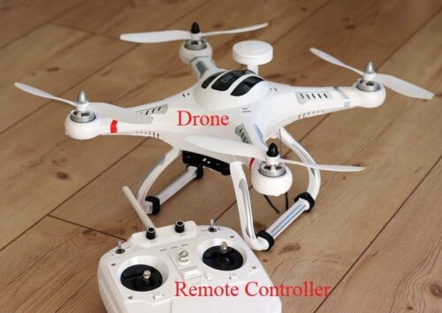
Over the past few years, drones have become extremely popular. You may have seen them online, at department stores, or even at the grocery store. Drone is a broad term that can refer to any unmanned aircraft. However, it usually refers to a multirotor. The term can also refer to military drones, which are usually large, unmanned airplanes. A multirotor has three or more propellers that can be used to hover or fly in any direction. The most common type is a quadcopter, which has four propellers as seen in the figure below:
Quadcopters operate at two main wireless communication frequencies, 2.4 GHz and 5.8 GHz.
_
Actually it is a specially designed multi propeller system inside a drone that makes this device highly independent and also assists in reduction of failures. One important thing to note about this multi propeller system is that even if any motor inside this device stops working; it will keep on flying as it gets support from propellers that are working in group. Drones that possess large number of motors inside are able to gain more control over their elevation and hence can carry more loads during flight. These propellers get their power from a dedicated source and most of these devices contain removable batteries so that it can stay in air for long run. The flight time can be extended with use of powerful batteries in design.
Controller plays an important role in drone flying mechanism. This device is used by remote pilot for controlling every movement of drone, ranging from its launching, navigation abilities and even up to landing. Market is flooded with variety of controllers these days and developers often use to do various experiments to create drones with impressive features. Major task of a controller is to establish proper communication channel between remote unit and the radio waves. Most of the drones use to work on 2.4 GHz frequency range and many of these controls take help from Wi-Fi networks for making active decisions regarding movements. Many features of a smartphone and drone are same as like both carry GPS, Wi-Fi and many other common sensor units. These onboard sensors help drone to stay in air for long run and make right decisions about its height, direction and other important movements. The landing process is also controlled by propeller system inside and the sensors make decisions about its speed, altitude and motor rotation etc. A drone works like an intelligent air unit that can cover large distance when used with powerful batteries and can bring the hidden information for you like a spy. This is the main reason behind its popularity in military applications.
_
Why are they so popular?
Well, in addition to flying, they have some other cool features:
-1. Many drones have cameras, which allow you to see things from the drone’s perspective. The camera can also record videos, so you can share your flying adventures with other people.
-2. Every drone has a built-in flight controller that keeps it stable. If a gust of wind tips it over, the flight controller will instantly adjust the propeller speeds to re-level it. This makes it easier for beginners to learn to fly.
-3. Some drones have additional smart features that let them do cool things like fly autonomously.
There are countless drones to choose from, and they come in a range of sizes. The smallest ones can fit in the palm of your hand, and some cost less than $20. However, many of these do not include cameras. Larger drones usually have high-quality cameras, and they may have other advanced features. Companies like DJI, Yuneec, and Parrot offer many options in the $100 to $500 range. High-end drones can cost thousands of dollars.
They have revolutionized aerial videos:
Traditionally, aerial videos required a full-sized airplane or helicopter. Drones can now do many of the same things for much cheaper. As a result, YouTube is filled with gorgeous aerial videos taken by both professionals and amateurs.
Some drones can “think” for themselves:
Not all drones require a pilot. Many of them can fly themselves, guided by GPS, and some can even avoid obstacles. This is known as autonomy: In other words, the drone can make decisions on its own without any human input.
Some drones have a follow-me mode, which is used by many action sports enthusiasts. In this mode, the drone will follow you at a safe distance and handle all of the camerawork.
_
Are all drones unmanned?
Yes. All drones are designed to be remotely piloted from the ground using GPS. They can also fly autonomously if programmed to do so. Ongoing technological advances, such as algorithms to avoid obstacles and planned network configuration, increasingly allow pilots to fly their aircraft beyond the visual line of sight (VLOS), thus opening up the option of autopilot.
What is the difference between a drone and a quadcopter?
A quadcopter is a type of drone. It refers to an aircraft with four main rotors, including a motor and propeller on each. Quadcopter is a more specific term, whereas the term drone covers a broad range of unmanned aircrafts.
What is the difference between a drone and UAV?
The terms drone and UAV can be used interchangeably as they both mean the same thing. UAV stands for Unmanned Aerial Vehicle and the term drone is a broad term for an unmanned aircraft. Both are controlled remotely or autonomously. This is why you may find the same aircraft referred to as both a drone and a UAV.
_
They have some downsides:
Like most new technologies, drones have introduced some new problems:
-1. Privacy: Drones allow users to direct a flying camera almost anywhere they want, including other people’s property. Although there are laws restricting where drones can fly, some users ignore these laws.
-2. Airspace issues: Drones are a hazard to full-sized airplanes and helicopters, and they can interfere with firefighting and rescue operations. In some cases, wildfires have spread further because a drone was hovering nearby, preventing firefighting planes and helicopters from reaching the fire.
-3. Crashes: Drones can crash into people, cars, or buildings. Because the propellers spin very quickly, they can cause significant injuries or damage. If you decide to buy a drone, make sure to keep it away from people and pets.
Because of these issues, the Federal Aviation Administration (FAA) requires most U.S. drone owners to register.
______
______
UAV Definitions:
“Drone” is a very broad term. Colloquially, drones are usually thought of as remote-piloted flying devices used by militaries for surveillance and offensive tactics or by civilians for recreational or business purposes. Merriam-Webster defines it as “an unmanned aircraft or ship guided by remote control or onboard computers.” Essentially, though, the term can refer to any vehicle that is controlled without being in direct contact with a human. While drone machines that are remotely controlled are effectively just tools — such as flying drones used to inspect commercial property roofs thus increasing workplace safety — drones that run themselves require some level of artificial intelligence to guide their actions.
The Federal Aviation Administration (FAA) refers to UAVs as “unmanned aircraft” and they have defined them as: “a device that is used, or is intended to be used, for flight in the air with no onboard pilot”. These devices may be as simple as a remotely controlled model aircraft used for recreational purposes or as complex as surveillance aircraft flying over hostile areas in warfare. They may be controlled either manually or through an autopilot using a data link to connect the pilot to their aircraft. They may perform a variety of public services: surveillance, collection of air samples to determine levels of pollution, or rescue and recovery missions in crisis situations. They range in size from wingspans of six inches to 246 feet; and can weigh from approximately four ounces to over 25,600 pounds. (FAA, 2007)
The Global Air Traffic Management Operational Concept (Doc 9854) states “An unmanned aerial vehicle is a pilotless aircraft, in the sense of Article 8 of the Convention on International Civil Aviation, which is flown without a pilot-in-command on-board and is either remotely and fully controlled from another place (ground, another aircraft, space) or programmed and fully autonomous.” This understanding of UAVs was endorsed by the 35th Session of the ICAO Assembly.
ICAO recognizes many categories of aircraft, among them balloons, gliders, airplanes and rotorcraft. Aircraft can be land, sea or amphibious. Whether the aircraft is manned or unmanned does not affect its status as an aircraft. Each category of aircraft will potentially have unmanned versions in the future. This point is central to all further issues pertaining to UA and provides the basis for addressing airworthiness, personnel licensing, separation standards, etc.
To the maximum extent possible, all terms in common use in ICAO documents will remain unchanged by the introduction of UAS. The definition of “operator” remains unchanged from existing use while “controller” equates only to “air traffic controller”. With regard to “pilot”, the function of this position remains unchanged despite the person or persons being located other than on board the aircraft. To distinguish those pilots who conduct their piloting duties from other than on board the aircraft, the term “remote pilot” will be applied.
To better reflect the status of these aircraft as being piloted, the term “remotely-piloted aircraft” (RPA) is being introduced into the lexicon. An RPA is an aircraft piloted by a licensed “remote pilot” situated at a “remote pilot station” located external to the aircraft (i.e., ground, ship, another aircraft, space) who monitors the aircraft at all times and can respond to instructions issued by ATC, communicates via voice or data link as appropriate to the airspace or operation, and has direct responsibility for the safe conduct of the aircraft throughout its flight. An RPA may possess various types of auto-pilot technology but at any time the remote pilot can intervene in the management of the flight. This equates to the ability of the pilot of a manned aircraft being flown by its auto flight system to take prompt control of the aircraft.
_
UAV versus cruise missile:
Cruise missile weapons are occasionally confused with UA weapon systems because they are both unmanned. The key discriminators are (1) UA are equipped and intended for recovery at the end of their flight, and cruise missiles are not, and (2) munitions carried by UA are not tailored and integrated into their airframe whereas the cruise missile’s warhead is. Ballistic or semi ballistic vehicles, cruise missiles, and artillery projectiles are not considered unmanned aerial vehicles.
_
UAV Fundamentals:
Remote-controlled (RC) planes and helicopters in the past were typically gas-engine powered vehicles. The advent of lithium-polymer batteries has replaced gas engine with electric motors that are weight savings and quieter along with ease of operation and maintenance. With this, increasingly-lightweight cameras are now offering high-quality photo and video capabilities that makes these units when paired with a UAV very useful in construction. Most construction photographic applications require a steady platform that has hover-ability to achieve quality results. The advent of multi-rotor helicopter units with three to eight separate propellers as compared to the single standard- helicopter rotor has yielded units that are significantly easier to fly and to easily achieve expected results.
_
The demand for small civil drone flying visual line-of-sight (VLOS) (see Figure below) for law enforcement, survey work, and aerial photography and video will continue to grow.
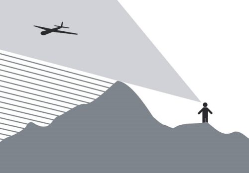
Figure above shows visual line of sight.
Larger and more complex RPA — able to undertake more challenging tasks — will most likely begin to operate in controlled airspace where all traffic is known and where ATC is able to provide separation from other traffic. This could conceivably lead to routine unmanned commercial cargo flights. Controlled airspace means the airspace of defined dimensions within which air traffic control service is provided in accordance with the airspace classification.
The flight of drone to conduct visual surveillance/observation missions, which typically occur in visual meteorological conditions (VMC), is far more challenging due to the need to avoid collisions without benefit of separation service provided by ATC.
_
Collision avoidance:
The pilot-in-command of a manned aircraft is responsible for detecting and avoiding potential collisions and other hazards (see Figure below).
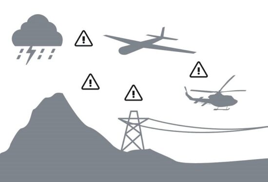
Figure above shows detect and avoid.
The same requirement will exist for the remote pilot of an RPA. Technology to provide the remote pilot with sufficient knowledge of the aircraft’s environment to fulfil the responsibility must be incorporated into the aircraft with counterpart components located at the remote pilot station. Aircraft pilots are required to observe, interpret and heed a diverse range of visual signals intended to attract their attention and/or convey information. Such signals can range from lights and pyrotechnic signals for aerodrome traffic to signals used by intercepting aircraft. Remote pilots will be subject to the same requirements despite not being on board the aircraft, necessitating development and approval of alternate means of compliance with this requirement.
Considering each of the above, RPAS detect and avoid solutions will be required to meet specified performance requirements related to flight crew responsibilities. Both the aircraft and the remote pilot station will need to incorporate aspects of this functionality to achieve the complete technical solution required as part of the RPA operational approval. Depending on the type and location of the operations the RPA will conduct, these could include the ability to:
-1. recognize and understand aerodrome signs, markings and lighting;
-2. recognize visual signals (e.g., interception);
-3. identify and avoid terrain;
-4. identify and avoid severe weather;
-5. maintain applicable distance from cloud;
-6. provide “visual” separation from other aircraft or vehicles; and
-7. avoid collisions.
_____
UAV Cost-Effective Considerations:
Aerial photography via conventional plane or helicopter can be an expensive item for a construction project. Operational costs of hundreds of dollars per hour place these periodic costs beyond the budgetary abilities of many projects save for brief periods of time over the course of a project. In contrast, the operational costs of a UAV are significantly less since both equipment costs and operational costs are far lower compared to helicopters. It takes less time and skill to learn to capably operate a UAV as opposed to piloting planes and helicopters. Time savings also accrue to the project since the UAV is stored, when not in use, at the project site in the job trailer or in a vehicle’s trunk. Conventional planes and helicopters require basing remotely at an appropriate facility that is often at a significant distance from the project site. This remote-basing also creates its own separate cost structure for storage.
_____
_____
Adoption of UAV technology:
Whether you call them Unmanned Aerial Vehicles (UAVs), Miniature Pilotless Aircraft or Flying Mini Robots, drones are rapidly growing in popularity. They are still in the infancy stage in terms of mass adoption and usage, but drones have already broken through rigid traditional barriers in industries which otherwise seemed impenetrable by similar technological innovations. Over the past few years, drones have become central to the functions of various businesses and governmental organizations and have managed to pierce through areas where certain industries were either stagnant or lagging behind. From quick deliveries at rush hour to scanning an unreachable military base, drones are proving to be extremely beneficial in places where man cannot reach or is unable to perform in a timely and efficient manner. Increasing work efficiency and productivity, decreasing workload and production costs, improving accuracy, refining service and customer relations, and resolving security issues on a vast scale are a few of the top uses drones offer industries globally. Adoption of drone technology across industries leapt from the fad stage to the mega-trend stage fairly quickly as more and more businesses started to realize its potential, scope, and scale of global reach.
The drone industry is rapidly growing and will continue to expand in the future. Unmanned aerial vehicles (UAVs) make various applications easier, such as commercial delivery, mapping and search & rescue. Along with the economic benefits they create, these tools also speed up data collection and reduce the workload of the enforcement teams. UAVs are well known for their ability for large-scale data collection. For example, in a recent project they were used to inspect 4,000 miles of power transmission lines in Ohio, USA, using photogrammetry. The mapping practices are not limited to ground features only. For instance, CAT Strategic Metal Corporation is planning to begin a high-resolution magnetic survey for approximately 1,200 hectares of land in the Bathurst Mining District of New Brunswick, Canada, to map the magnetic disruption. A detailed structural map will be created to locate copper-silver concentrations.
_
UAVs are popularly commended as being well suited to civil applications that are dull, dirty or dangerous, in other words, tasks that entail monotony or hazard for the pilot of a manned aircraft. However, there is a far broader potential scope for UAVs, including, inter alia, commercial, scientific and security applications. Such uses mainly involve monitoring, communications and imaging. Typical monitoring and surveillance tasks include border and maritime patrol, search and rescue, fishery protection, forest fire detection, natural disaster monitoring, contamination measurement, road traffic surveillance, power and pipeline inspection, and earth observation. Moreover, the ability of some UAVs to keep station for days, weeks or even months makes them particularly well suited for use as communication relays. Other UAVs are already being exploited for commercial imaging purposes such as aerial photography and video. Because drones can be controlled remotely and can be flown at varying distances and heights, they make perfect candidates to take on some of the toughest jobs in the world. They can be found assisting in a search for survivors after a hurricane, giving law enforcement and military an eye-in-the-sky during terrorist situations and advancing scientific research in some of the most extreme climates on the planet. Drones have even made their way into our homes and serve as entertainment for hobbyists and a vital tool for photographers. Police departments, fire departments, public safety offices and law enforcement agencies of all varieties are using drones to gather intelligence, safely evaluate threats, apprehend criminals, find lost hikers, even diagnose industrial accidents and explosions.
_
Whether drones are controlled by a remote or accessed via a smartphone app, they possess the capability of reaching the most remote areas with little to no manpower needed and require the least amount of effort, time, and energy. This is one of the biggest reasons why they are being adopted worldwide, especially by these three sectors: Military, Commercial, and Personal Technology.
-1. Military Drone Technology:
Military usage of drones has become the primary use in today’s world. Used as target decoys, for combat missions, research and development, and for supervision, drones have been part and parcel of the military forces worldwide. According to a recent report by Goldman Sachs, military spending will remain the main driver of drone spending in the coming years. Goldman estimates that global militaries will spend $70 billion on drones by 2020, and these drones will play a vital role in the resolution of future conflicts and in the replacement of the human pilot. Military spending also tends to come in larger increments, as US Predator drone system costs approximately $40 million and total spending for the program is estimated at a total of almost $2.4 billion. Unmanned Aerial Vehicles will continue to be applied in various military operations due to their high convenience in reducing losses and enabling the execution of high profile and time-sensitive missions.
_
-2. Commercial Drone Technology:
Commercial usage of drones is gaining steady momentum and has become the talk of the hour, as multiple industries are working with drones as part of their daily regular business functions. The market for commercial and civilian drones will grow at a compound annual growth rate (CAGR) of 19% between 2015 and 2020, compared with 5% growth on the military side, according to BI Intelligence, Business Insider’s premium research service. The commercial drone industry is still young, but it has begun to see some consolidation and major investments from industrial conglomerates, chip companies, IT consulting firms, and major defense contractors. For now, the industry leaders are still a handful of early-stage manufacturers in Europe, Asia, and North America. As it becomes cheaper to customize commercial drones, the door will be opened to allow new functionality in a wide array of niche spaces. Sophisticated drones could soon be doing everyday tasks like fertilizing crop fields on an automated basis, monitoring traffic incidents, surveying hard-to-reach places, or even delivering pizzas. At the end of the day, the impact of commercial drones could be $82 billion and a 100,000 job boost to the U.S. economy by 2025, according to AUVSI.
_
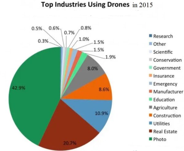
Top Industries using Drones are depicted in the Chart below:
_
-3. Personal Drone Technology:
As the sales of the civilian drones rise, the safety concerns surrounding them among regulators and law enforcement agencies also tend to go up, seeing the past of drone collisions with airplanes and crashes into crowded stadiums. BI Intelligence expects sales of drones to top $12 billion in 2021. And no small amount of that will come from the sale of personal drones used for film-making, recording, still photography and gaming by common tech-savvy enthusiasts. Consumers will however, spend $17 billion on drones over the next few years. Drones come in all shapes and sizes, from small and inexpensive single-rotor devices to large, $1,000+ quadcopters with GPS, multiple camera arrays, and first-person control. While primarily aimed at hobbyists, these types of devices are widely available and the market is growing.
_
The European Commission predicts that by 2035 the European drone sector will:
-1. directly employ more than 100,000 people
-2. have an economic impact exceeding €10 billion per year, mainly in services
As the use of drones spreads, the need to balance the advantages and challenges they bring will also increase. For instance, unmanned aircraft can add value when used in gathering and interpreting data in different sectors of the economy. But drones can also pose liabilities in terms of data protection, privacy, noise and CO2 emissions.
_______
_______
Brief overview of modern commercial and military drones in use today:
-1. Single-Rotor Drones (helicopter drones)
These are by far some of the most basic types of drones. Whereas most drones are made with 4 rotors, a helicopter drone is different in that it uses a single rotor similar to what you’d get out of a typical helicopter. That is, the drone is like a remote-control helicopter. It is ideal for when you want to keep a drone still in the air for an extended period of time. This is useful for it is often easier to land and can easily stay in one place at a time. But the drones are often not as stable, and while they can still hover over areas, they can also be more difficult to fly than drones that have multiple rotors to keep them balanced and airborne.
-2. Multi-Rotor Drones (for example quadcopter)
Where a single-rotor drone looks like a helicopter and is able to maintain flight with a single rotor, these units have several rotors positioned at strategic points on the craft. These extra rotors can make it easier for the craft to maintain its balance and keep hovering. However, when it comes to different types of commercial drones, as a general rule of thumb, the more rotors you add, the less time the craft is able to remain airborne. As such, while these units offer good stability, they often top out at half an hour of flight time.
The quadcopter is the most popular drone you can find in the market. This is an option that uses 4 rotors organized in a square pattern. The rotors are arranged onto each individual corner of the quadcopter’s body. This allows for an even amount of support to get the drone off the ground and to make it turn in different directions. Most quadcopters are headless models that don’t require you to keep it pointing in one direction for it to be controlled properly. Also, these are often small in size and can be flown right out of the box depending on what you order. Some models may even come with a camera built on the inside. Others will at least offer a mounting surface that allows you to secure a small HD camera on it. A quadcopter, like with most other drones, is made with a battery. This can be recharged as needed to give your drone energy.
-3. Fixed-Wing Drones
The lack of rotors and fixed-wing style of these drones make them more similar to controllable airplanes rather than the helicopter style of other drones. Rather than rotors, their wings provide vertical lift, which means they only need enough energy to keep moving forward, making them ideal long-range drones. Some fixed-wing drones can be gasoline powered. Where multi-rotor units cannot remain airborne long, a fixed-wing drone can remain in the air for as long as 16 hours of continuous flight. However, they are not able to hover the way drones with helicopter-style rotors can. The lack of a rotor also makes them harder to land. They must be very carefully brought in for an extremely soft “belly landing,” and in less-than-expert hands, this can go very wrong very quickly.
-4. Fixed-Wing Hybrid Drones
This type of drone attempt to take the best from fixed-wing and rotor-based designs, making for drones that feature both. A fixed-wing hybrid drone will tend to have a couple rotors attached to the ends of fixed wings. Many of these drones are actually based on designs for aircraft that have been around since the 1950s and 1960s. However, the technology to bring them to life was considered too difficult, and they were largely shelved before the rise of drones. These units are still rather experimental, and so are far less commercially available than their single-rotor, multi-rotor, and fixed-wing counterparts. However, with several companies developing them, they may well be the wave of the future.
-5. Small Drones
As opposed to the first four drone types listed here, all of which can easily cost tens or even hundreds of thousands of dollars, these tend to only cost up to around $100. “Small” in this context typically means between 20 and 80 inches long. These drones are strictly recreational and usually cannot perform many of the commercial functions of which some of those other models are capable. For example, when properly mounted, cameras onboard highly stable multi-rotor can capture stunning aerial pictures and video. By contrast, small drones are usually too light and do not have the stability necessary for the picture perfect balance required for accurate picture taking. Nevertheless, these options can be a great inexpensive intro to the world of drones for hobbyists and children.
-6. Micro Drones
While smaller drones may mean recreation in the eyes of consumers, for militaries who use drones, micro drones are all business. The most well-known example of this type of drone in action today is the Black Hornet, manufactured for the British military. Since their adoption in 2013, these tiny 1 X 4 inch drones have been used by the British military to look around walls and other installations in Afghanistan. While cameras may be too much for recreational small drones, the special micro-cameras on these small drones can provide useful intelligence. When they are not in use, Black Hornets can be stored in a special belt. They can fly for up to 25 minutes on a single battery charge, and have a range of up to a mile. In addition, some Black Hornets have been outfitted with infrared cameras.
-7. Tactical Drones
These drones are large enough to not be pocket-sized, while still being far smaller than the type used for general combat and larger tasks. The preferred tactical drone of the US military is the Raven, which measures 4.5 ft and weighs 4.2 lbs. These types of drones are often used for surveillance work. As with the Black Hornets, the Ravens are capable of being outfitted with special infrared cameras, helping them supply soldiers with an accurate picture of the area even in the night-time. The units come with onboard GPS technology. While they are on the simple side and do not boast a lot of bells and whistles, this also makes them quite accessible and easy for soldiers to use without the need for special training.
-8. Reconnaissance Drones
With another military drone class, we once again move up in size a bit to drones that are not designed to be handheld. Instead, these drones measure around 16 ft long, are launched from the ground, and are called Medium Altitude Long Endurance (MALE) or High Altitude Long Endurance (HALE) drones. These drones are among the most commonly employed by militaries around the world. The Heron, designed by Israeli Aerospace Industries, has manufactured drones of this nature for military recon use for the US, Canada, Turkey, India, Morocco, and Australia. The drones in question can weigh over 2200 lbs and remain in the air for 52 hours straight at a cruising height of 35,000 ft. The German military makes use of another type of drone, the LUNA, which is less expensive than the Heron, but has shorter operational periods.
-9. Large Combat Drones
Chances are when you think of “drones” in a military sense, these are the types you imagine. Variants such as the Predator and Reaper, used by the US, are around 36 ft long and able to fire on targets with air-to-surface missiles and laser-guided bombs. These units can operate for 14 hours over a range of a thousand miles. These drones have been used for operations such as military strikes in Pakistan and other countries with which the US is not officially at war. The US may be the most famous (or infamous) user of drones, but they are hardly alone. Fellow NATO nations such as the UK, Spain, and France use them as well, while China has manufactured its own version, the CH-4, which has been bought by Egypt and Iraq.
-10. Non-Combat Large Drones
By contrast, there are large drones that are not meant to be used in combat. These can take on a variety of jobs, often reconnaissance, and are used for more large-scale recon missions than their miniscule Black Hornet and Raven counterparts. For example, the Global Hawk, manufactured by Northrop Grumman, is primarily used over combat zones, but not meant for combat. Rather, it is used for surveillance, such as scanning cell phone calls. Just because these drones do not engage in combat does not mean that they are not expensive. The Global Hawk, for example, can cost as much as $131 million, and that does not include ground infrastructure.
-11. Decoy Drones
One of the most important things to keep in mind about military drones is that they can serve several functions depending on the situation. For example, while some drones can be used for surveillance and some are meant for strike capabilities, while some operate as decoys. What these decoy missions look like, however, is bound to change depending on the individual nature of the mission. As such, these types of military drones must be ready to act as decoys in any number of ways. For example, some decoy drones can carry out their mission by simulating an incoming missile. This can draw fire from ground anti-aircraft units, thereby distracting them from any actual combat drones or incoming missiles.
-12. GPS Drones
A GPS drone is a model that will link up to GPS signals from satellites. This kind of drone uses this as a mean of identifying where it can go or where its base (or point of origin) is. These drones can return to you in the event that it gets out of your control reach or it starts to run out of battery power. In particular, the drone will identify the GPS location of where it started up and automatically return the device to that location. This should make it easier for you to keep from losing the drone. It will require a clear sight of the sky so it can actually identify the GPS signals that it needs for it to work properly. You can use a GPS drone by programming it through a computer feature to move to a particular destination. You will typically need to use a separate program, a link to a computer and a memory card to help you get such a drone to link up to a destination you want it to reach. This can be a great way to map out large topographies.
-13. Photography Drones
While cameras on many drones are designed to take videos, photography drones are designed with still images in mind. That is, they can come with their own built-in cameras designed to take pictures. Photography drones are typically designed with HD-quality cameras that are designed with guards around their lenses. The guards help to keep the lenses from being at risk of damages from weather conditions in an area or any debris that might fly around. A photography drone typically has to be easy to keep steady. It is often easier for a drone like this to take clear pictures if the drone can actually stop moving. This can keep the blur effects in a shot from being visible. The controller used for such a drone will often come with a button. This button can be pressed to allow the camera to take pictures. Not all controllers will have real-time shots of whatever the camera is taking a picture of. There are times when you could get a smartphone or tablet to link up to a drone through a Wi-Fi connection so you can get a quick look at what is on its camera. These drones don’t have to be very large. They just need to be big enough to where you can easily get a camera to fit in on the inside.
-14. Racing Drones
A racing drone is designed to be used for racing purposes in mind, hence the name. Such a drone can travel about 40 to 60 miles per hour in some of the best cases. Also, they are fast and fun to play with. Racing drones can work quicker with controllers that require their own unique radio connections. These can be used with a variety of frequencies to ensure that the connection between a drone and its controller will not interfere with any other signals. This is important for cases where two or more drones are being flown at the same time during a race. These drones can be designed with slim bodies and will not be impacted by wind conditions. However, such a drone might require a much stronger engine than a more traditional electric engine.
-15. Drones that are ready-to-fly
RTF drones are Ready-to-Fly drones. That is, you can get such a drone to start working for you right after you buy it, take it out of the box and charge it up. This is typically reserved for smaller quadcopters and is for those who are new to the world of drone flying. It is often easier to learn how to fly one of these drones than anything else, thus making them ideal for beginners.
-16. Trick drones
Trick drones are designed to be used as smaller toys. That is, they are items that can pull off barrel rolls, flips and other quick and easy manoeuvres. These smaller drones are typically a few ounces in weight and only about ten inches in length at the most. Also, while some of these drones might come with their own built-in cameras, those cameras are typically very small. They may not record things in HD quality either. These drones are often used by casual drone operators. They are also ideal for those who are new to the world of drones and want to learn more about how they can work.
-17. Delivery drones
A delivery drone is an unmanned aerial vehicle (UAV) used to transport packages, medical supplies, food, or other goods. Delivery drones are typically autonomous. Delivery drones are designed to transport materials. A delivery drone will work with an anchor or basket-like feature on the bottom part. This will be linked up to the drone’s body to allow it to carry items of all sorts.
Delivery drones are useful for when someone needs to get an item that is a few pounds in weight transported through a particular distance. These drones are especially being developed by Amazon as a mean of making it easier for the retail giant to quickly deliver items in certain parts of the country. These devices could, technically, be used in military situations as well. These include drones used to drop off materials for people to use in the combat field. These may also be used as aid drones. They can deliver first aid materials and other items to a person who needs medical attention while waiting for proper authorities to reach a certain spot. This may be worthwhile in areas where mountain ranges and other large bodies might make it harder for people to access certain sites. The amount of weight that such a drone can handle at a given time will vary by each model. Such a drone can work with up to twenty to thirty pounds at a time before it can start to struggle with trying to lift items. In November 2020 the FAA proposed airworthiness criteria for type certification of delivery drones with an intent to initialize commercial operations. Zipline, Wingcopter, and Amazon Prime Air were amongst the 10 companies selected for this type certification.
-18. Gas-powered drone
Batteries are typically used to get most drones to run. However, some drones can work with other materials to power them up. Like the name suggests, a gas-powered drone is a drone that runs on gasoline instead of an electric battery. This kind of drone can operate for a longer period of time before it has to be charged up again. This is thanks to how you just have to add gasoline into the drone when necessary. Also, this can often work at greater heights as these drones are typically a little stronger than other models. However, such a drone can be heavier and more complicated. You might have to check the oil in the drone on occasion to ensure that the drone is actually working and isn’t at risk of breaking down while in flight.
-19. Nitro-powered drone:
A nitro-powered drone is similar to a gas-powered one in that it needs a particular fuel for it to work. However, in this case, nitro fuel is required. Nitro fuel combines nitromethane with methanol to create a stronger drive within a device. It allows for better propulsion and can burn cleaner. The most important part is that it brings in oxygen into the combustion process. This allows the engine to run smoothly. A nitro-powered drone will more than likely be lighter in weight and agiler. This should be rather easy for you to move around in the sky.
_____
_____
Commercial drone:
A commercial drone is any drone used for work. This means that commercial drones include both those drones that are made for specific types of jobs, like Flyability’s Elios 2 made for flying in confined spaces, and drones that are made for general consumers but can also be used in professional settings, like DJI’s new Mavic Air 2.
The top seven commercial drones on the market:
DJI Matrice 300 RTK—Outdoor inspections
Flyability Elios 2—Indoor inspections
DJI Mavic 2—Aerial photography/videography
Freefly Alta 8—High-end cinematography
DJI Agras MG-1—Agriculture
Parrot ANAFI USA—Public Safety
senseFly eBee Classic—Mapping & Surveying
_
Commercial Drone Data:
Drones present a powerful tool for collecting data remotely. In inspection scenarios, using a drone to collect data instead of a person can make a big impact on safety since it reduces the exposure of personnel to potentially dangerous scenarios, such as climbing a cell tower or walking along scaffolding inside a giant tank to collect visual data. People also use drones to collect data for things like surveying, mapping, or even to help investigators find human remains.
Here are the primary types of data currently collected by drone:
-1. Visual data. This is by far the most common type of data a drone is used to collect. By flying over an area or object of interest, a drone can be used to help see things that might not be otherwise visible, and collect a record of what is seen.
-2. Thermal data. After visual data, thermal data is one of the most common types of data industries collected by drone. Aerial thermal data can help firefighters determine where to focus their efforts during an active fire, or help inspectors identify potential problem areas in a solar array.
-3. LiDAR data. A LiDAR sensor illuminates a target with a laser light and then measures the reflection to create data points that can be used to map the area. Aerial LiDAR can be used to help companies in various industries to create 3D maps of an area, which can be used for project planning or progress tracking. Since LiDAR can penetrate tree cover and even earth to reveal structures hidden underground, it has also been used by archaeologists to help them discover new sites of interest for excavation.
-4. Multispectral data. Multispectral data is collected by sensors that measure reflected energy within several specific sections (or bands) of the electromagnetic spectrum. Aerial multispectral data can be used in agriculture and conservation to monitor plant and tree health, and it’s also being used by law enforcement to help find human remains.
-5. Hyperspectral data. Hyperspectral sensors measure energy in narrower and more numerous bands than multispectral sensors. Aerial hyperspectral data can be used in agriculture for monitoring the health of crops, and in security and defense for detecting the presence of those who shouldn’t be in a given area.
Please note that this list is not meant to be exhaustive, but only to present the most common types of data collected by drone right now. The reality is that drones can collect whatever data we want, so long as a drone-compatible sensor (i.e., a sensor that can be attached to a drone) exists for its collection. As drone technology continues to advance, we’ll continue to see more and more sensors developed for drones to be used for new types of data collection, such as radiation for nuclear power plant inspections or thickness measuring for inspecting industrial assets.
_
Commercial Drone Deliverables:
Now that we’ve covered some of the main types of data that drones can capture, we need to address what is done with that data. The truth is that simply sharing a folder that contains a huge amount of data will not be very helpful for most people. What they need is for that raw data to be converted into actual deliverables, which can then be used for a variety of purposes.
Here are some of the most common deliverables created from drone data:
-1. Photos and videos. One of the most common deliverables for commercial drone work are stills and videos. These might be for professional photography/videography purposes (such as weddings or family photo shoots), aerial shots of real estate to help market it, or even high-end cinematography for work in filmmaking.
-2. 3D maps. Across various industries 3D maps are becoming a common deliverable for drone data, helping people to better visualize the spaces in which they’re working.
-3. Orthomosaics. An orthomosaic is a photo representation of an area created by stitching together several photos. Orthomosaics are used in construction to visualize building sites, in public safety to record the details of places where large groups of people commonly gather, or in civil engineering to track the progress of a large project, such as restoring part of a beach.
-4. Actionable reports. In some industries a deliverable produced from drone data could include a report generated by industry-specific software. For example, Pix4D’s agriculture-specific software Pix4Dfields allows users to produce agricultural indices to better understand plant stress as well as aggregating vegetation index maps into zones.
_
Top Industries using Drones for work:
Here are some of the top industries and sectors using drones for commercial purposes today, along with the ways that they’re using them:
-1. Agriculture. Farmers use drones to collect data on their crops and then use that data to improve their yields.
-2. Chemicals. Drones are being used in the chemicals industry to improve indoor inspections by taking the place of inspectors in collecting visual data inside large assets used in chemical processes.
-3. Conservation. One of the main ways drones are helping conservation efforts is by providing detailed vegetation maps to help track forestry work and water mapping to better understand how water moves through an area. Drones have also been invented that shoot out seeds from the air, which could help reforestation efforts in places that have been clear cut.
-4. Construction. Mapping and surveying construction sites can be quite slow when done by walking a site. Drones help speed up these efforts, allowing construction companies to provide real-time maps of progress and surveys that can help them both plan for projects and improve projects that are underway, leading to significant savings.
-5. Delivery. Consumer drone delivery has yet to be rolled out at a large scale anywhere in the world but it does present a major contribution for commercial drones. Medical drone delivery is currently taking place throughout the world in countries as far-reaching as Rwanda, the U.S., and Switzerland (where Flyability is headquartered).
-6. Filmmaking. For years now, high-end drones have been used to capture aerial shots for movies instead of helicopters, which are more expensive and cumbersome to work with.
-7. Mining. Mining companies are turning to tough indoor drones like the Elios 2 to help them create maps of their mines. These maps lead to improved safety and can also help companies locate ore that might otherwise be lost.
-8. Insurance. Insurance companies are always processing claims, especially after large storms. Drones are helping insurance companies process claims on roof damage much more quickly by allowing adjusters to collect visual data from the sky instead of by climbing up ladders. Insurance companies are also using drones for accident reconstruction, helping them to piece together how an auto collision took place so that they can verify the validity of auto-related insurance claims.
-9. Oil & Gas. Indoor drones like the Elios 2 are making a big impact in Oil & Gas by providing inspectors with a tool for collecting high-quality visual data inside assets crucial to the oil refining process, such as tanks and FCC units. and risers.
-10. Power Generation. In power generation, indoor drones are also helping inspectors to access areas that would otherwise be difficult to reach. Drones can also help keep inspectors from the harm presented by radiation at nuclear power plants by taking the place of inspectors in collecting visual data of key assets like boilers.
-11. Public Safety. Law enforcement, fire departments, and search and rescue have all adopted drones over the last several years. Police use drones to help them get better situational awareness and to map densely populated areas, firefighters use drones to collect thermal data that can pinpoint where they should focus their efforts, and search and rescue personnel are using both thermal and visual sensors on drones to help find people missing in the wilderness.
-12. Sewer Maintenance. Indoor drones have been helping inspectors enter city sewer systems to collect visual data that can be used to identify the source of a problem or to evaluate the condition of the infrastructure as part of the regular maintenance process.
As drone technology develops, people continue to find new ways to use drones to save money, improve safety, and increase efficiency in their operations. For example, we recently learned that crime investigators have been using drones equipped with multispectral imaging to help find human remains, and that scientists are experimenting with using drones to release sterile mosquitoes in an effort to control mosquito-borne disease.
________
________
Drone statistics:
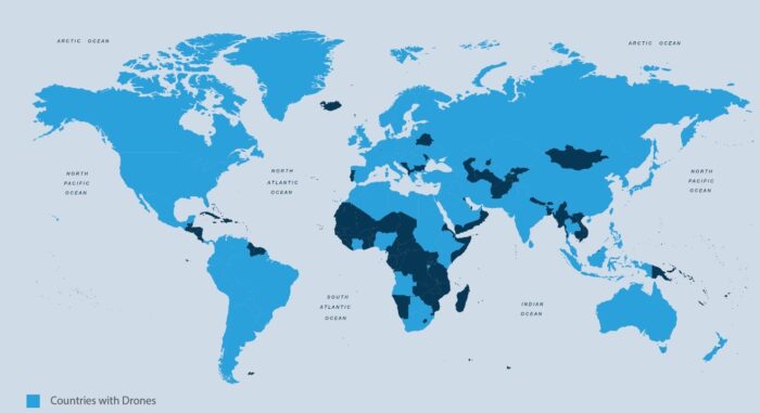
Source: Michael C. Horowitz and Matthew Fuhrmann, “Droning On: Explaining the Proliferation of Unmanned Aerial Vehicles,” October 24, 2014.
___
Electrifying Drone Statistics in the U.S.:
-1. As of January 2021, there are 1,782,479 drones registered in the US, the drone registration statistics show.
-2. The business and the government spent $13 billion on drones.
-3. Sales of consumer drones in the US exceeded $1.25 billion in 2020.
-4. The drone industry is expected to grow at 15.37% CAGR over the next five years.
-5. Roughly 15% of Americans have flown a drone according to US drone statistics.
-6. Only 8% of Americans own a drone.
-7. The number of jobs operating drones in the industry will reach 422,000 by 2021.
-8. Among all the drone crashes in the world, the US Army is responsible for 70%.
-9. The largest drone provider in the US is DJI with nearly 80% of the market.
-10. The minimum age for flying a drone legally is 16 years.
-11. The drone accident statistics showed 385 accidents involving drones in 2017.
-12. More than 50% of registered drones in the US are used for recreation.
-13. Drone Deploy has over 100 million drone pictures online.
-14. Drones can deliver a package in less than 30 minutes.
-15. The surveying costs of companies can be reduced for up to 98%.
-16. The US Army owns around 11,000 combat drones.
-17. In 2015, a drone broke the White House security
-18. There are 25 reports of drones flying too close to aircraft monthly.
-19. The FAA requires a remote ID for drones.
_____
_____
UAS aircraft designers are solving for three basic variables:
Time aloft – how long do you need the bird to stay in the air to complete the mission. 30 minutes is a different design than 30 hours.
Lift – what type or types of sensors does the drone have to lift to complete the mission. Are you carrying cameras, other sensors or weapons? 30 ounces is a different design than 30 pounds.
Range – how far will it go – and how far can you control it. How far it will go is a function of the power plant and the aircraft design. How far you can control it is a function of the type and size of transmitters and receivers used for command and control. 3 miles is a different design than 30 miles.
While there are many other important design variables including cost, size, stability in extreme weather and cost of ownership; all designs can be seen as tradeoffs to solving the time, lift and range problems.
______
Range:
How far a drone can fly from the controller while still maintaining a viable signal is called the drone’s range. Each model of drone has an advertised flight range, which may or may not play out in real life situations, but gives a pretty good idea as to what you can expect. But the physical limits of your drone’s range must give way to the legal requirement to keep your drone in sight at all times during flight.
_
Different drones are capable of traveling varying heights and distances. While a toy drone might have a range of about 20 to 100 yards, a high-end consumer drone can have a range of about 2.5 to 4.5 miles (4 – 8km). Mid-level consumer drones will typically have a range of about 0.25 to 1.5 miles (400m – 3km). Very close-range drones usually have the ability to travel up to three miles and are mostly used by hobbyists. Close-range UAVs have a range of around 30 miles. Short-range drones travel up to 90 miles and are used primarily for espionage and intelligence gathering. Mid-range UAVs have a 400-mile distance range and could be used for intelligence gathering, scientific studies and meteorological research. The longest-range drones are called “endurance” UAVs and have the ability to go beyond the 400-mile range and up to 30,000 feet in the air.
_
Here are some drones with their controller range.
|
Flight Range |
Flight Time |
|
|
Holy Stone HS210 Mini Drone |
50m |
7 min. |
|
SIMREX X300C Mini Drone |
45m |
8 min. |
|
Altair Outlaw SE |
400m |
15 min. |
|
Holy Stone HS720 Foldable GPS Drone |
1km |
26 min. |
|
DJI Mavic Mini |
4km |
20 min. |
|
Autel Robotics EVO Drone |
7km |
30 min. |
|
DJI Phantom 4 Pro V2.0 |
8km |
30 min. |
|
Autel Robotics EVO II |
9km |
40 min. |
|
DJI Mini 2 |
10km |
31 min. |
|
DJI Mavic 2 Pro |
10km |
31 min. |
_
The specific range of your drone depends on the strength of the controller signal and the type of transmitting technology used. Unsurprisingly, more expensive drones will generally offer a longer range. For most recreational uses, however, you’ll have trouble reaching the limit of your controller signal without first going way beyond your visual line of sight, which is a big no-no under FAA regulations. Notwithstanding, there are some other good reasons to opt for a stronger controller signal.
The Visual Line of Sight (VLOS) Limitation:
Even if your drone can keep contact with its controller at the distance of 4 miles, it’s doubtful whether you can still see it clearly enough to know whether it’s responding appropriately to your controls.
Why does it matter?
For one thing, it’s a matter of safety. If you can’t physically see your drone (i.e., it’s not within your visual line of sight), you can’t readily tell whether it’s about to crash into something, or if it is going left when you tell it to go right. An out of control drone is a danger to people, buildings, vehicles and itself.
For this reason, the FAA guidelines for safe operation of drones for recreational use require that you keep the drone within your visual line of sight. How far you can physically keep a clear view on your drone will depend on the terrain, nearby obstacles and air conditions. But realistically with an unobstructed view, you can only really clearly see your drone from about 1,500-2000 feet away. That’s less than half a mile. And at that distance, you’re going to have a hard time telling your drone from a bird.
So if you have to keep your drone within a mile’s range or less in order to have a good visual on it, what’s the point of having a drone with a longer range than that? There are several good reasons for using drones with longer range than VLOS:
Long range drones that can travel 3-4 miles from the controller and the operator have very practical uses in a variety of industries. Because of the commercial demand for drones that can fly farther than the pilot can physically see them, licensed drone pilots can apply for a waiver from the FAA to operate BVLOS (beyond visual line of sight).
-1. Agriculture
For farmers scouting a field, a drone that can travel the entire field, reaching 3-4 miles away from the controller, is absolutely basic. Pre-planned flight path settings make it easy to have the drone cover the entire space without needing the operator to keep the drone in sight. Long battery flight times also ensure that the drone can cover the whole field in one go, then return to the take off point when the course is finished.
-2. Mapping
Similarly, when used for mapping, drones need to cover a large amount of territory, and can do this most effectively when they can travel far beyond the range the operator can see. Long range drones can cover a large area to capture data for making highly detailed, and even 3D maps.
-3. Safety & Security
For perimeter security at large construction sites, prisons or commercial warehouses, a drone that can cover the entire perimeter will likely need to leave the visual line of sight of the operator. Likewise, public safety agencies tracking suspects, or performing search and rescue missions need a drone that can fly far beyond the starting point.
-4. Package Delivery
For this nascent industry, drones need to have a range of several miles to make delivery by drone a reasonably viable operation. Whether leaving from a warehouse, or deployed from a delivery truck, it needs to be able to get a few miles away to the delivery location. Automated flight planning will virtually eliminate the need for an operator to keep eyes on the drone.
-5. Recreational Benefits
Even if you’re not planning to map miles of territory with a drone, having a drone with longer range capability is not only for the professionals. Keep in mind that a drone with a more powerful signal transmission is likely to be able to keep a stronger signal even at a closer range. A stronger signal and more powerful transmission can help to compensate for other factors that might otherwise interfere with either the controller connection or the video transfer signal. This means that while you might not be taking a long range drone for long range missions as a hobbyist, it could be the answer for video stutter or latency issues in the closer range.
_
Drone out of Range:
It’s worth noting here that for most consumer drones, there are two different ranges to keep in mind: the controller range and the video signal range. The controller usually operates on the 2.4GHz range and will carry farther than the live video feed signal, which operates on the 5.8GHz range. This means that you will lose your video feed long before your drone will lose connection with the controller.
When you lose your video feed, it will be fairly clear, as the image on screen will begin to stutter, and then fail altogether. Don’t panic, because your drone should still be responsive to your controls. You won’t be able to see through the screen what’s near your drone, so that’s one of the reasons to make sure you’re not going beyond visual line of sight. Just hit the return to home button, or manually bring your drone a bit closer to yourself to pick up the video feed again.
_
When your drone reaches the outer limit of the controller range, there are few things that could happen:
-1. The drone will automatically return to home. Best case scenario, and for most GPS drones, this is the built-in failsafe.
-2. The drone will stop and hover in midair. This can give you a chance to move yourself closer to the drone to pick up the controller signal again.
-3. The drone will land wherever it is. This is fine unless you flew out over water, or are flying in difficult to reach terrain.
-4. The drone will keep flying away (a flyaway drone situation). The least likely scenario for most decent drones, unless you have disabled failsafe settings.
-5. The drone will crash into something. This could happen if the return to home function is activated and there are obstacles in the way. Or it could happen as a result of a flyaway.
Rather than finding out what happens first hand when you get out of operating range, it’s best to know your drone’s limits, and take a preventative approach.
_
How to increase your Drone’s Range:
If you really need to get better range from the drone you already have, whether it’s to be able to fly farther away, or to overcome other types of interference in your location, there are a few things you can try.
-1. Make sure your drone’s firmware settings are set to the FCC limits, rather than the CE limits (Europe) to get the best possible operating range.
-2. Add an antenna extender and/or a better antenna to your controller. Also add a more powerful receiver on your drone.
-3. Range extender could get you a significant jump in operating range.
_
Endurance of large UAV:
Endurance is the amount of time an aircraft can stay in the air with one load of fuel. UAV endurance is not constrained by the physiological capabilities of a human pilot. Because of their small size, low weight, low vibration and high power to weight ratio, Wankel rotary engines are used in many large UAVs. Their engine rotors cannot seize; the engine is not susceptible to shock-cooling during descent and it does not require an enriched fuel mixture for cooling at high power. These attributes reduce fuel usage, increasing range or payload. Proper drone cooling is essential for long-term drone endurance. Overheating and subsequent engine failure is the most common cause of drone failure. Hydrogen fuel cells, using hydrogen power, may be able to extend the endurance of small UAVs, up to several hours. Solar-electric UAVs, a concept originally championed by the AstroFlight Sunrise in 1974, have achieved flight times of several weeks. Electric UAVs powered by microwave power transmission or laser power beaming are other potential endurance solutions.
______
______
Drone noise:
Drones have made one of the biggest shifts in today’s industry, and their usage is increasing day by day. Drones can reach places that we would never reach by ourselves. One of the flaws we can say that today’s drones have is their buzzing noise, which can sometimes get on nerves. The rotors, engines, and electronic parts required to run the standard quadcopter create lots of vibration and can often be quite loud and annoying. They can bother other people in the area where you’re flying and are sometimes troublesome for the pilot themselves. This is why more and more buyers are becoming interested in silent drones, a quiet alternative to standard quadcopters.
_
Drones emit a buzzing sound, which is caused by motors and propellers that produce it during rotation, and thus they create vibrations. Therefore, drones that are larger in size and thus of the aforementioned components will be much louder than smaller ones. Take for example a helicopter that is quite loud because of its large rotating blades and motors that drive him. So nowadays, future drone buyers are starting to consider also the noise factor that drone produces as they fly a short distance away from them. However, we must understand that drones can by no means be silent, but that the only thing we can do is pick a drone that is less noisy than others.
_
The noise the drone produces depends on the drone type and the propeller size. The types of drones most commonly used today by category are professional drones, hobby drones and mini drones. We can say that hobby drones produce noise level around 75 dB when they fly over our heads, while at longer distances this noise decreases dramatically. Being exposed to the buzzing sound of a drone for a while is not detrimental to our ears, but exposure to that kind of sound all day can be detrimental. The amount of time a person spends in loud sounds is an important factor. The World Occupational Safety Chamber has clear rules that say that people and workers should not be exposed to sound of 85 dBA or more at a place where they work for 8 hours as hearing damage may occur. The U.S. Environmental Protection Agency (EPA) and the World Health Organization (WHO) recommend maintaining environmental noises below 70 dB over 24-hours (75 dB over 8-hours) to prevent noise-induced hearing loss. The FAA is also subject to similar rules and states that quadcopters must not produce noise greater than 70 dB for a 24h period. Therefore, before drones come into commercial use at all, such as drone delivery, this problem will need to be addressed. Because if cities are flooded with drones and their buzzing sound is not resolved, it could do more harm than good to use them.
_
Can Drone Noise be reduced?
Yes, NASA is working on a project that will try to reduce the noise of the drones, and they did so by increasing the number of small propellers to make less noise than a few large propellers. The reason this is possible is because each of these smaller propellers rotates at a different (non-synchronized) speed (RPM), and these sounds do not make one common buzz sound but more of a smaller sound. This means that the generation of similar harmonics that produce the drone sound can be spread across many frequencies reducing the sound of the drone. NASA has therefore created a GL-10 drone that can fly at 98 feet above the ground and be completely silent.
As for commercial drones that are used on a daily basis, their sound can be reduced by a different choice of propeller design. Drones create a buzzing noise because of their motors and propellers that create air velocity over the blades. Therefore, drones can’t be completely silent. The only way drones can reduce their noise for several decibels is by adding the appropriate type of silent propellers and propeller shrouds. That ‘silent propellers’ are better than the classic ones because they are made with a new aerodynamic design, thus reducing the flow of air through the propellers that create vibration and sound. You can purchase low noise propellers which can significantly change the volume of the noise by having a very smooth surface, and they can reduce the noise by about 3.5 dB. A shroud firstly reduces the noise by the propeller by absorbing the sound and then reflects any residual noise up and away from people that are on the ground below. There are specific frequencies absorbed in the core as it is made of acoustic materials that absorb some frequencies. The shrouds can be retrofitted to nearly any drone manufacturer but must be specific to the drone that you are using. Using larger propellers means that the propeller can move slower to displace the same amount of air. Increasing the diameter of the propellers will increase their thrust factor and create a greater vertical push. Slowing down the propeller will also make the frequency of the noise much lower. Other features that reduce noise include brushless motors and careful construction to reduce as much friction as possible with the motors, and specially designed insulator materials on its body to keep vibrations and shaking down.
_
Silent drones:
“Silent drone” is a bit of a misnomer here – as long as drones have the moving parts that keep them in the air, they’re going to make some noise. However, more manufacturers are keeping noise in mind when they’re building drones, leading to quieter quadcopters than the norm. The role of silent drones can be very important factor for the police, the military, animal monitoring situations and filming industry. When we talk about the police, they are increasingly using drones as a means of tracking suspects or in crisis situations where they send a drone to survey a hostage situation. Monitoring animals in the wild is one of the great advantages of drones but the drones that make noise scare the same animals and thus cannot be monitored. As for the military, they also aim to keep the drones as quiet as possible for espionage and unnoticed shooting. When it comes to filmmaking, drones that make too much noise can spoil the recording with sound, and movie scenes must be recorded and assembled separately, which takes a lot of time and money. The sound of a drone in flight is about 75 decibels on average. A quiet drone is usually considered to be a drone that only makes 65-70 decibels of sound from a distance of three to five feet away from you. According to a study by The Verge, the loudest DJI Mavic Pro Platinum ever gets is 60 decibels, compared to the 80 decibels of the original Mavic Pro.
______
______
How to fly drone:
If you’ve ever used a drone, you know: It’s so much fun. If you haven’t used one, either because of lack of opportunity or abundance of disinterest, just give it a shot. The latest drones are much easier to pilot and they’re less bulky compared to the earlier versions. Plus, you can find a good one for not too much money.
-1. First, before buying a drone, be sure that you know the requirements, and potential restrictions, involved.
-2. You must register your drone with the FAA if you’re going to be operating it in the USA and it weighs more than 250 grams.
-3. The next-most-important thing is knowing whether or not you can legally fly in a certain area. Property owners can set their own rules, so it’s perfectly valid for, say, a college campus to ban drone flights.
-4. Operating a drone responsibly also means having situational awareness. For example, you can’t ever fly in certain areas — like Washington, D.C. — or if there is a temporary flight restriction.
The less expensive drones are more portable but lack advanced features, which makes them harder to fly. But that’s okay, because beginners will want to take these drones out to practice their piloting ability. Another big trade-off for smaller drones is their weaker battery, so don’t expect to go on longer excursions. If you spend a little more money, expect features like GPS, longer battery life, better photo and video capability, and flight stabilization. This makes it much easier to fly. A drone without flight stabilization makes difficult piloting and more chances of crash.
_
Before you take out your drones for a spin, ensure you know the major parts of these drones so that you will be able to identify issues in case of a malfunction. The main parts of a drone include the frame, the flight control boards, radio transmitter and receiver, propellers, batteries, and motors. You will use the radio transmitter as your remote control. The drone will get a control order from you through the receiver on its antenna. You will need the drone controller to control the drone. The four main controls of a drone controller include the yaw, the throttle, roll, and pitch. It is also advisable to do a preflight checklist before you fly your drones. This ensures that everything is in place for your flight. Before each flight also be sure to check out the weather, the speed of the wind, visibility, and cloud base.
_
Drones are relatively easier to fly than RC planes, and this is because of some of the functionalities which they come with. For example, many drone devices come with GPS guidance that takes away the need for intense practice to attain the skill level to fly them. Some drone models even come with return-to-home and auto-landing features which make it quite easy for a beginner to take off, move in any direction and land on the first few tries. Beginner pilots of RC planes do not have those luxuries and as such may find flying their devices relatively harder to fly.
Drones are also easier to manoeuvre and do tricks with. Once you master the basics of flying your drone, you can turn your attention to the tricks or moves programmed into them. Some of these moves include 360 degree flips and 180 degree flips that invert the plane and allow you to do various landings. Any pilot could learn all these moves by simply glancing through the instruction manual—not by spending hundreds of hours honing their craft and sense of balance.
Different manufacturers might use different controls for tricks and basic flight but in general they can easily be grasped.
Basic flying, for example will involve using the two control sticks on the transmitter. With these, you can move the drone in any direction you want.
Doing tricks would vary between manufacturers. For example, some might require pressing a specific button to perform a particular trick or handling the sticks a particular way. And some might not be capable of performing tricks at all, of course.
In any case, you have a level of ease, control, and versatility that is simply not available to an RC plane pilot.
Flight controllers built into drones also make them easier to fly. Flight controllers act as an interface between you the pilot and the drone. When you input a command with the transmitter, flight controllers respond by adjusting the speed of the appropriate motors. This change of thrust results in the drone moving in the required direction. It’s as simple as that. The flight controller does this so you don’t have to think about it.
Some of the more advanced drones can even have their motor direction reversed in a split second by the flight controller. This is feature is becoming more common among drone models because it makes sustained inverted flight possible. And this, in turn, means more three-dimensional tricks can be built into the transmitter.
This versatility and hands-off control is not available in an RC plane. RC planes are fast, making it difficult for pilots to perform any pretty “tricks” like the ones seen with drones. An RC plane’s high speed also means pilots have relatively less time to dodge obstacles and avoid crashing. You would rarely see them being flown in closed spaces like a house or an office, though some drones are also capable of breakneck speeds.
Undoubtedly, the relative ease of flying drones plays a huge part in their popularity today. While the RC plane remains largely the preserve of flight enthusiasts and hobbyists, drones have gone mainstream. They are now being used in many industries to push the boundaries of what is possible.
On that note, it is worth insisting that drones (as well as RC planes) are certainly not crash proof. They still require practice and discipline to master. For example, with the camera drones, it is quite easy to lose concentration and accidentally fly your drone out of your line of sight and into danger or out of range.
______
How tiny autonomous drones fly themselves:
Drones can usually start, fly, and land automatically. All they need is a GPS signal, an uploaded flight route, and a starting signal. After the start signal, the drone begins to hover and fly to the first GPS point autonomously. The flight route includes not only the GPS position but also the altitude, the speed of the drone, and in which direction the drone should be aligned. When the drone reaches the end of the flight route, it hovers over the landing position and slowly starts to reduce its height. It usually descends at 1m/sec until it reaches the ground. This system can be used, for example, to transport medication between two hospitals. Generally, the autonomous flight of drones is strictly regulated by law.
Over the past decade, there’s been an explosion in the capabilities of UAVs. Smaller, more power-efficient hardware for laptops and mobile computing have also brought about a revolution in aerial robotics. Ten years ago, research in automated flight needed big, fixed-wing RC aircraft that cost tens of thousands of dollars and could only be flown from airports. Now, it’s possible to fit the same abilities into a tiny helicopter that fits in the palm of a hand.
Still, even with advances in hardware, it’s always a challenge to fit enough computing onboard a flying robot. This has driven the other side of UAV development: the creation of smarter algorithms that let these UAVs fly, learn, and sense their environments. These algorithms are the brains behind flying autonomous drones.
The basic hardware is pretty common across UAVs: motors and actuators, computing, gyroscopes that report the attitude angle (roll, pitch, yaw) of the robot, accelerometers, and often sonar to report altitude.
Most modern UAVs have their computing split into two levels, like the higher and lower brain functions in humans. There’s a powerful, high-level computer that handles things like communications, sensing, and path planning. Then there is a lower level processor, often a micro-controller, which stabilizes the UAV in flight. The low-level processor acts like the involuntary nervous system, which controls reflexes like balance. It samples the gyros and other sensors several hundred times per second, adjusting the motors to keep the UAV stabilized in the air.
But how does the low-level computer know what to change and how to make adjustments? That’s the role of the control algorithms, the code running on the computer that samples the sensors and decides how fast to run the motors. Designing and building a control system means first understanding how motor commands change the physical states of the UAV (things like acceleration, rotational rate, etc.).
The ironic thing about quadrotors is, although they may look more complicated than regular helicopters and airplanes, they’re actually simpler to control (at least for a computer). It’s this simplicity that made them so popular, and it makes possible the kind of manoeuvres.
Take a look at this comparison between the main rotor of a regular helicopter, and one of the rotors on a quadrotor. The helicopter has a complicated collection of linkages and gears that control the exact angle of the individual rotor blades. On the quadrotor, the propeller is directly attached to the motor, and the only thing that changes during flight is how fast the propeller spins.
A helicopter changes directions in the air by tilting the entire rotor disk: to fly to the left, the pilot tilts the rotor to the left, and so on. The pilot uses the controls to change the pitch angle of the rotor blades as they spin, so a blade generates more lift on one side of the helicopter than on another. This literally causes the blades to fly up and down as they rotate, tilting the angle of the rotor disk and moving the helicopter in the desired direction. The process itself is not simple. Because of gyroscopic precession, the lift offset is actually 90 degrees out of phase with the actual deflection of the rotor blades, so a leftward tilt of the rotor disk is actually created by increasing the blade pitch at the rear of the helicopter, and decreasing it at the front. A helicopter’s controls have to automatically account for this when mapping the pilot’s control inputs to the rotor system. As you might imagine, tilting the rotor blades like this is complicated, and helicopters are really hard to fly without a lot of training. A small change in a single control input like rotor angle affects the helicopter in many different ways. And this also makes life rough for a robot designer: it’s hard to predict how changes in the controls will affect the flight of the helicopter. Human pilots train for hundreds of hours to develop the muscle memory that enables them to fly a helicopter.
A quadrotor is more straightforward. The four rotors on a quadrotor are in symmetric pairs: two spin clockwise (1 and 3), two counter-clockwise (2 and 4). To control a quadrotor, instead of tilting the rotors, the entire vehicle tilts. By spinning one pair rotor faster (1 and 2) and another one slower (3 and 4), the quadrotor will tilt in the direction of the slower rotor. And to rotate in place, the quadrotor simply spins one pair of rotor (1 and 3) faster and the other counter rotating pair (2 and 4) slower, generating a torque that rotates it about the yaw axis. There’s a base level of thrust that all four motors generate to keep the vehicle in the air. To keep the quadrotor at a particular height, all four rotors can be spun faster or slower to generate the right amount of total thrust.
This simplicity makes it easier to design automated control systems for a quadrotor, because most of the time it’s easy to connect changes in the motor commands to changes in the quadrotor’s orientation and position. Say you want to control the roll angle of a quadrotor. To roll to the left, the control code simply needs to increase the thrust on the right rotor and decrease the thrust on the left rotor. Based on the angle desired, the controller can calculate how much to change the thrust of each motor to get the right angle.
To simultaneously control all of the different angles and the altitude, the controller can compute the appropriate adjustment for the motors for each axis. The computer can add up all of those adjustments to get the commands for each motor. This is simple for a computer: perform four calculations, add the results. You can think of the difference between a regular helicopter and a quadrotor like this: a regular helicopter has a few control inputs that affect many things; whereas a quadrotor has many control inputs that each affects only a few things. A human has a hard time controlling four different motors at once, but a computer has no trouble at all.
Once you can control the angles that the quadrotor is flying at, it’s pretty simple to control position as well. Tilting the quadrotor points the thrust vector of the rotors slightly to the side, and this causes the quadrotor to move sideways. The greater the angle, the faster the quadrotor will move. The computer can control the quadrotor’s position by controlling the angle appropriately.
With the position and angular control in place, the high-level computing can generate paths for the UAV. Given a goal for the quadrotor and the obstacles in the space, high-level computing can also generate a string of points the quadrotor can fly to, with the correct speeds and accelerations to fly through those points and reach the goal.
_____
Can you fly Two DJI Drones together?
Flying drones is a skill that still relatively few people have. And only the chosen few can fly two drones at the same time. Although flying two drones together is difficult, it is not entirely impossible. You can fly two DJI drones together without facing any significant hitches. You can fly these drones at the same time using different DJI accounts. Before flying, ensure you have permission from relevant authorities, especially if you are flying in controlled airspace. Flying more than three drones at the same time is dangerous. To understand why this is dangerous, you need to know how drones communicate.
A drone requires a radio or WI-FI connectivity to communicate with its controller. If your drone is radio-controlled, it will work on frequencies of about 2.4 GZ to 5.8 GHz. Such drones are controlled using a hand-held radio transmitter, sometimes called a remote ground control station (GCS) or a ground cockpit. It is clear that drones use radio frequencies to communicate with their controllers. When you fly three or more drones in close proximity, you risk frequency interference—resulting in the drones losing connection with the controller. Once communication between a controller and a drone is interfered with, the chances of this drone getting out of control are high. If you have two or more drones operating in close proximity at the same time, they can easily collide with each other and crash.
What happens when Two Drones fly together?
A lot can happen when two drones fly together. First and foremost, depending on the kind of transmission the drones use, they may experience frequency interruptions. Drones that use radio frequency to communicate with the controller should not fly in close proximity. This helps limit radio frequency interruptions. If there are any transmission issues, the drones may lose control and collide with each other. You can also lose the visibility of one drone while paying attention to the other. To avoid this, it can help to have different colored drones to help you keep track of which is which. Alternatively, have a friend control the second drone. You should also sync each drone with a separate controller to avoid signal collisions and interruptions. Doing this lessens the risk of signal interruptions. The benefit of flying two drones together is that the other one can take over if one fails.
_
Nowadays, technology has made it possible to fly multiple drones without the need for many operators. For example, the highest number of drones ever launched and controlled by a single person is fifty. This is such a massive number for a single operator to control. Correspondingly, more and more people are welcoming the idea of drone swarming. However, if you have dozens of drones in the air, you risk overlapping the communication signals. To avoid this, drones in a swarm are designed to communicate with each other using a system powered by strong WI-FI. This differs from the conventional radio frequency drone communication system.
______
EASA recommendations for use of drones:
What to do:
-Keep your drone in sight at all times
-Plan your flight and choose an unobstructed site
-Get permission if you want to use your drone for paid work
-Read the manufacturer’s instructions carefully
What not to do:
-Do not fly in a way that endangers anyone
-Do not fly overhead or within 50 meters of people, property or vehicles
-Do not fly higher than 150 meters from the ground
-Keep away from airports and helipads
______
Why do drones fly away?
A drone flyaway happens when your controller’s link to the drone is interrupted or completely lost thus making it difficult or impossible to control the drone. Other common causes include low battery, flying in poor weather conditions and flying the drone too high or too far from your position.
Why is my drone not taking off?
If your drone propellers are spinning, and the drone attempts to take off, leans to one side and almost flips over, the most common reason why your drone might not be taking off is because the propellers ARE NOT on the right motor.
Can you track a lost drone?
A GPS tracker lets you pinpoint a precise search area. You have a much higher chance of finding your lost UAV with one. You can purchase a tracker for around $80. The cheaper ones use SIM cards that provide coordinates when you need them.
Can my Drone be hacked?
Drones can be hacked from as much as a mile away. Hijacking the command and control signal between the operator and the drone can deliver full control of the drone and its systems to the hacker.
Can drones follow me?
With DJI, drones such as the Phantom 4, the GPS is very strong at a height of 30 meters (98.4 feet) and a distance of 20 meters (66.5 feet). DJI drones can follow you at a much further distance than this.
How can I track my drone signal?
Drones operating on RF communication can be tracked using RF sensors, while others that are GPS Pre-Programmed to a way point can be tracked using Radar detection. Visual detection technology like Pan, Tilt and Zoom (PTZ) Cameras can be used to get visuals on the detected drone, and confirm a drone threat.
Can drones be seen on radar?
Yes, radar can detect all types of drones regardless of whether it uses RF communication, GPS preprogramming or Wi-Fi/Cellular communication. The only limit to radar detection is the size of the drone.
How can we prevent drone detection?
Placing mirrors on the ground, standing over broken glass, and wearing elaborate headgear, machine-readable blankets or sensor-jamming jackets can break up and distort the image a drone sees.
_____
_____
Drone buying tips:
Market these days is flooded with variety of drones and every piece of hardware under this category possesses unique features. So if you are going to buy a drone as a beginner then it may be little difficult to make decision about which one out of all these will be best for your needs. The basic frame work of most of the drones uses to be similar with four propellers and gyroscope unit but they still have variations in terms of other potential features. If you are planning to enjoy your drone flight within house then harmless toy drones are good for you. Those who are searching for drones that can assist in awesome shoots or photography applications must think about prosumer camera quadcopters.
Here are some drone buying tips:
-1. Budget:
One of the major factor playing roles behind your drone selection is your planned budget. You can prefer to go for higher end collections or being a beginner can pick the basic one. Note that, most of people find difficulties to fly a cheap drone collection but expensive drones show impressive results in flight due to their advanced sensor units and powerful propellers. The low budget investment will lead to a drone that has small battery life with limited features whereas the expensive units can serve you with amazing results in every flight.
-2. Flight Time:
This parameter is used to decide the average flying time of your drone with single charge. It is good to plan for a powerful battery backup if you need to use your drone for photography purpose. Few drones come with rechargeable batteries whereas others also offer replacement options so that users can use spare batteries for emergency hours. Most of these drones take almost 45 to 90 minutes to full charge and the minimum flight time is observed to be 10 to 12 minutes. Note that if you keep on doing tricks and flips with your drone then it will definitely lead to faster decay in power and flight time will automatically get reduced. Size of battery, load carrying capacity and several other factors can affect flight times of a drone.
-3. Camera:
Many quadcopters are designed with abilities to carry a camera unit with them so that they can shoot scenes from different angles in the air. Even various action cameras also possess specially designed drone mounts so that they can fulfill the needs of high quality recording. This impressive attachment to drone is really a great idea but one need to use high resolution camera units for this purpose and preferably it should be share free. Some drones are sold with pre-mounted camera units whereas others may come with dedicated mounts. The GPS enabled drones can assist users to capture stills or videos with active location information.
-4. Controller:
Every drone possesses a controller inside it and this works like brain of the whole system. Controller is sometimes also known as transmitter that assists in transferring input commands to the copter during flight. Drone controllers commonly operate at 2.4 GHz frequency range. This frequency range is standard for all drone designs that are used for commercial as well as entertainment related applications. Buyers are advised to check features and specifications of drones before placing order because there is a wide range of capabilities that you can access with different designs. Few units are designed with buttons on their body whereas others may have LCD screen for managing controls. The controller works like a central unit in every case.
-5. Sensor:
Cheap drones do not have sensors or may have very few embedded on them but if you buy an expensive unit then it will accommodate so many advanced sensors on board. Some of the most popularly used sensor types are GPS and temperature sensors. The GPS enabled units are able to move via specific locations as fixed in their programming controls. It is possible to adjust the longitude and latitude values of device so that it can travel in a preset direction only. One advanced quadcopter named as DJI Phantom is having return home feature that makes it able to come back to actual location when users press the home button.
-6. Educate Yourself:
Before you decide to invest on any drone it is good to gather information about all so that you can rate them as per your need. Many buyers spend huge money on wrong drones just because of lack of information about their functionality and capabilities. Buying a drone is a costly affair so it is good to educate yourself first and then pick right device after making huge analysis. Make a set of features that you are expected from your drone and plan your budget carefully. If you need some additional accessories to operate your drone for specific applications then they must be included in the budget list. You can easily find various tutorials in form of videos over internet that can provide huge information about how to use a drone.
-7. Respect the Law:
You might be aware about the fact that every country follows some specific set of rules of drone flights and they must be followed strictly. The flight heights, timing and locations- everything should be well planned to avoid air accidents. Rule violation can cause damage on large scale so buyers are advised to stay updated about government guidelines. Every drone buyer need to sign permission letter from agency and the flight rules must be followed strictly.
_____
_____
Military drone pilots:
From a pilot’s perspective, drones have several key advantages. First, mission duration can be vastly extended, with rotating crews. No more trying to stay awake for long missions, nor enduring the physical and mental stresses of flying. In addition, drones provide far greater awareness of what’s happening on the ground. They routinely watch targets for prolonged periods—sometimes for months—before a decision is made to launch a missile. Once a B-1 is in flight, the capacity for ground observation is more limited than what is available to a drone pilot at a ground station. From his control station at the Pentagon, drone pilot is not only watching the target in real time; he has immediate access to every source of information about it, including a chat line with soldiers on the ground.
_
Drones collect three primary packages of data: straight visual; infrared (via a heat-sensing camera that can see through darkness and clouds); and what is called sigint (Signals Intelligence), gathered via electronic eavesdropping devices and other sensors. One such device is known as lidar (a combination of the words light and radar), which can map large areas in 3‑D. The optical sensors are so good, and the pixel array so dense, that the device can zoom in clearly on objects only inches wide from well over 15,000 feet above. With computer enhancement to eliminate distortion and counteract motion, facial-recognition software is very close to being able to pick individuals out of crowds. Operators do not even have to know exactly where to look.
_
American air force put in the theatre a system called Gorgon Stare. Instead of one soda-straw-size view of the world with the camera, they put essentially 10 cameras ganged together, and it gives you a very wide area of view of about four kilometers by four kilometers, that you can watch continuously. Not as much fidelity in terms of what the camera can see, but you can see movement of cars and people—those sorts of things. Now, instead of staring at a small space, which may be, like, a villa or compound, you can look at a whole city continuously for as long as you are flying that particular system.
_
Surveillance technology allows for more than just looking: computers store these moving images so that analysts can dial back to a particular time and place and zero in, or mark certain individuals and vehicles and instruct the machines to track them over time. A suspected terrorist-cell leader or bomb maker, say, can be watched for months. The computer can then instantly draw maps showing patterns of movement: where the target went, when there were visitors or deliveries to his home. If you were watched in this way over a period of time, the data could not just draw a portrait of your daily routine, but identify everyone with whom you associate. Add to this cell phone, text, and e-mail intercepts, and you begin to see how special-ops units in Iraq and Afghanistan can, after a single night-time arrest, round up entire networks before dawn.
_
To be used effectively, a drone must be able to hover over a potential target for long periods. A typical Predator can stay aloft for about 20 hours; the drones are flown in relays to maintain a continuous Combat Air Patrol. Surveillance satellites pass over a given spot only once during each orbit of the Earth. The longest the U-2, the most successful spy plane in history, can stay in the air is about 10 hours, because of the need to spell its pilot and refuel. The Predator gives military and intelligence agencies a surveillance option that is both significantly less expensive and more useful, because it flies unmanned, low, and slow.
_
Precisely because drones fly so low and so slow, and have such a “noisy” electronic signature, operating them anywhere but in a controlled airspace is impractical. The U.S. Air Force completely controls the sky over active war zones like Afghanistan and Iraq—and has little to fear over countries like Yemen, Somalia, and Mali. Over the rugged regions of northwestern Pakistan, where most drone strikes have taken place, the U.S. operates with the tacit approval of the Pakistani government. Without such permission, or without a robust protection capability, the drone presents an easy target. Its datalink can be disrupted, jammed, or hijacked. It’s only slightly harder to shoot down than a hot-air balloon. This means there’s little danger of enemy drone attacks in America anytime soon.
_____
Drone Pilot stress:
Drone pilots fight a war from the safety of bases in the U.S. but confront some of the same wartime stresses as their comrades on the battlefield. Around 1,100 Air Force pilots fly remotely piloted aircraft, or drones. These planes soar over Iraq or Afghanistan, but the pilots sit at military bases back in the United States.
A new Pentagon study shows that 29 percent of drone pilots surveyed suffer from what the military calls “burnout.” It’s the first time the military has tried to measure the psychological impact of waging a “remote-controlled war.” The report, commissioned by the U.S. Air Force, shows that 29 percent of the drone pilots surveyed said they were burned out and suffered from high levels of fatigue. The Air Force doesn’t consider this a dangerous level of stress. However, 17 percent of active duty drone pilots surveyed are thought to be “clinically distressed.” The Air Force says this means the pilots’ stress level has crossed a threshold where it’s now affecting the pilots’ work and family. A large majority of the pilots said they’re not getting any counselling for their stress.
Reasons For Pilot Stress:
The Air Force cites several reasons for the elevated stress levels among drone pilots.
First is the dual nature of this work: flying combat operations or running surveillance in a war zone, and then, after a shift, driving a few miles home in places like Nevada or New Mexico, where a whole different set of stressors await. The Air Force says switching back and forth between such different realities presents unique psychological challenges.
Second is the issue of demand. Drones have proven to be the key U.S. military tool in the wars in Iraq and Afghanistan, and U.S. military officials say over the past decade, there has been constant demand for more pilots to fly these platforms. While training for drone pilots has increased, there are still not enough to meet demand, and pilots end up working longer than expected shifts, keeping these planes in the air 24 hours a day.
The particular nature of drone warfare is also a contributor to the higher stress levels. While the number is very small, officials who conducted the study said they did encounter a handful of pilots who suffered symptoms of PTSD — post-traumatic stress disorder — directly linked to their experience running combat operations. Unlike traditional pilots flying manned aircraft in a war zone, the pilots operating remote drones often stare at the same piece of ground in Afghanistan or Iraq for days, sometimes months. They watch someone’s pattern of life, see people with their families, and then they can be ordered to shoot. When they have to kill someone or where they are involved in missions and then they either kill them or watch them killed, it does cause them to rethink aspects of their life.
Air Force officials say they are putting plans in motion to try to address some of the causes of the elevated stress levels in drone pilots. Right now, there are 57 drones flying in 57 different positions in the world at any given moment.
______
______
Best drones for beginners, intermediate users and “prosumer” enthusiasts:
Want to get the best photos and videos from the air?
These drones are the ones to go for.
Flying a drone around is not only lots of fun, it’s even more enjoyable when you can use a drone camera to take photos or video of a point of view that was once limited to pilots and birds. Because technology moves even faster than a drone, the cameras, wireless networking gear and lithium-ion batteries needed to take drone photos and videos has evolved greatly in recent years. Now, you can get a great drone that will pilot itself, fly for 30 minutes (or more) and shoot 4K video with an HD camera for less than $500.
And even a cheap drone for beginners can offer plenty of fun. For about $50, you can get a basic quadcopter drone with an integrated camera that can fly for nearly 10 minutes on a charge. But there are plenty of affordable options for drone owners that fall somewhere in the middle, offering various combinations of features, video quality and price for every drone enthusiast. Here are the best drones for the beginner and intermediate drone pilot looking to spend less than $1,000.
|
Best drone for most people |
Best beginner drone |
Best camera drone |
Best racing drone for beginners |
|
|
Model |
DJI Mini 2 |
Ryze Tello |
DJI Air 2S |
Emax Tinyhawk 2 |
|
Price |
$449 |
$100 |
$999 |
$209 |
|
Photo |
12 megapixels |
5 megapixels |
20 megapixels |
600 TVL |
|
Video |
4K at 30fps |
720p at 30fps |
5.4K at 60fps |
600 TVL |
|
GPS support |
Yes |
No |
Yes |
No |
|
Flight time |
31 minutes |
13 minutes |
30 minutes |
8 minutes |
|
Weight |
249 grams |
80 grams |
595 grams |
9 grams |
|
Requires registration (in the US) |
No |
No |
Yes |
No |
_
DJI is the undisputed leader in drone technology and dominates the market, thanks to a vast lineup of cheaper drone models (such as the Mavic, Mini, Tello and Phantom) for consumers, hobbyists and professionals that start at around $100 and go up to expensive drone models that exceed $20,000. And there are other reputable brands making high-quality consumer quadcopters, including Parrot and Skydio, as well as countless upstarts making inexpensive drones you can buy at Walmart, Amazon and Best Buy. You can even get a mini drone or drones with autonomous flight or intelligent flight modes if the fancy so strikes you.
_
As with most things, the more you spend, the more you get. And while there are exceptions, most flying drones under $50 may frustrate you with limited features, primitive controls and just a few minutes of flight time. As you explore the options, here are a few key things to consider:
-1. Controls: Many drones come with a dedicated remote — they often look like game controllers — and can also be piloted using a smartphone app, or with a combination of the two. Some come with first-person view (FPV) goggles that give you an immersive view of the drone flight as if you were in a cockpit.
-2. GPS support: Support for GPS (or GLONASS, the Russian variation) will make your flights and video more stable, assist with taking off and landing and cut down on crashes. Drones with GPS often have a “return to home” feature that can recall them automatically if you get into a sticky situation.
-3. Sensors: Air pressure sensors and gimbals that can help with altitude assistance or “holding” will let you concentrate on flying your drone instead of having to constantly adjust the throttle.
-4. Batteries: The lithium-ion batteries that power most of the best drones run for 15 to 25 minutes on a charge, though an increasing number of mid-tier models, like the DJI Mini 2, can now fly for 30 minutes or more. Still, you’ll need spare batteries — they range from $45 to $70 for the DJI drone models included here — to extend your flight time beyond that.
-5. Rules and regulations: In the US, if your drone weighs 250 grams or more, you’ll need to register it with the FAA. And regardless of the weight, US national parks are off-limits — as are many state parks. Most counties and municipalities have their own regulations regarding remote control aircraft. The UK has similar rules (as does the EU), based on the drone’s weight. Always make sure you’re flying legally, wherever you are.
_____
_____
Benefits and concerns of drones:
_
Benefits of Drones:
-1. They can save lives. In natural and manmade disasters, UAS can be positioned to survey damage, locate stranded and injured victims, and assess ongoing threats without risking the safety of rescue teams and first-responders.
-2. They can support law enforcement. UAS can be used to search for lost children, provide tactical surveillance and suspect tracking, assist in accident investigations, and monitor large crowds.
-3. They can contribute to safe infrastructure maintenance and management. Dangerous jobs typically done by humans are slowly being replaced by drones. Consider the difficulty of inspecting the underside of a bridge or the top of a skyscraper, not to mention the costs and risks. With UAV, scaffolding, cranes, or harnesses are not required. Just deploy the system to assess the structure’s condition remotely.
-4. They can streamline agriculture management. Using a crop management system to observe, measure, and respond to variability in individual plants, farmers can target areas requiring attention. By pinpointing these areas, farmers can provide care only where needed—improving yield, conserving resources, and avoiding waste.
-5. They can give media access to hard-to-reach places. Aerial photography for a news broadcast or a blockbuster film can be efficiently, economically, and safely captured by a UAS.
-6. Creating new Jobs and opportunities. Although the emerging disruptive technology is starting to phase out a variety of jobs, it also creates new ones. For all of the pilots that will be replaced by drones, it is most likely that their new job will be to control them. The drones also have a significant impact on manufacturing and maintenance industries. Companies like Boeing and Lockheed Martin will fill up jobs from their manufacturing processes and new maintenance companies will be born that specialize in drone technology. In a report by the Teal Group corporation that specializes in aviation and security, “More than 89 billion dollars will be spent on unmanned aerial vehicles in the next decade” (Zipkin, 2014).
-7. Versatility of drones. Whether it be agricultural or military, Amazon or pizza restaurants, this disruptive technology is being frequently utilized in an extremely unrelated list of industries. A short list of industries that will begin to heavily depend on drones includes the following: Delivery service, agricultural, law enforcement, military, aerospace, weapon manufacturers, and aviation manufacturers.
-8. Drones boosts productivity. This revolutionary technology that has been woven into the twenty-first century has been able to enhance productivity through greater efficiency and effectiveness. Companies are beginning to realize the opportunities drones create and figuring out ways in which they can add business value. Amazon is an example of a company that has taken advantage of the opportunities drones provide by enhancing productivity with reduced delivery times.
-9. Drones provide weak barrier to entry. Barriers to entry is an economics and business term describing factors that can prevent or impede newcomers into a market or industry sector, and so limit competition. The exponential rate of expansion in the UAV market can partially be explained by the weak barriers to entry. An MIT research specialist, Christopher Green, reported that, “advances in open source drone software and hardware has made technology relatively inexpensive” (Zipkin, 2014). What Christopher Green means by open source software and hardware is that the software and hardware source code for UAVs is available for alterations or customization by anyone. Therefore, this suggests that no monopoly will exist in the drone market leading to an abundance of companies that will begin to enter.
___
Concerns of drones:
-1. Concerns among the public about privacy, security, and safety:
The public is understandably concerned about issues surrounding the use of drones. Drones are beginning to add fuel to the fire over privacy issues that have already been created by modern technology such as video cameras and enhanced satellite imaging. With drones’ capability to move to any location and their incredible picture quality, citizens believe that UAVs violate individual privacy. No one wants drones peeking into their windows. People may approve of law enforcement using drones to track down fleeing suspects, but they worry about government agencies using drones to spy on innocent citizens. And these days, everyone fears terrorists using drones to scout out targets or even deliver explosives.
It does not help when we hear about commercial airline pilots spotting drones nearby during takeoff or landing, drones interfering with helicopters engaged in firefighting operations, or neighbors feuding over drones. There should be severe penalties for drone users who endanger manned aircraft. There are also technical solutions, such as geofencing, that can be used to prevent drones from flying where they should not fly.
Naturally, the biggest concern is safety. The public will not accept drone delivery if there is a substantial risk of drones falling from the sky. The only way to develop drones that are highly reliable, and that can make soft landings in the rare event of an equipment failure, is to allow them to be used in places where citizens and their local government agree, so that manufacturers and operators can gain much-needed experience. Companies such as Amazon, who are attempting to launch their delivery drone, are worried about the unmanned aircrafts crashing and hitting someone or something, in which they would be liable.
-2. Today’s drones have limited flight endurance and payload capacity
Today’s drones can only fly for 15 to 30 minutes before they need to swap out or recharge batteries. And while there are drones that can carry payloads up to twenty pounds, five pounds or less is more common. To complicate matters further, there’s an inverse relationship between payload weight and flight endurance: increase the payload and you get less flight time. What this means is that even in compelling applications, such as inspecting bridges and gas flares, there are frequent interruptions. And drones can’t even be considered for bigger jobs.
-3. Competing solutions refuse to die
Large corporations do not change the way they handle mission-critical tasks without studying, testing, and planning. While drones may be the superior solution, the old way of doing things has stood the test of time. In many applications, drones look particularly promising, but there are several alternative solutions. Drones enable precision agriculture, but tractor-based sensors and satellite imaging systems can perform similar functions. If a drone detects that a field needs more fertilizer or pesticide, a small plane may still be required to do the spraying. Plus, many types of crops are commodities, and farmers are under pressure to spend as little on advanced technology as possible
-4. Lack of adequate regulation:
In many cases today, technology has evolved quicker than its corresponding regulation; drones are no exception. Affordable, high-efficiency drones entered the market and began to be widely used before regulators could react. Although great efforts have been made in many cases, there is still a lack of comprehensive and useful regulation framework that safely regulates the use of drones while not hampering their integration. Both the FAA in the US and EASA in Europe have introduced regulations with varying degrees of effectiveness.
-5. The industry is trying to develop the perfect traffic management system:
Drones don’t get along very well with planes. Regardless of their negligent use, drones have difficulty recognizing, communicating and avoiding other aircrafts or objects with the same degree of safety as manned aircrafts. One of the major challenges in making drones commonplace is how they will fit into a jammed airspace. The problem doesn’t simply exist within drone collisions with airplanes, however, keeping track of all the UAVs and their flight routes seems to be the primary concern.
Instead of integrating drones with the national airspace system, it makes more sense to keep unmanned and manned air traffic separate. This is the core of Amazon’s proposed airspace model for drones. There simply isn’t enough drone traffic today to justify a highly complex and integrated system.
Alternatively, what’s needed today are simple technical solutions and tools for ensuring that drones don’t pose hazards to manned aircraft. Planes cruising at 30,000 feet don’t need to know the exact positions and headings of drones flying at 300 feet, but drone operators must be aware of restricted airspace (such as near airports), temporary flight restrictions (for a special event), and any helicopters or small planes operating in the vicinity.
-6. Inexpensive Weapons:
Drones are commonly being used in the military for a wide range of operations. With their efficient aerodynamics and accurate targeting, drones are becoming the cornerstone of modern warfare. Although this seems like an advantage for regular armies, the low cost and open-source drone technology will allow terrorist or rebel groups to create their own with ease.
-7. Data Collection:
As little regulation exists within the drone industry, nobody knows what the UAVs will do with the information they collect. This concern exists within law enforcement, as they are not obliged to inform the public about the information they collect, and how they will use it.
-8. Vulnerable to hackers:
UAVs vehicles are controlled at remote area thus they require a data link with the base control. Hackers can intercept the data link network and access your control system. Once your enemies have access to link via their local mobile telephone network, they can affect your monitoring in the area or even trace your remote location. Current drones have big vulnerabilities, such as hacking or GPS-jamming, that can jeopardize their operation and turn them into potential hazards.
-9. Collateral damage:
Although drones can be used precisely, sometimes collateral damages occur. Missiles and explosives fired by military drones lead to death to people caught in the targeted area.
-10. Battery life:
The battery life limits the flying time of the drone and sometimes you need to have multiple batteries fitted on the drone to extend its flying time. Cold temperatures in an area reduce the battery life. The problems are similar between the drones and the smartphones. Both suffer from battery life. Just like we feel happy if the smartphone battery lasts one day, drone pilots feel more than happy if they manage to fly their drones over half an hour. Battery improvements would lead to improved flight time. DJI Mavic is very warm when it lands and the battery is also significantly warmer. In order to recharge the battery safely, you wait at least 30 minutes for the battery to cool down.
-11. Weather changes:
Weather changes in an area affects the use of drones. Flying drones in rain or snow can damage the electronic components and interfere with the communication between the drone and the controller.
-12. Cost:
Buying a drone fitted with all the features needed for your use may be very expensive. The federal law requires drones of different uses be fitted with specific software, hardware, and camera features and this may be costly. Special training is required for those going to operate the drones which add to its cost.
______
______
Section-4
Classification of UAVs:
Different opinion writers and different school of thoughts have come out over the years to emphasize that there are too many types of drone technologies across the world, each type varies as it depends on the purpose which it is produced. An article published in USAID (2018) stated that the most suitable drone type depends on the application, environmental conditions, regulatory framework, organizational needs, associated cost, and supporting infrastructure, among other considerations as factors that determine a drone technology type. There is no single dimension through which drones can be classified. One way to categorize the types of drones is to divide them into those used primarily by commercial drone pilots, who fly for work; those used primarily by recreational drone pilots, who fly for fun; and those used primarily by military drone pilots, who fly for intelligence, reconnaissance, surveillance and strike.
_____
NATO troupes have developed a classification system for drones in three classes: class I – less than 150 kg, class II – from 150 kg to 600 kg and class III – more than 600 kg.
In class I there are three categories: Micro, mini and small.
In the micro category, UAVs weigh less than 2 kg, their normal operating altitude (above ground level) is up to 200 feet, their range is 5 km in the line of sight. An example is the black widow.
In the mini category, UAVs weigh between 2 and 20 kg, their normal operating altitude (above ground level) is up to 3000 feet, their range is 25 km in the line of sight. Some examples are: Scan Eagle, Skylark, Raven, DH3, Aladin and Strix.
In the small category, UAVs weigh more than 20 kg, their normal operating altitude (above ground level) is up to 5000 feet, their range is 50 km in the line of sight. Some examples are: Luna and Hermes 90.
In class II there are tactical UAVs, that can reach up to 10.000 feet for the normal operating altitude (above ground level) and their range is up to 200 km in the line of sight. Some examples are: Sperwer, Iview 250, Hermes 450, Aerostar and Ranger.
In class III there are strategic UAVs that fall into three categories: fighter, high altitude long endurance (HALE) and medium altitude long endurance (MALE). In the fighter category, the normal operating altitude is up to 65.000 feet, the range is unlimited, beyond line of sight. In the HALE category, the normal operating altitude is up to 65.000 feet, the range is unlimited, beyond line of sight. An example of a HALE UAV is the Global Hawk. In the MALE category, the normal operating altitude (mean sea level) is up to 45.000 feet, the range is unlimited, beyond line of sight. Some examples are: Predator A, Predator B, Heron, Heron TP, Hermes 900.
_____
UAVs may be classified like any other aircraft, according to design configuration such as weight or engine type, maximum flight altitude, degree of operational autonomy, operational role, etc.
-1. Based on the weight
Based on their weight, drones can be classified into five categories — nano (weighing up to 250 g), Micro air vehicles (MAV) (250 g – 2 kg), Miniature UAV or small (SUAV) (2-25 kg), medium (25-150 kg), and large (over 150 kg).
-2. Based on the degree of autonomy
Drones could also be classified based on the degree of autonomy in their flight operations. ICAO classifies uncrewed aircraft as either remotely piloted aircraft or fully autonomous. Some UAVs offer intermediate degrees of autonomy. For example, a vehicle that is remotely piloted in most contexts but has an autonomous return-to-base operation. Some aircraft types may optionally fly manned or as UAVs, which may include manned aircraft transformed into uncrewed or Optionally Piloted UAVs (OPVs).
-3. Based on the altitude
Based on the altitude, the following UAV classification have been used.
Hand-held 2,000 ft (600 m) altitude, about 2 km range
Close 5,000 ft (1,500 m) altitude, up to 10 km range
NATO type 10,000 ft (3,000 m) altitude, up to 50 km range
Tactical 18,000 ft (5,500 m) altitude, about 160 km range
MALE (medium altitude, long endurance) up to 30,000 ft (9,000 m) and range over 200 km
HALE (high altitude, long endurance) over 30,000 ft (9,100 m) and indefinite range
-4. Based on the composite criteria
An example of classification based on the composite criteria is U.S. Military’s unmanned aerial systems (UAS) classification of UAVs based on weight, maximum altitude and speed of the UAV component.
According to the U.S. Department of Defense, UAVs are classified into five categories, as shown in Table below:
|
UAVs Classification according to the US Department of Defense (DoD) |
||||
|
Category |
Size |
Maximum Gross Takeoff Weight (MGTW) (lbs) |
Normal Operating Altitude (ft) |
Airspeed (knots) |
|
Group 1 |
Small |
0-20 |
<1,200 AGL* |
<100 |
|
Group 2 |
Medium |
21-55 |
<3,500 |
<250 |
|
Group 3 |
Large |
<1320 |
<18,000 MSL** |
<250 |
|
Group 4 |
Larger |
>1320 |
<18,000 MSL |
Any airspeed |
|
Group 5 |
Largest |
>1320 |
>18,000 |
Any airspeed |
|
*AGL = Above Ground Level |
||||
_____
Types of UAVs by Size:
-1. Very small UAVs
The very small UAV class applies to UAVs with dimensions ranging from the size of a large insect to 30-50 cm long. The insect-like UAVs, with flapping or rotary wings, are a popular micro design. They are extremely small in size, are very light weight, and can be used for spying and biological warfare. Larger ones utilize conventional aircraft configuration. The choice between flapping or rotary wings is a matter of desired maneuverability. Flapping wing-based designs allow perching and landing on small surfaces. Examples of very small UAVs are the Israeli IAI Malat Mosquito (with wing span of 35 cm and endurance of 40 minutes,) the US Aurora Flight Sciences Skate (with wing span of 60 cm and length of 33 cm), the Australian Cyber Technology CyberQuad Mini (with 42×42 cm square), and their latest model, CyberQuad Maxi.
-2. Small UAVs
The Small UAV class (which also called sometimes mini-UAV) applies to UAVs that have at least one dimension greater than 50 cm and no larger than 2 meters. Many of the designs in this category are based on the fixed-wing model, and most are hand-launched by throwing them in the air as shown in figure below.
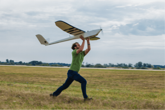
Examples of members of this small UAV class are:
-the 1 meter long RQ-11 Raven, by US Aero Vironment with a wingspan of 1.4 m;
-the Turkish Bayraktar, which weighs about 5 kg and has a data link range of 20 km;
-the US Army RQ-7 Shadow
Some of the UAVs of this class are based on a rotary-wing design.
-3. Medium UAVs
The medium UAV class applies to UAVs that are too heavy to be carried by one person but are still smaller than a light aircraft. They usually have a wingspan of about 5-10 m and can carry payloads of 100 to 200 kg. Examples of medium fixed-wing UAVs are the Israeli-US Hunter and the UK Watchkeeper. There are other brands used in the past, such as the US Boeing Eagle Eye, the RQ-2 Pioneer, the BAE systems Skyeye R4E, and the RQ-5A Hunter. The Hunter has a wingspan of 10.2 m and is 6.9 m long. It weighs about 885 kg at takeoff. The RS-20 by American Aerospace is another example of a crossover UAV that spans the specifications of a small and medium sized UAV. Many other medium UAVs can be found in the reading assignment. There are also numbers of rotary-based medium sized UAVs.
-4. Large UAVs
The large UAV class applies to the large UAVs used mainly for combat operations by the military. Examples of these large UAVs are the US General Atomics Predator A and B and the US Northrop Grumman Global Hawk as seen in the figure below:
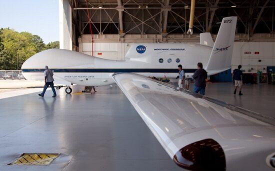
_____
Classification based on the type of aerial platform:
Drones can be classified on a different basis, like drones for photography, drones for aerial mapping, drones for military purposes and surveillance, etc. However, the best classification of drones can be made on the basis of aerial platforms. Based on the type of aerial platform used, there are 4 major types of drones; fixed wing drones, multi rotor drones, single rotor drones and fixed wing hybrid VTOL drones as seen in the figure below:
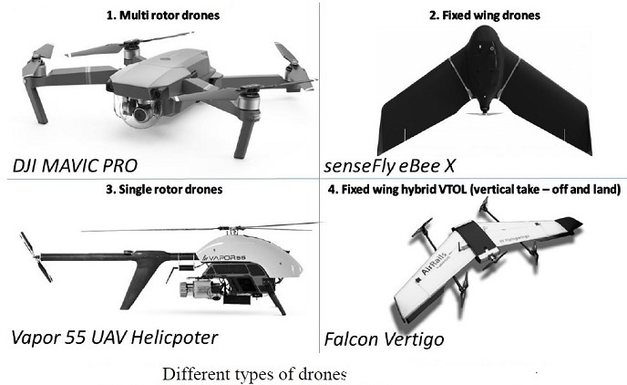
_
Multi-Rotor:
If you want to get a small camera in the air for a short period of time, then it is hard to argue with a multi-rotor. They are the easiest and cheapest option for getting an ‘eye in the sky’, and because they give you such great control over position and framing, they are perfect for aerial photography work. The downside of multi-rotors is their limited endurance and speed, making them unsuitable for large scale aerial mapping, long endurance monitoring and long distance inspection such as pipelines, roads and power lines.
Although the technology is improving all the time, multi-rotors are fundamentally very inefficient and require a lot of energy just to fight gravity and keep them in the air. With current battery technology they are limited to around 20-30 minutes when carrying a lightweight camera payload. Heavy-lift multi-rotors are capable of carrying more weight, but in exchange for much shorter flight times. Due to the need for fast and high-precision throttle changes to keep them stabilised, it isn’t practical to use a gas engine to power multi-rotors, so they are restricted to electric motors. So until a new power source comes along, we can only expect very small gains in flight time.
Multi-rotor drones are the most commonly used types of drones, which are used not only for fun, but also for professional aerial mapping. Common applications of multi rotors are aerial photography, video recording and aerial surveying. These types of drones can be classified according to the number of rotors, e.g., tricopters (3 rotors), quadcopters (4 rotors), hexacopters (6 rotors) and octocopters (8 rotors). Hexacopters are often used for industrial work like inspections and aerial data collection for mapping, while octocopters are often used in high-end cinematography.
_
Fixed-Wing:
Fixed-wing drones (as opposed to ‘rotary wing’, i.e., helicopters) use a wing like a normal aeroplane to provide the lift rather than vertical lift rotors. Because of this they only need to use energy to move forward, not hold themselves up in the air, so are much more efficient. For this reason they are able to cover longer distances, map much larger areas, and loiter for long times monitoring their point of interest. In addition to the greater efficiency, it is also possible to use gasoline engines as their power source, and with the greater energy density of fuel many fixed-wing UAVs can stay aloft for 16 hours or more.
The main downside of a fixed-wing aircraft is obviously their inability to hover in one spot, which rules them out for any general aerial photography work. This also makes launching and landing them a lot trickier, as depending on their size you can need a runway or catapult launcher to get them into the air, and either a runway, parachute or net to recover them safely again at the end. Only the smallest fixed-wing drones are suitable for hand launch and ‘belly landing’ in an open field.
Other downsides are their higher cost, and that it is much more difficult to learn the ropes with fixed-wing drones. One reason why multi-rotors have become so widespread is that it is easy to get started: anyone can buy a cheap quad-copter and start hovering in their back yard, practicing the skills and gradually getting more and more confident before flying further, higher and faster. That isn’t the case with fixed-wing drones: the first time you launch one you need to be confident in your abilities to control it from launch, through the flight and then bring it back to a soft landing. You don’t get a chance to put it into a hover and think, putting the sticks in the middle won’t keep it in place: a fixed-wing drone is always moving forward and they move a lot quicker than a multi-rotor!
Another consideration of fixed-wing drone work is that it is much more about the data, not just taking pretty pictures. With a multi-rotor session you’re generally done with the job when the flight is over, you only need to hand over the imagery. With fixed-wing work the flight is just the beginning, you’ve captured the images but it isn’t yet the data the clients are looking for. The imagery is fed through the first stage processing to stitch the hundreds (or thousands) of separate images into one big tiled image, but there can be a lot more to be done after this in performing data analysis such as the stockpile volume calculations, tree counts, overlaying other data on to the maps, and so on.
Finally, a big challenge when operating fixed-wing drones is Wedge-tailed Eagles. You won’t find them in the city, and they won’t often attack a multi-rotor flying low regardless, but for the average fixed-wing job further out of town and flying 100m high, these huge birds are a menace. Many people have had their new drones ripped from the sky by these amazing but incredibly aggressive birds of prey. Keep a close lookout, and be ready to make some quick evasive manoeuvres!
_
Single-Rotor Helicopter/Drone:
While a multi-rotor has many different rotors to hold it up, a single rotor has just one, plus a tail rotor to control its heading. Helicopters are very popular in manned aviation, but currently only fill a small niche in the drone world.
A single-rotor helicopter has the benefit of much greater efficiency over a multi-rotor, and also that they can be powered by a gasoline motor for even longer endurance. It is a general rule of aerodynamics that the larger the rotor blade is and the slower it spins, the more efficient it is. This is why a quad-copter is more efficient than an octo-copter, and special long-endurance quads have a large prop diameter. A single-rotor drone allows for very long blades which are more like a spinning wing than a propeller, giving great efficiency.
If you need to hover with a heavy payload (e.g., an aerial LIDAR laser scanner) or have a mixture of hovering with long endurance or fast forward flight, then a single-rotor drone is really your best bet.
The downsides are their complexity, cost, vibration, and also the danger of their large spinning blades. While a multi-rotor prop can certainly leave you with a bad scar, it is unlikely to do much more than that but the long sharp blades of a helicopter drone can cause more serious damage if you get in their way, and there have been a number of fatalities from RC hobby and drone helicopters.
In terms of difficulty, single-rotor drones lie somewhere between multi-rotors and fixed-wing aircraft. On one hand they can hover on the spot, so it is possible to start easy and work your way up, but on the other hand they aren’t as stable or forgiving in the event of a bad landing, and they also require a lot of maintenance and care due to their mechanical complexity.
_
Hybrid drones:
Fixed-Wing Hybrid VTOL:
Merging the benefits of fixed-wing UAVs with the ability to hover is a new category of hybrids which can also take off and land vertically. Fixed wing unmanned aircraft is known to be more energy efficient than quadcopters and as a result can cover long distances much faster. But quad-shaped drones do not need that much space for take-off and landing. That is also why some manufacturers have decided to combine these characteristics and have developed unmanned aircraft that can take off vertically and then go into horizontal flight using wings i.e., hybrid drones. The hybrid drone flies on a pre-scheduled flight route at a user-specified height and collects data through its color and multispectral sensors. Upon completion of its mission, the drone will land vertically back to the starting point.
There are various types under development, some of which are basically just existing fixed-wing designs with vertical lift motors bolted on. Others are ‘tail sitter’ aircraft which look like a regular plane but rest on their tails on the ground, pointing straight up for takeoff before pitching over to fly normally, or ’tilt rotor’ types where the rotors or even the whole wing with propellers attached can swivel from pointing upwards for takeoff to pointing horizontally for forward flight.
Many of these configurations were tried in the 1950s and 60s for manned aircraft, but they proved too complex and difficult to fly, with some disastrous results. With the arrival of modern autopilots, gyros and accelerometers, suddenly these whacky types are feasible because the autopilot can do all the hard work of keeping them stable, leaving the human pilot the easier task of guiding them around the sky. There are only a handful of hybrid fixed-wing aircraft currently on the market, but you can expect this to be a much more popular option in the coming years as the technology is perfected. One example getting a lot of attention is Amazon’s Prime Air delivery drone.
____
Pros and Cons of drones based on different aerial platform:
|
Pros |
Cons |
Typical Uses |
|
|
Multi-Rotor |
|
|
Aerial Photography and Video Aerial Inspection |
|
Fixed-Wing |
|
|
Aerial Mapping, Pipeline and Power line inspection |
|
Single-Rotor |
|
|
Aerial LIDAR laser scanning |
|
Fixed-Wing Hybrid |
|
|
Drone Delivery |
______
______
Classification of drones based on capabilities:
In an effort to describe the kinds of capabilities that will be available to various types of actors, UAVs are categorized based on two characteristics: (1) the degree to which they are accessible to any given actor; and (2) the technology base and infrastructure required to produce and/or operate them. Using this taxonomy, four categories of drones are identified: hobbyist drones, midsize military and commercial drones, large military-specific drones, and stealth combat drones.
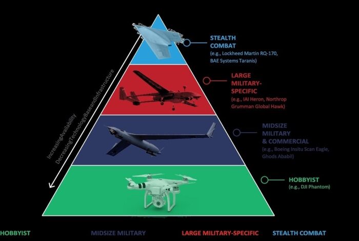
-1. HOBBYIST
Limited payload capacity
Limited range/persistence
High-definition imagery/video transmission
Autonomous GPS and waypoint navigation
-2. MIDSIZE MILITARY& COMMERCIAL
Moderate payload capacity
Moderate range/persistence
Advanced radar
Encrypted, high-bandwidth data links
Limited jamming/electronic warfare
Target identification and designation
Communications relay function
-3. LARGE MILITARY-SPECIFIC
Larger payload capacity
Long range/persistence
Low-probability-of-intercept radar
Enhanced jamming/electronic warfare
Beyond line-of-sight communications
Releasable missiles/bombs
-4. STEALTH COMBAT
Low observable features
Low-probability-of-intercept/low-probability-of-detection data links
Higher resistance to adversary jamming
_
-1. HOBBYIST DRONES
First, hobbyist drones include those that are readily available for purchase – generally for no more than a few thousand dollars – by any interested party. These systems may either be pre-assembled or assembled from component parts and do not require formal infrastructure or training to operate. Current commercial off-the-shelf technology enables hobbyist drones to perform aerial surveillance or deliver payloads – including explosives or chemical or biological agents – of a few kilograms at ranges up to a few kilometers. Eventually, however, hobbyist drones will be capable of GPS-independent autonomous flight and could be used for stand-alone strikes or, in large numbers, saturation swarming attacks against government, military, and civilian targets.
Many commercial off-the-shelf (COTS) drones – including the best-selling model, the DJI Phantom – are now equipped with GPS and waypoint navigation systems. These systems enable the drone to accurately determine and hold its position, in turn removing the need for line-of-sight communications and allowing for autonomous flight. In the event that the operator loses contact with the system, this feature can return the drone to a predetermined location.
_
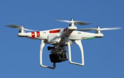
Figure above shows Chinese-made DJI Phantom with GoPro camera mounted below.
_
Operators of pre-assembled systems can also take advantage of smartphone-based control systems, dramatically improving ease of use. Such systems enable the user to navigate the drone simply by selecting a destination on a map or even by merely tilting the user’s phone. While some COTS drones contain firmware that restricts flight in designated “no-fly zones,” such as those around airports and certain national security landmarks, skilled programmers could remove these restrictions. Furthermore, such restrictions do not apply to drones assembled from component parts.
High-definition video cameras are also widely available on COTS drones and, when combined with video downlinks, can provide real-time intelligence, surveillance, and reconnaissance (ISR) capabilities to multilocation receivers, though these capabilities are often limited by range and battery life. As an alternative, operators can extend the drone’s range by recording higher resolution video footage and still photographs for later viewing. Operators can additionally use a control module to make in-flight adjustments to the camera’s tilt and resolution, thus optimizing ISR capabilities. Infrared thermal cameras, enabling heat detection, are also available for commercial purchase.
While not yet fully integrated into existing systems, camera-, laser-, and sensor-based sense and-avoid capabilities will likely be introduced on hobbyist drones within the next several years. These capabilities will enable the drone to identify and maneuver around obstacles in its flight path when in autonomous flight, rather than restrict it to a set path determined by pre-programmed GPS coordinates or waypoints that may contain otherwise impassable objects. These technologies will, in turn, lead to a dramatic improvement in drone autopilot features.
Over time, hobbyist drone capabilities will become increasingly accessible to non-state actors and individuals and increasingly sophisticated – ultimately approaching currently available small military-grade capabilities and blurring the line between civilian and military systems.
Today, relatively capable COTS drones are widely available for purchase, ranging in price from several hundred to several thousand dollars. While most are used for recreational purposes, they have also been used for public nuisance – generally in the form of unauthorized surveillance or flights over private property or restricted government areas, notably including the White House and nuclear facilities in France, Belgium, and the United Kingdom.
Commercially available drones are also known to have been used for warfighting purposes by both state and non-state actors. The Ukrainian military has made extensive use of commercial systems, including modified DJI Phantoms and other reconfigured hobbyist drones, in its conflict with the self-declared Donetsk People’s Republic, a rebel group backed by Russia. Reports indicate that ISIS has also used a commercial drone, the DJI Phantom FC40, for surveillance purposes. Usage of these systems will almost certainly continue to expand in conjunction with falling prices and improved ease of use.
Though most COTS drones have relatively short range and limited payload capacity, they have been successfully used to smuggle drug packages and could be modified to carry explosives, firearms, or other damaging objects instead. The Wall Street Journal reports, “authorities in the U.S., Germany, Spain, and Egypt have foiled at least six potential terrorist attacks with drones since 2011,” and more can be expected. The difficulty of monitoring and regulating the sale of such systems in the future – a major contributor to their appeal to disruptive actors – is compounded by the fact that they are dual-use, with both military and civilian applications, and unlike firearms do not require registration. Furthermore, given the construction material, small size, and flight altitude of most hobbyist systems, they are rarely visible on radar and are therefore particularly difficult to detect. For this reason, defenses against them often require either visual or possibly auditory identification or concerted signal-jamming to disrupt the operator’s communications link with the system and/or the system’s GPS. Most such detection methods, however, require either a pre-existing knowledge or expectation of the system’s presence in a given area and thus are markedly less effective against unanticipated use. And as future systems begin to incorporate GPS-independent means of navigation, such as visual-aided or inertial navigation, signal-jamming will cease to be an effective countermeasure. For these reasons, hobbyist systems hold significant disruptive potential.
Capabilities:
Relatively affordable hobbyist drones, costing no more than a few thousand dollars, are widely available for purchase by states, non-state actors, and individuals alike. These systems have a comparatively lower level of sophistication than higher-end systems and require no standing infrastructure to operate.
- Deliver payloads, including explosives, of no more than a few kilograms at ranges up to a few kilometers
- Capture high-definition images and video; real-time transmission at ranges of up to a couple of kilometers
- Persist for limited periods (no more than approximately 15 minutes)
- Operate in communications-denied environments using fully autonomous GPS and way-point navigation
- Limited navigation in GPS-denied environments using low-cost inertial navigation systems
Limitations:
- Limited payload, endurance, and range
- Vulnerable to electronic countermeasures, including GPS-jamming and spoofing
- Vulnerable to small-arms fire
- Unencrypted data links and video feeds vulnerable to intercept
- No ability to release missiles or bombs
Technology advancements:
- Sense-and-avoid systems to navigate autonomously around obstacles
- Encrypted communications links
- Multivehicle cooperative control, allowing one operator to control several vehicles in flight simultaneously
- Increased range, payload, and endurance
- Visual-aided navigation to allow precision GPS-independent navigation, eliminating vulner-ability to jamming and spoofing attacks
__
-2. MIDSIZE MILITARY AND COMMERCIAL DRONES
Second, midsize military and commercial drones are those that are not generally available to individuals due to cost or infrastructure requirements. These systems may, however, be sold or transferred to foreign militaries and non-state actors. While these systems are generally used for surveillance purposes at present, they are likely to be increasingly armed, either with an explosive payload that can perform a kamikaze mission or, in time, with releasable precision-guided munitions.
Beyond individual recreational use, drones are now used for a wide range of commercial and military activities. In the commercial sphere, they increasingly serve as low-cost alternatives to helicopters for the purposes of professional photography and videography. Drones are used by the agriculture industry to survey and spray crops, by aid groups to monitor disaster zones and deliver humanitarian assistance, by conservationists to track animal populations and land use, and by oil and gas companies to map and model infrastructure. They are also being considered for commercial deliveries – most famously by online retailer Amazon.com – though their use in this capacity is restricted within the United States by Federal Aviation Administration regulations.
Midsize commercial and military systems frequently offer an additional level of sophistication when compared with hobbyist drones, and their accessibility is generally more restricted. Their cost – ranging from hundreds of thousands of dollars to millions of dollars – is also generally prohibitive for individual use. There are, however, a growing number of midsize commercial and military systems available to state actors through foreign military sales. Certain producers of such systems – Iran, in particular – have additionally transferred them to non-state actors.
Compared with hobbyist drones, most midsize commercial and military systems are larger, with longer range and endurance, and carry more sophisticated payloads and communications technologies. Similar to hobbyist drones, they are primarily used as ISR platforms, though they could additionally be used to deliver dangerous payloads, including explosives or chemical or biological weapons. Like hobbyist drones, midsize commercial and military systems are capable of either manual or autonomous flight and can carry high-definition cameras, including night-vision infrared cameras. Many of these systems can also carry advanced electro-optical cameras that are capable of capturing high-resolution images. Furthermore, synthetic aperture radar and/or ground moving target indicator radar are being increasingly integrated onto tactical UAVs, allowing for all-weather terrain mapping, target tracking, and even improvised explosive device (IED) detection. Feeds from these sensors can then be transmitted in real time over high-bandwidth, encrypted data links that increase the difficulty of unauthorized access by third parties. Furthermore, many midsize commercial and military systems can create a beyond-line-of-sight communications relay for ground-based radios, thus extending the communications range for associated ground forces and improving situational awareness and coordination. For example, Boeing Insitu’s ScanEagle, operated by a number of countries including Yemen, has successfully received ground control station data at a range of over 28 kilometers; it has then relayed that data to ground forces an additional 10 kilometers away.
In addition, the range and endurance of midsize commercial and military systems are significantly greater than those of hobbyist systems. While most advanced hobbyist systems are limited to around 20 minutes of flight and an operating distance of no more than a couple of kilometers, midsize commercial and military systems often have an endurance of over an hour at a range of at least 10 kilometers. For example, AeroVironment’s RQ-11B Raven – the most common military UAV in operation – has an endurance of 60 to 90 minutes, depending on operating conditions and payload, and a range of between eight and 10 kilometers. Ghods’ Ababil-3 – variants of which Iran has reportedly transferred to Hamas and Hezbollah, among others – has a claimed endurance of up to four hours and a range of 100 kilometers. These performance characteristics enable increased loiter time and further improve targeting and ISR collection capabilities.
Given their relative affordability, accessibility, and ease of use, midsize commercial and military systems – with varying degrees of sophistication – are operated by a number of state and nonstate actors. Today, 87 countries – ranging from major military powers such as the United States and China to smaller nations such as Cyprus and Trinidad and Tobago – operate such systems, and this number is likely to grow in the years to come. Nor are these systems confined to nation-states alone. Both Hamas and Hezbollah are known to operate midsize military-grade systems, believed to be variants of the Iranian-supplied Ababil-1 and Mohajer 4, respectively. They have repeatedly flown these systems into Israeli airspace, penetrating as far as 225 kilometers into Israel. Indeed, Hezbollah’s Mohajer 4, which it calls the Mirsar, was able to elude Israeli radar on several occasions due to its small size. While both Hamas and Hezbollah have large quantities of unguided rockets that they have launched into Israel on numerous occasions, UAVs could increase the precision of an attack, resulting in a greater ability to inflict casualties or strike specific high-profile targets. In addition, drones can be more challenging to shoot down than rockets since they do not follow a high, ballistic trajectory – a factor that complicates detection and interception.
Capabilities:
Midsize commercial and military drones, ranging in cost from tens of thousands of dollars to no more than a couple million dollars, are widely available for purchase by states and industry. They may also be procured and operated by more established or well-organized non-state actors with limited supporting infrastructure.
- Deliver payloads of up to a couple hundred kilograms at ranges of up to a couple hundred kilometers
- Capture high-definition images and video at ranges of up to a couple hundred kilometers; real-time transmission at ranges of up to around 30 kilometers
- Persist for moderate periods (generally between 60 minutes and a few hours)
- Operate in communications-denied environments using fully autonomous GPS and way-point navigation
- All-weather terrain mapping and target tracking via advanced radar
- Identify and designate targets via laser range finders and illuminators
- Transmit data via encrypted, high-bandwidth data links
- Limited jamming and electronic intelligence-gathering
- Communications relay function
- Ability to perform a kamikaze mission using an explosive payload
Limitations:
- Vulnerable to countermeasures, including GPS-jamming and spoofing, small-arms fire (at lower altitudes), and man-portable air-defense systems (MANPADS) (at higher altitudes)
- Not survivable in contested or denied airspace
- Line-of-sight communications
- Data links vulnerable to interception
- No current ability to release missiles or bombs
Technology advancements (in addition to the technologies available to hobbyist drones):
- Increased range, payload, and endurance
- Releasable missiles or bombs
__
-3. LARGE MILITARY-SPECIFIC DRONES
Third, large military-specific drones – often including armed drones – require substantial military infrastructure to operate and are not generally accessible to or operable by actors beyond major militaries. These systems represent a high level of technological sophistication, with greater range, endurance, and payload capacity than both hobbyist and midsize commercial and military drones. In addition, many large military-specific systems are capable of beyond-line-of-sight communications and signal-jamming and, if armed, can deliver payloads of over 1,000 kilograms at ranges of thousands of kilometers. Partnered with a secondary drone operating as a line-of-sight communications relay, these drones could reach several hundred kilometers into neighboring territory without the use of satellite communications. These factors enable large military-specific drones to operate and strike deep inside an adversary’s territory. However, without stealth or electronic attack capabilities, they will remain vulnerable to advanced air defenses as well as to enemy fighter aircraft.
In addition to the capabilities found on midsize commercial and military systems, large military specific systems have a number of relatively sophisticated features, including increased range, endurance, and payload capacity. For example, General Atomics’ Predator – variants of which are operated by several NATO countries has an endurance of between 18 and 40 hours, while Israel Aerospace Industries’ Heron – flown by over 20 countries – has an endurance of up to 45 hours. This level of endurance dramatically increases the persistence of the platform, allowing for greater time on target and improved ISR collection. Some large military-specific systems, such as Northrop Grumman’s RQ-4 Global Hawk, also operate active electronically scanned array radars that deliver higher resolution than that available in baseline systems, as well as integrated sensor suites that synthesize inputs from the system’s radar, cameras, and other sensors. This further improves the system’s ability to conduct air-to-air surveillance and track both individuals of interest and ground vehicles. Some large military-specific systems also feature enhanced jamming capabilities that enable broader, beyond line-of-sight electronic warfare.
_
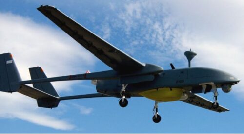
Figure above shows Israeli Aerospace Industries’ Heron.
_
Large military-specific systems offer a number of additional improvements in communications capabilities. Many include wide-band satellite communications (SATCOM) that expand the amount and extend the range of transmittable data, providing distant ground stations with real-time ISR. Like some baseline systems, high-end systems are generally capable of line-of-sight communications with other platforms operating in their area and, for this reason, are often employed as communications relays. Perhaps the most vivid example of the force-multiplying effects of such capabilities is the EQ-4 – what is essentially an RQ-4 Global Hawk outfitted with the Battlefield Airborne Communications Node (BACN). BACN serves as a universal translator for a diverse set of U.S. aircraft that are not otherwise capable of communicating with each other due to incompatible data links – providing a vital connection between, for example, fourth-generation F-16 fighter jets, B-1 bombers, and stealthy, fifth-generation F-22s. Communications relay capabilities (figure below) will also allow states to operate drones at extended ranges (300 to 800 kilometers) without satellite communications, allowing significant penetration into neighboring countries or contested areas. 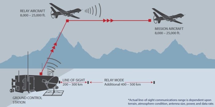
_
Additionally, many military-specific systems have the capacity for a weapons payload. Indeed, 10 countries currently possess armed drones, with at least 20 more openly reported to have active development programs. It should be noted, however, that there is a range in the sophistication of armed drones – from Israel’s and the United States’ highly advanced systems to Nigeria’s less-sophisticated Chinese-origin models. For example, General Atomics’ MQ-9 Reaper carries “up to 14 [AGM-114] Hellfire missiles … or various combinations of the GBU-12 Paveway II laser-guided bomb, the AIM-9 Sidewinder, or the GBU-38 JDAM.” Systems such as the armed Reapers, currently operated by only the United States and the United Kingdom, thus provide a flexible menu of options for precision-guided air-to-air, anti-personnel, and armor-piercing capabilities that can be delivered at a range of approximately nine kilometers, from altitudes of up to 50,000 feet. This range, in turn, increases the difficulty of detection and neutralization from a counterair perspective, falling outside the range of, for example, many widely operated MANPADS. This stands in contrast to Nigeria’s CH-3, which reportedly carries only two air-to-ground missiles and can reach altitudes of no more than 20,000 feet. In addition, while large military-specific drones offer a relatively high level of sophistication, without stealth or electronic attack capabilities they will remain vulnerable to advanced air defenses as well as to enemy fighter aircraft.
Capabilities:
Highly sophisticated military-specific drones, costing in the millions of dollars, currently require substantial training and infrastructure to operate. Because of that, they are neither accessible to nor affordable for non-state actors and many state militaries. Nonetheless, the increasing number of indigenous producers and growing international market suggest that an increasing number of countries will possess armed drones in the next 5 to 10 years.
- Deliver payloads of over 1,000 kilograms at ranges of several hundred to a few thousand kilometers
- Real-time transmission of high-definition images and video at global ranges
- Persist for lengthier periods (up to 24 hours or more)
- Operate in communications-denied environments using fully autonomous GPS and way-point navigation
- Identify and designate targets via laser range finders and illuminators
- All-weather terrain mapping and target tracking via low-probability-of-intercept radar
- Transmit data via encrypted, high-bandwidth data links
- Enhanced jamming and electronic intelligence-gathering
- Higher resistance to adversary jamming
- Wide-band, beyond-line-of-sight satellite communications
- Releasable missiles or bombs
- Communications relay to enable extended-range (300 to 800 kilometers) operations without relying on SATCOM
Limitations:
- Vulnerable to countermeasures, including GPS-jamming and spoofing
- Not survivable in contested or denied airspace with advanced enemy air defenses
- Vulnerable to enemy fighter aircraft
Technology advancements (in addition to the technologies available to hobbyist and midsize military and commercial drones):
- Increased range, payload, and endurance
- Beyond-line-of-sight electronic warfare
- Simple air-to-air capabilities against slow-flying aircraft, such as other drones
__
-4. STEALTH COMBAT DRONES
Finally, stealth combat drones include those that contain highly sophisticated technologies, such as low-observable features, and are not accessible to nonindigenous producers. Stealth combat systems, including ISR and armed UAVs, represent the highest levels of technological sophistication – akin to the most advanced, fifth-generation fighter aircraft. While a number of countries have development programs for such systems, only the United States is known to operate them. Furthermore, due to the sensitivity of stealth combat drones, the United States does not export them and rarely discusses their existence or capabilities in public.
Although many stealth combat systems are classified, defense officials have confirmed the existence of two: Lockheed Martin’s RQ-170 Sentinel and Northrop Grumman’s RQ-180 – short- and medium-range stealthy ISR UAVs, respectively. Both systems are reportedly designed to minimize their radar cross-section via low-observable features such as stealth coatings that absorb the radio waves of adversary radar and shaping measures that minimize radar reflection. Indeed, neither system has the radar-reflective vertical stabilizers found on most manned aircraft; the systems are instead shaped like tailless flying wings with, according to open-source reporting, specially designed inlets and exhaust – features that improve broadband, all-aspect stealth. Like fifth-generation aircraft, these and other stealth combat drones are also likely to feature low-probability-of-intercept/low-probability of-detection communications that can transmit data while in stealth mode, as well as an array of passive sensors. This suite of technologies, in turn, enables stealth combat systems to operate in contested and denied environments that contain advanced, integrated air defense systems – a capability not resident in less sophisticated UAVs.
_
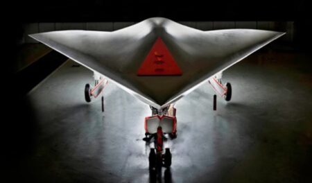
The BAE Systems’ Taranis is a demonstrator program for unmanned combat air vehicle technology.
_
Although no other currently operating, publicly acknowledged drones feature such technologies, reports indicate that BAE Systems’ Taranis and Dassault Aviation’s nEUROn – jointly developed by France, Italy, Sweden, Spain, Greece, and Switzerland – will have similar stealth features when they eventually become operational, as will systems being developed by Russia, Israel, China, and India. Furthermore, while the RQ-170 and RQ-180 are being used for ISR purposes, according to open-source reporting, many international development programs such as the Taranis and nEUROn are intended to produce strike platforms.
Capabilities:
- Real-time transmission of high-definition images and video at global ranges
- Persist for lengthier periods (between 5 hours and 24 hours, depending on size)
- Operate in communications-denied environments using fully autonomous GPS and waypoint navigation
- Operate in contested and denied airspace with advanced enemy integrated air defense systems as a result of low-observable features
- All-weather terrain mapping and target tracking via low-probability-of-intercept radar
- Enhanced jamming and electronic intelligence-gathering
- Higher resistance to adversary jamming
- Wide-band, beyond-line-of-sight satellite communications
- Transmit data via low-probability-of-intercept/low-probability-of-detection data links
- Releasable missiles and/or bombs
Limitations:
- Some vulnerability to countermeasures, including GPS-jamming and spoofing
Technology advancements (in addition to the technologies available to other drones):
- Increased range, payload, and endurance
- Autonomous aerial refueling
- Air-to-air combat
- Coordinated operations in communications-contested environments
- High-resolution precision GPS-independent navigation systems to allow operations in GPS-denied environments
______
______
Miscellaneous drone types:
-1. Drone in a Box:
The drone in a box is an emerging form of autonomous unmanned aerial vehicle (UAV) technology that uses drones that deploy from and return to self-contained landing “boxes.” Traditional drones, or UAVs, consist of both a non-manned aircraft and some form of ground-based controller. Drone-in-a-box systems, on the other hand, deploy autonomously from a box that also functions as a landing pad and charging base. After carrying out a pre-programmed list of instructions, they return to their “base” to charge and/or upload information.
Stand-alone drone-in-a-box systems are composed of three main components: a ground station that charges and shelters the drone, the drone itself, and a computer management system that allows the operator to interact with the system, including multiple drones. The ground station also provides battery charging and conducts health checks, and can be made of either metal or carbon fibres.
_
-2. Drone flies as both biplane and helicopter using one propeller: TU Delft:
There are helicopter drones and fixed-wing drones, but creating a hybrid of both is tricky. Even Parrot’s Swing, as clever as it is, needs four propellers and elaborate wings to pull off its stunt. However, TU Delft (with backing from Parrot) has a far more elegant solution. Its DelftAcopter drone doubles as both a fixed-wing aircraft and a helicopter using only one propeller — its tailless biplane design lets it take off and hover vertically, but gracefully turn into a fast-moving airplane (up to 62MPH) at a moment’s notice. It’s an incredibly simple design that makes you wonder why someone hadn’t considered it for drones before.
The machine is completely autonomous thanks to GPS, motion sensors and computer vision — it can pick a safe place to land all on its own. The prototype has a relatively long 37-mile range, too, and it can run for an hour on its electric motor. Contrast that with a typical quadcopter drone like DJI’s Phantom 4, which lasts for 28 minutes and tops out at 45MPH.
And unlike some drone experiments, TU Delft already has a clear idea of what its vehicle will do. The DelftAcopter would carry medical supplies to and from hard-to-reach places — you could deliver much-needed medicine to a flood zone. It’s not hard to imagine uses in search-and-rescue and recon missions, too. While it’ll likely take a while before you see the robotic biplane enter service, it’s easy to see this invention saving lives.
_
-3. Skeeter drone:
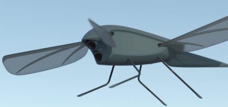
Skeeter is a ground-breaking flapping wing micro-drone designed for covert surveillance and surveying tasks. Based on the body plan of a dragonfly, flapping wing propulsion maximises efficiency and enables gliding and gust tolerance. The ornithopter or “flapping wing” utilizes bird flying mechanics as the power source of the UAV. This technology has been used by the military to develop a small “bird-like” UAV capable of surveillance. However, there are a few downsides to this technology. One downfall is the lack of flight time due to the extreme power requirements needed for the flapping mechanism. Another downfall is the lack of manoeuvrability.
Key Features:
Small and lightweight: <200g
High endurance
High speed
Ability to glide and hover
Quiet and covert
Gust tolerant
Autonomous guidance and navigation in both GPS and GPS-denied environments
Fleet capability
Use Cases:
The initial use for Skeeter is as a short-range surveillance platform, for situational awareness – with the ability to operate in high wind conditions and fly longer distances on lower power than existing small UAS. Small UAS are currently in use by the military, and have proven valuable when weather conditions allow. Skeeter is designed to extend the capability of small UAS, resulting in a vehicle that can operate in a greater range of conditions. Skeeter also has uses in search and rescue, surveying, and agriculture; and in particular where small-scale hovering UAS with high gust tolerance, high speed and greater endurance are required.
_
-4. Lighter than Air UAV:
Lighter-than-air UAVs are aircraft such as blimps and balloons. These vehicles benefit from quiet operation and endurance. With their long endurance flight capability these vehicles can be used for surveillance and aerial photography. However, due to their lack of manoeuvrability these systems are usually tethered. The tether allows the user to maintain control and to keep the UAV from drifting due to winds. In some systems the tether can also act as a communication system to download and upload information from the vehicle.
_
-5. UUV:
Unmanned underwater vehicles (UUV), sometimes known as underwater drones, are any submersible vehicles that are able to operate underwater without a human occupant. These vehicles are robotic, and may be divided into the two categories of remotely operated underwater vehicles (ROUVs), which are remotely controlled by a human operator; and autonomous underwater vehicles (AUVs), which are highly automated and operate independently of direct human input. Sometimes only vehicles in the second category are considered a kind of autonomous robot, but those in the first category are also robots though requiring a remote operator, similar to surgical robots.
Applications:
The navies of multiple countries, including the US, UK, France, Russia, and China are currently creating unmanned vehicles to be used in oceanic warfare to discover and terminate underwater mines. For instance, the REMUS is a three-foot long robot used to clear mines in one square mile within 16 hours. This is much more efficient, as a team of human divers would need upwards of 21 days to perform the same task. In addition to UUVs with the purpose of clearing out mines, autonomous submarines began to be prototyped as of 2008. Especially autonomous submarines face much of the same ethical issues as other unmanned weapons. Other applications include ship hull inspection (Bluefin), wreck inspection (Blueye Pioneer), nuclear reactor decontamination, exploration, and mining/drilling.
Unmanned underwater vehicles have other potential military applications. A survey conducted by RAND Corporation for the US military analyzed the missions which unmanned underwater vehicles could perform, which included intelligence, reconnaissance, mine countermeasures, and submarine warfare.
OODA Technologies, a data collection and analysis company, is highly interested in utilizing UUVs along the coasts of Canada. According to OODA, these unmanned craft provide much greater coverage of an area at a much lower cost. The quality of the data returned by unmanned marine vehicles is also stated to be much higher than that of traditional manned craft.
_
-6. Switchblade (kamikaze, suicide or killer drones):
This new weapon brings power and peril to the U.S. military. Some experts believe the spread of low-cost, light-weight “killer” drones will change ground warfare as profoundly as the machine gun did. They are called “Switchblade” because their bladelike wings spring out on launch. These unmanned aircraft don’t fire missiles — they are the missiles. But unlike typical missiles, they can circle above a target, wait for the ideal moment and strike with incredible precision. Weighing just 5½ pounds, including its small warhead, the Switchblade can be taken into battle in a backpack and fly up to 7 miles to hit a target. The 300 model is designed to kill individuals, while a larger version, the 600, can destroy armored vehicles. The Switchblade has a feature that allows the operator to adjust the blast radius, so it can kill the driver of a vehicle but not a passenger, for example. The weapon can be “waved off” up to two seconds before impact in the event of a mistake or a risk to civilians. That wave-off capability is notable in light of the catastrophe in September 2021 when the U.S. military killed 10 civilians, seven of them children, in a drone strike in Afghanistan that officials now say was a tragic mistake. Switchblade cost just $6,000 a piece, compared to $150,000 for the Hellfire missile typically fired by Predator or Reaper drones.
_
-7. UGV:
Unmanned ground vehicle (UGV) is a vehicle that operates while in contact with the ground and without an onboard human presence. UGVs can be used for many applications where it may be inconvenient, dangerous, or impossible to have a human operator present. Generally, the vehicle will have a set of sensors to observe the environment, and will either autonomously make decisions about its behavior or pass the information to a human operator at a different location who will control the vehicle through teleoperation. The UGV is the land-based counterpart to unmanned aerial vehicles and unmanned underwater vehicles. Unmanned robotics are being actively developed for both civilian and military use to perform a variety of dull, dirty, and dangerous activities. Operations like radioactive waste handling, bomb disposal, surveillance, search and rescue are today performed mostly by humans at great risk to their own safety and well-being. In order to minimize direct human intervention in such operations, remotely operated versatile Unmanned Ground Vehicles are preferred.
NASA’s Mars Exploration Rover project included two UGVs, Spirit and Opportunity, that performed beyond the original design parameters. This is attributed to redundant systems, careful handling, and long-term interface decision making. Opportunity (rover) and its twin, Spirit (rover), six-wheeled, solar powered ground vehicles, were launched in July 2003 and landed on opposite sides of Mars in January 2004. The Spirit rover operated nominally until it became trapped in deep sand in April 2009, lasting more than 20 times longer than expected. Opportunity, by comparison, was operational for more than 14 years beyond its intended lifespan of three months. Curiosity (rover) landed on Mars in September 2011, and its original two-year mission has since been extended indefinitely.
The Indian military is looking for new unmanned ground vehicles (UGVs) for missions in high-altitude areas. The country’s need for unmanned platforms that can operate in high-altitude regions stems from the challenges it faced in Ladakh, where a clash took place with Chinese soldiers at over 15,000 feet (4,572 meters). The new UGVs should be suitable for military operations, including surveillance, reconnaissance, targeting enemy positions, delivering critical supplies, and carrying out rapid evacuations. The platform should also carry a machine gun to support combat missions, particularly along India’s northern borders.
______
______
Section-5
Technology of drone:
While drones serve a variety of purposes, such as recreational, photography, commercial and military, their two basic functions are flight and navigation. To achieve flight, drones consist of a power source, such as battery or fuel, rotors, propellers and a frame. The frame of a drone is typically made of lightweight, composite materials, to reduce weight and increase maneuverability during flight. Drones require a controller, which is used remotely by an operator to launch, navigate and land it. Controllers communicate with the drone using radio waves, including Wi-Fi. Ultimately low-frequency radio waves display low signal attenuation, making them suitable for long-distance communications, whereas high-frequency radio waves (wi-fi) tend to display high signal attenuation and is suitable for short-distance communications. Both are affected by obstacles such as walls and other matching radio frequencies, therefore you have a better chance of reaching the distances you need using low-frequency radio technology.
With a joystick and a GPS system, the operations of most consumer drones seem no more complex than playing a video game. However, behind the easy user interface are an accelerometer, a gyroscope, and other complex technologies working to make the mechanics of drone flight as smooth as possible. Gyro stabilization technology give the UAV drone its smooth flight capabilities. The gyroscope works almost instantly to the forces moving against the drone, keeping it flying or hovering very smoothly. The gyroscope provides essential navigational information to the central flight controller. The inertial measurement unit (IMU) works by detecting the current rate of acceleration using one or more accelerometers. The IMU detects changes in rotational attributes like pitch, roll and yaw using one or more gyroscopes. Some IMU include a magnetometer to assist with calibration against orientation drift. The Gyroscope is a component of the IMU and the IMU is an essential component of the drone’s flight controller. The flight controller is the central brain of the drone.
A self-flying drone is built with various in-built with computerized programming and using technology like propulsion and navigation systems, GPS, sensors and cameras, programmable controllers as well as equipment for automated flights.
_
Materials used in drones:
An unmanned aerial vehicle (UAV), commonly known as a drone, is an aircraft without a human pilot aboard. The flight of UAVs may operate with various degrees of autonomy: either under remote control by a human operator, or fully or intermittently autonomously, by on-board computers. There is a wide variety of UAV shapes, sizes, configurations, and characteristics. UAVs perform a wide variety of functions. The majority of these functions are remote sensing, this is central to the reconnaissance role, that most UAVs fulfill, other functions include transport, research and development, to search for and rescue people in perilous locations etc. However, as UAVs tend to be smaller than conventional aircraft and with a limited fuel capacity, their flight times tend to be significantly lower than those of their manned counterparts. This issue becomes even greater when considering the payload of the vehicle, which can range from a set of surveillance payloads to a small stock based on user requirement. In order to improve this, a reduction of weight in the UAVs is paramount and the use of conventional aerospace materials might not be a feasible design option in the construction of UAVs. As a result, composite materials take a central role in the design and manufacture of drones. Composite materials have been extensively used in defense, automotive and aerospace applications attributed to their high stiffness and low weight. In these applications, they play a key role in absorbing the energy against impact loading. An impact event could range from a dropped tool, travelling at a low velocity (<10m/s), to high speed projectiles travelling at a few hundred meters per second.
Following materials are used in drones:
-Carbon fiber-reinforced composites (CRFCs)
-Thermoplastics such as polyester, nylon, polystyrene, etc.
-Aluminum
-Lithium ion batteries
Every gram of material used to make a drone costs energy to lift, and every gram that can be saved improves performance:
-Increased cargo capacity
-Extended flying time
-Reduced inertia and improved maneuverability
This process of selecting materials and designing components to minimize mass is called “lightweighting”. This gives us the most important material property selection criteria: minimizing mass by selecting low-density materials.
_
Drone Technologies:
-1. Vertical Take-Off and Landing (VTOL)
Every drone is not capable of vertical take-off and landing. Drones that are quadcopters that can take-off, fly, hover, and land vertically. That is why it is called VTOL. There are drones that can be launched from palm of your hand.
-2. Radar positioning drone technology
These drones are equipped with dual navigation technology. It connects to a group of navigation satellites when it is turned on. This satellite constellation gives this drone accurate coordinates of the destination. This type of drone has a GNSS/GPS system which helps in knowing the real-time location, and improves accuracy.
-3. Obstacle Detection drone technology
This kind of drone is loaded with many detection sensors. Such as ultrasonic, vision sensor, infrared, lidar, monocular vision etc. These drones scan surroundings and do the 3D mapping.
-4. Gyro Stabilization drone technology
Drones equipped with gyroscope which allows them to fly, rover, and land smoothly against any external force.
-5. Drone propulsion technology
These drones have a propulsion system that allows the drone to fly and hover in any direction.
-6. Drone Transmission technology
Such drones are used to send and receive real-time data. With the introduction of 5G network the accuracy and speed of transmission of data in such drones have improved manifold.
-7. Live video drone technology
These drones are equipped with high definition cameras that records and transmit real-time video (Live Video) of a location while flying at a height.
____
Drones contain a large number of technological components, including:
Electronic Speed Controllers (ESC), an electronic circuit that controls a motor’s speed and direction.
Flight controller
GPS module
Battery
Antenna
Receiver
Cameras
Sensors, including ultrasonic sensors and collision avoidance sensors
Accelerometer, which measures speed
Altimeter, which measures altitude
_
Any discussion about drone features is closely tied to the type and use case of the drone, including recreational, photography, commercial and military uses. Examples of features include:
Camera type, video resolution, megapixels and media storage format
Maximum flight time, such as how long the drone can remain in the air
Maximum speeds, including ascent and descent
Hover accuracy
Obstacle sensory range
Altitude hold, which keeps the drone at a fixed altitude
Live video feed
Flight logs
_
Navigational systems, such as GPS, are typically housed in the nose of a drone. The GPS on a drone communicates its precise location with the controller. An accelerometer feeds the drone information about its speed and direction, while an altimeter tells the machine its altitude. These features also help a drone land slowly and safely, preventing it from sinking into an air vacuum called a wash that could pull the aircraft down in an unpredictable way.
Drones can be equipped with a number of sensors, including distance sensors (ultrasonic, laser, lidar), time-of-flight sensors, chemical sensors, and stabilization and orientation sensors, among others. Visual sensors offer still or video data, with RGB sensors collecting standard visual red, green and blue wavelengths, and multispectral sensors collecting visible and non-visible wavelengths, such as infrared and ultraviolet. Accelerometers, gyroscopes, magnetometers, barometers and GPS are also common drone features.
For example, thermal sensors can be integral in surveillance or security applications, such as livestock monitoring or heat-signature detection. Hyperspectral sensors can help identify minerals and vegetation, and are ideal for use in crop health, water quality and surface composition.
Some drones employ obstacle detection and collision avoidance sensors. Initially, the sensors were designed to detect objects in front of the drove. Some drones now provide obstacle detection in all six directions: front, back, below, above and side to side.
For the purpose of landing, drones employ visual positioning systems with downward facing cameras and ultrasonic sensors. The ultrasonic sensors determine how close the drone is to the ground.
_____
_____
UAV Design:
Typically, any UAV or drone architecture consists of three main elements: Unmanned Aircraft (UA), Ground Control Station (GCS), and Communication Data-Link (CDL).
- Flight Controller: it is classified as the drone’s central processing unit.
- Ground Control Station: it provides human operators with the necessary capabilities to control and/or monitor UAVs during their operations from a distance. GCSs differ depending on the size, type, and drones’ missions.
- Data Links: are wireless links used to control the information flow between the drone and the GCS. This depends on the operational range of UAVs.
Drones’ control can be categorized based on their distance from the GCS:
-Visual Line-of-sight (VLOS) Distance: allows control signals to be sent and received via the use of direct radio waves.
-Beyond Visual Line-of-Sight (BVLOS) Distance: allows drones to be controlled via satellite communications or other aircrafts via communication relay.
_
Computer control systems:
UAV computing capability followed the advances of computing technology, beginning with analog controls and evolving into microcontrollers, then system-on-a-chip (SOC) and single-board computers (SBC). System hardware for small UAVs is often called the flight controller (FC), flight controller board (FCB) or autopilot. Microprocessor consists of only a Central Processing Unit, whereas Micro Controller contains a CPU, Memory, I/O all integrated into one chip. The same advancements in microchip technology that created the modern smartphone make it possible for drones to be flying computers. Many of the same chips that can be found in smartphones (Intel, Nvidia, Qualcomm, Arm, etc.) also appear in drones. As drones get smarter, they are becoming capable of taking on more sophisticated tasks with less human control. At present, this means drones can follow predetermined paths without a human pilot or record measurements from an even larger array of sensors. But researchers are learning how to program drones to perform increasingly complex tasks without human help.
To most people, the entire purpose of drones is to carry a camera to heights a human could not otherwise reach. Even basic consumer-level drones carry a camera that either broadcasts video back to a smartphone or records images to memory. Movie studios use high-end drones to shoot their big-budget films. However, advancements in the field of “computer vision” are turning cameras into more than just a payload or aid for human pilots. The drones of the future will use cameras to see the world around them and use that information to pilot themselves.
Drones are becoming increasingly capable of flying without help from either a human pilot or even GPS to navigate, and this is giving rise to a powerful new capability: drones working together. Drone swarms have previously been comprised of teams of drones using GPS and communicating with a central controller to determine where each individual fits into the group. However, cutting-edge research has produced drones that use their own onboard sensors, and even their cameras, to recognises other drones and fly in formation. Soon, it may become common to see teams of autonomous drones acting as lifeguards, caring for crops, or flying in search formations to aid disaster relief efforts.
_
Loop principles:
Open loop – This type provides a positive control signal (faster, slower, left, right, up, down) without incorporating feedback from sensor data.
Closed loop – This type incorporates sensor feedback to adjust behavior (reduce speed to reflect tailwind, move to altitude 300 feet). A proportional–integral–derivative controller (PID controller) is common. Sometimes, feedforward is employed, transferring the need to close the loop further.
_
Sensors:
Position and movement sensors give information about the aircraft state. Exteroceptive sensors deal with external information like distance measurements, while exproprioceptive ones correlate internal and external states. Non-cooperative sensors are able to detect targets autonomously so they are used for separation assurance and collision avoidance.
Degrees of freedom (DOF) refers to both the amount and quality of sensors on board: 6 DOF implies 3-axis gyroscopes and accelerometers (a typical inertial measurement unit – IMU), 9 DOF refers to an IMU plus a compass, 10 DOF adds a barometer and 11 DOF usually adds a GPS receiver.
Actuators:
UAV actuators include digital electronic speed controllers (which control the RPM of the motors) linked to motors/engines and propellers, servomotors (for planes and helicopters mostly), weapons, payload actuators, LEDs and speakers.
Software:
UAV software called the flight stack. The purpose of the flight stack is to obtain data from sensors, control motors to ensure UAV stability, and facilitate ground control and mission planning communication.
UAVs are real-time systems that require rapid response to changing sensor data. As a result, UAVs rely on single-board computers for their computational needs. Due to the open-source nature of UAV software, they can be customized to fit specific applications.
_
Autonomy:
The level of autonomy in UAVs varies widely. UAV manufacturers often build in specific autonomous operations, such as:
Self-level: attitude stabilization on the pitch and roll axes.
Altitude hold: The aircraft maintains its altitude using barometric pressure and/or GPS data.
Hover/position hold: Keep level pitch and roll, stable yaw heading and altitude while maintaining position using GNSS or inertial sensors.
Headless mode: Pitch control relative to the position of the pilot rather than relative to the vehicle’s axes.
Care-free: automatic roll and yaw control while moving horizontally
Take-off and landing using a variety of aircraft or ground-based sensors and systems
Failsafe: automatic landing or return-to-home upon loss of control signal
Return-to-home: Fly back to the point of takeoff (often gaining altitude first to avoid possible intervening obstructions such as trees or buildings).
Follow-me: Maintain relative position to a moving pilot or other object using GNSS, image recognition or homing beacon.
GPS waypoint navigation: Using GNSS to navigate to an intermediate location on a travel path.
Orbit around an object: Similar to Follow-me but continuously circle a target.
Pre-programmed aerobatics (such as rolls and loops)
______
______
Components and systems of drone:
Drones are complex devices composed of different components working together. Each component fulfils a different function, so different considerations come into play when selecting materials for each part. However, for each piece of a drone, the material density must be taken into account to minimise the weight and maximise performance.
_
The frame: holding it all together:
The frame gives a drone its shape and holds all of the subsystems in place. It acts as a skeleton in which different components are placed in such a manner that they uniformly distribute the drone’s center of gravity. Because it serves a mechanical function, the most important material property for the frame is strength. For commercial drones, thermoplastics such as variants of nylon, polyester, and polystyrene, are popular choices because they are inexpensive to make into complex parts using injection molding processes.
Flight LED:
These flash various colors to show the user what direction the drone is facing. The two flashing red lights show the front of the drone (the direction the camera is facing). The two green flashing lights are the back of the drone.
Drone Antennas:
Inside the legs of the drone is the transmission system which relays information from the drone to the controller and from the controller to the drone. Also, in the legs of this drone is two compass sensors which relay its direction to the flight controller.
Landing gear:
This is a structure meant for safely landing the drone. However, it can be exempted since an experienced user is capable of balancing the motors speed for safe landing in emergencies. There are two major types of landing gear. One is fixed landing gear and the other is retractable landing gear.
_____
Drone Propulsion system:
Traditional piston and jet engines remain in use for drones requiring long range. However for shorter-range missions electric power has almost entirely taken over. Besides the traditional piston engine, the Wankel rotary engine is used by some drones. This type offers high power output for lower weight, with quieter and more vibration-free running. Claims have also been made for improved reliability and greater range. Small drones mostly use lithium-polymer batteries (Li-Po), while some larger vehicles have adopted the hydrogen fuel cell. The energy density of modern Li-Po batteries is far less than gasoline or hydrogen. However electric motors are cheaper, lighter and quieter. Complex multi-engine, multi-propeller installations are under development with the goal of improving aerodynamic and propulsive efficiency. For such complex power installations, Battery elimination circuitry (BEC) may be used to centralize power distribution and minimize heating, under the control of a microcontroller unit (MCU).
_
The propulsion system (motors, electronic speed controllers and propellers) moves the multirotor UAV into the air and to fly in any direction or hover.
Drone Motors:
Motors are essential for the propeller’s rotation. This enhances a thrust force for propelling the drone. Still, the number of motors should be the same as the number of propellers. The motors are also fitted in a way such that they are easily rotated by the controller. Their rotation enhances the drone control in terms of direction. Choosing the right motor is essential for the efficiency of the drone. You have to check carefully about various parameters such as voltage and current, thrust and thrust to weight ratio, power, efficiency and speed, and so on. Drones (quadcopters) have two clockwise motors (1 and 3) and two counter clockwise motors (2 and 4) to equalize the turning force produced by the rotating propellers (See figure below). Each rotor produces both lift and torque about its center of rotation, as well as drag opposite to the vehicle’s direction of flight. If all four rotors are spinning at the same angular velocity, with two rotating clockwise and two counter clockwise, the net torque about the yaw axis is zero, which means there is no need for a tail rotor as on conventional helicopters. Flight control is provided by independent variation of the speed and hence lift and torque of each rotor. Pitch and roll are controlled by varying the net center of thrust, and yaw is induced by mismatching the balance in aerodynamic torques (i.e., by offsetting the cumulative thrust commands between the counter-rotating blade pairs).
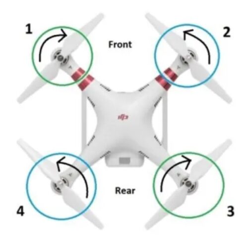
Electric Motors provide the thrust necessary to propel quadcopter up and in the direction we wish to fly. Airplanes use angle of attack to create pressure differences around the wings that allow the lift of airplane. It is the hard-hitting air molecules on the lower surface of wings that generate lift and drag. Multirotor VTOL aircraft, on the other hand, use a similar technique but without the use of wings. Instead, they rely on a combination of efficient electric motors with matching propellers to stay airborne. Efficiency is one of the key components in selecting an electric motor; because it will determine how much fuel you will consume. Efficiency being one factor, a drone manufacturer should keep in mind that every gram added will reduce the drone’s flight duration. Currently there are high quality UAV electric motors being manufactured by Tiger Motors, KDE-Direct, Hacker Motor, and Plettenberg to name a few. What they all have in common is being a brushless DC motor which is heavy by nature. There is also light weight custom BLDC electric motor to save excessive weight and increase system efficiency (power to weight ratio). High torque at less weight improves the flight mechanics, stability and above all; flight duration!
Drone Propellers:
Propellers are clove like blades structured to create a difference in air pressure. When in motion, they cut through the air creating difference in pressure between the top and bottom of the rotors. The top side is characterized by low pressure as compared to the bottom causing the drone to lift into the air. In a fixed-wing aircraft, the angle of attack (the angle of the wing in relation to the relative wind) is important in determining lift. The same is true in a quadcopter drone, where the angle of attack is the angle at which the relative wind meets the chord line of the propeller blade. This angle of attack creates pressure differences around the propeller blades that allow the lift of drone. It is the hard-hitting air molecules on the lower surface of the propeller blades that generate lift and drag. Air flows more slowly at the hub of a blade, than at the faster moving tip. So to produce an even amount of lift along the blade, we need higher angle of attack at the hub than at the tip. That’s achieved by making the propeller blade with a twist along its length. As drones (quadcopters) have two counter clockwise motors and clockwise motors, it also has two different propellers, one for each motor direction. Each propeller rotates pushing the air down and hard-hitting air molecules on lower surface of propeller blade lifts drone up. Typical rotational speeds for the propellers of small multirotor drones are between 4000 and 6000 rpm, and they are typically near 5000 rpm in flight.
Drone Rotors:
A drone relies on rotors for its vertical motion. Drones use their rotors—which consist of a propeller attached to a motor—to hover, meaning the upward thrust of the drone is equal to the gravitational pull working against it; climb, when pilots increase the speed until the rotors produce an upward force greater than gravity; and descend, when pilots perform the opposite and decrease speed. To hover, two of a drone’s four rotors move clockwise (1 and 3), while the other two move counter clockwise (2 and 4), ensuring that the sideways momentum of the drone remains balanced. By adjusting the pitch, your drone will sag down in the front causing it to go forward, or sag in the back causing it to go backwards. While moving forward and backwards—the rotors of the drone must apply thrust while making sure the spin of the rotors keeps the drone balanced. To adjust its yaw, or make it turn left or right, the quadcopter applies more speed to one set of motors and less speed to another set of motors. To rotate the drone, decrease the spin of rotor 1 and 3 and increase the spin for rotors 2 and 4. The angular momentum of the rotors doesn’t add up to zero, so the drone body must rotate. But the total force remains equal to the gravitational force and the drone continues to hover. Since the lower thrust rotors are diagonally opposite from each other, the drone can still stay balanced.
Without a source of thrust, a drone would never get off the ground. The motors that drive drones are conventional electric motors with copper windings and permanent magnets. The housing of the motors can be chosen to minimise weight, and either thermoplastics or aluminium alloys present good strength-to-weight ratios. However, motors can generate significant heat. So, materials with high thermal conductivity, like aluminium, can be used for the housing to help cool the motor. The rotor blades of drones turn at high speeds, so they tend to absorb the most wear-and-tear when a drone flies (or crashes). Just like the frame materials, choosing an optimal rotor blade material is a matter of maximising strength while minimising weight. Some rotor blades are made from carbon fiber-reinforced composites. However, rotor blades are frequently damaged and replaced, so many are made of thermoplastics to reduce the cost of replacing them when they break. Because rotor blades are usually damaged in high-speed impacts while spinning, an engineer seeking to design a durable rotor blade could filter materials by impact strength and density to select a suitable material.
_
Things to consider when choosing drone motors:
-1. Weight of your drone
The very first criterion for selection of right motor for your drone is to have clear idea about overall weight of drone itself. You can have approximate weight idea for your drone by simply calculating weight of its individual parts or components. But note that the list must include all parts like payload (if you are connecting gimbals and camera), battery unit, motors, wires, PDB, flight controller and frame of the device. Once you know the overall size of frame then it can help you to determine right propeller size. Whereas the idea about size and weight of propeller will help users to know about the overall thrust of motor that they will need for perfect lifting of drone during flights. Your decision will help to maintain speed of drone in air and this weight will also contribute in flight time adjustments.
-2. Thrust to weight ratio
Do you know the golden rule for selection of drone motor? It must allow your drone to hover in the midair with half throttle. It clearly means that your selected motors must be capable enough to produce about 50 percent higher thrust as compared to weight of drone. This is a very essential parameter as it means your motor is going to have additional thrust to keep your drone safe during windy weather or at the time of flight maneuvers.
Let us consider a situation: suppose your drone have overall weight of 650 grams then we need to pick a motor that can generate at least twice amount of thrust. Means thrust must range somewhere around 1360 grams where each motor must be capable enough to produce 340 grams thrust.
And in case if they are able to produce higher thrust then this rated value, your drone will naturally become able to move with much faster speed.
-3. Efficiency
The formula used for calculation of motor efficiency is “thrust/power used in W”; its overall unit becomes g/W. now, if you have higher value of g/W rating that means your motor is more efficient and it will assist drone in longer flights.
Professionals recommend choosing a motor that has efficiency value near about 7 or above this. There are chances that a motor could be efficient with its lower throttle range; in that case they will lose efficiency with increasing current range at higher limits.
When you connect motors having low efficiency to your drone unit then you have to make lots of compromise for flight time as well as energy. It will also cause voltage sags for your batteries. Never forget to check thrust/current ratio while buying new motor for your drone.
-4. Torque
The torque range helps to define the ability of motor to shift between RPM values. This change ultimately decides responsiveness of drone in air. If your motor has high torque value then it will naturally lead to snappy response as RPM will accept faster changes. It will also lead to lesser propeller wash.
If you have high torque value for your motor then it means it is capable enough to run much heavier props but will also suck more current. In case if you try to fit a heavier propeller on low torque type motor, it will not be able to achieve the desired RPM value or will not be able to generate enough torque for spinning. Ultimately, it will end up making lower thrust while drawing lower current from system. However, there is one disadvantage of connection high torque type motors; that is, it generates more oscillations and they cannot be tuned so easily.
Note that, high torque type motors are able to generate faster response rate so users can move between different RPM rating easily and efficiently. It may also amplify error and can cause oscillations even at yaw axis.
-5. Pole Count
The pole count of a motor is the number of permanent magnetic poles, north and south, on the rotor. Manufacturers define their pole count by the number of pole pairs or stator windings. Increasing the number of pole pairs on the rotor itself (or adding more stator phases) increases resolution. You will generally find two options for this: first one if quadcopter motors that have higher pole count. These types of motors are able to produce greater torque value but at the same time it will demand more voltage for operation. Note that these motors are able to produce lower RPM. Professionals suggest choosing larger blades for such motors. If we talk about the second category, here you will find motors having lower pole count but they deliver higher RPM. Now, these motors will be accompanied by smaller blades and will serve with smaller lift from ground. If you want to get rid of additional gear box then it is essential to start with higher pole count.
If you are working on a project where motor is expected to be used for very less time, it is recommended to connect brushed DC motor as it will provide sufficient output with cost effectiveness. But in case if you need motors continuously or when your device is going to work on higher power rating then brushless motor will be best idea for long hour flights.
_____
Electronic Speed Controller (ESC):
This is an electronic control board that varies the motor’s speed. It also acts as a dynamic brake. As the name suggests, the ESC controls the RPM to maintain the required altitude, speed or flight angle. The component helps the ground pilot to approximate the height at which the drone is running in. This is attained by gauging the amount of power used by all the motors. Altitude is associated with power drain from the power reservoirs. The ESCs are connected to the power distribution board (the battery) and the flight controller, as the ESCs receive signals from the flight controller it changes the amount of power given to each of the motors.
_____
Drone Flight Controller:
This is the brain of the drone. The flight controller takes in inputs from the GPS module, compass, obstacle avoidance sensors, and the remote controller and processes it into information that is given out to the ESCs to control the motors. The flight controller is dedicated to provide a stable flight at all times. Systems equipped with GPS antennas can hold altitude and hover at any given position without having to rely on operator commands. An example of this is seen when a drone is hovering during windy conditions. In the past or if you have a cheap drone it will just drift around as there are no sensors relaying information about the drone’s location and how to correct for these changes. In modern drone however, the drone knows its exact location from the GPS and the downward vision sensors, so even if wind is blowing it will stay in its exact place this is because the flight controller sends the proper instructions to the ESCs and intern the motors to compensate for the wind factor.
These systems can also provide a map based autopilot flight control where operators can designate way points along with flight altitude and flight paths on a map interface. There are several flight controllers on the market aimed at novice and professional users, ranging in price and complexity. Commonly used systems are NAZA, WOOKONG and A2 made by DJI along with several open source flight controllers such as ARDUPILOT (APM), PIXHAWK by 3D Robotics and SNAPDRAGON by Qualcomm. These vary in their complexity, accuracy and ease of use. There is also an advanced autopilot system: Dronee Pilot.
_____
Batteries: the power to fly:
Of all the components in a drone, improvements to battery technology might be the most important breakthrough that made modern multirotor drones possible. In the same way that strength-to-weight ratios are considered when designing mechanical components, battery performance can be measured in terms of the battery’s weight. Measurements like specific energy (J/kg) and specific power (W/kg) describe a battery’s ability to store and release energy in terms of the battery’s mass. Older lead-acid and Ni-Cd batteries weighed too much for a drone they powered to fly for long, if it could lift itself off the ground at all. However, modern lithium ion batteries offer enough energy and power in a lightweight package to make today’s multirotor drones possible. The rating of a typical battery is 3000mAh and 4V. These batteries are ‘intelligent’ meaning that they have over-charge protection, temperature data, charge cycle history, and communicate power output to the drone. This is to ensure the battery is safe to use repeatedly and so that there are no problems during flight. Future advancements in battery and capacitor technology will enable even lighter, higher-performance drones.
The high amounts of energy demanded by UAVs limit flight time and have pushed developers to search for innovative ways to reduce energy consumption. Available energy sources include Gas/Diesel/Nitro combustion engines, electric battery powered systems that use Lithium Polymer (Lipo) or Lithium Ion (Li-ion) batteries. There are new experiments being conducted using Fuel Cell technology or hybrid systems. Each one has an advantage or disadvantage over the other. Petroleum based fuels store a lot of energy but the engines are heavy due to their structure. Lipo batteries have better charge/discharge values compared to Li-ion batteries but weigh more in comparison. This is where electric motor efficiency plays an important role in determining the type and size of batteries used.
_____
Sensors: the drone’s nervous system:
Multirotor drones are engaged in a delicate balancing act every time they fly. If one motor provides too much thrust, the drone will tilt or even flip. Just like how the human body uses a complex network of senses and nerves to balance itself when walking, multirotor drones use an impressive set of sensors and feedback mechanisms to stay in the air. The most vital parts of a drone’s “nervous system” are its tilt sensors. Combining a mix of gyroscopic sensors and accelerometers, tilt sensors are tied into feedback loops with the drone’s motors.
Drones can fly smoothly because of the gyroscope stabilization technology embedded in them. In addition, the gyroscope also provides important navigational data to the central flight controller.
A drone in flight constantly makes tiny adjustments to motor thrust to remain level, allowing it to recover from air currents and extreme manoeuvres. Some advanced drones can also independently tilt each rotor, allowing the drone to control both the direction and strength of the thrust it gets from each rotor.
Drones can also employ a variety of other sensors to monitor their internal systems and the world around them. Current and voltage sensors help the drone track the energy drawn from its power reserves, helping its pilot know when it is time to land and recharge.
GPS and magnetic sensors aid in navigation by measuring the drone’s location and orientation. Airflow sensors allow drones to detect their airspeed or wind currents, and that information can be fed back into its balancing circuits to make the drone’s flight even more stable.
Lidar, Multispectral and Photogrammetry sensors are being used to build 3D models of buildings and landscapes. Low light night vision and Thermal vision sensors are being used on drones to scan buildings and landscapes to assist in agriculture, firefighting, search and rescue.
_
Drones can carry different sensors with the software combining the data together for better results. This technology is known as sensor fusion. Sensor fusion is software, which intelligently combines data from several different sensors such as a thermal camera and a regular RGB camera sensor for the purpose of improving application or system performance. Combining data from multiple sensors corrects the errors from individual sensors to calculate accurate position and orientation information. For example, multispectral sensors on drones can create Digital Elevation Maps (DEMS) of land areas to provide precision data on the health of crops, flowers, fauna, shrubs and trees. In 2016, drones using Time-of-Flight (ToF) sensors came on the market. ToF sensors, also known as “Flash Lidar” can be used on their own or with RGB and regular lidar sensors to provide various solutions across the sectors. ToF depth ranging camera sensors can be used for object scanning, indoor navigation, obstacle avoidance, gesture recognition, tracking objects, measure volumes, reactive altimeters, 3D photography, augmented reality games and much more. Time-of-Flight cameras have a huge advantage over other technologies, as it is able to measure distances to objects within a complete scene in a single shot.
_
Drones with Sensors to Create 3D maps:
For lidar and photogrammetry mapping, the UAV is programmed to fly over an area autonomously, using waypoint navigation. The camera on the drone will take photographs at 0.5 or 1 second intervals. These photos are then stitched together using specialized photogrammetry software to create the 3D images. DroneDeploy is one of the leaders in the creation of 3D mapping software. Their mobile app and Live Map is being used in various sectors for creating 3D maps and models. They have a specialized solution for the agriculture sector and their software will work with most of the latest drones. Capturing high resolution images on a stabilized drone is very important. Using top photogrammetry software to process the images into real maps and models is just as important.
______
Obstacle Detection and Collision Avoidance system:
The latest high tech drones are now equipped with collision avoidance systems. Drone has stereo vision sensors on the front and on the bottom, these sensors work in pairs, just like your eyes. These sensors calculate depth by identifying which image pixels from each sensor correspond to the same point. From this, the drone is able to calculate the distance it is from the object in front of it as the distance between the sensors is constant. In other words, the drone solves the Pythagorean Theorem repeatedly to calculate the distance an object is from the drone. There is also ultrasonic sensor that sends out a high-frequency sound pulse and the other sensor receives the pulse. Based on the amount of time between sending the pulse and receiving the pulse the drone calculates the height of the drone off the ground. These obstacle detection sensors scan the surroundings, while software algorithms and SLAM technology produce the images into 3D maps allowing the drone to sense and avoid.
The DJI Mavic 2 Pro and Mavic 2 Zoom have obstacle sensing on all 6 sides. The Mavic 2 uses both Vision and Infrared sensors fused into a vision system known as omni-directional Obstacle Sensing. The DJI Mavic 2 obstacle sensing system is top drone technology. The Mavic 2 will sense objects, then fly around obstacles in front. It can do the same when flying backwards. Or hover if it is not possible to fly around the obstacle. This technology is known as APAS (Advanced Pilot Assistance System) on the DJI Mavic 2 and Mavic Air drones.
____
Gimbals & Tilt Control:
Gimbal technology is vital to capture quality aerial photos, film or 3D imagery. This is how drone footage is kept so still and stabilized. A motor is placed on the 3 different axes around the camera. When the sensors detect motion on any of these axes, the motors counteract the motion to cancel it. This happens almost instantly as thousands of calculations are executed to provide smooth footage. The gimbal allows the camera to tilt while in flight, creating unique angles. More importantly, the gimbal reduces camera vibration. These are mostly 3 axis stabilized gimbals with 2 working modes, non-FPV mode and FPV mode. Practically all the latest drones have integrated gimbals and cameras. The leader in aerial gimbal technology is DJI with their Zenmuse range.
_____
GNNS/GPS Module:
Modern drones are integrated with dual Global Navigational Satellite Systems or GNSS, which includes GPS and GLONASS. These drones can fly in GNSS as well as non-satellite modes. Radar positioning helps in accurate drone navigation and also displays the current position of the drone in relation to the controller. The Return to Home feature guides the drone back to the controller.
When the quadcopter is first switched on, it searches and detects GNSS satellites. High end GNSS systems use Satellite Constellation technology. Basically, a satellite constellation is a group of satellites working together giving coordinated coverage and are synchronized, so that they overlap well in coverage. Pass or coverage is the period in which a satellite is visible above the local horizon. Russian network known as GLONASS (Globalnaya Navigazionnaya Sputnikovaya Sistema) is comprised of 24 satellites orbiting Earth. This is used in conjunction with the United States GPS network consisting of 31 satellites. GLONASS position accuracy is 5-10m while GPS is 3.5-7.8m. Therefore, GPS outweighs GLONASS in accuracy as lower error numbers are better. These satellites transmit information about its location to Earth’s surface. These signals travel at the speed of light and are read by the GNNS/GPS/GLONASS module on the drone. From there, the drone calculates its geolocation based on the amount of time it took for the signals to arrive from the various satellites. These global positioning satellites give the drone the ability to understand where it is on Earth and maintain its position.
Radar Positioning & Return Home:
The latest drones have dual Global Navigational Satellite Systems (GNSS) such as GPS and GLONASS. Drones can fly in both GNSS and non satellite modes. For example, DJI drones can fly in P-Mode (GPS & GLONASS) or ATTI mode, which doesn’t use GPS. Highly accurate drone navigation is very important when flying, especially in drone applications such as creating 3D maps, surveying landscape and SAR (Search & Rescue) missions.
The GNSS radar technology will signal the following on the remote controller display;
-1. Signal that enough drone GNSS satellites have been detected and the drone is ready to fly
-2. Display the current position and location of the drone in relation to the pilot
-3. Record the home point for ‘Return To Home’ safety feature
Most of the latest UAVs have 3 types of Return to Home drone technology as follows;
-1. Pilot initiated return to home by pressing button on Remote Controller or in an app
-2. A low battery level, where the UAV will fly automatically back to the home point
-3. Loss of contact between the UAV and Remote Controller, with the UAV flying back automatically to its home point
______
FPV Drone:
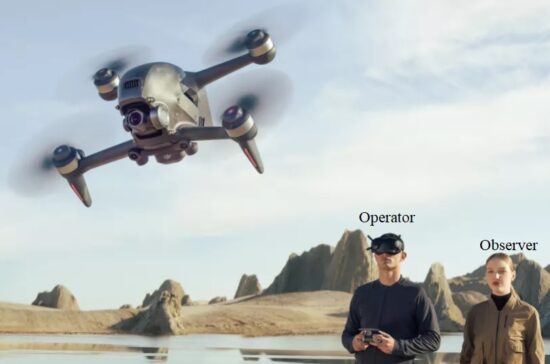
Figure above shows Video piloting (first-person view or FPV)
_
FPV means “First Person View”. A video camera is mounted on the unmanned aerial vehicle and this camera broadcasts the live video to the pilot on the ground. The ground pilot is flying the aircraft as if they were on-board the aircraft instead of looking at the aircraft from the pilot’s actual ground position. Though it is expensive in comparison to the normal control device interface screen, it gives the user an interactive 3D view experience. The first person view (FPV) gives the user an ultimate feeling of as if the user is flying. Nearly every camera drone out there lets you monitor a live view from its camera on a mobile device or controller with a built-in screen. While watching your camera feed on a smartphone can technically be referred to as “FPV flying,” drone enthusiasts generally consider true FPV to be flying with FPV goggles: video goggles that strap to your head for enhanced flight immersion.
_
Both helicopter, multiple rotors and fixed-wing RC aircraft are used for FPV flight. The most commonly chosen airframes for FPV planes are models with sufficient payload space for larger battery and large wings for excellent gliding ability. Suitable brushless motors are installed as the most common pushers to provide better flight performance and longer flight time. Pusher-propeller planes are preferred so that the propeller is not in view of the camera. Flying wing designs are also popular for FPV, as they provide a good combination of large wing surface area, speed, maneuverability, and gliding ability.
_
FPV allows the unmanned aircraft to fly much higher and further than you can from looking at the aircraft from the ground. FPV allows for more precise flying especially around obstacles. FPV allows unmanned aerial vehicles to fly very easily indoors, or through forests and around buildings. The exceptionally fast growth and development of the drone racing league would not be possible without FPV live video transmission technology. FPV aircraft are frequently used for aerial photography and videography.
_
This FPV technology uses radio signal to transmit and receive the live video. The drone has a multi-band wireless FPV transmitter built in along with an antenna. Depending on the drone, the receiver of the live video signals can be either the remote control unit, a computer, tablet or smartphone device. The DJI Mavic 2 has an FPV live video range of 5 miles (8 km) with a 1080p quality video transmission. Other, slightly older UAV drones such as the DJI Mavic and Phantom 4 Pro, can transmit live video up to 4.3 miles (7 km). The Phantom 4 Pro and Inspire 2 use the latest DJI Lightbridge 2 transmission system.
There are two major components of an FPV system. The first one is the ground component. The ground component is also called the ground station. It consists of a video receiver and a display system on the ground. The video receiver receives the data by matching the frequency of the receiver with the transmitter present of the drone. The most common frequencies used for transmission of video are 433 MHz, 869 MHz, 900MHz, 1.2 GHz, 2.4 GHz and 5.8 GHz. Advanced versions of ground components have sophisticated antennas which result in greater image resolution. The airborne component has a camera and a video transmitter on the drone. Advanced FPV systems have advanced components and functions. For example, the FPV system can be added with a GPS navigation system. It can also have flight data systems. Further advanced FPV systems have “return home” systems which allow the drones to come back to the position from where they initially took off.
_
In the United States, the Academy of Model Aeronautics’ (AMA) Safety Code (which governs flying at AMA affiliated fields) allows FPV flight under the parameters of AMA Document #550, which requires that FPV aircraft be kept within visual line of sight with a spotter maintaining unaided visual contact with the model at all times. Similarly, in the United Kingdom, the Civil Aviation Authority (CAA) Air Navigation Order 2009 under General Exemption E 4185 requires small unmanned aircraft (SUA) be kept within visual line of sight with a competent observer maintaining direct unaided visual contact with the model at all times for the purpose of collision avoidance. Because these restrictions prohibit flying beyond the visual range of the pilot (an ability which many view as the most attractive aspect of FPV), most hobbyists that fly FPV do so outside of regular RC clubs and flying fields.
______
Ground Control Station (GCS):
The ground control station is the nervous system of the operation. The GCS will control the launch, flight, and recovery of the UAV. It also processes the data from the internal and external sensors of the payload. Ground Control Stations are the central control unit that allows a UAV to fly and a UAS to operate. These stations can be as large as a desk with multiple views to as small as a handheld controller or even an app. These platforms can range from backpack sized to permanent buildings. The GCS can be user controlled or operated via satellites and is capable of controlling flight, controlling payload sensors, providing status readouts, mission planning and tethering the data link system.
UAV ground control station (GCS) is a land- or sea-based control center that provides the facilities for human control of Unmanned Aerial Vehicles (UAVs or “drones”). It may also refer to a system for controlling rockets within or above the atmosphere, but this is typically described as a Mission Control Centre.
Hardware:
GCS hardware refers to the complete set of ground-based hardware systems used to control the UAV. This typically includes the Human-Machine Interface, computer, telemetry, video capture card and aerials for the control, video and data links to the UAV.
Fixed Installation and Vehicle Mounted GCS:
Larger military UAVs such as the General Atomics MQ-1 Predator GCS resembles a “virtual cockpit”. The pilot or sensor operator sits in front of a number of screens showing the view from the UAV, a map screen and aircraft instrumentation. Control is through a conventional aircraft-style joystick and throttle, possibly with Hands on Throttle and Stick (HOTAS) functionality. In addition, the GCS consists of satellite or long-range communication links that are mounted on the roof or on a separate vehicle, container or building.
Portable GCS:
Smaller UAVs can be operated with a traditional “twin-stick” style transmitter (controller), as used for radio controlled model aircraft. Extending this setup with a laptop or tablet computer, data and video telemetry, and aerials, creates what is effectively a Ground Control Station. A number of suppliers offer a combined system that consists of what looks like a modified transmitter combined with what is usually a touch screen. An internal computer running the GCS software sits behind the screen, along with the video and data links. This device may be in the form of a simple, off the shelf Radio Controller that uses multiple channels to send RF signals to manipulate a drone’s movements.
Larger GCS units are also available that typically fit inside flight cases. As with the smaller units, they feature an internal computer running the GCS software, along with video and data links. Large single or dual screens are also fitted that can be high-brightness or treated with an anti-glare coating to increase visibility in bright sunlight. They can either be placed on the ground, on a portable table, or feature integrated folding legs.
Some portable GCS units are in the HOTAS (Hands On Throttle And Stick) layout. This layout includes a 3-Axis Joystick to control yaw, pitch and roll of the UAV. A slide or t-bar fader can increase or decrease the airspeed of the UAV.
Joysticks:
These translate the physical movement of the sticks into information that the controller can use to communicate with the drone. The left joystick moves the drone up and down and does pan right and pan left. The right joystick moves the drone forward and backward and does drift right and drift left. Almost, all the latest drones can use 2.4 or 5.8 GHz operating frequencies.
Software:
GCS software is typically run on a ground-based computer that is used for planning and flying a mission. It provides a map screen where the user can define waypoints for the flight, and see the progress of the mission. It also serves as a “virtual cockpit”, showing many of the same instruments as in manned aircraft.
Main Remote Controller Board:
This receives information from the drone about its location, altitude, and what the camera is seeing. It also takes inputs from the joysticks and sends the commands to the flight controller.
______
______
Drone camera:
Drone photography is the capture of still images and video by a remotely-operated or autonomous unmanned aerial vehicle (UAV), also known as an unmanned aircraft system (UAS) or, more commonly, as a drone. Drone photography allows images and video to be captured that might not be otherwise possible for human photographers and videographers. That capacity can be enabled by the flight abilities of drones, their small size or their ability to tolerate harsh environments. For all intents and purposes, drones equipped with computer vision, face recognition, object recognition and other tracking technologies are flying robots. Their increasing presence in the environment is enabled by the combination of networking, robotics and artificial intelligence (AI). These advanced AI-capable drones can adapt to their environment and perform many autonomous tasks, like taking a drone-based selfie (also known as a “dronie”) or following an owner and taking pictures or filming while they walk around or travel in a vehicle.
_
Drone photography is used in surveillance to gain intelligence against enemy targets by government agencies in war and for competitive intelligence by businesses. It is used in journalism and also law enforcement, as well as spying. It is also used artistically and in journalism to capture previously impossible or extremely costly helicopter photography. As long as drones are under 35kg, no special permits (except drone registration) are required by private citizens looking to use drones non-commercially. Special flight operations certificates are required for drones over 35kg but most personal drones are under that weight limit. For commercial purposes, the Federal Aviation Administration requires a certificate of authorization for drone use. Other FAA regulations include a restriction on flight above 400ft or within two miles of an airport. In the United States, privacy rights in regard to drone photography are often regulated on a state-to-state basis and are still being worked out. Some states ban all aerial photography of private property.
_
In general most drone pilots use CMOS digital cameras due to their wide availability and cost. Drone cameras are relatively new, but they’ve become more popular thanks to improving technology and shrinking prices. You can find great beginner drones with a camera, a drone with a powerful HD camera, and even high-res 4K camera drones. While the variety of models has grown quickly, most drones share many of the same controls and functionality. When we talk about a drone or a drone camera, we’re typically referring to a quadcopter configuration. These models dominate the market almost exclusively thanks to their relative simplicity compared to single-rotor or other systems. Quadcopter drone cameras maintain stability, direction, and motion using four rotors; two rotate clockwise and the other two counter-clockwise. A mounted camera sits at the center to take photos and record videos. While the marketplace continues to find more uses for these small drones with cameras, their basic layout is fairly consistent. You may find some with more complex or sensitive hardware, but the structure is essentially the same.
_
Drones are great for taking photos and capturing video. For photographers, they provide a way to get a unique angle on events or take eye-catching selfies, and they can even be set up to follow you around for more dynamic footage. Drone cameras also have some practical advantages and features you may not know about. As the technology becomes widely available, drones are becoming more integral to a whole range of professions. For example, they take a lot of the risk out of the equation for surveying hazardous areas or identifying maintenance needs. They’re a great foundation for a lot of small businesses, too, so you don’t have to be a surveyor or a wildlife manager to get a lot of benefit out of one. Wedding and event photographers, filmmakers, journalists, and real estate agents can make great use of a drone.
_
Some basic operating procedures to follow when you use your new drone camera:
-1. Make sure that you’ve thoroughly studied your drone’s layout and controls beforehand
-2. Check your battery and recharge the device if necessary so you don’t lose control in an inconvenient location
-3. Familiarize yourself with whatever area you plan to use for your flight. It’s always best to avoid flying too close to buildings or natural obstacles. You should also make sure you’re aware of any drone or flight regulations in your area
-4. Don’t lose track of your drone mid-flight, particularly around obstructions or other people
-5. Remember to plan your takeoff and landing, making whatever preparations you need to overcome tall grass or uneven surfaces
_
When you are considering buying a drone you may have a specific case in mind. Whether or not you like landscape photography or you are looking to observe and explore things in the distance you may wonder how far can a drone camera see? There are a wide range of variables which determine how far a drone camera can see but, ultimately, it comes down to the amount of pixels per foot the drone camera is able to detect at different distances. An average drone camera operating at 1080p can recognize people up to 50 ft away. Between 50 and 100 ft, the camera is able to classify objects (such as people or animals or cars), past 100 ft the camera is only able to detect movement and cannot determine objects or recognize individuals. The distance a drone camera can see depends on the terrain, nearby obstacles, quality of the drone camera, and air conditions.
_
Pixels Per Foot (PPF):
In the security world, the most important factor is the number of pixels per foot at a given distance. This can be calculated from the resolution of the camera and the distance at which you are observing an object. The standard measurement for the size of an object on a recorded video is pixels per foot (PPF). The pixels per foot is a measurement of quality of the final video based on the size of the area the video is recording. Here are some common qualities and number of pixels horizontally and vertically.
|
Camera Classification |
Number of Pixels (horizontal) |
Number of Pixels (vertical) |
|
720 HD |
1280 |
720 |
|
1080 Full HD |
1920 |
1080 |
|
4K |
3840 |
2180 |
|
6K |
5472 |
3076 |
|
8K |
7680 |
4320 |
The higher the resolution of the camera the higher the number of pixels.
Note that 720p HD camera resolution provides images that are 1280 x 720 pixels (that adds up to 921,600 pixels, which means a 720p HD camera is not technically a megapixel camera), and 1080p HD cameras provide 1920 x 1080-pixel resolution, or 2.1 megapixels. We are discussing resolution of video camera and it cannot be compared with still camera.
_
Below is the table of pixels per foot at various distances for various cameras. Color-coded distances with green, yellow, and red signifies the recognition, classification, and detection distances that each drone is able to achieve. The most important aspects of this table are where the recognition, classification, and detection limits are.
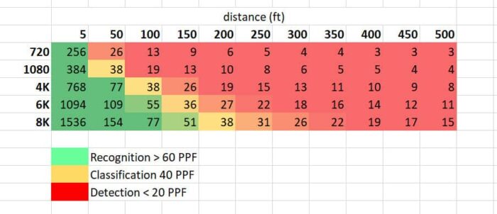
You can see that the higher the resolution of the camera the further that it can recognize individuals from a scene. For example, an 8K camera can identify people at approximately 150 foot in distance. Whereas, a 1080p camera quickly loses recognition distance and can only classify subjects at 50 foot and cannot pick out any identifying features past 100 feet from the subject.
_
The three levels of footage classification:
Drone cameras can see very far into the distance. Their unique vantage point – from very high in the sky – can give them an un-obstructed view of large area. However, even though the drone can see that distance it may not be able to actually recognize any person or identify any object. Here is a rundown of each of the classifications used in the security industry and the most important factor is the pixels per foot.
-1. Recognition
The highest classification of pixels per foot is the recognition classification. This is the highest classification at which you are able to identify a person or object. This is 60 PPF in day time and 90 PPF at night. In this classification you are able to directly identify features on a person such as facial features, logos on clothing and license plate numbers on cars. For security reasons this is the most useful type of video as it identifies a lot more about an object. The issue with getting this type of quality with a drone is that the drone is very loud and hovers closely to the subject. This means that it is unlikely that a drone would be able to record this level of footage of you without you being aware of the drone’s presence. Typically, a drone has to be within 5 foot of you to identify you if it has a 720p camera and it can recognize you with 4K at a distance of 50 feet away from. Here is a table that highlights the distances at which different resolution cameras can recognize you.
|
Camera resolution |
Distance (foot) |
|
720 |
5 |
|
1080 |
25 |
|
4K |
50 |
|
6K |
75 |
|
8K |
100 |
_
The next level of classification is where the camera is not able to pick up individual traits but can classify the object.
-2. Classification
In this section of classification the footage is able to identify aspects of you and the object. For example, it is able to identify your gender, race or ethnicity, the colour and types of clothes that you are wearing and it can also distinguish the make and model of the car. This is at 40 PPF in the day time and 60 PPF at night. A drone is able to fly a little bit further away from your location but it is likely that you will still be able to hear the propellers in the distance and you will be aware that a drone is in the area. Typically, a 720p camera will be able to classify you at approximately 50 foot whilst a 4K camera is able to classify you from approximately 100 ft away. Here is a table of distances for different resolutions at which a drone camera can classify subjects in the footage.
|
Camera resolution |
Distance (foot) |
|
720 |
50 |
|
1080 |
75 |
|
4K |
100 |
|
6K |
150 |
|
8K |
200 |
_
The last definition and classification of footage is called detection.
-3. Detection
Detection is the lowest form of footage classification and you are able to see activity that you are not able to pick out individual details of a person or a car. For example, you will be able to see a person or car move in the image that you will not be able to identify any features about that subject. This is at 20 PPF in the day time and 40 PPF at night. It is possible that a drone is able to collect these sorts of images of you without your knowledge. This is because the drone is able to fly up to 350 feet away from your current location and still be able to pick out and detect movement in the scene. This sort of footage is the less important for security reasons since it is not able to personally identify people or objects. Typically, a 720p camera is unable to make out details at a distance of approximately 100 foot whilst a 4K enabled camera is not able to resolve anything in the image from a distance of approximately 200 foot. Here is a rundown of the detection limits of cameras of various resolutions.
|
Camera resolution |
Distance (foot) |
|
720 |
75 |
|
1080 |
100 |
|
4K |
200 |
|
6K |
300 |
|
8K |
400 |
You can see that this distance is dramatically higher than the other classifications and after this distance the footage gets worse and worse.
_
Other factors besides camera resolution:
Besides resolution of the camera there are a number of factors that go into determining how far drones can see in the real world. Given perfect conditions the numbers, discussed above, make perfect sense. However, there are very few instances where the perfect conditions exist.
-1. Moving closer to objects
The first thing about a drone is that it is not a fixed entity. That means that it is able to quickly move towards an object if it wants to see more details. If you have 8K camera you don’t have to get particularly close or move particularly far if you want to move from classification to recognition distance. If a drone wants to make out more detail about a particular area of the scene they are able to simply fly towards object to quickly improve the resolution and usefulness of the footage.
-2. Field of view
There are many different types of cameras with a variety of fields of view. Because the primary metric is the number of pixels per foot a wide field of view quickly limits the number of pixels per foot in the image. A wider field of view is much better for landscape drone photography and videography but will not enable the drone pilot to make out as much detail. On the other end of the spectrum, if you’re drone camera has a very narrow field of view you will be able to make many more features and the classification and identification of people and objects in the image will be much clearer and easier.
-3. Zoom features
Drone cameras have improved significantly over recent years. There are a number of drones on the market which include optical zoom capabilities. This means that you are able to optically zoom into the scene and allows the drone pilot to increase the resolution of a particular area. Some popular drones are able to zoom up to 4 times which can quickly increase the number of pixels per foot in the image. The DJI Mavic air 2 has a 4 times optical zoom.
-4. Day/nighttime
The amount of light that is getting into the camera is one of the most important features of determining how far a drone can see. There are many drones that do not operate well in lowlight situations. However there are drones with night vision cameras. Quite simply, drones operate much better when there is a significant amount of light entering the lens and making its way to the sensor. As soon as this is impacted the quality of the footage diminishes significantly and the ISO setting of the drone needs to be increased. This setting increases the sensitivity of the drone to the incident light which can introduce a lot of noise into the image.
-5. Type of camera
Lastly, the type of camera that a drone is able to carry has diversified in recent years. How far a drone can see not only depends on the number of pixels per foot of the image but it also depends on the type of camera it is carrying. This can include thermal imaging and night-time cameras as well as lidar for 3D imaging and cloud point imaging of objects and infrastructure. We are most familiar with drones carrying an optical camera but it is not limited to this. The difference between night vision vs thermal imaging is: Night vision works by amplifying nearby visible light. Thermal imaging works by using infrared sensors to detect differences in temperatures of objects in its line of sight.
_
Table below shows some drones with camera resolution, endurance and range:
|
Name |
Camera |
Battery |
Range |
|
Potensic D88 |
2K |
18min |
1.5km |
|
DJI Mavic Mini |
2.7K 12MP |
30min |
4km |
|
Parrot Anafi |
4K |
25min |
4km |
|
Autel EVO 2 |
8K |
40min |
8km |
|
DJI Mavic 2 Pro |
4K |
30min |
8km |
|
DJI Air 2S |
5.4K |
32min |
12km |
|
DJI Mavic 3 |
4K |
45min |
15km |
As the drone becomes advanced and expensive, camera resolution, endurance and range increases.
_
Here are some frequently asked questions about how far drones can see.
How far can drones see at night?
The distance a drone can see at night is significantly limited by the lack of available light. Unless the drone has night vision it is unlikely to be able to see past a few feet.
How far can a military drone camera see?
Because military drone cameras are incredibly high resolution it is likely they are able to see and recognize people from a much greater distance than civilian drones. Military drones have of 1-2 gigapixels cameras that can resolve details as small as six inches from an altitude of 20,000 feet (6km).
Can drones see inside your house?
Drones can only see inside your house through a window. It’s actually very difficult for a drone to be able to look directly into the window and make out the entire room. It is likely that they will only be able to pick up objects and people standing window. Thermal cameras are able to identify hot houses and heat leakages by looking at the infrared part of the spectrum. This will be able to give the viewer an idea of your house and could potentially indicate what is inside the house. For example, police tend to use thermal imaging cameras on the roofs of suburban houses to detect grow houses or other illegal activity.
______
______
Satellite versus unmanned aerial vehicle (UAV) mapping:
We’ve been living in the age of satellites for more than half a century now, and the ways in which those eyes in the sky are helping people’s daily lives are as significant as they are immeasurable. Tasks associated with everything from weather monitoring to surveillance are being supported with data gathered by satellite, and the scope of information that satellites can provide is incredible. Just as they have with manned aircraft through, drones have proven to be a reliable alternative when it comes to gathering information that would otherwise be provided by satellites in a faster and cheaper way. Typically though, it’s really not a question of “either/or” when it comes to deciding whether it’s better to utilize drone or satellite data, because the platforms are gathering information in very different ways, at totally different scales. These distinctions have created completely different value propositions for each approach. Of course, these technologies are alike in the fact that they both support mapping functions. However, if you’ve only heard about these two technologies in passing, you may be confused about how they differ from one another and which one might be right for the needs of your project. First of all, it’s important to make the distinction that satellite mapping and UAV mapping are not competing technologies. Rather, they are complementary technologies, in the sense that each can do something that the other can’t. This is why it’s so important to understand the differences between the two if you’re going to make an educated decision about which one best meets your needs.
_
It may help to think about different mapping technologies on a spectrum: the further away from the Earth the technology operates, the wider coverage it can provide. However, this wider coverage comes with tradeoffs, in the form of a much lower level of detail and a view that can often be blocked by clouds or other obstacles. On one end of this spectrum is satellite mapping technology. By definition, satellite mapping technology operates at a plane that is further away from the Earth than any other technology. As a result, satellite mapping provides a level of coverage that is much higher than that offered by any other mapping technology. However, the images gathered using satellite technology are typically very low in resolution, and so may not be useful for projects that require a very high level of detail and accuracy. In addition, the high costs of taking advantage of satellite mapping technology may make it a bad fit for all but the very largest projects. Ultimately, whether it makes sense to use one or the other or both is a question of the tasks that need to be performed and the specific data that needs to be obtained. There are instances when a drone just won’t do the job as well as a satellite, but there are also plenty of instances when it would be foolish to try and utilize a drone if satellite data is available. These distinctions have allowed us to come up with some rules of thumb around where and when it makes sense to use one over, or in addition to, the other.
_
Changes in drone tech, and the laws governing it, are expected to impact whether someone wants to use a drone or a satellite to do the job. BVLOS operational approval may be a requirement for some missions but it’s extremely difficult to get a waiver from the FAA in the U.S. to make these types of flights a reality. There are also certain geographies which may be in close proximity to controlled airspace and airports. Operations in those areas also need approval. Satellite is the only option in these situations.
_
Choose Satellite when a “macro” view of the terrain is needed:
Sometimes drones just aren’t the best tool for the job. Satellite companies are imaging the entire globe every single day and are in the process of making use of that wealth of data. Drones are great to get the ‘micro’ view of fields but in certain cases, the satellite-provided ‘macro’ view can be more than enough for a given task. It all depends on the goals of the end user and what they want to accomplish.
Choose Drone when a “micro” take of the land is apropos and scaling up doesn’t matter:
Many drone advocates have talked about the issue the technology creates at scale, which is especially evident in the agriculture. Someone who has 100 acres of a certain crop won’t necessarily be able to use a drone in the same way as someone who has 1,000 acres, even if it’s the exact same crop in the exact same climate. While others are confident that the technology will eventually be able to easily and effectively scale, it’s clearly not going to be a fit for everyone. Scaling up quickly can be cost-prohibitive for farmers and growers.
Choose Satellite when large amount of data must be gathered quickly:
Satellites scale up well on farm surveying but don’t offer the kind of fine details that can be obtained with drones. In the satellite vs. drone debate, using the drone to do more spot-checking, rather than gathering a huge glob of data, is probably the ideal use case right now. With a satellite, the world is essentially your oyster. You can get data over large areas and also within controlled airspace. The disadvantage there may be the economics or the quality of the data itself.
Choose Both:
There are opportunities on the horizon for a merging of some of these technologies, to the benefit of the consumer and the companies alike. Companies like Airbus Aerial are trying to merge their fleets of satellites with drone data to provide their clients with a holistic approach, tailored to their needs. This is a big opportunity and if it can be done effectively then there are big wins on the horizon for plenty of companies who are investigating these types of aerial data. Satellite imagery is still useful to the commercial sector. It is used for Preflight Planning and Flight Planning Software. It is still useful to the general public. Satellites make it easier and more efficient for the planning of operations. It’s exciting to think about what it will mean to see a solution that can combine drone data with satellite imagery in a powerful way. Even after that sort of capability is developed, there will still undoubtedly be cases where it makes sense to use one approach over the other. Hopefully though, a more seamless integration of drone data with satellite data will help operators understand that their approach should focus on how these solutions can complement one another.
_____
Benefits of using Satellite Imagery over Drones:
-1. Autonomy
While drones need to be piloted by someone, satellites are fully autonomous. Once they’re in orbit, they rotate around the Earth, using sophisticated lenses and sensors to image the planet and send data back to the ground station. Typically, when someone wants to buy commercial satellite imagery, they just have to specify their area of interest (AOI), frequency of image collection, date range, and resolution. Then, it can take anywhere from a few hours to a few days until the results are delivered. It’s just that simple!
-2. Accessibility
Landscapes that are difficult to navigate by road or by foot, may not be best suited for drone surveying. For example, you may want to think twice before sending a drone to forestry or mountainous locations. These natural obstacles can add more complexity to the operation, resulting in longer flight times and the risk of losing the equipment. Remote areas and drones are not exactly the best friends, either. That’s because most drones can’t fly too far away from the controller, meaning that the drone operator needs to be at least within a few kilometers of it. When you use satellite images, you don’t have to worry about any of that.
-3. Consistency
This detail often overlooked when deciding the best way to capture images:
Sun angle:
Commercial drones have a flight time of about half an hour, so they might need to be recharged to complete the job. Each full charge takes between 60 to 90 minutes. Because our planet revolves around the sun, the sun angle will have changed when the drone is able to fly again. If you’re just recording some footage, that’s OK. But if you’re a GIS manager who needs to conduct geospatial analysis, you’ll have to account for different elevations and sun angles when processing your image. One of the benefits of using satellites over drones is consistency, so you don’t have to spend extra time making corrections to your images.
-4. Scalability
When it comes to capturing images, one of the biggest differences between satellites and drones is scalability. Because satellites are easier to operate, work well in remote locations, and offer more consistency, it’s no surprise that they’re often the preferred solution for imaging large areas. Satellites are also better suited for customers interested in change detection, which requires the ongoing capture of images for comparison. Satellites tend to constantly map the entire planet and any changes can be analyzed. This is useful in the case of looking at things being built, being buried or being transported.
-5. Price
Aerial drone images cost around $100/hour. On the other hand, satellite imagery pricing is based on area size, resolution, and when the data is captured. For example, a medium-resolution archive image can cost $2.50/km², whereas a high-resolution new image, that still needs to be captured, can cost $12/km². For $300, a satellite can take high-resolution images of the same area covered by a drone, with the benefit of also collecting processed data. The price of commercial satellite images is dropping every year because the cost of sending satellites into space is lower than ever, prompting more space companies to build their own constellations. As a result, the increased supply makes prices go down. UAVs are cheaper so long as you want to cover a limited area and/or for a limited time, satellites are cheaper if you want to cover larger area and for longer time.
_
Benefits of using Drone Imagery over satellites:
There are a few situations when drones can be a better alternative to satellite imagery.
-1. First, you have to consider the level of detail you need. High-resolution satellites can give you a good view of the top of a building, but if you need more granularity to see small objects, you’d be better off with a drone.
-2. You should also use drones if you need more control over the angle at which an image is captured. Although this is changing with more sophisticated satellites, most satellite images can look a bit flat.
-3. Drones are a safer bet if you have the urgency to obtain images. With satellites, clouds can cover parts of your area of interest and there’s not much you can do about it besides putting in a request for a new satellite image. On the other hand, UAVs can’t work in bad weather while satellite can.
-4. Real-time availability: Satellites tend to have an orbital period, as a result you can’t easily task them to a location on-demand without expending a huge amount of the available manoeuvring propellant. However the UAV can be deployed to an area and launched to a specific task/operation on-demand.
______
______
Drone Communications:
UAVs use a radio for control and exchange of video and other data. Early UAVs had only narrowband uplink. Downlinks came later. These bi-directional narrowband radio links carried command and control (C&C) and telemetry data about the status of aircraft systems to the remote operator. In most modern UAV applications, video transmission is required. So instead of having separate links for C&C, telemetry and video traffic, a broadband link is used to carry all types of data. These broadband links can leverage quality of service techniques and carry TCP/IP traffic that can be routed over the Internet.
The radio signal from the operator side can be issued from either:
-1. Ground control – a human operating a radio transmitter/receiver, a smartphone, a tablet, a computer, or military ground control station (GCS).
-2. Remote network system, such as satellite duplex data links for some military powers. Downstream digital video over mobile networks has also entered consumer markets, while direct UAV control uplink over the cellular mesh and LTE have been demonstrated and are in trials.
-3. Another aircraft, serving as a relay or mobile control station – military manned-unmanned teaming (MUM-T).
Modern networking standards have explicitly considered drones and therefore include optimizations. The 5G standard has mandated reduced user plane latency to 1ms while using ultra-reliable and low-latency communications.
_
Drone communications types:
Drone communications can be classified into four main types, Drone-to-Drone (D2D), Drone-to-Ground Station (D2GS), Drone-to-Network (D2N), and Drone-to-Satellite (D2S). The communication framework is illustrated in figure below:
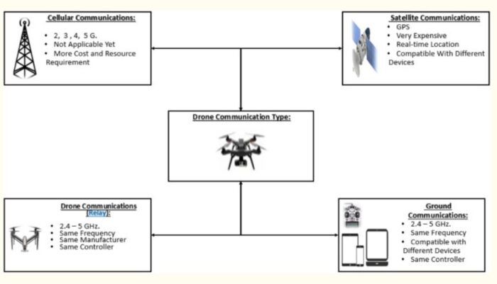
_
Drone-To-Drone
Such communication is not yet standardized. In fact, Machine Learning can be leveraged in order to design and optimize a smart UAV-based wireless communication system. In most cases, D2D communications can be modeled as Peer-to-Peer (P2P) communication. This would make it vulnerable to various types of P2P attacks including jamming (i.e., Distributed Denial of Service (D-DoS) and sybil attacks).
Drone-To-Ground station
This communication type is based on the already known and standardized industrial protocols, which are based on wireless communications such as Bluetooth and Wi-Fi 802.11 including 2.4 GHz and 5.8 GHz. However, most drone-to-ground communications are public and not secure, using a single factor authentication, which can be easily broken, making them vulnerable to passive (eavesdropping) and active (man-in-the-middle) attacks.
Drone-To-Network
This communication type allows the choice of the network based on the required security level. It may also include cellular communications, which means relying on 3 GHz, 4 GHz, 4G+ (LTE) and 5 GHz. It is essential to secure such wireless communications networks when being used.
Drone-To-Satellite
This is the type of communication needed for sending real-time coordinates via the Global Positioning System (GPS). This allows any drone to be called back to its initial station in case it went beyond the line of control or outside the line of sight. Satellite communications are deemed secure and safe. However, they exhibit a high cost and maintenance requirements. This is why they are heavily used by armed forces.
__
Connectivity:
Drones can be controlled remotely, often from a smartphone or tablet. Wireless connectivity lets pilots view the drone and its surroundings from a birds-eye perspective. Users can also leverage apps to pre-program specific GPS coordinates and create an automated flight path for the drone. Another handy wirelessly-enabled feature is the ability to track battery charge in real time, an important consideration since drones use smaller batteries to keep their weight low.
_
Data Links:
Data link uses a radio-frequency (RF) transmission to transmit and receive information to and from the UAV. These transmissions can include location, remaining flight time, distance and location to target, distance to the pilot, location of the pilot, payload information, airspeed, altitude, and many other parameters. This data link can also transmit live video from the UAV back to the GCS so the pilot and ground crew can observe what the UAV camera is seeing.
There are various frequencies used in the data link system. The frequencies that are used are based on UAV brand as well as functionality of the UAV. For example, the DJI systems use 2.4Ghz for UAV control and 5.8 Ghz for video transmission. This setup will give the user approximately 4 miles of range. However, if using 900Mhz for UAV control and 1.3Ghz for video, a distance of 20+ miles can be achieved.
The Data Link portion of the UAS platform also happens to be the most vulnerable in detection and cyber-attacks. Many UAV detection systems use the data link footprint as their main method of UAV detection.
_____
_____
Drone Cooling:
Overheating — and subsequent engine failure — is the most common cause of drone failure. This can be especially dangerous in military-grade drones, in which failure may cause a UAV to fall in a hostile territory, giving them access to sensitive information. Plus, losing a military drone can come with a price tag around $2 million. Even in civilian applications, drones are expensive pieces of equipment. Losing a drone can come with serious consequences, and may even result in injuries or property damage. Proper UAV thermal management, therefore, is imperative. In fact, adequate cooling is the key to long rotary engine life.
DC fans feature high-quality bearings that ensure a long-life span and allow for silent operation. The unique multi-blade design allows for increased airflow while providing protection against high temperatures, vibration, dust, and water. The smaller, significantly lighter micro fans, meanwhile, are ideal for heat reduction in low-power applications. The lighter design ensures higher energy efficiency and a long operating life, even under power and space constraints.
Alternatively, micro blowers utilizing axial air gap technology eliminate power loss at higher temperatures and are smaller and more energy-efficient than traditional blowers. In addition to use in UAVs, these miniature fans and blowers are often employed in other military-grade integrated cooling applications, such as combat helmets.
_______
_______
Drone and audio recording:
Privacy is a very important component of flying a drone. If you are in an area where there are drones flying regularly you may wonder if drones can actually hear your conversations. It is unlikely that consumer drones are able to hear your conversations as most of them do not carry microphones. However, with special microphones and audio software drones are able to listen in on your conversations. In DJI Mavic audio was only able to be collected and recorded through the DJI app.
Most of the consumer drones available on the market are not able to record sounds. Drones are incredibly noisy due to the high propeller rotation frequency combined with the amount of air that they are required to force downwards in order to stay in flight. If you were to simply put a microphone on a drone it is likely that the microphone will pick up to main sounds which would wash out anything that could be heard in the distance. Those sounds are the electric noise generated by the motors and the sound of the propellers moving air across the surface of the microphone. In order to add reliable and useful recording capabilities to a drone you need to add an external shot gun microphone which is able to remove all of the background noise generated by the drone and is on the long arm so that it is far away from the turbulent air produced by the propellers.
Such a microphone has been developed by a company called Dotterel. Dotterel is a company that develops noise reduction and audio recording technology for unmanned aerial vehicles. They have created an aerial audio microphone which can be carried by a drone and can be used for emergency services, defence, and TV or film. You can also have live one-to-one conversations when using a speaker on the drone. The same company that produced the microphone is also producing passive noise reduction shrouds to make the drones quieter.
Can drone hear inside your house?
In order for a drone to be able to hear inside your house the audio and sound waves need to escape from your house. Not only do they need to escape from your house but they also need to be at a high enough volume that it is able to be recorded over the noise generated from the drone. This is a problem unless you have a specific shot gun microphone mounted far away from the down wash created by the drones propellers.
How to protect yourself against drone recordings?
-Get further away from the drone
-Move out of line of sight
-Talk in noisy urban environments
-Report the drone to police
_____
_____
Section-6
Unmanned combat aerial vehicles (UCAV): Military (combat) drones:
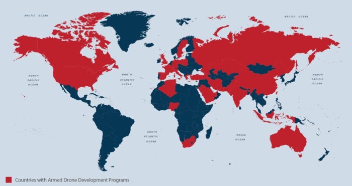
Figure above shows countries with armed drones.
_
In the early days of the United States’ involvement in World War II, President Franklin D. Roosevelt approved research into a plan to release bomb-wielding bats from airplanes. The bombs — small kerosene-filled incendiary tubes that operated on a chemical time-release fuse — were connected to a surgical clip with a short piece of string, and the clip was attached to a bat’s chest. The idea was to cool the bats down into a state of forced hibernation, initiate the chemical fuse, attach the device, load the placid bats onto a plane and then release them over a target area. Ideally, the bats would seek shelter in buildings, chew through the string (separating themselves from the devices) and then the device would detonate, setting enemy infrastructure on fire. What actually happened is that a bunch of hibernating, bomb-laden bats were dropped to their deaths from an airplane. Six thousand bomb-rigged bats gave their lives in these military experiments. The experiments did give researchers insight into possible problems that UAVs may cause or encounter. For one, it was unlikely that many people would support the type of loose targeting standards enforced by bomb-laden bats that flew astray into civilian territory. During the course of the experiments, researchers witnessed this problem first-hand when some of the armed bats escaped and fire-bombed an Army airplane hangar and a general’s car.
__
An unmanned combat aerial vehicle (UCAV), also known as a combat drone, colloquially shortened as drone or battlefield UAV, is an unmanned aerial vehicle (UAV) that is used for intelligence, surveillance, target acquisition, and reconnaissance and carries aircraft ordnance such as missiles, ATGMs, and/or bombs in hardpoints for drone strikes. These drones are usually under real-time human control, with varying levels of autonomy. Unlike unmanned surveillance and reconnaissance aerial vehicles, UCAVs are used for both drone strikes and battlefield intelligence.
Aircraft of this type have no onboard human pilot. As the operator runs the vehicle from a remote terminal, equipment necessary for a human pilot is not needed, resulting in a lower weight and a smaller size than a manned aircraft. Many countries have operational domestic UCAVs and many more have imported armed drones or have development programs underway. Drones will now carry out the majority of aerial operations, including using air-to-ground missiles or laser-guided bombs. or even experimental air-to-air capability raising the question of how long manned military jets will last before becoming a historical curiosity.
_
Cameras are regularly used as sensors on unmanned aerial vehicles (UCAVs) as reconnaissance and intelligence gathering systems and used for support of front-line troops on operations. The cameras on these vehicles can be of the order of 1 -2 gigapixels with frame rates of the order of 25 -100 frames per second, meaning the data is gathered at terapixels per second, that is 3 -5 terabytes of information per second, and it can resolve details as small as six inches from an altitude of 20,000 feet (6km). As this reconnaissance data is gathered, operators on the ground have to sift through each frame looking for important objects or points of interest to support the operations.
_
The US military pioneered the use of Unmanned Combat Aerial Vehicles (UCAV) or military drones. They contribute to several different missions in the Armed Forces such as:
Target and decoy – providing ground and aerial gunnery forces with a target that simulates an enemy aircraft or missile.
Reconnaissance – providing battlefield intelligence.
Logistics – delivering cargo.
Combat – providing attack capability for high-risk missions.
______
Technology of UCAV:
UCAV commonly referred to as drones have become the weapon of choice in modern warfare, with both state and non-state entities employing them. The rise of drones to indispensability is unsurprising, given their high level of effectiveness, relatively low-price tag, and high degree of deniability they provide on the battlefield.
Existing Technologies:
Many of the technology areas below that have already been developed will witness sustained innovation based on the growth of the military UAV industry.
-1. RADAR/LiDar
-2. Wireless/Cellular Communications
-3. Optoelectronics
-4. Photonics
-5. Actuators/Connectors
-6. Satellite Communications
-7. Inertial Navigation System
-8. Micro-Electro-Mechanical Systems (MEMS)
-9. Global Navigation Satellite System
-10. Gallium arsenide (GaAs) Solar Cells
Emerging Technologies:
For the military UAV industry, Infrared Thermography (IRT) and Hyperspectral Imaging (HSI) are two major technology areas of focus.
Infrared Thermography (IRT): For years, IRT has been used in a variety of industries. Recent advances in advanced thermal imaging cameras, on the other hand, use focal plane arrays (FPAs) that use uncooled microbolometers as FPA sensors. IRT has long been used in military applications.
Hyperspectral Imaging (HSI): HSI is a new area in which the advantages of optical spectroscopy as an analytical instrument are combined with optical imaging’s two-dimensional object visualisation.
_
There are a few developments that could lay the groundwork for expanding and transforming military UAV technology in the future. Some of these are:
-1. Artificial Intelligence powered UAVs
Improved ability to recognise and respond to their environment would undoubtedly be a key feature of future military UAVs. If we want to trust them to fly autonomously, we’ll need to develop AI systems like Computer Vision and Motion Planning to help them do so. And it’s starting to happen.
-2. Perching and Resting
By saving battery power Perching helps small UAVs extend their time of operation. In addition to the perching capability, researchers are working to build UAVs that can make and stabilise contacts with the environment, allowing the UAV to use less energy while maintaining its altitude.
-3. Submersible UAV
Engineers at John Hopkins University are designing a submersible UAV that can be launched from an underwater station or unmanned underwater vehicle (UUV), which can float to the surface from depths of hundreds of feet. It can stay inactive when not in use even under a murky environment.
-4. Airborne Communication Nodes
Aside from being sensor and shooter platforms, UAVs can also act as airborne communications nodes, similar to satellites, offering mobile network coverage for manoeuvring forces. This frees up manned systems to focus on higher-value missions while still providing a cost-effective way to maintain secure communications.
UAVs will follow the paradigm change toward a network-centric warfare concept, seamlessly integrating into all three main areas of defence systems: sensor, shooter, and C2 network. By providing platforms for deploying sensors, weapons, and communications architecture, UAVs can enable the force commander to see first, understand first, act first, and finish decisively.
-5. Battery Technology
Military UAVs can gain new value thanks to rapid advancements in battery technology. Lithium-ion batteries’ energy density is increasing by 5 to 7 per cent each year, and their lifetime is predicted to double in the next five years. Small military UAVs will be able to fly for more than an hour without recharging as a result of these advancements, allowing for a wide range of new applications.
_
Airborne Radar for Unmanned Combat Air Vehicles:
Unmanned air vehicles (UAV) have proven to be useful for observing activity on the ground without placing an air crew at risk. Using television cameras aboard small UAVs, the Israelis have successfully penetrated hostile air defenses and observed ground activity in enemy territories.
UAVs have several advantages over their manned counterparts. In addition to the obvious safety benefit, UAVs are relatively small and are thus difficult to detect either visually or with radars. Propeller-driven UAVs are also difficult to detect with an infrared (IR) sensor because their engines run at much cooler temperatures than jet engines. This combination of factors makes UAVs more survivable in a hostile environment than manned aircraft. The vehicles are also less expensive than their manned counterparts.
Current UAVs carry optical-sensor payloads—such as TV cameras and forward-looking infrared (FLIR) sensors—which are less susceptible to detection than active devices such as radars. Under favorable conditions, optical sensors can supply high-quality images of the ground for human interpretation. However, optical sensors suffer from a limited field of view and from severely reduced performance in adverse weather and battlefield smoke and dust conditions.
Radars, on the other hand, can be designed to rapidly scan large areas and they are less affected by weather, smoke, and dust. Without crossing international borders, long-range standoff surveillance radars, such as the Joint Surveillance and Target Attack Radar System (Joint STARS), can provide rapid surveillance of large areas of foreign territory. (Standoff radars are radars whose long range permits them to remain at a distance from the area under observation.)
To avoid enemy air defenses, manned airborne systems must stay a considerable distance behind the forward line of troops. This requirement makes it difficult for radars aboard manned aircraft to scan area of interest. Combining the attributes of a modern radar with the UAV’s ability to penetrate hostile air space creates a valuable complement to Joint STARS. During a time of hostilities, Joint STARS could direct a UAV to explore critical areas blocked from view by terrain or foliage, or it could cue the UAV to provide a closer look at the activity in a particular area of interest.
If survivability becomes more of an issue, the survivability of UAVs could be increased with a number of countermeasures. For example, cheap radar decoys could be used to trick the enemy into firing expensive missiles at the decoys, or inexpensive escort UAVs could be used to attack enemy search radars.
Over the years airborne radars have proven their value as wide-area, nearly all-weather surveillance tools. Typically, airborne radars are large systems mounted in manned aircraft. Lincoln Laboratory, however, has built a very capable radar system that is compact and lightweight; the radar has been integrated into an unmanned air vehicle (UAV) as seen in the figure below. The work is sponsored by the Army’s Harry Diamond Laboratories and the Defense Advanced Research Projects Agency (DARPA). A significant component of the radar is a Lincoln Laboratory—designed programmable processor that performs moving-target detection on board the UAV. The onboard processing permits the use of a UAV data link that transmits kilobits per second of moving-target reports instead of tens of megabits per second of raw radar data. The system—the airborne portion of which weighs only 110 lb—detects and tracks moving vehicles such as tanks, trucks, and low-flying helicopters out to a range of 15 km, and classifies them at shorter ranges.
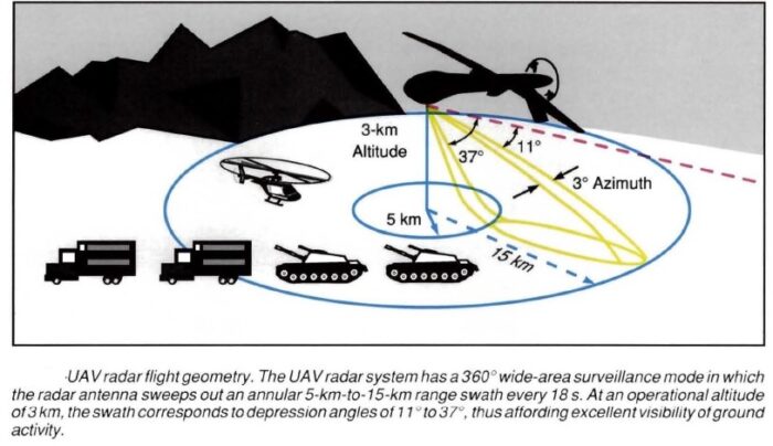
The UAV radar is designed to penetrate hostile airspace; the operational altitude of the radar puts it out of the range of the most common air defense systems such as antiaircraft guns and shoulder-fired IR missiles. Although system weight was a major concern in designing the prototype UAV radar, the primary emphasis was on proving the feasibility of the system. A second prototype design could easily reduce the radar weight by 15 to 20 1b, which would result in a maximum weight of 90 to 951b for the radar system alone. In addition, elements of the support equipment such as the frame could be lightened.
_
The nature of strike and reconnaissance operations involving UAVs will also undergo some changes in the future. If there’s one lesson to be learned from Turkey’s UAV activity in Syria, it’s that costly UAVs/drones like the Anka or Orion shouldn’t be used for close support because they’re expensive, don’t carry enough weapons, and are easy targets. Instead it would be more prudent to arm the large, heavy drones and have them fly at higher, safer altitudes, while smaller drones fly at lower altitudes searching for targets and attracting ground fire for the higher-flying drones to detect and then aim in the future. Small assault drones could be carried by the high-flying drones and released for a closer look and direct attack. However a ball turret with optics and sensors to direct their command guided missiles would be suitable in most cases, as a high-altitude launch would give them excellent performance against pretty much any target, regardless of camouflage.
Military spending on UAV technology is predicted to rise as a fraction of significant military budgets, such as the US defence budget and China’s defence budget, providing a huge potential for specialized drone manufacturers and software developers. While drones will never totally replace soldiers, in the current strategic atmosphere, this question is becoming less relevant.
_
Drone carriers:
In March 2013, DARPA began efforts to develop a fleet of small naval vessels capable of launching and retrieving combat drones without the need for large and expensive aircraft carriers. In the UK the UXV Combatant, which would have been a ship dedicated to UCAVs, was proposed for the Royal Navy. In November 2014, US DoD made an open request for ideas on how to build an airborne aircraft carrier that can launch and retrieve drones using existing military aircraft such as the B-1B, B-52 or C-130. In February 2021, president of the Turkish Presidency of Defense Industries (SSB) Ismail Demir made public a new type of UAV being developed by Baykar that is planned to be stationed to Turkey’s first amphibious assault ship, TCG Anadolu. The new aircraft being developed is a naval version of the Bayraktar TB2 equipped with a local engine developed by TEI. According to the initial plans the ship was expected to be equipped with F-35B fighter jets but following the removal of Turkey from the procurement program, the vessel entered into a modification process to be able to accommodate UAVs. Mr. Demir stated that between 30 and 50 folding-winged Bayraktar TB3 UAVs will be able to land and take off using the deck of Anadolu.
_______
Why military drones:
Military forces worldwide work hard to achieve one goal — destroy maximum enemies but sacrifice a minimum. This was the core reason why defense technologies such UCAVs evolved and have been so very successful. These can be operated remotely even in the most dangerous zones, without reconsiderations as there is no loss of human life. Since these are unmanned and operated remotely, it expels the possibility of losing soldiers by ordering them to enter dangerous terrains. Drones are often used for military purposes because they don’t put a pilot’s life at risk in combat zones. In addition, drones don’t require rest, enabling them to fly as long as there is fuel in the craft and there are no mechanical difficulties. Drones also have powerful capabilities when it comes to surveillance and reconnaissance. Furthermore, military drones are capable of sending missiles or bombs in drone strikes. Consequently, the U.S. Military has relied upon drones for several coordinated attacks that in the past would have required more soldiers on the ground.
However, unlike the drones used in agriculture, construction or for recreation, drones in the military need to have much higher precision and accuracy — that makes them even more expensive. Achieving this requires advanced algorithms and powerful sensors that can detect the surrounding and execute the task assigned to it. Unlike other drones that use the pre-built flight control solutions, drones in the military need custom-built solutions designed by those with extensive experience in this field.
_____
UCAVs are descended from target drones and remotely piloted vehicles (RPVs) employed by the military forces of many countries in the decades immediately after World War II. Modern UCAVs debuted as an important weapons system in the early 1980s, when the Israeli Defense Forces fitted small drones resembling large model airplanes with trainable television and infrared cameras and with target designators for laser-guided munitions, all downlinked to a control station. Rendered undetectable by their small size and quiet engines, these vehicles proved effective in battlefield surveillance and target designation. Other armed forces learned from the Israeli success, notably the United States, which purchased some of the early Israeli models or produced them under license. The most important American tactical UCAV—and one that is representative of trends in the development of these aircraft—is the MQ-1 Predator, which first flew in 1994 and entered service the following year. The MQ-1B Predator, an unmanned, lightly armed surveillance aircraft, is the direct predecessor of the MQ-9 Reaper. The Predator has a 49-foot (14 m) wingspan and can climb to about 25,000 feet (7.6 kilometers). There are somewhere between 320 and 400 individual Predator drones in use today. The use of UAVs like the Predator and the Reaper is growing rapidly within the Air Force, and other branches of the military are showing interest in them as well. Aside from a quick ambush of an unsuspecting target, Predators don’t pack much of a punch. Enter the MQ-9 Reaper, which was designed to address this issue. While the Predator is a surveillance platform with weapons capabilities, the Reaper is a hunter/killer with surveillance capabilities. The 140 mph (225 km/h) speed of a Predator is suitable for hovering back and forth in the skies in search of troop movements, the coordinates of which can be called in to a nearby fighter jet. The 300 mph (482 k) top speed of a Reaper, on the other hand, is better suited for quickly targeting and destroying enemy personnel and vehicles that are on the move. The Reaper can fly about nine times farther and twice as high as the Predator, and it doesn’t require any fighter jets for backup. One important thing to remember about the Reaper (and the Predator as well) is that the Reaper is a weapons system and not just an individual drone. Each Reaper system consists of four individual Reaper drones operated by four different flight teams. The whole system costs about $54 million to build. Both the Predator and the Reaper have been used in the conflicts in Iraq and Afghanistan and have been purchased by allies of the United States.
_
The dual purpose of the Reaper is best understood when it’s compared to the Predator in action. In June 2006, a Predator tracked and located Abu Musab al-Zarqawi, the leader of al-Qaida, in Iraq. However, the Predator flight crew had to request assistance with the mission from an F-16 because the Predator didn’t have enough explosive ordnance to destroy the safe house where al-Zarqawi was hiding. It turned out that the al-Qaida leader was killed by the F-16, but the delay could have allowed him to make a getaway. With this type of scenario in mind, the Reaper was designed to eliminate any delay in tracking a target and striking it as it can do both.
_
Figure below shows MQ-1 Predator unmanned combat aerial vehicle:
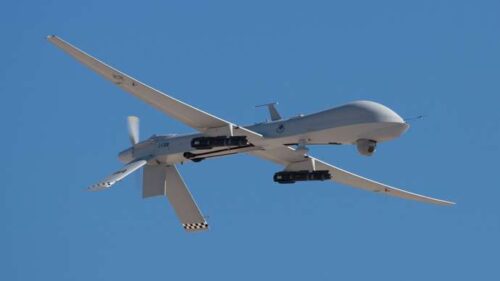
_
Each Reaper/predator drone is operated remotely by a team of two: a pilot and a sensor operator. The pilot’s primary function is flying the plane, while the sensor operator monitors the performance of the many different sensor systems (like infrared and night-vision cameras) utilized by the drone. The Reaper/predators are deployed in groups of four. Each Reaper/predator is controlled by its own two-airman team located at a ground control station. This station may be located in the theatre of operations, like Balad Air Base in Iraq, or it may be located far from the flight path, such as at the Creech Air Force Base in Nevada. (British flight teams also operate their Reapers from the Air Force’s UCAV control center in Nevada). The teams are actually able to switch control of the drone mid-flight. So a team at an airbase in Iraq may be responsible for take-offs and landings from its base but then hand over control to a team in the United States. Why would they do this? Remember that the operation of these UCAVs is in motion 24 hours a day. It’s more efficient to have some teams dedicated to getting them airborne and bringing them back down safely and others dedicated to fulfilling specific missions. This way, there are fewer teams overseas landing drones all day and more teams based in the United States who are responsible for the Reaper/predator during the duration of its mission, which might last as long as a full 24-hour day. A crew responsible for take-offs and landings may have absolutely no idea where the aircraft has been in the interim period.
_
Figure below shows GCS (virtual cockpit) of predator:
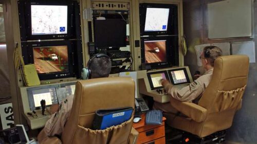
The pilot (left) and sensor operator (right) of a U.S. Air Force MQ-1 Predator, having just launched the aircraft from Balad Air Base in Iraq, prepare to hand over control to personnel stationed in the United States.
_
How military drones work:
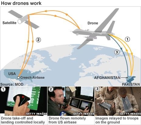
The base may be local to the combat zone or thousands of miles away – many of the drone missions in Afghanistan are controlled from Creech air force base in Nevada, USA – although take-off and landing are always handled locally.
_
Larger UCAVs are used for strategic reconnaissance. The most important of these is the U.S. RQ-4 Global Hawk, a jet-powered craft 44 feet (13 meters) long and with a wingspan of 116 feet (35 meters). The Global Hawk has a cruise speed of 400 miles (640 km) per hour and an endurance of some 36 hours, and it carries a variety of photographic, radar, and electronic sensors.
The IAI Harop (or IAI Harpy 2) is a loitering munition developed by the MBT division of Israel Aerospace Industries. It is an anti-radiation drone that can autonomously home in on radio emissions. This SEAD-optimised loitering munition is designed to loiter the battlefield and attack targets by self-destructing into them. The drone can either operate fully autonomously, using its anti-radar homing system, or it can take a human-in-the-loop mode. If a target is not engaged, the drone will return and land itself back at base. It has been designed to minimize its radar-signature through stealth (low-observability). This anti-radiation drone is designed to target enemy air-defense systems in a first line of attack, as the small drone (with its small radar cross-section) can evade SAMs and radar detection systems which are designed to target much larger aircraft or to intercept fixed-trajectory missiles.
Extremely small UCAVs, in some cases hand-launched, are used to extend the vision of ground combat units beyond their front lines.
_____
According to new projections, the global market for military drones will jump to $8.6 billion by 2022 from what was $4.4 billion in activity in 2015. Though the U.S. remains the market leader, new players from other countries are entering the field, spinning up the competition according to Susan Eustis, lead author of the report Military Drones: Market Shares, Strategy, and Forecasts Worldwide, 2016 to 2022. “Drone applications provide the prospect of trillions of dollars in economic growth,” Eustis says “And because the U.S. has chosen not to sell its high-end drones abroad, other countries, such as Turkey, are now highly motivated to build their own.” Drone capabilities are becoming key to the militaries in every country, said Eustis, with units designed to perform high-speed, long-endurance, more covert, multi-mission intelligence, surveillance and reconnaissance and precision-strike missions over land or sea. “Military drones represent the future of the national security presence for every nation,” she says. “Increasing technology sophistication and lower costs are achieving dramatic market shifts.”
- GENERAL ATOMICS SYSTEMS is leading the military drone market, according to the report, with a 19.9 % market share (2015 figures). The company’s Predators and Reapers are among the best-known armed unmanned aerospace systems (UAS) in the world, featuring ease of use and relatively affordable prices.
- LOCKHEED MARTIN has a 15.4 % market share as the number two market participant.
- NORTHROP GRUMMAN is number three with an 11.5 % share.
- BOEING is in fourth place with a 10.1 % market share.
- CHINA AEROSPACE, which produces the CH-3, is the number five market participant with a 7.6 % market share.
- HONEYWELL is in sixth place with a 5.6 % market share.
- The number seven market participant is AEROVIRONMENT with a 4.8 % share.
- British defense conglomerate BAE, currently developing a large, combat-capable drone, the Taranis, has a 3.4 % market share.
- TEXTRON SYSTEMS UNMANNED SYSTEMS, ISRAEL AEROSPACE INDUSTRIES, which produces the Heron armed drone, holds a measurable market share, as do RAYTHEON and DRAGONFLYER. In 2015, Raytheon purchased drone maker Sensitel, which previously was a subsidiary of BAE Systems.
Looking forward, the U.S. still accounts for 73 % of worldwide spending on research, development, testing and evaluation of drone technologies though China is investing heavily, wrote Eustis. The U.S. is expected to maintain its advantage for the next decade. Turkey has become the fifth country to produce its own military UAS, following the U.S., China, Israel and Iran. Iran produces the Shaheed 129 and exports it to Sudan, Iraq, Lebanon, Venezuela and Syria.
UAVs in the U.S. military:
As of January 2014, the U.S. military operates a large number of unmanned aerial systems (UAVs or unmanned aerial vehicles): 7,362 RQ-11 Ravens; 990 AeroVironment Wasp IIIs; 1,137 AeroVironment RQ-20 Pumas; and 306 RQ-16 T-Hawk small UAS systems and 246 MQ-1 Predators and MQ-1C Gray Eagles; 126 MQ-9 Reapers; 491 RQ-7 Shadows; and 33 RQ-4 Global Hawk large systems.
______
Drones uses by military forces:
Drones in the military have revolutionized the way in which defense strategies are planned and executed. Its success can be reflected by the fact that defense forces worldwide make use of these UCAVs for supervision, combat mission, and target decoys. In the next decade, there is a likelihood of over eighty thousand drones being purchased for surveillance and over two thousand for launching attacks. These high estimates are despite the fact that UCAV technology does not come cheap — in fact, a single unit may cost around 15 million US Dollars.
Drones as Target Decoys:
There are times when a defense strategy may require using drones as target decoys to mislead its opponents and launch an attack from another direction. In the yesteryears, deploying target decoys wasn’t easy and often required at least one soldier to be inside the aircraft, despite the risk involved in such missions. However, this becomes much easier as UAVs and UACVs can be operated remotely. However, as there can be no scope for error, military forces need to engage the services of dedicated professionals who possess the necessary expertise.
Drones for Combat Missions:
The payload and precision of UACVs play a critical role in how well a combat drone can perform in a combat mission— so that the drone does not miss hitting the target or achieving the desired impact. Currently, Predator C Avenger, Heron TP, and MQ-9B SkyGuardian are the most popular combat drones that are designed with the necessary hardware capabilities. While the Predator C Avenger by GA-ASI can carry a payload of 2948 kgs, the Heron TP can handle a maximum of 2,700 kgs, which is still quite impressive because it can endure up to thirty hours. The MQ-9B SkyGuardian can take a maximum payload of 1,814 kgs and can fly up to 40 hours when operated strategically. So, the key to getting the most out of these combat drones is by using the right flight control mechanism to manage them.
Drones are used for Assessment and Supervision:
Defense troops need to continuously monitor and assess the movements of its enemies and doing this involves risk to life. However, by making use of unmanned vehicles, there are several ways in which this technology can be used to assess and analyze the enemy’s movements. Also, it can be used to figure out where the existing soldiers are and to build communication with them or to pass on useful information. As drones come in all sizes, by simply sending over one with a powerful camera attached to it, one can easily spy on the enemy’s forces. However, since these are operated remotely, there needs to be a powerful flight control mechanism that is adequate to keep it away from being noticed. Technology plays a critical role in managing UAVs and UACVs which are operated remotely in different terrains and under various climatic conditions. This is why it becomes critical to make use of a flight control mechanism that is compatible with the best navigational solutions. With technologies such as Real-Time Kinematic (RTK) it is now possible to achieve centimeter-level precision.
A growing role in counterinsurgency:
Drones assumed a leading role in counterterrorism/counterinsurgency for three reasons.
First, their low noise meant that adversaries were less likely to detect their presence.
Second, drones could loiter over an area longer than manned aircraft.
Lastly, they could fly low and expose themselves to enemy fire in order to verify the nature of their targets. Consequently, the prospects of collateral damage among the local noncombatant population were reduced (but not eliminated).
Upon being inducted into Afghanistan, drones became a favoured means of assassinating Taliban leaders. Fear of drone strikes led to the Taliban randomly executing members of local tribes on suspicion of being informers. This in turn, increased the flow of community intelligence to security forces, as the tribesmen sought revenge.
Drones have saved scores of American soldiers, by helping in the detection of buried roadside bombs and pursuit of the bombers. Unlike satellites, which followed fixed and predictable paths, they can be tasked on an opportunistic basis to follow targets as and when intelligence leads present themselves. This last quality is applicable beyond counterinsurgency; it is also relevant to surveillance of hostile state installations. The United States for instance, is widely believed to now be using drones to monitor the Iranian nuclear program. Finally, drones also obviate the need for combat search and rescue operations should an aircraft be shot down. Their use denies hostile regimes the propaganda advantage that would come with parading a captured pilot before television cameras.
_____
Limitations of military drones:
Notwithstanding the above factors, drones have yet to prove themselves as better than manned aircraft, on the basis of common standards of performance. For a start, drones are only effective in attack roles when operating against targets with no air defence capabilities. Unlike a fighter jet pilot, drone operators cannot detect threats to the safety of their aircraft. Surface-to-air missiles therefore pose a much greater threat to drones than to other forms of military aviation.
The vulnerability of drones to ground fire could become a debilitating factor, if greater dependence is placed on drones in warfighting. One of the biggest advantages of unmanned aircraft is their low acquisition cost, relative to manned aircraft. However, heavy losses to enemy fire would drive the overall cost of drone operations beyond sustainable levels. The United States had a similar experience when it attempted to use helicopters on a massive scale in Vietnam. Conversely, should efforts be made to enhance the operational sophistication of drones, per-unit costs will rise, making the loss of a drone a serious concern for military commanders. This would increase risk aversion.
In the final analysis, drones are well-liked because they present a low-cost option for locating and destroying low-tech adversaries. If they were to be upgraded to penetrate sophisticated air defence systems, their advantages vis-à-vis manned aircraft would fall away. Furthermore, drones have higher operating costs than manned aircraft, which in the long run, militates against greatly enhancing their use in warfare. They are also ten times more prone to crashing than fighter jets – a problem that can only be overcome through expensive technical upgrades.
Such considerations mean that drones have a niche role in contemporary military operations. They are by no means a transformative technology that has the potential to make manned flight obsolete. Expanded use of drones could even prove counterproductive, as it would threaten to lead to information overload. Predator and Reaper drones in Afghanistan delivered around 400 hours of video footage daily to US forces. The transmission of this data to ground controllers based in the United States consumes vast amounts of communications bandwidth.
An illustration of the strain that drones pose to communications systems is provided by the fact that a single Global Hawk uses five times as much bandwidth as did all US forces involved in the 2001 invasion of Afghanistan. Although communications technology is presently being upgraded to cope with the demands posed by drone tasking and coordination, there are limits to which existing bandwidth can be expanded. This suggests that, even allowing for technological progress, there are limits to the potential use of drones in military operations. Furthermore, increased bandwidth also increases vulnerability to electronic counter-measures such as jamming.
_
Drones also have two undesirable side-effects.
Firstly, they encourage senior commanders to micro-manage operations and insist that the latest imagery be provided to them before any action is taken. This stifles tactical initiative and lengthens the time between identification and elimination of a target.
Secondly, commanders at both operational and tactical levels can grow so dependent on drone support that they refuse to deploy their troops without it. Convoy movements in Iraq and Afghanistan are now partially conditional on the availability of drone cover – a sign of poor morale.
_
Political controversies:
Although drones have been a part of developed countries’ arsenals since the 1970s, their recent prominence stems from frequent use of them in Pakistan. Drones offered a cheap alternative to sending ground forces into Pakistani tribal areas. Such a move would cause heavy casualties among the local population, as well as destabilising the Pakistani state. Due to their low visibility, drones are considered less disruptive to local politics than any other coercive option.
Even so, controversy has erupted over drone strikes in Pakistan. Critics base their arguments on three points: first, that drones kill large numbers of innocent bystanders, second, that the rules of engagement governing their use should be made explicit, and third that they represent a violation of Pakistani sovereignty. To some extent, the first two points are inter-connected, since drone operations are shrouded in secrecy, which fuels speculation about the nature of damage they cause.
Estimates of non-combatants killed in drone strikes vary from 10 % to 98 % of total fatalities. The range of difference stems from the fact that there is no reliable channel by which fatalities can be counted and categorised. The Taliban insist that the drones overwhelmingly kill innocents, while US officials deny this.
______
______
Drone strike:
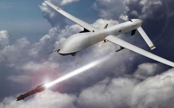
A drone strike is an air strike delivered by one or more unmanned combat aerial vehicles (UCAV) or weaponized commercial unmanned aerial vehicles (UAV). Only the United States, Israel, China, Iran, Italy, India, Pakistan, Russia, Turkey, and Poland are known to have manufactured operational UCAVs as of 2019. Since the turn of the century, most drone strikes have been carried out by the US military in such countries as Afghanistan, Pakistan, Syria, Iraq, Somalia and Yemen using air-to-surface missiles, but drone warfare has increasingly been deployed by Turkey and Azerbaijan. Drone strikes are used for targeted killings by several countries. In 2020 a Turkish-made UAV loaded with explosives detected and attacked Haftar’s forces in Libya with its artificial intelligence without command, according to a report from the UN Security Council’s Panel of Experts on Libya, published in March 2021. It was considered the first attack carried out by the UAVs on their own initiative.
It had previously been assumed that drones would not play a major role in conflicts between nations due to their vulnerability to anti-aircraft fire, while this might be true for major powers with air defences, it was less true for minor powers. Azerbaijani tactics and Turkey’s use of drones indicated a “new, more affordable type of air power”. And the ability of drones to record their kills enabled a highly effective Azerbaijani propaganda campaign.
UCAVs may be equipped with such weapons as guided bombs, cluster bombs, incendiary devices, air-to-surface missiles, air-to-air missiles, anti-tank guided missiles or other types of precision-guided munitions, autocannons and machine guns. Drone attacks can be conducted by UCAVs dropping bombs, firing a missile, or crashing into a target.
Commercial unmanned aerial vehicles (UAVs) can be weaponized by being loaded with dangerous explosives and then crashed into vulnerable targets or detonated above them. They can conduct aerial bombing by dropping hand grenades, mortar shell or other improvised explosive munitions directly above targets. Payloads could include explosives, shrapnel, chemical, radiological or biological hazards. Multiple drones may attack simultaneously in a drone swarm.
Anti-UAV systems are being developed by states to counter the threat of drone strikes. This is, however, proving difficult. According to James Rogers, an academic who studies drone warfare, “There is a big debate out there at the moment about what the best way is to counter these small UAVs, whether they are used by hobbyists causing a bit of a nuisance or in a more sinister manner by a terrorist actor.”
_
Arguably, no emerging weapons technology has received more attention from scholars over the last decade than drones, because drones represent the most visible application of the Information Age to contemporary warfare. Drones are piloted remotely and have launch and landing capabilities. Unlike missiles, they are designed for repeated use (Horowitz et al. 2016). Note that it is possible to add a payload and use a drone as a one-way missile, as the attacks on Saudi oil facilities in September 2019 demonstrated. Debates in the literature surround the relative effectiveness of drone strikes, specifically the use of drones for counterterrorism and counterinsurgency operations generally by the United States. Research on drone strikes includes qualitative case studies surrounding US drone strike campaigns in Afghanistan, Pakistan, or elsewhere, as well as quantitative, micro-level data on the same campaigns. Scholars are divided about the effectiveness of drone strikes.
_
Those who conclude that drones are effective in counterterrorism and counterinsurgency argue that they are more efficient and cost-effective in accurately targeting adversaries than alternative uses of force such as inhabited aircraft or teams of soldiers on the ground (Byman 2013). The ability of drones to loiter for long periods of time over a target means that the attacker can gain better intelligence on the target and surrounding area, making a more accurate strike more likely. This reduces the risk of civilian casualties. From a purely military perspective, drone strikes may also decrease the capacity of militant groups to conduct subsequent attacks (Mir 2018). Johnston & Sarbahi (2016) use data on US drone strikes in Pakistan between 2007 and 2011 to show that drones reduce the risk of subsequent terrorist attacks, as well as the targeting of tribal elders by militant groups. There is also evidence that drone strikes do not broadly cause blowback by generating more militant group recruitment (Shah 2018).
_
An alternative line of argument suggests that drones are ineffective and lead to blowback that degrades the effectiveness of counterterrorism and counterinsurgency operations in many cases. Critics argue that drone strikes are often based on faulty intelligence and that the intelligence information that is most likely to lead to successful strikes comes from sources on the ground, meaning that even when attacks succeed, drones do not deserve the credit (Boyle 2013, Cronin 2013). Smith & Walsh (2013) find that drone strikes against al Qaeda did not, at least initially, significantly reduce al Qaeda’s ability to generate propaganda. Critics also argue that the public in attacked locations tend to blame the attackers, not militant groups, meaning that attacks generate radicalization in the local population that makes further militant activity more likely and reduces the potential for local governments to cooperate with the attackers (Boyle 2013, Cronin 2013, Kilcullen & Exum 2009). Drone strikes can also generate international backlash due to the perception that strikes outside the context of recognized war zones are questionable under international law, leading to reputational costs. The latter objection relates to the debate about decapitation strikes against terrorist groups. Drones are not the only military tool used for decapitation strikes, but, especially in areas that lack effective air defenses, drones are a popular tool for attacks designed to kill the leaders of insurgent and terrorist groups. Jordan (2009, 2014) argues that these attempts often fail and do not generally degrade group capabilities, but others disagree (Johnston 2012). More recent work attempts to navigate these debates by studying, at an even more micro level, how drone strikes shape militant group behavior. Mir & Moore (2019), evaluating geocoded violence data and US–Pakistan counterterrorism cooperation, show that drones strikes succeeded at suppressing militant behavior, but often through anticipatory effects. Militant groups stopped communicating and planning attacks in an attempt to avoid being monitored and targeted.
_
Civilian casualties from U.S. drone strikes:
Since the September 11 attacks, the United States government has carried out drone strikes in Pakistan, Yemen, Somalia, Afghanistan, Iraq, and Libya. Drone strikes are part of a targeted killing campaign against militants. Determining precise counts of the total number killed, as well as the number of non-combatant civilians killed, is impossible; and tracking of strikes and estimates of casualties are compiled by a number of organizations, such as the Long War Journal (Pakistan and Yemen), the New America Foundation (Pakistan, Yemen, Somalia, and Libya), and the London-based Bureau of Investigative Journalism (Yemen, Somalia, and Pakistan). The estimates of civilian casualties are hampered methodologically and practically; civilian casualty estimates are largely compiled by interpreting news reports relying on anonymous officials or accounts from local media, whose credibility may vary.
Taken together, independent estimates from the non-governmental organizations New America and the Bureau of Investigative Journalism suggest that civilians made up between 7.27% to 15.47% of deaths in U.S. drone strikes in Pakistan, Yemen, and Somalia from 2009–2016, with a broadly similar rate from 2017–2019.
Since 2016, Congress has enacted legislation separately requiring the Defense Department to release “annual reports about bystander deaths from all of its operations” including strikes inside war zones (such as Afghanistan and Syria). For example, disclosure is required pursuant to Section 1057 of the National Defense Authorization Act for Fiscal Year 2018. This legislation requiring disclosure of bystander deaths, however, covers only Defense Department drone strikes and does not extend to separate CIA drone strikes.
_
The drone fundamentally alters the nature of combat.
For people in some parts of the world, it would be nice not to associate the sound of a drone with impending missile fire. Consider the emotions of those on the receiving end, left to pick up the body parts of their husbands, fathers, brothers, friends. Where do they direct their anger? When the wrong person is targeted, or an innocent bystander is killed, imagine the sense of rage. How do those who remain strike back? No army is arrayed against them, no airfield is nearby to be attacked. If they manage to shoot down a drone, what have they done but disable a small machine? No matter how justified a strike seems to us, no matter how carefully weighed and skillfully applied, to those on the receiving end it is profoundly arrogant, the act of an enemy so distant, so superior and so untouchable. The political message [of drone strikes] emphasizes the disparity in power between the parties and reinforces support for the terrorists. Moreover, by resorting to military force rather than to law enforcement, targeted killings might strengthen the sense of legitimacy of terrorist operations, which are sometimes viewed as the only viable option for the weak to fight against a powerful empire. Arguably the strongest force driving lone-wolf terror attacks throughout the Western world has been anger over drone strikes. The drone is effective. But because its aim can never be perfect, can only be as good as the intelligence that guides it, from time to time it kills the wrong people.
_
Public Attitudes Toward Drones:
Some research evaluates public attitudes about drones, generally in the context of drone strikes. There is limited debate between scholars in this context. Drone strikes tend to be popular with the American public, with support crossing party lines between Democrats and Republicans (Walsh & Schulzke 2018). Scholars have investigated what explains this support and what could lead to variation. Soft support for drone strikes likely exists because drones are perceived as a way to strike at adversaries without putting US troops at risk (Kreps 2014, Walsh & Schulzke 2018). That drones, in the US public eye, also seem effective (variously defined) likely generates support as well (Kreps & Wallace 2016). However, perceptions regarding the compliance of drone strikes with international humanitarian law can shape public attitudes. The public becomes less supportive of drone strikes when they are perceived to violate international law (Kreps 2014). Critiques of drone strikes in general are most salient with the public when they focus on legal issues rather than on questions of effectiveness (Kreps & Wallace 2016). While most of the research on public attitudes concerning drones uses samples of the American public, some research expands beyond America’s borders, looking at countries such as Pakistan, which has been on the receiving end of US drone strikes (Fair et al. 2014).
_
Hobbyist drone in drone strike:
For a few hundred dollars, anyone will be able to purchase a small hobby drone with the ability to perform aerial surveillance or deliver payloads of a few kilograms at ranges up to a few kilometers. Eventually, however, hobbyist drones will be capable of GPS-independent precision navigation, including indoors. In large numbers, they could be used for saturation swarming attacks against an array of government, military, and civilian targets. While much research to date has focused on military UAVs, hobbyist drones are often less discussed within a security context, though they perhaps hold the greatest potential for achieving overmatch against the United States in the near term. Indeed, hobbyist drones are growing increasingly sophisticated – offering autonomous flight, high-end ISR capabilities, and ever-expanding payload capacity, range, and endurance. They are also widely accessible to potentially disruptive actors and, because drones assembled from component parts generally do not have identifiable markings, could increase the difficulty of attribution if used in an attack. In addition, due to their size, construction material, and flight altitude, hobbyist drones are difficult to defend against if their presence in a particular area is unknown or unexpected. These factors could in turn increase the likelihood that hobbyist drones – particularly those assembled by the operator, and thus not subject to manufacturer-installed geofencing – could be weaponized and autonomously deployed in a terrorist attack against civilians or in an IED-like capacity against patrolling military personnel.
While such systems may not appear sophisticated in a traditional military sense, ground-emplaced IEDs have caused thousands of American deaths in Iraq and Afghanistan and proved profoundly hard to defeat. Drones will enable airborne IEDs that can actively seek out U.S. forces, rather than passively lying-in wait. Indeed, low-cost drones may lead to a paradigm shift in ground warfare for the United States, ending more than a half century of air dominance in which U.S. ground forces have not had to fear attacks from the air. Airborne IEDs could similarly be used in a terrorist attack against civilians or in precision strikes against high-profile individuals or landmarks.
_____
_____
Drone swarms:
Large number of drones flying in coordinated process is known as drone swarm. In other words, drone swarm refers to multiple drones flying similar to flock of birds in order to perform coordinated tasks. The drone swarm system either can be remotely controlled or they are self-controlled based on automation algorithm built during their development. The drone swarm concept has been taken from natural flocking behaviour found in birds, animals and insects. Several factors are considered while designing the drone swarm technology. The major factors are number/size of drones, payload carrying capacity, diversity, coverage distance and so on. The technology is being explored throughout the world in many areas for various applications. These include defense systems to provide security to the people, stage entertainment, spot spraying during fire outbreaks, hunting thieves, space exploration, Wi-Fi coverage and so on.
There are two major categories of drone swarm system development based on their working operation. Manual drone swarm works by controlling them from ground station. Automatic drones self-organize themselves based on their communication with other drones in the flock and takes care of collisions between them as well as with other surrounding objects during their travel. Military drone swarm systems are equipped with weapons to block missiles. The technology development in AI (Artificial Intelligence), Big data and IoT have made drone swarm system more effective. AI algorithms enable drones to imitate certain animals which work together which is very helpful for synchronized tasks being performed by drones.
_
Drone swarm technology—the ability of drones to autonomously make decisions based on shared information—has the potential to revolutionize the dynamics of conflict. And we’re inching ever closer to seeing this potential unleashed. In fact, swarms will have significant applications to almost every area of national and homeland security. Swarms of drones could search the oceans for adversary submarines. Drones could disperse over large areas to identify and eliminate hostile surface-to-air missiles and other air defenses. Drone swarms could potentially even serve as novel missile defenses, blocking incoming hypersonic missiles. On the homeland security front, security swarms equipped with chemical, biological, radiological, and nuclear (CBRN) detectors, facial recognition, anti-drone weapons, and other capabilities offer defenses against a range of threats.
_
In general, the more drones in a swarm, the more capable the swarm. Customizable drone swarms offer flexibility to commanders, enabling them to add or remove drones as needed. Swarms may incorporate drones specifically designed to counter jamming. A future drone swarm need not consist of the same type and size of drones, but incorporate both large and small drones equipped with different payloads. Joining a diverse set of drones creates a whole that is more capable than the individual parts. A single drone swarm could even operate across domain, with undersea and surface drones or ground and aerial drones coordinating their actions. Current drone swarms consist primarily of small, identical, sensor drones, but simple multi-domain swarms have already been developed.
_
Benefits or advantages of Drone Swarm Technology:
-1. Military drone swarm system is equipped with anti-jamming and anti-radiation weapons in order to block hypersonic missiles. Hence it helps in providing security to war fighters and citizens of a nation.
-2. Due to their small size, drones are difficult to see and hard to catch on radar.
-3. Drone swarms are cost effective unlike expensive combat jets.
-4. They can easily detect enemy targets and strike them down with smaller weapon loads.
-5. Drones are easily be 3D printed in bulk numbers.
-6. Drone swarm technology can generate business and employment opportunities.
Drawbacks or disadvantages of Drone Swarm Technology:
-1. Militants and enemies can misuse the technology for their wrong desires. This is a threat to native war fighters and citizens of the country.
-2. Present drone swarm system generate considerable noise. Moreover they are equipped with inaccurate sensors and short range communication devices. These challenges are being analyzed to make drone swarm system more robust in the future.
-3. Designing drone swarm system which can support large number of drones and cover greater distances is also a challenge for designers.
_____
Drone swarms of mass destruction:
Imagine hundreds of airborne drones darting through New York City, seeking out targets and dosing them with nerve agent. These imaginary scenarios are not yet reality, but they are quickly becoming so. Drone swarm technology could have a significant impact on every area of military competition, from enhancing supply chains to delivering nuclear bombs. As autonomy and multivehicle control become more mature, it is also possible that an adversary could deploy swarming attacks of inexpensive, expendable hobbyist drones against U.S. ships and bases. While this approach would produce a large, easily detectable radar cross-section, it would additionally complicate U.S. targeting. In this way, swarms of UAVs could be used to temporarily deny the United States access to airspace within a given area of operations or to overwhelm U.S. air defense systems for ships and bases. These … low-cost drones may lead to a paradigm shift in ground warfare for the United States, ending more than a half-century of air dominance in which U.S. ground forces have not had to fear attacks from the air. These approaches could enable an individual, non-state actor, or state to achieve capability overmatch against the United States.
_
Military Advantages of Drone Swarms:
Precisely defined, drone swarms are “multiple unmanned platforms and/or weapons deployed to accomplish a shared objective, with the platforms and/or weapons autonomously altering their behavior based on communication with one another.” The fact that components of the swarm can communicate with one another makes the swarm different from just a group of individual drones. Communication allows the swarm to adjust behavior in response to real-time information. Drones equipped with cameras and other environmental sensors (“sensor drones”) can identify potential targets, environmental hazards, or defenses and relay that information to the rest of the swarm. The swarm may then maneuver to avoid a hazard or defense, or a weapon-equipped drone (an “attack drone”) may strike the target or defense. Real-time information collection makes drone swarms well-suited for searching over broad areas for mobile or other hard-to-find units.
But swarming also adds new vulnerabilities. Drone swarms are particularly vulnerable to electronic warfare attacks. Because drone swarms are dependent on drone-to-drone communication, disrupting that signal also disrupts the swarm. As swarms become more sophisticated, they will also be more vulnerable to cyberattack. Adversaries may attempt to hijack the swarm by, for example, feeding it false information, hacking, or generating manipulative environmental signals. Although numerous counter-drone systems are in development, current defenses do not appear sufficient and even promising systems will face scalability challenges, from deployment allocation to training, in the system’s use.
Analysts are divided on whether drone swarms offer significant cost benefits. T.X. Hammes has posited in War on the Rocks that the future of warfare is “small, smart, and cheap platforms.” He highlights swarms of drones as one example, arguing the costs are already low and likely to become lower. But Shmuel Shmuel disagrees, arguing in a skeptical essay that this new technology will be more expensive to operationalize than most think. Ultimately, the cost and its relevance depend in part on what role the swarm will play and what alternatives are available. Even multimillion-dollar drone swarms can be cost-effective on balance if they meaningfully increase the survivability of more expensive or particularly crucial platforms, such as aircraft carriers or nuclear deterrent forces. Simple, low-cost drones may also fill capability gaps, such as the Marine Corps’ interest in small, tactical drones and drone swarms to provide infantry organic close-air-support and reconnaissance.
_
Nuclear Deterrence:
Drone swarm technology has significant implications for both the offensive and defensive sides of the nuclear deterrence equation. Swarms offer new means of defeating traditional nuclear delivery systems — a defensive advantage. They could serve as novel missile defenses, potentially even against hypersonic missiles. Imagine 100,000 cheap, simple drones forming a dome over a high-value target. Any incoming missile, no matter how fast or maneuverable, would likely hit a drone (whether lightweight drones are enough to damage a reentry vehicle or throw it off course is an open question). The same drones could also serve effectively as air mines, colliding with or exploding in the vicinity of incoming bombers. Even small drones can significantly damage airplane wings. This could be especially effective against low-flying bombers because there is less airspace to cover and defenders can use short-range drones.
_
Drone swarms also offer new means to improve nuclear delivery — that is, nuclear offense. States are already pursuing drone delivery systems for nuclear weapons, and drone swarms can also improve existing nuclear delivery systems without being armed with a nuclear weapon. Just as they may be able to serve as air and missile defenses, drone swarms can be used to defeat, disable, or trick those same defenses. While it’s true that air and missile defenses are highly mobile, creating significant challenges for locating and destroying them, drone swarms have the advantage of being able to spread out broadly to search for them. Along the same lines, Israel used drones as decoys to trick Syrian air defenses into believing they were Israeli aircraft. Drone swarms could do the same in larger, more distributed numbers to encourage defenses to hit the drones instead of the delivery systems carrying nuclear, biological, or chemical weapons. Drone swarms would move more effectively as a unit, akin to how groups of actual aircraft would behave.
_
Swarms may also improve nuclear targeting. Drones can be used to collect information to identify vulnerabilities or previously unknown defenses. Traditional delivery systems such as cruise missiles, while not technically drones, might incorporate drone swarm technology to adjust their approach en route, for instance based on other systems’ success or failure in striking targets. This is especially useful for counterforce strikes against an adversary’s military, which hinge on accurate and comprehensive target identification and precise strikes on those targets. Improved targeting is less important for second strikes and countervalue strikes, which target cities and civilians. Additionally, more accurate weapons mean fewer warheads and delivery systems would be needed. Targeting improvements may also lower upkeep or other costs.
_
In this way, drone swarm technology could make nuclear delivery systems either more or less survivable, depending on who uses the technology and how. Delivery system survivability is critical to nuclear stability. A nuclear threat is less credible if the threatened state believes it can reliably defeat the nuclear system. And on the other hand, if a state believes its nuclear delivery systems can be defeated, it may develop and deploy more nuclear weapons and novel delivery systems, as well as act more aggressively in crises and conflicts. Such concerns underlie Russia’s objections to U.S. ballistic missile defenses. This was also a key reason the United States and others have pursued multiple means of delivering nuclear weapons: to ensure nuclear weapons could always survive a first strike.
_
Will drone swarms ultimately improve nuclear offense more than they would improve nuclear defense? It’s unclear. But theoretically, emerging technologies that improve the ability to defeat nuclear weapons are more disruptive to overall nuclear competition than improvements to delivery. Nuclear weapons already inflict such significant damage that delivery improvements are unlikely to fundamentally alter the character of nuclear warfare. If North Korea can significantly deter the United States with a small, simple nuclear arsenal, for instance, delivery systems improvements seem unlikely to alter the fundamental dynamic. Therefore, while drone swarm technology could aid attacking states, the improvements for defenders are likely to matter more.
_
Chemical and Biological Weapons Proliferation:
Drone swarm technology is likely to encourage chemical and biological weapons proliferation and improve the capabilities of states that already possess these weapons. Terrorist organizations are also likely to be interested in the technology, especially more sophisticated actors like the Islamic State, which has already shown interest in drone-based chemical and biological weapons attacks. Drone swarms may also aid counter-proliferation, prevention, and response to a chemical or biological attack, but those applications appear less significant than the offensive applications.
_
Indeed, swarms have the potential to significantly improve chemical and biological weapons delivery. Sensor drones could collect environmental data to improve targeting, and attack drones could use this information in the timing and positioning for release, target selection, and approach. For example, attack drones may release the agent earlier than planned based on shifts in wind conditions assessed by sensor drones. Dispersed attacks also allow for more careful targeting. Instead of spraying large masses of agent, drones could search for and target individuals or specific vulnerabilities such as air ventilation systems. This also means the drones would not need to carry as much agent. Moreover, drone swarms enable the use of combined arms tactics. Some attack drones within the swarm could be equipped with chemical or biological payloads, while others could carry conventional weapons. Chemical or biological attack drones might strike first to force adversary troops into protective gear that inhibits movement, then follow up with conventional strikes. Although combined arms tactics are possible with current delivery systems, drone swarms allow much closer integration between conventional and unconventional weapons.
_
These improvements in chemical and biological delivery could conceivably weaken both the military and moral justifications for the relative marginalization of weapons in international politics (with some key exceptions). As far as military utility goes, chemical and especially biological weapons are often unreliable modes of attack. Environmental and territorial conditions such as precipitation, wind, humidity, and vegetation reduce the efficacy of the agent, while protective gear may significantly or wholly mitigate the harm they cause. But drone-based environmental sensors could make these weapons much more reliable, while combined arms tactics could mitigate the impact of, or even gain advantage from, adversary use of protective gear.
The moral opposition to chemical and biological weapons has much to do with their indiscriminate nature and the consequential risk of collateral harm. In 1968, wind blew a cloud of VX nerve agent from the Dugway Proving Grounds in Utah into a nearby farm, killing thousands of sheep. Public opposition to the event helped catalyze the Nixon administration’s review of the U.S. chemical and biological weapons programs, culminating in an end to the bioweapons program. With improved targeting, including employing drone-based environmental sensors, it’s possible to imagine less error-prone, more discriminate chemical and biological weapon delivery systems that might be less morally objectionable.
Of course, just because these weapons are more usable does not necessarily mean they will re-emerge. Modern chemical and biological weapons emerged in a different security environment. Various international laws may constrain rearmament and significant usage, as might popular opinion or political leadership. Still, it’s worth considering how advances in technology could make previously indiscriminate weapons more discriminate.
_
At the same time, drone swarms may also help prevent and respond to chemical and biological weapon attacks. Drone swarms could aid counter-proliferation efforts by, for example, coordinating searches for previously unknown chemical and biological facilities to secure stockpiles after a war. They could similarly coordinate searches along national borders to identify potential smuggling activity, including CBRN material smuggling, or searches through cities to search for gaseous plumes. Notably, swarms could serve as mobile platforms for chemical or biological detectors with different types of sensors to mitigate false positives. If an attack is successful, drones could coordinate mapping of affected areas to help guide responders. Drones could even have sprayers to help clean up after an attack, without risking harm to humans. But given the rarity of chemical and biological weapons attacks and the technical uncertainty of creating reliable drone-based CBRN detectors, these applications appear less significant than the improvements to offensive capabilities.
Note:
‘CBRN’ is the abbreviation commonly used to describe the malicious use of Chemical, Biological, Radiological and Nuclear materials or weapons with the intention to cause significant harm or disruption.
_______
_______
Section-7
Drones with Artificial Intelligence:
Drones and AI go hand in hand. Any machine that operates with a degree of autonomy needs to in some sense understand its surroundings. There are also obvious goals to achieve: a flight path, an obstacle to avoid, a point of interest to survey. But aside from getting off the ground and the basic functions of today’s flying cameras, artificial intelligence is proving useful when it comes to the analysis of drone data. Drones can gather data from all kinds of sensors in all kind of scenarios, and AI is helping us make sense of it all.
Artificial intelligence and drones are a match made in tech heaven. Pairing the real-time machine learning technology of AI with the exploratory abilities of unmanned drones gives ground-level operators a human-like eye-in-the-sky. More than ever before, drones play key problem-solving roles in a variety of sectors — including defense, agriculture, natural disaster relief, security and construction. With their ability to increase efficiency and improve safety, drones have become important tools for everyone from firefighters to farmers. Smart UAVs are so popular, in fact, that they’re now used on more than 400,000 jobs sites worldwide. Until recently, though, drones were only able to display what their cameras captured. Now, thanks to artificial intelligence software, they can perceive their surroundings, which enables them to map areas, track objects and provide analytical feedback in real-time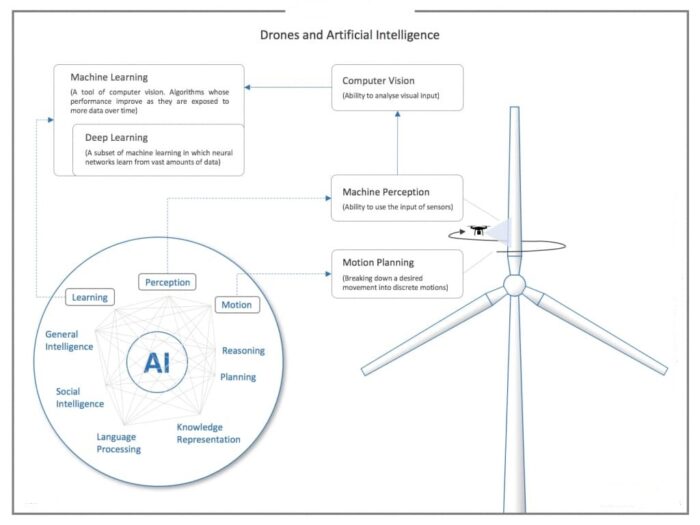
Drones often generate large amounts of data – sometimes more than we can handle. Unmanned aerial vehicles only add value to the user if there are ways to process data quickly and without putting additional efforts into this process. The faster, the more accurate, and the easier the images can be evaluated, the better. Combining drones and artificial intelligence seems to be the answer to these challenges. Nowadays, almost every company that deals with data processing, analytics or ‘autonomous’ flight control claims the use of artificial intelligence, machine or deep learning. In general, AI describes the capability of machines that can perform sophisticated tasks which have characteristics of human intelligence and includes things like reasoning, problem-solving, planning, learning, and understanding and reading human languages as shown in the graphic above.
Machine Perception:
Since many AI-related tasks for drones are dealing with image recognition, the unmanned aerial vehicle must be able to perceive and absorb the environment or objects in some way. This is usually done with sensors such as electro-optical, stereo-optical, and LiDAR. This process is referred to as Machine Perception. Sensors are important components for AI-based drones. Sensors are used to collect all the data that is processed by drone systems, including visual, positioning, and environmental data.
Computer Vision (CV):
Once the drone has captured raw sensor data, it usually needs to be analysed in some way to extract meaningful information for a certain purpose. This ability is called Computer Vision and is concerned with the automatic extraction, analysis, and understanding of useful information from one or more images. Computer vision involves the building of algorithms that can help automate recognition of objects and environment by machines. Computer Vision in drones helps to detect the various types of objects like vehicles, foothills, buildings, trees, objects on or near the surface of the water, as well as diverse terrain. Computer vision also helps detect livening beings like humans, whales, ground animals and other marine mammals with a high level of accuracy. Automated intelligent visual recognition software can be used in commercial as well as military drones.
Machine Learning (ML)
To optimize differentiable parameters, techniques of Machine Learning can be applied. Unlike software that has been programmed manually and performed tasks with specific instructions (like Computer Vision software), Machine Learning algorithms are designed in such a way that they can learn and improve over time when exposed to new data.
Deep Learning (DL)
Deep learning, on the other hand, is a specialized method of information processing and a subset of machine learning that uses neural networks and copious amounts of data for decision-making. The learning methods are based on the functioning of the human brain, which also consists of interconnected neurons. So-called Artificial Neural Networks consist of multiple layers of which each is connected to the next layer and is responsible for a certain task. This design makes it possible to combine and expand what has been learned with new content.
While many companies have moved from Computer Vision to conventional Machine Learning approaches, it appears that the first steps are being taken with deep learning algorithms in the drone industry. Recent developments in the tech industry, namely GPUs (Graphic Processing Units), have it made it possible to exploiting DL through its price-to-performance ratio as well required hardware infrastructure. Although much more computing power is available through GPUs, it still takes a reasonable amount of time to train DL algorithms, and mostly millions of images are needed to reliably perform a certain task with DL. Consequently, this means that if you have access to a big data set of images and sufficient processing power, DL methods might be the preferable choice since it usually outscores conventional ML and CV methods, especially in image recognition.
Motion Planning:
It is a strong tool when it comes to situational awareness and, in a broader sense, Sense & Avoid technology and BVLOS (Beyond Visual Line of Sight) flights. The prerequisite for motion planning is usually capturing the environment – that is, Machine Perception. To do so, the drone visualizes the environment, e.g., with SLAM (Simultaneous Localization and Mapping) technology. This gives the drone the capability to not necessarily identify what exactly is in the environment, but the distance to it. In the context of Motion Planning, Deep Learning is deployed to detect and recognize objects like humans, biker, or cars to and subsequently to create a corresponding flight route.
Self-navigation drones get pre-defined GPS coordinates about departure and destination points, with the capability to find the most optimal way and get there without manual control. However, GPS navigation is not enough to solve the problem of collision avoidance. Here, the drone needs to be trained with a huge amount of data sets to make it learn and detect a wide variety of objects and obstacles, both static and in motion, and avoid them when moving at a high speed. AI in drones helps to track the objects while working for self-navigation and detect the obstacles to avoid a collision from such objects. Object tracking drone captures the real-time data during the flight, processes it with an on-board intelligence system in real-time, and makes a human-independent decision based on the processed data.
In a nutshell:
If you only have a limited number of pictures available image processing software (CV) be the best solution. When huge datasets are available, and many different tasks to be processed, ML or DL approaches probably outperform image processing software solutions. In other words, the more tasks and the more complicated they are with image processing software, the more likely it is that ML/DL approaches are the best way to solve them, since your data size increases. Most applications of ML and DL algorithms are currently found in the areas of inspection and maintenance. The goal of drones and artificial intelligence is to make efficient use of large data sets (such as aerial images) as automated and seamless as possible. No one wants to look at 5000 plain white picture of a wind turbine and look for tiny cracks. Drones can only unlock their full potential when data acquisition and data analytics happen at a high (or someday full) degree of automation. Great potential to process this mass of data as automated as possible seems to be ML od DL approaches. Due to an immense and rapid increase in processing power, costs of storage and availability of digital data in the recent years, the utilization of complex AI algorithms have become feasible for drones, and first and solid solutions are already on the market.
_____
Artificial intelligence gives machines the ability to interact in an intelligent way. This is why the fusion between drones and artificial intelligence represents the response to many needs in aerial imagery and provides new headlines in the future of aerial technology for different sectors like Energy, Construction, Security, Agriculture. Solutions based on drone, computer vision and neural networks include:
Obstacle detection and collision avoidance
Object detection, counting, segmentation and tracking
Person or animal detection and tracking
Crowd counting
Thermal detection
Check compliance of the use of face masks in public spaces and in professional places
Detection of the use of protective equipment (glasses and helmets)
Face detection and recognition
Fire and smoke detection
License plate reading
Crack damage detection on surfaces
______
AI-enabled drone uses:
Thanks to artificial intelligence software, drones can now process what they see and report back in real-time. This new wave of drones, for instance, can map up to 2.7 million square miles (an area roughly as large as the contiguous 48 U.S. states). Additionally, the military deploys them in war zones, and emergency response teams — such as firefighters battling forest fires — use them in containment and recovery efforts. Artificial intelligence might be just what drones need to mature into a cross-industries solution. Equipped with computer vision, ML and advanced sensors, AI-based drones can continually identify and assess their surroundings and react accordingly. These capabilities are crucial for search and rescue, as well as military and defense applications.
-1. Drone in Smart Cities & Urban Management
Smart cities are developed with the most advanced features like well-connected home and equipment systems with control on the user’s palm. Most of the infrastructural amenities are either fully or partially automated with advanced security surveillance used in AI-based cameras for quick facial recognition and trace unwanted objects. And in urban management drones help to get the Aerial view mapping of urban houses and the urban landscape design allowing civil engineers or architecture to make the most feasible plan layout.
-2. Drone in Agriculture & High-tech Farming
AI drones in agriculture are playing a crucial role in monitoring the crops and plants health conditions. Drones are capable to monitor crops, assess soil, check the soil fertility and help crop protection. Drones can also be used for planting and maintaining crops. For example, by scattering seeds, pollen, fertilizers, or pesticides. These devices can use built-in AI to determine the exact treatment that crops need, optimizing yields.
-3. Drone in Real Estate & Construction Industry
Construction companies can use drones to scan and monitor construction sites continuously and automatically. These devices can enable companies to evaluate areas that are dangerous for humans to evaluate. Drones also enable much faster evaluation, eliminating the need to separately document conditions, walk through sites, or climb structures. With a bird-eye view, for the construction vehicles during the projects, drones are providing an accurate position and information to create self-guided equipment in the near future. Similarly, real estate companies are using drones to get photographs of homes and commercial buildings, as well as aerial maps and local information for homebuyers to provide them a real scenario without physically visiting at the sites helping them to save their time and efforts.
-4. AI Drone in Military and Defense Sector
Military drones are perhaps the most well known for incorporating AI and have been used for more than a decade. Often, these drones are used for surveillance or offensive operations. By incorporating AI, teams are able to reliably replace live pilots with drones and extensively map areas. AI can potentially reduce the human costs of military action by reducing the likelihood of an attack or the need to retaliate. It also indirectly increases stealth since drones are significantly smaller than other aircraft and less likely to be noticed. Autonomous drones could allow military operators to focus their own efforts on more pressing actions that engage their skillsets. As an example, autonomous drones can be used to monitor the territory a squad of soldiers has just cleared in combat, making sure enemy reinforcements are not planning to catch them by surprise. There may be many benefits to autonomous drones on the battlefield and those benefits, if harnessed correctly, could save the lives of operators and human resources of a military. This may be why the field of drones and artificial intelligence is bursting with real-world application and companies that have excellent real-world traction.
-5. Drones in Security and Surveillance
Drones are also used for tracking humans in societies or at parks from the security perspective. Its camera is used for face recognition to detect suspicious people or track their face gestures or emotion tracking while flying.
-6. eCommerce
Giants of eCommerce and delivery are working on creating drones that can deliver orders to customers. Companies like Amazon are already testing their drones, providing some of their customers with drone deliveries.
-7. Search and Rescue
Drones have the potential to be a huge help when it comes to search and rescue, particularly in conditions that are unsafe for humans to venture. For example, drones could be used to scan avalanche areas with infrared in an effort to identify trapped skiers or hikers. This would enable rescuers to search a much larger area much faster, speeding response times, and potentially saving lives. Another option is the use of drones to process action in real-time at a scale that humans can’t match. For example, identifying a vehicle used in a kidnapping by flying over traffic routes or parking areas in a city. Where a human might overlook a vehicle due to haste, AI-based drones can scan vehicle makes, models, and license plates without slowing down.
-8. Measuring and Identifying Whales
Intel devised a machine learning platform capable of analyzing the live images being streamed from the drones. As a result, researchers were able to identify and catalog whales in real time. Previously, biological samples were required as part of a time-consuming effort to identify the whales and their sex. AI made it possible to measure and record certain details before the drones were even back on the boat, despite limited visibility at sea.
-9. Counting Sheep
The Sheep Counter app uses object detection tools from TensorFlow – Google’s open-source machine learning platform – to identify and count individual sheep in a field. Sheep Counter allows drone pilots to plot a flight path around a field, import the drone images and stitch them together to provide a total headcount. The app is a great example of how drones and AI can be used to quickly count objects.
-10. Protecting Architectural Heritage
French startup Iconem is leading the way in this field. Founded by architect Yves Ubelmann, Iconem is setting new standards for the 3D modelling and documentation of important historical sites. Many are threatened by looting, urbanization, mass tourism, conflict and climate change. Preserving them has therefore become an international priority. After all, these are sites where cultures emerged and civilisations started. The aim is to preserve and protect global heritage, but the approach could not be more modern. Iconem combines drones with sophisticated modelling algorithms and cloud computing. The result is highly-detailed and immersive models of major historical sites, that can be shared with researchers, restorers and the general public. Iconem has contributed to restoration projects, exhibitions, augmented reality experiences and more.
_____
AI powered Software platforms of drones:
-1. DroneSense
DroneSense is a drone software platform for public safety officials that takes raw data captured by drones and turns it into actionable insights for police, fire and other emergency teams. The DroneSense OpsCenter enables multiple drone users to collaborate, view what each drone sees and even traces a drone’s flight pattern in real-time. The DroneSense public safety platform has been used by dozens of teams to combat a variety of public safety threats. The AI-powered software assists SWAT teams in gathering scene intelligence, assessing damage after hurricanes and tornadoes and even employs thermal imaging to locate missing persons.
-2. Neurala
Neurala is a deep learning neural network that helps drones sift through crowds to find and identify persons of interest. It can even inspect large industrial equipment, like telephone towers, and generate a real-time damage report. In order to scan crowds for an individual, its AI-powered software only needs 20 minutes to understand the image of an individual, rather than industry-standard hours or days. The Lindbergh Foundation uses Neurala-powered drones to combat elephant poaching in Africa. The artificially intelligent drones use image recognition technology to monitor elephant herds and spot possible poachers miles before they reach the elephants.
-3. Scale
Scale uses AI and machine learning to help train drones on aerial imagery. The machine learning software helps drones identify, label and map everything from homes in a neighborhood to individual objects like cars. The Scale machine learning platform is used for drone training purposes by insurance companies like Liberty Mutual, which employs the UAVs to identify and quantify insurance claims.
-4. Skycatch
Skycatch builds software that autonomously captures, processes and analyzes drone data from aerial images. This software turns aerial images into orthomosaics, 3D meshes or thermal images to get a holistic view of the land being surveyed. Japanese construction giant Komatsu uses Skycatch-integrated drones on more than 5,500 job sites. They can generate 3D imagery that’s accurate up to 5 centimeters. It then takes the integrated software only about 30 minutes to process aerial images as opposed to days for humans to accomplish the same task.
-5. Alive
The Alive Platform uses AI to help drones inspect equipment and infrastructure. The drone software comes with 2D/3D modelings, terrain mapping, image recognition technology and even soil analysis sensors, which enables the drones to inspect everything from crop yields to wind turbines. The Alive software platform is used in hundreds of drones in a variety of sectors ranging from green energy to railroads. On construction sites, workers use the software to process aerial images and as an inspection device on the end-to-end building process.
_____
FlyBase: cloud based AI platform for drones:
A startup has come up with a scheme for securely connecting drones to the cloud, effectively making them another cloud-based application and, the startup claims, the first “Internet of Drones” platform. Drones generate vast amounts of data, which is usually in the form of images or video streams. Identification of objects of interest, counting them, or detecting change over time, are some of the tasks that are monotonous and labor intensive. FlytBase AI platform offers a complete solution to automate such tasks. It has been designed and optimised specifically for drone applications. FlytBase AI controlled drones platform is based in the cloud, wherein the entire workflow of preparing datasets, training models and deploying trained-models for inferencing has been automated. This enables quicker turn around time and faster iterations when a use case is being worked upon. Being in the cloud also helps in scaling the system up at runtime when demand (either for training, or for real-time inferencing) increases. Computer vision systems, mounted on drones, enable them to gather rich visual data either in the form of photos or videos. Processing this data using AI unfolds unique perspectives and information, which otherwise would be either impossible or very expensive to derive using traditional techniques involving human effort.
______
Drone acrobatics enabled by AI:
AI-Powered Drone learns extreme Acrobatics that can perform manoeuvres that are challenging for even the best human pilot.
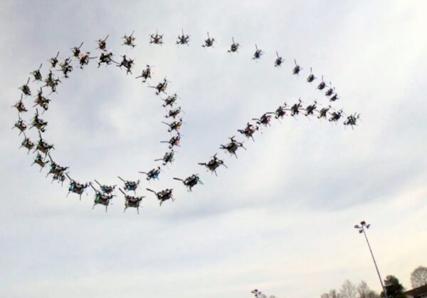
Quadrotors are among the most agile and dynamic machines ever created. In the hands of a skilled human pilot, they can do some astonishing series of manoeuvres. And while autonomous flying robots have been getting better at flying dynamically in real-world environments, they still haven’t demonstrated the same level of agility of manually piloted ones. Now researchers from the Robotics and Perception Group at the University of Zurich and ETH Zurich, in collaboration with Intel, have developed a neural network training method that “enables an autonomous quadrotor to fly extreme acrobatic manoeuvres with only onboard sensing and computation.”
There are two notable things here: First, the quadrotor can do these extreme acrobatics outdoors without any kind of external camera or motion-tracking system to help it out (all sensing and computing is onboard). Second, all of the AI training is done in simulation, without the need for an additional simulation-to-real-world (what researchers call “sim-to-real”) transfer step. Usually, a sim-to-real transfer step means putting your quadrotor into one of those aforementioned external tracking systems, so that it doesn’t completely bork itself while trying to reconcile the differences between the simulated world and the real world, where, as the researchers wrote in a paper describing their system, “even tiny mistakes can result in catastrophic outcomes.”
To enable “zero-shot” sim-to-real transfer, the neural net training in simulation uses an expert controller that knows exactly what’s going on to teach a “student controller” that has much less perfect knowledge. That is, the simulated sensory input that the student ends up using as it learns to follow the expert has been abstracted to present the kind of imperfect, imprecise data it’s going to encounter in the real world. This can involve things like abstracting away the image part of the simulation until you’d have no way of telling the difference between abstracted simulation and abstracted reality, which is what allows the system to make that sim-to-real leap.
______
Enhanced Deployment Strategy for the 5G Drone-Base Station Using Artificial Intelligence, a 2019 pap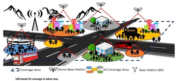
The use of drones to perform various task has recently gained a lot of attention. Drones have been used by traders to deliver goods to customers; scientists, and researchers to observe and search for endangered species; and by the military during critical operations. The flexibility of drones in remote controlling makes them ideal candidates to perform critical tasks with minimum time and cost. In this paper, authors use drones to setup base stations that provide 5G cellular coverage over a given area in danger. The aim of this paper is to determine the optimum number of drones and their optimum location, such that each point in the selected area is covered with the least cost while considering communication relevant parameters such as data rate, latency, and throughput. The problem is mathematically modeled by forming linear optimization equations. For fast optimized solutions, genetic algorithm (GA) and simulated annealing (SA) algorithms are provisionally employed to solve the problem, and the results are accordingly compared. Using these two meta-heuristic methods, quick and relatively inexpensive feedback can be provided to designers and service providers in 5G next generation networks.
_____
_____
Autonomous drones:
An autonomous drone is able to conduct a safe flight without the intervention of a pilot. It does so with the help of artificial intelligence, enabling it to cope with all kinds of unforeseen and unpredictable emergency situations. This is different from automatic operations, where the drone flies pre-determined routes defined by the drone operator before starting the flight. For this type of drone, it is essential for the remote pilot to take control of the drone to intervene in unforeseen events for which the drone has not been programmed. To be clear, drones already enjoy a degree of autonomy. Many are already automated, following pre-programmed flight paths, for example. There’s a huge difference between automated and autonomous, though. For example, a fully autonomous drone would make all its own decisions. Autonomous drones are unmanned aerial vehicles (UAVs) that operate using Artificial Intelligence (AI)-powered navigation and operational software, and do not require a human pilot.
There is no denial that AI has had a worldwide impact in society. There are nearly no industries that have not been revolutionized in some way or another by AI. Current day drones generate massive amounts of data so it was only a matter of time that AI would be thrown into the mix. But what exactly does AI offer to drones? The key word here is autonomy. There are different levels of autonomy ranging from “no autonomy” all the way to “full autonomy” in all cases. Here we are not going to enter the debate into what level is achievable today and use the term broadly to refer to systems that require no human input in the operation. There are 4 basic key components of autonomous flight:
-1. State Estimation: the ability to estimate the position, orientation and velocity of the vehicle.
-2. Control: the ability to compute and execute the necessary commands to produce desired actions.
-3. Mapping: the capability, through its sensors, to map the environment in which it operates.
-4. Planning: the ability to compute a safe trajectory between two given points.
_
-AI can help in State Estimation and Control problems. AI has proven more than capable of helping optimize and enhance drone control especially in unstable and aggressive environments. Classical control and state estimation techniques have limited effectiveness as they tend to only be optimised for approximate mathematical models of the drone and not real operational data. AI and ML algorithms have proven their usefulness in learning from experience and making drones state estimation and control capabilities adapt to changes (e.g., broken propeller) or to the environment (e.g., wind gusts or rain). One proven use of AI is helping find optimal values for proportional–integral–derivative controller (PID controller) to provide better performance in extreme situations. Complex neural networks such as CNN or RNN have also been used to better handle changes in systems, deteriorations, possible uncertainties and perturbations for favourable tracking performance for the motion control of drones.
-The ability to map and gain awareness of surroundings is another key factor contributing to a drone’s full autonomy. Currently, you can find drones equipped with high tech mapping systems such as electro-optical, stereo-optical or LIDAR. Modern mapping sensors are very good at generating high fidelity mappings of surroundings, but their weight or price can sometimes be a limiting factor. Here, AI’s major impact is Computer Vision algorithms (CV). Nowadays, it is easy to find lightweight, high-resolution cameras at a relatively cheap price. Combining these cameras with state-of-the-art CV algorithms can improve mapping capabilities and situational awareness to practically any drone at negligible costs. Aerial-mapping using drones and CV algorithms is an increasing business in many different industries. The main drawback to CV algorithms is the large amount of data and examples needed for its training.
-Finally, real-time path planning and posterior navigation is one of the most challenging and fundamental aspects of real, autonomous systems. Once the drone knows where it is and where it wants to go (Mapping), it now needs to find the way to get there in the safest and most efficient manner possible. The use of deep neural networks such as reinforcement learning have been used to develop effective, real-time planning as well as to create simultaneous multi-drone cooperative planning. AI has also had a big impact in collision avoidance. In the past, many classical collision avoidance systems relied on the very expensive LIDARs or RGB-D Cameras. AI algorithms have helped provide cost-effective collision avoidance solutions for many types of drones. Researchers from the Carnegie Mellon University and the Graz University of Technology were able to, through the use of cheap cameras, CV algorithms and state-of-the-art imitation learning techniques, safely navigate a drone through a forest.
-It is undeniable that both AI and drones have come to stay. Many industries such as agriculture, construction, logistics or emergency services are betting on the use of these new technologies. AI has proven to have huge potential benefits for drone systems, especially when talking about autonomous systems. AI has leveraged the huge amount of data produced by these systems to enable the existence of more effective, robust and precise decision-making drones. Needless to say, all these benefits come with potential risks, such as ensuring a Trustworthy AI or the need of new regulatory frameworks, that surely need to be tackled before introducing more widespread use of drones and autonomous systems.
__
Autonomous drone technology is, to an extent, already available. To demonstrate, let’s assume the aerospace industry were to adopt the automotive industry’s five levels of autonomy. If so, then we can define:
Level 0: There is no autonomy.
Level 1: There are autonomous systems, like altitude control, but the pilot is in control.
Level 2: There are multiple autonomous systems running simultaneously, but the pilot is in control.
Level 3: The craft operates autonomously under certain conditions, but a pilot must monitor its progress.
Level 4: The craft is autonomous in most situations; the pilot can take over but generally doesn’t have to.
Level 5: The drone is fully autonomous.
Currently, the technology is between Level 3 and Level 4, where the drone can make some decisions, but a certain level of human supervision is necessary.
To make this technology fully autonomous, we have to overcome a few challenges to ensure drones meet local laws, regulations, air/road traffic conditions and safety standards.
These challenges include:
-1. Designing, testing and certifying sensors, radar and cameras able to observe any environment the drone may encounter — particularly in adverse weather
-2. Developing, testing and certifying software that is functionally safe and secure
-3. Increasing travel distances and carrying capacity by improving aerodynamics, reducing weight and increasing battery or propulsion system performance
- Simulation will play a critical role in addressing these challenges by helping us optimize individual parts and certify whole systems.
_
Relatively speaking, it’s easy to design a UAV that can safely fly itself high over a city between two pre-defined points, or vertiports. But it’s much harder to design one that can deliver pizza to your front door in an urban environment. The most challenging parts of any flight are the approach, landing and takeoff. In an urban area, the pizza bot will need to perform these actions while avoiding houses, pets, people, clothes lines, weather, birds and other objects in the sky. Until an autonomous craft can perform these actions reliably in an urban setting, prepare to tip the pizza delivery person.
Current drone technology has limitations. For instance, many functions are automated, but an expert is typically supervising the flight, ready to take control.
Generally speaking, the technology isn’t ready to:
-1. Manage complex, unpredictable situations
-2. Handle adverse weather
-3. Fly without restrictions in populated areas
We are already starting to see drones being used for remote asset inspections, deliveries to remote areas and emergency use in hazardous situations. In a few years, these and other applications will be commonplace. Once these applications prove the viability and commercial success of the technology, fully autonomous drones capable of transporting humans will become a reality. In short, it will be some time before we are comfortable letting go of the ultimate safety feature — the remote pilot.
_
Safety with Fully Autonomous Drones:
-1. First, sensors must be able to clearly sense their environments without being fooled by fog or lighting conditions, such as glare or shadows. These sensors must be affordable and light to maximize the UAV’s carrying capacity or maneuverability.
-2. The sensors must also be able to view the airspace in every direction around the craft.
-3. We already have the technology needed to avoid air traffic conflicts. Modern airplanes use radar and transponders to sense other planes. These technologies could be added to the UAV system.
-4. Next, software and AI will need to take all the sensor information and make decisions. Simulations will test and train these systems to ensure they will be able to make the safest choice in any conceivable situation.
-5. Finally, fully autonomous UAVs are likely to be electric or hybrid to keep urban emissions down. However, batteries have limited energy densities. Therefore, to get the aircraft to travel farther, carry more and remain efficient, we need better batteries and lighter, highly reliable components.
_
Simulation is the Key to Autonomous Drone Technology:
Autonomous drone technologies will need to be designed, tested and — in the case of artificial intelligence (AI) — trained to ensure public safety. These tasks would include simulation models of environments, cities and weather conditions that the UAV might face. By tweaking each simulation, we can test, optimize and certify the safety of autonomous technology faster than we ever could using physical prototypes. Simulations can ensure an autonomous drone can keep track of all the air/road traffic it might encounter
Simulation can also be used to:
-1. Optimize, verify and certify camera, lidar, radar and other sensor performance
-2. Verify and certify software logic and AI systems
-3. Test the link between sensors, software and virtual worlds
-4. Perform functional safety assessments with software, AI and sensors in the loop
-5. Lightweight components
-6. Optimize battery, motor and electric propulsion performance
__
Over the past few years, an increasing number of public and private research laboratories have been working on small, human-friendly drones that one day may autonomously fly in confined spaces and in close proximity to people. The development of these small drones has been supported by the miniaturization and cost reduction of electronic components (microprocessors, sensors, batteries and wireless communication units), largely driven by the portable electronic device industry. These improvements have enabled the prototyping and commercialization of small (typically less than 1 kg) drones at smartphone prices.
Small autonomous drones will have important socio-economic impacts as seen in the figure below:
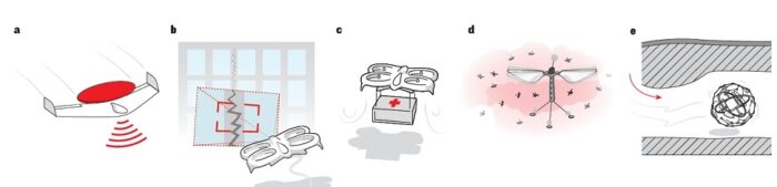
Autonomous drones in rescue situations. a, Fixed-wing drones with a long flight time could provide bird’s-eye-view images and a communication network for rescuers on the ground. b, Rotorcrafts with hovering capabilities could inspect structures for cracks and leaks; and c, transport medical supplies from nearby hospitals. d, Swarms of dispensable drones with flapping wings could enter buildings to search for chemical hazards. e, Multi-modal caged robots could fly and roll into complex structures to safely search for signs of life.
______
______
Artificial Intelligence Efforts for Military Drones:
In the U.S., the Defense Advanced Research Projects Agency (DARPA) is engaged in UAS AI efforts, including the Offensive Swarm-Enabled Tactics (OFFSET) program to equip soldiers fighting in urban areas with swarms of up to 250 UAS and unmanned ground systems. Companies, such as Northrop Grumman and Raytheon, are taking part in the program. DARPA is also leading a research effort with California-based AeroVironment to study how the military can learn from the mechanics of insect flight to increase UAS autonomy by reducing the computation required for AI. California-based Aitech said that its A176 Cyclone and A178 Thunder supercomputers can provide generous AI for military drones, as the systems are ruggedized to military specification and run-on parallel NVIDIA general-purpose computing on graphics processing units (GPGPU). Companies are embarking on efforts to embed artificial intelligence (AI) on military unmanned aircraft systems (UAS), though the timing of full and effective autonomy for such drones is uncertain. While it is easy to imagine a future with significant embedded AI, i.e., online learning and autonomous decision making deployed on large swarms of UAS, there are significant challenges to adopting non-deterministic learning algorithms on unmanned systems operating in real-world situations. Through edge processing, drones do not have to send information to the cloud and thus may achieve greater performance, information security, and autonomy.
_
Insitu Inc. is an American company that designs, develops and manufactures unmanned aerial systems (UAS). The company is a wholly owned subsidiary of Boeing Defense, Space & Security. Recently Insitu announced a new extended range satellite communications kit for the company’s Integrator drones and an Alticam-14 (AC-14) enhanced intelligence, surveillance and reconnaissance (ISR) turret with telescoping video imaging capability to able to identify people from the air. The AC-14 payload has a number of other ISR features, including the ability of an operator to monitor electro-optical, infrared, and short-wave infrared video streams simultaneously. Insitu has also worked on an optional, laser designator upgrade for the AC-14 that could allow Boeing Apaches to team with Insitu Scan Eagle drones to allow Apache crews to remain out of enemy reach while firing Hellfire missiles.
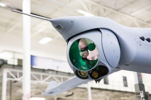
AI is to aid in analyzing the data provided by the AC-14 for the Integrator drones as seen in the figure above. The Hood Tech Vision AC-14 Imager payload uses embedded processing onboard for image stabilization and target tracking. Insitu Common Open-mission Management Command and Control (ICOMC2) and Inexa GCS software suites use processing on the ground to assist flight planning and sensor control. And Tacitview/ Catalina suite leverages server and cloud computing based processing of live and archived full motion video to extract information from sensor data. Insitu teams are working hard to bring more value to each part of the system – air, ground and cloud.
_______
Autonomous military drones:
‘Autonomy’ in the context of military applications can be defined as: the condition or quality of being self-governing to achieve an assigned task, based on a system’s own situational awareness (integrated sensing, perceiving, and analysing), planning, and decision-making.
An autonomous weapon system (or lethal autonomous weapon system, LAWS) is a weapon system that, once activated, can select and engage targets without further intervention by a human operator. A distinction is often made by some between automatic, automated and autonomous systems, while others use these terms interchangeably.
_
Armed drones have been on the battlefield for decades, but until now they have been simple devices that are controlled from a distance. Calling current drones unmanned is a mistake, since they are at all times under the control of a human pilot. The potential leap forward is profound: today the talk is about making devices the size of a domestic drone, capable of deciding for themselves and without human supervision who is to be attacked and then doing so. According to what Paul Scharre, ex-special operations officer, former Pentagon adviser and author of the new book Army of None: Autonomous Weapons and the Future of War (WW Norton & Company, 2018), says while “no country has stated that they intend to build fully autonomous weapons,” at the same time “few have ruled them out either.” Scharre warns that: “Many countries around the world are developing ever more advanced robotic weapons, including many non-state groups.” These advances may include varying degrees of autonomy, and for the expert the key question is whether the line will be crossed towards the total elimination of human control, “delegating life and death decisions to machines.”
However, there is no doubt that this technology is now accessible. And there is no shortage of those who believe that if states that respect the law abstain from developing it, they will be defenceless against its use by aggressor nations and terrorist groups. Another question is whether AI applied to warfare will end up being used. Some experts suggest that it could generate a deterrent effect that leads to a balance of power, as happened with the nuclear escalation during the Cold War. But Scharre doubts the viability of this scenario, since nuclear missiles could be tracked via satellite; on the contrary, given that software gives autonomy to AI-based weapons, their surveillance is enormously complex. “The biggest challenge is the difficulty in verifying compliance with any kind of cooperation,” says the expert. “This makes it very likely that nations will invest in autonomous technology, if nothing else out of fear that their adversaries are doing so.”
_
The proliferation of a broad range of artificial intelligence (AI)-augmented autonomous weapon systems (AWS) could have significant strategic implications for nuclear security and escalation in future warfare. Several observers anticipate that sophisticated AI-augmented AWS will soon be deployed for a range of ISR and strike missions. Experts generally agree that AI machine-learning systems are an essential ingredient to enable fully autonomous systems. Even if AWS are used only for conventional operations, their proliferation could nonetheless have destabilising implications and increase the risk of inadvertent nuclear escalation. For example, AI augmented drone swarms may be used in offensive sorties targeting ground-based air defences by nuclear-armed states to defend their strategic assets (for example, launch facilities and their attendant command, control and early-warning systems), and to exert pressure on a weaker nuclear-armed state to respond with nuclear weapons – in a use-them-or-lose-them situation.
_
Lethal autonomous weapons (LAWS):
Beyond the use of AI for ISR UAS, AI may enable autonomous UAS that serve as weapons, and, for the latter uses of AI, technological obstacles are not the sole ones. As dozens of defense companies seek to use AI to develop lethal autonomous weapons (LAWS), humanitarian groups seek to build international support for a treaty to ban them. LAWS, so-called “killer robots,” would rely on AI to remove the human from targeting decisions. U.N. Secretary General António Guterres wrote that “autonomous machines with the power and discretion to select targets and take lives without human involvement are politically unacceptable, morally repugnant and should be prohibited by international law.”
_
Drones have been hackable for years. In 2009, defense officials told reporters that Iranian-backed militias used $26 of off-the-shelf software to intercept the video feeds of drones flying over Iraq. And in 2011, it was reported that a virus had infected some drone control systems at Creech Air Force Base in Nevada, leading to security concerns about the security of unmanned aircraft. It may be that the only way to make a drone truly secure is to allow it to make its own decisions without a human controller: if it receives no outside commands, then it cannot be hacked (at least as easily). And that’s where LAWS, might be the most attractive.
Any autonomous weapons system is unlikely to be used by the military, except in extraordinary circumstances, argued Will McCants, a fellow at the Brookings Saban Center and director of its project on U.S. Relations with the Islamic World. “You could imagine a scenario,” he says, “in which LAWS planes hunted surface-to-air missiles as part of a campaign to destroy Syria’s air defenses.” It would remove the risk to U.S. pilots while exclusively targeting war equipment that has no civilian purpose.
Heather Roff, a visiting professor at the University of Denver, said many conflicts, such as the civil war in Syria, are too complex for LAWS. “It’s one thing to use them in a conventional conflict,” where large militaries fight away from cities, “but we tend to fight asymmetric battles. And interventions are only military campaigns — the civilian effects matter.” Roff says that because LAWs are not sophisticated enough to meaningfully distinguish between civilians and militants in a complex, urban environment, they probably would not be effective at achieving a constructive military end– if only because of how a civilian population would likely react to self-governing machines firing weapons at their city. “The idea that you could solve that crisis with a robotic weapon is naïve and dangerous,” she said.
Avoid human errors and emotions:
Those who support the development of autonomous military drones also point to their ability to avoid human errors and emotions, freeing current pilots from the moral responsibility of casualties. However, in addition to the danger of suppressing any hint of humanity, other experts suggest that the refining process of all technology is fraught with errors, and in this case will result in deaths due to software bugs or errors in recognition. What’s more, those companies and individuals that contribute to creating the necessary basic technologies may suddenly find themselves as potential military objectives.
_____
Artificial Intelligence and Military Drone Swarming:
Swarms could be used as decoys to create false signatures (for example, time delays in tricking a defender), or to force an enemy to reveal (or ‘light up’) its weapons by switching on their radars to attack drone swarms. Drone swarms might also be used in swarm versus swarm combat scenarios, including drones armed with nuclear and conventional payloads and hypersonic boost-glide variants. Machine-to-machine collaboration is still at a very nascent stage, however. The rapid proliferation of a new generation of artificial intelligence (AI)-augmented and -enabled autonomous weapon systems (AWS), most notably drones used in swarming tactics, could have a significant impact on deterrence, nuclear security, escalation, and strategic stability in future warfare. James Johnson argues that emerging iterations of AWS fused with AI systems will presage a powerful interplay of increased range, accuracy, mass, coordination, intelligence, and speed in a future conflict. In turn, the risk of escalatory use-them-or-lose-them situations between nuclear-armed military powers and the attendant dangers posed by the use of unreliable, unverified and unsafe AWS will increase, with potentially catastrophic strategic outcomes.
______
______
Section-8
Drone applications:
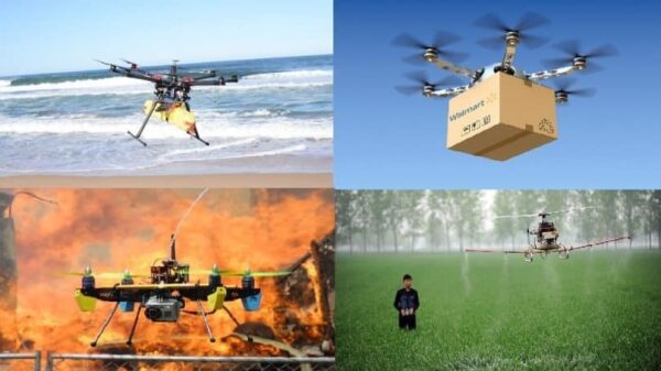
Today, the application areas of drones are limitless. The technology that was once designed to destroy is now being used for the betterment of mankind. From wildlife conservation to disease control, emergency response, insurance to mapping, UAVs are being used in multiple sectors. Drones have many applications, some of which we have not yet imagined. UAVs are starting to replace hazardous works such as climbing tall structures, inspecting confined areas and traversing dangerous terrains. They are helping save lives during search and rescue efforts and are optimizing energy production and delivery. The ability to safely and quickly gather data and to access inaccessible locations opens a world of possibilities for of drones use. Their ability to thoroughly and accurately map natural features while minimizing human trespass may lead to better understanding of ecologically fragile areas.
_
Drones help in monitoring the number of animals, identifying spices and collecting samples allowing conservationists to track poachers as seen in the figure below:
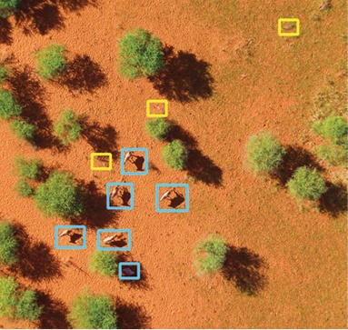
_
There is a great potential in UAVs for emergency management agencies to assess damage in the wake of a natural disaster. Dresdner Robin based out of New Jersey has been using UAVs to provide critical data on river conditions to flood-prone communities. For one of its recent projects, the company reviewed Pompton Lakes’ flood-prone waterways by using 11 individual flights 215 feet above the water level. The drones moved at 10mi/h, using a 15-millimeter fixed-zoom lens, capturing 60 feet sections of the terrain. Images were snapped every two seconds (1,042 in total) and were later analyzed to locate obstructions in the river channel. These pictures aided a stream-cleaning project that is part of the borough’s flood mitigation program.
_
Drones have become an eye in the sky to give us the view from above. They provide real-time, high-resolution imagery at a very low cost. Drone data is more likely to result in correct measurements in the first time, vastly reducing the time and cost of repeat site visits. Satellite imagery has played a pivotal role for almost two decades now. But, it has several limitations concerning cost, data sharing and time. In contrast, drones can capture aerial imagery at a far higher resolution, more quickly and at a much lower cost. And unlike satellites, people can own drones. UAVs also have real-time streaming capabilities that enable quick decision-making. Using drone photographs as a backdrop for graphic plans allow easy integration of aerial pictures into graphic presentations without the loss of image clarity that we generally encounter when using readily available satellite imagery.
With miniaturization of sensors, it has now become easy to capture imagery using drones. The advancement in sensors has two primary impacts: data quality and automation. Better visual and thermal sensors capture ever-higher resolution images, which means drone data is more accurate and easier to use. New sensors are also being used to guide a drone’s flight path, keeping a consistent distance from a structure or the ground to enable automated flights and increase measurement precision. The future of drone technology depends on sensors in many ways. From multispectral camera sensors for agriculture to thermal sensors for search and rescue, we have seen this technology changing. Today, new drone mounted multi-sensor systems running Artificial Intelligence and Machine Learning are being used for critical infrastructure inspections. Further, chemical sensors can be attached to find out information about the chemical composition of an environment. With government and private entities across sectors opting for drones for key operations, many believe that the growth and success story of drones has just started.
________
________
Multipurpose drone uses:
Drones will play a major role in the near future, by delivering goods and merchandise, or even serving as flying mobile hot-spots for broadband wireless access. The main goal is to serve a massive number of users in a specific area. Moreover, drones can be used to maintain all the needed security and surveillance techniques, which are implemented to ensure the usage of these drones safely, securely and properly according to. Therefore, the focus is on the multi-purpose usage of these drones, both in the civilian and military domains. The multi-purpose uses of drones are illustrated in figure below:
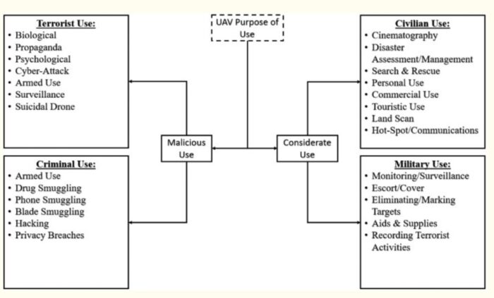
_
Civilian multi-purpose use cases:
The main civilian applications of drones include:
- Cinematography: Drones are currently being used by various filmmakers to ensure aerial filming like never before, enabling a new level of creativity with a bird’s eye view.
- Natural Disaster Response and Control: UAVs are being deployed for disaster control and assessments ever since the Katrina hurricane in 2005, where roads were blocked by fallen trees, cars, road signs, etc. This helped in assessing the disaster consequences and in checking for missing, injured and trapped survivors.
- Search and Rescue: UAVs can be used for the purpose of searching for lost, scattered or stranded people, especially when human presence is deemed dangerous or limited.
- Tourism: UAVs can also be used to capture stunning views including the bird’s eye view. This can be used to attract tourists and to promote touristic places and areas of interest, which enhances the overall tourism industry.
- Commercial Ads: Drones are also being used in commercial ads since they can be used to capture (film) a scene with High Definition (HD) quality and for a specific amount of time. This reduces the need for expensive equipment and human interaction.
- Crisis Management: In case of a terrorist attack or a natural disaster (earthquake floods), UAVs can act as hot spots or base stations, which allows for the collection of short messages sent by affected people, or used to alert response teams. In other cases, it helps in locating people based on their GPS location or MAC addresses.
- Emergency Response: Drones are currently being used as mobile medical kits that can be sent to first aid response teams on scene. This offers the necessary help without delays, in contrast to ambulance cars. In fact, drones were deployed across the streets of Spain and China (mainly Wuhan), using cameras and speakers to raise awareness and warm people, using aerial spray and disinfection to fight the corona-virus (COVID-19) spread. In addition, drones were used as a flying delivery mean to supply isolated/infected patients with goods (i.e. food and medicine), and also as a flying mean to transport testing samples at a faster pace, reducing human interaction.
- Environmental Management: Drones can be used to perform pollution measuring tasks (i.e. environmental drones for air quality measurement and analysis), agricultural tasks (i.e. soil analysis, crop/seed/livestock management and pest control), or nature/wildlife research/conservation tasks (i.e. anti-poaching, endangered species protection).
- Underwater/Maritime Purposes: Underwater drones or Unmanned Ocean Vehicles (UOV) saw an increase use of underwater search-and-rescue operations, environmental and coastal data collection and detecting and monitoring maritime fauna (animals).
_
Police multi-purpose drone usage:
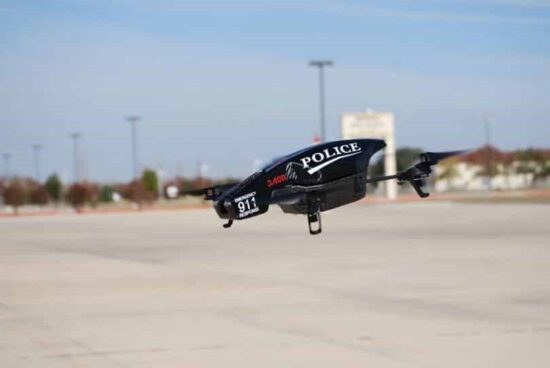
Drones are used to track down suspects using the aerial bird watch view. This proved to be cheaper and more maneuverable than a helicopter. In fact, drones will soon have the ability to contain thermal, motion, and night vision detection, which can be used to track down suspects at any time of the day. Furthermore, drones can be used to enhance traffic efficiency by offering quick response and identification of road conditions. This helps in avoiding traffic congestion, and in responding to a traffic accident or emergency. Moreover, these drones can be used for surveillance purposes, with the ability to detect suspicious targets hidden within public domains, which proved to be more flexible than fixed cameras. The reason is due to their capability in identifying and recognizing suspects from their height, size, and facial recognition, and thus, making it very difficult for suspects to hide in public. Crowds of people can be monitored and criminal activity can be detected in case there is an emergency. These can also be used for law enforcement officials at crime scenes, where a more detailed view can give us more information about the situation. Moreover, drones are also used by border patrol officials who work towards monitoring criminal activity at the border, especially the transport of drugs.
_
Military applications are discussed in the section military drones and malicious application are discussed in the section malicious uses.
______
Drones as First Responder (DFR) programs can save lives:
First responders, firefighters, search and rescue teams, and members of law enforcement can mobilize in a matter of minutes. The UAV integrated with thermal imaging provides the ability to see through smoke, dust, light fog, and foliage. This technology allows the user to find persons even in total darkness – see much farther than with other low-light night vision goggles and cameras. According to a new DJI report, more than 500 people worldwide have been rescued from danger by drones. DJI lists rescues from around the world on the DJI Drone Rescue Map, which tracks more than 300 incidents when police, firefighters, rescue squads, and bystanders have used drones to save people from danger since the first known rescue in 2013. Not only do drones make the work of first responders quicker and safer, but the public receives much better response services, potentially saving the lives of first responders and the citizens they serve. Law enforcement and public safety agencies are significantly benefiting from using drones as first responders. More and more departments are adopting drones as a must-have device in their modern tool belt to better protect and serve their communities. Drones have become more effective, more affordable, and easier to fly in recent years. Thus, making UAS a realistic option to keep responders safer and provide opportunities for missions that manned aircraft couldn’t maneuver through, such as exploring inside buildings and tunnels. Drones as a first responder is the natural progression of law enforcement using drones in their daily operations.
Use cases for Drones as First Responder:
search-and-rescue missions
tactical surveillance
suspect tracking
traffic accident investigations
security sweeps
wildfire surveillance and suppression
disaster readiness and response
911 calls
______
______
Civilian and commercial uses of drones:
In broad terms commercial use cases for drones include:
-1. remove people from dangerous work;
-2. reduce the number of people needed;
-3. reduce the number of steps in the process;
-4. replace more costly methods;
-5. access inaccessible (by humans) locations;
-6. perform tasks quicker or more efficiently;
-7. and, perform functions people do not want to perform / not strong enough labor pool.
_
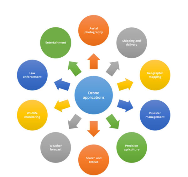
_
Filming, journalism and aerial photography:
The world of media has really conquered the idea of using drones to their fullest extent. A lot of movies these days are shot using quadcopters and other drones. This idea has given the movie industry a completely new look and some of the names that come up when we talk about filmography with drones are James Bond’s Skyfall, the well-acclaimed Leonard Di Caprio’s The Wolf of Wall Street, the evergreen Harry Potter and the Chamber of Secrets, the popular television series Game of Thrones and many more. Filmmakers have fully grasped the idea of drone flight in their creative process and have managed to generate a wide range of new ideas and perspectives.
Also, the ability of the drones to reach places where reporters cannot reach has heightened their use in the world of journalism. Aerial footage for live broadcast is becoming increasingly useful these days.
Drones are also extremely popular in the world of aerial photography. Whether you are a professional or an amateur, you can most likely see the appeal of taking high-quality images from fresh perspectives. Drones allow you to reach many places that you cannot reach on foot, and the opportunity for creative photography is vast. Many consumer drones are developed with the specific purpose of aiding in commercial photography and videography. If you can add a gimbal, it stabilizes the camera to get you better pictures. Also, you can control what the camera sees and captures right from your smartphone, immediately getting HD video right to your phone. There are even drones that will follow you around and film you as you move. Simply by holding a tracker, the drone can follow your movements and record you as you are doing something. This is a great option for extreme sports athletes such as snowboarders and surfers!
_
Shipping and delivery:
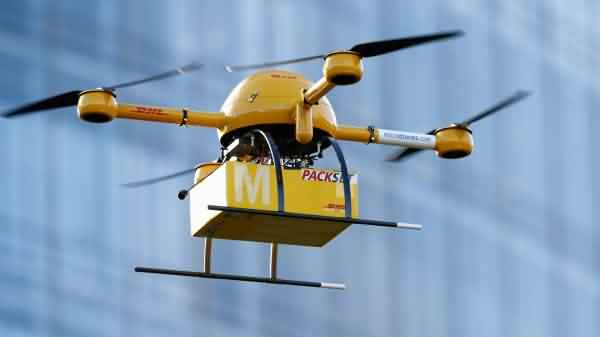
Even though the shipping and delivery applications of UAVs are still being developed, this idea could be revolutionary for the world in the near future. This could significantly improve delivery times and reduce human labor. Be it delivering pizzas, letters, or even small parcels, these programmed drones could do the work for you for last mile delivery. DHL has for the first time tested parcel deliveries with a drone. In fact, Amazon is working on its resources to facilitate 30-minute delivery services by means of drones. If this is brought to fruition, more than half of your shopping and food orders could be done within a span of a few minutes, with drones delivering your packages at your doorstep. Wal-Mart estimated that 90% of Americans live within 10 miles of a Wal-Mart store. This close proximity to the “last-mile”, which is traditionally the costliest of the shipping process, seems primed for cost cutting and time savings innovation, both of which drones can supply.
_
Disaster management:
One of the most important applications for these UAVs lies in disaster management. It is often seen that there is utter chaos and mismanagement of resources soon after a disaster, be it a man-made or a natural calamity. Drones could help you significantly here. By coordinating valuable resources and eliminating the need for a vast amount of manpower, these drones could be of great help immediately following a disaster, and even save lives.
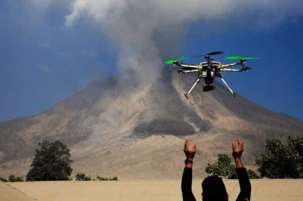
With powerful cameras, these devices could collect information and drone images of the debris in a specific area. You would get clearer footage of the accident site without having to spend a lot of money on helicopters. Add to that, owing to their small size, they are able to penetrate into places that would otherwise be difficult for helicopters to enter and provide close-up views and high-quality images.
In the aftermath of hurricanes and earthquakes, UAVs have been used to assess damage, locate victims, and deliver aid. And in certain circumstances, they are helping to prevent disasters altogether. In 2017, drones were used to help restore power to areas damaged by Hurricane Harvey, as well as survey damage to flooded areas and assist in search and rescue efforts. To help monitor and combat forest fires, surveillance drones outfitted with thermal imaging cameras are being deployed to detect abnormal forest temperatures. By doing so, teams are able to identify areas most prone to forest fires or identify fires just minutes after they begin. Demand for this kind of technology is growing. In 2019, the Department of Defense made an official request for drones that can be deployed during a natural disaster to distribute food and water to affected areas.
_
Search and rescue:
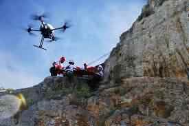
Usually, a rescue operation is a fight against time. You need to get the work done fast and smoothly. This is where drones come in handy. With the help of thermal sensors, drones can locate lost persons. They are also especially useful at night or even in challenging terrains. Simply put, drones can easily reach places that many humans cannot, and this can be invaluable when timely rescues are critical. These can be deployed quickly and can travel through small spaces. Besides, these UAVs are also useful for sending in food or medical supplies to unreachable locations before the rescue team comes in to help. Thus, drones can be the first to arrive and collect information for rescue operations.
_
Archaeological surveys:
Over the years, a lot of people have spent a lot of time and energy over archaeological surveys. Now, drones have made this work easier since they can bring us important footage and essential details about these archaeological sites. This has significantly helped the archaeologists in their mission of discovery. A tool that can quickly survey the area and collect data is invaluable to archaeologists, and allows them to more fully concentrate their efforts on research, analysis, and interpretation.
_
Geographic mapping:
Drones also have had an enormous effect in the field of 3D geographic mapping. There are regions on the earth that are not easily accessible to humans. This might include some dangerous coastlines or unattainable mountain tops. For the purpose of studying the terrain and preparing 3D maps, drones have been put to use.
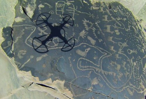
This technology is now available to everyone to capture imagery for mapping these locations. Thus, geologists now find it easier to collect data from these sites to pursue various mapping processes. In the case of planning large-scale and complex construction projects, consultation of topographic maps is essential. Topographic maps may reveal construction design errors that are inappropriate for terrain. Although topographic maps are useful for construction projects, their production is often costly and time consuming. The use of drones is very effective in these cases. Due to its ability to capture large amounts of data in a relatively short time, it leads to significant cost savings as well as the project costs required for these activities. Drones, thanks to their capabilities, ensure project time, budget and accuracy. Furthermore, from the high quality aerial images produced by drones, 3D models of the surface (DSM-digital surface model) or of the terrain (DTM-digital terrain model) can be created.
_
Land survey:
Several layers down on the spectrum of land surveying technologies is where you will find UAV mapping. As a relatively new surveying technology, UAV mapping fills in an important gap that has existed for decades. This is because UAVs can operate at a much higher altitude than traditional land-based surveying techniques, while of course operating on a much lower level than satellite mapping. When land surveyors started taking advantage of UAV technology, they opened up a whole new set of possibilities. UAVs provide a level of detail that is comparable to that which can be achieved using land-based surveyors, but is much quicker and safer, and can, therefore, make it easier to begin seeing a return on a project. In addition, UAVs are relatively affordable to use, making them a good fit for many types of projects. Since they are so much closer to the ground than satellites are, they can also provide a much higher level of detail and accuracy.
_
Building Survey:
Almost every building survey of the building requires the visibility of the roof of the building in order to assess its technical conditions and to assess any defects or failures. In most cases, the ascent to the roof is complicated, which often requires the use of scaffolding, ladders or other auxiliary structures, which may ultimately pose a danger which are both time consuming and costly. Use of a small drone in these cases can save time, costs, reduce health and safety risks which are connected with the building surveying of the roof structure and with accessing to complex or hard to reach parts of the building’s roof.
_
Safety inspections:
Some companies need to carry out regular inspections in order to ensure the safety of their infrastructure. This includes surveying power lines, oil and gas pipelines, wind turbines, bridges and buildings under construction and the likes. Drones are being put to use for these purposes. This can be especially ideal because it eliminates the safety concerns and time commitments involved with putting humans in these areas. Regular aerial monitoring can lead to significant improvements in constructing infrastructure, leading to improved performances and better developments. Besides, if the drones are small enough, they can get close to capturing imagery that can give us a more detailed idea of the construction, thus making the whole process more efficient.
_
Agriculture:
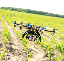
Some of the best operating deployments for drones are in large open areas, making agriculture a seeming ideal use case. This is especially true for large scale farmers who have reported significant improvements in crop yields with the use of these drones. Regular aerial monitoring of agricultural lands can provide us with a more in depth analysis of crop performance. With the help of the near infrared sensors, one could study the health of these crops and farmers could act accordingly. Moreover, drones can perform this analysis at low costs with no impact on the fields or the surrounding areas. This not only leads to healthy crop growth, but also increases their yield. Drones in agriculture are used for soil and field analysis, planting, crop spraying, crop monitoring, irrigation and plant health assessment. Using drones to: gather data and perform analysis (3-D maps, soil analysis, irrigation mapping, and soil composition analysis), cover large distances, provide aerial views, perform manual redundant tasks (seeding, planting, and spraying), and allow farmers to monitor their entire enterprise from one location are some of the use cases for drones in agriculture. Using thermal imaging to find dry spots in need of irrigation or to help calculate the vegetation index are other uses that come to mind. Drones have the potential to increase food production through prevention of environmental damage. Effective monitoring of the crop health of a variety of crops is possible through drones. Drones allow agriculturists to get insights on the health of soil and the nutrients in it before sowing. This data can be used to plan irrigation. Moreover, precise field maps enhance utilisation of resources such as water, compost and others.
The use of global positioning system (GPS) technology, together with geographic information system (GIS) tools, form a large part of these precision agriculture practices allowing fine-scale monitoring and mapping of yield and crop parameter data within fields. These provide more intense and efficient cultivation methods, which can help farmers adjust fertilizer prescriptions or identify crop diseases before they become widespread. With more data at their fingertips, farmers can make decisions based on economic and environmental factors – for example, by optimizing fertilizer treatment and applying only the right amount at the right time, significant cost and environmental savings can be made.
_
Fight against forestation:
Another area in which drones are increasingly being used is the fight against deforestation. A good example of this can be found in remote fields in the south of Yangon, where mangrove saplings were planted by drones, exhibiting the ability of the technology to restore forests. Biocarbon Engineering, a startup that makes drones to plant trees and grasses, took up the initiative. The company has also planted trees at abandoned mines in Australia and in other parts of the world. In Myanmar, it is working with a non-profit organization called Worldview International Foundation. For plantation, drones are first flown over an area to map it and collect information about the topography and soil condition so that it can be combined with satellite data and analyzed to determine the best locations to plant seeds. Once the surveying is done, drones fire biodegradable pods filled with germinated seeds and nutrients into the ground.
_
Wildlife monitoring and conservation:
Just like how drones are working on agricultural lands to improve their yields, these unmanned aerial vehicles are also striving towards monitoring the fauna of the regions. There are two specific advantages of this. Firstly, wildlife monitoring could lead to the prevention of poaching, which is one of the reasons why a lot of animals are becoming endangered these days. Secondly, the footage from the aerial devices could help us study animal behavior and analyze their patterns. The most effective thing about using drones for these services is that they do not affect or disturb wildlife. Additionally, they can be used at night with thermal camera sensors to monitor the animals at all times. A lot of wildlife sanctuaries and conservation parks are thus resorting to drones to ensure safety of the animals through proper monitoring and analysis.
_
Weather forecasting:
Scientists are leveraging new forms of hardware and software for data collection to help study the climate and better predict future changes to global weather systems. Today, most data is collected through stationary structures or captured with geospatial imaging solutions. Drones, however, offer a versatile option that can physically follow weather patterns as they develop. Weather forecasting maybe one of the use cases for drones with the highest payoffs, yet requires extensive expertise. The payoff being the reduction of human interaction with extreme weather. However, this is a highly complex use case where the weather could impact the performance of the drone. With exceptional cameras and effective sensors, these drones can collect important information that could aid in weather forecasts. For instance, sending drones into the hurricanes, tornadoes and the likes could bring us essential footage to study their patterns and occurrences. These drones can then focus on detailed weather parameters. Drones are also very apt for this job because of their unmanned nature. Drones could safely go into weather events when humans cannot, and we can collect valuable information and data in the process.
Using drones to capture important meteorology metrics like: temperature, wind speed & vector, humidity, and UV levels can help improve forecasting models and predictions. Using sturdier industrial drones, with higher thresholds for temperature, wind, navigation loss, could lead to fewer human ventures into extreme situations like: hurricanes, tornadoes, floods, earthquakes, hail, volcanic eruptions, etc. As an example, using drones, warning times from tornadoes can increase from minutes to almost an hour. Drones, especially solar powered long range drones, could allow scientists to quickly monitor weather events in faraway places, like oceanic earthquakes casing tsunamis. With multiple drones, the following of season long weather phenomena like El Nino or La Nina should be more efficient, less costly, and requiring fewer days of travel.
Three ocean drones were launched from Rhode Island recently and will travel along the Gulf Stream, collecting data in tough winter conditions that would be challenging for traditional ships with crews. The goal is to gather information that’s needed to improve medium and long-range weather forecasting, and to account for how much human-produced carbon dioxide the Gulf Stream can absorb. The carbon data could help improve the models that others use to hold countries accountable for their goals for lowering emissions.
_
Drone selfie:
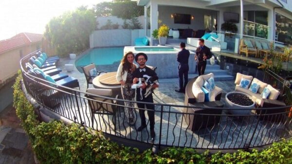
The selfie is the word of the decade now with more and more people taking them and posting them to all sorts of social media. With selfie sticks doing the rounds now, it would be a rather great idea to use a drone for this purpose. This is indeed one of the more interesting uses of a drone. This would mean a lot more people could fit into the picture and you would get a real aerial view. Besides, you could control the camera functions right from the base. This could work well as the longest distance selfie you’ve ever taken.
_
Drone racing:
This is another popular activity that is making its way into our lives. A lot more people are now engaging into this sport and pursuing it as a hobby. It is like video game racing except that you encounter real situations and you are controlling a real drone. Drone racing in the woods is not an uncommon activity. Besides, it can closely resemble real bike racing with a lot more thrill since you would be controlling the device from a distance. For this purpose, you would need an agile drone that can make swift turns and acrobatic movements. The construction of the drone in this case might be just as important as the skill of the drone racer.
_
Traffic management:
Traffic management has become a major challenge due to rapid urbanisation. And maintenance of roads in all weather conditions is a cumbersome task. Information collected with the help of drones eases identification of defects, patches on roads, the traffic situation at different times of the day, obstructions, etc. Drones can enable provision of cheap, safe and fast information to the concerned stakeholders. Their use also facilitates raising of alerts, detection of violations, etc.
_
Security:
Equipped with enhanced tools such as cameras and facial recognition systems, drones can play an important role in checking theft and tracking thieves. There are also a number of security applications which drones can support and real-time surveillance with a dynamic view can provide additional security insights. In critical situations such as fires, drones can intervene and inspect the surroundings for associated danger. Moreover, sensor-based drones can detect illegal transportation of drugs in border areas. Security companies are using drones to provide more comprehensive surveillance systems for industrial, commercial, and residential properties. One company, Nightingale Security, enables clients to establish repeatable pathways that the drones can travel daily, monitoring key security areas. The same service deploys drones with live streaming capabilities immediately after an alarm is triggered, allowing the security team and clients to obtain key footage of a potential breach. Sunflower Labs is working on an autonomous drone system that would scan for suspicious activity, alert homeowners of potential situations, and, if necessary, provide data to help file a police report.
_
Energy:
While alternative energy has become increasingly popular, fossil fuels still remain a key energy source for the world. Inspection of the infrastructure used to extract, refine, and transport oil and gas is an important part of the industry and often needed to ensure compliance with regulations and standards. With the use of drones, much of this inspection work can be done remotely and safely. Using specialized thermal sensors, some drones can find leaks faster than a human inspector, while onboard high-resolution cameras enable some issues to be diagnosed remotely. In the energy industry, drones are being used to identify methane leaks in oil and gas production, and to monitor pipelines and wind and solar installations. Sky-Futures offers UAVs for oil and gas inspection, and is used by many of the world’s largest oil companies to inspect offshore rigs. The company was acquired by Scotland-based maintenance company ICR in 2019. SkyX Systems uses drones for pipeline assessment, while Cyberhawk Innovations offers solutions for both fossil fuel and alternative energy providers.
Another area where drones have shown promise is in setting up new sites for the production of energy. Drones that survey areas and gather topographic detail can be used to help oil & gas companies identify new drill sites, or they can be used by solar utilities to design configurations for new arrays.
_
Mining:
Mining sites are unsafe and environmentally unfit for human activities. Drones can replace humans to do perilous tasks and increase effectiveness at mining sites. They are also currently used to acquire geotechnical and hydrological data for open-pit mines. Moreover, they help in remote soil sampling and tool delivery in exploration sites as well as to track changes in vegetation due to mining activity, and report this by using digital models.
_
Real estate:
The Real Estate industry is another of the leading industries in drone usage and adoption since 2016. Drones can relatively inexpensively show the most important aspect of real estate, “location”. Additionally, Real Estate has put both land and air drones to use capturing images from different/unique angles, mapping: property, interior and exterior of buildings, and building 3D renderings. Real Estate agents are using drones, or the 3D renderings, to do tours and property visits for business continuity during the COVID-19 pandemic. The finished product provides potential buyers with a perspective that mimics a physical walk-through. Resorts, partial ownerships, time shares, and similar living environments can use drone images not just for a walk-through or tour but to show the relative placement of on property amenities and off property areas of interest.
_
Insurance:
As mentioned in the previous paragraphs drones have been adopted by many industries for inspections due to: high quality images, ability to provide views either unobtainable or costly, and are unobtrusive / allow for socially distant inspection. Insurance company use of drones is centered on better risk management through improved data collection, analysis, and actionable insights; and reduced operational costs through improved efficiency and effectiveness in claims adjudication, claims processing, and customer experience.
Noted uses of drones and insurance include: home and land inspection, crop inspections, motor vehicle accident inspection, boiler & other tank inspections, post disaster claim inspection, fraud detection / prevention, and combination with other technologies to build models. Drones can help with pricing, risk engineering, and risk management, along with natural disaster monitoring and modeling. In addition, the use of drones, and the relative safety of the inspectors, may help reduce insurance companies: worker-compensation, on-the-job accident, travel, and inspection costs. As an example, after a major flood, hurricane, or other natural disaster causing wide spread destruction, drones can be used to survey the area, identify the area’s most in need, and allow a focused prioritization of resources based on data while reducing the number of team members onsite to gather the data.
The use of drones, and especially the use of drones by insurance companies, has prompted the rise of the drone insurance market, insurance for your drone. SkyWatch offers drone liability and hull coverage.
_
Disease Control:
Tracking animals also allows researchers to track disease. Drones with thermal imaging cameras have been used by the London School of Hygiene and Tropical Medicine to track macaque movements in the province of Palawan in the Philippines — a region where malaria is an active threat. The ability to follow these animals provided further insight into the possible movement of infectious disease and its jumps from animals to humans. In a similar vein, Microsoft is leveraging drone technology to capture and test mosquitoes for infectious disease. Ideally, this intelligence could be used to protect local residents, and in the future could help prevent epidemics before they begin.
Another illness being combated with the help of drones is schistosomiasis, a tropical disease caused by parasitic worms. A team of researchers made up of scientists from the University of Washington and Stanford pioneered an experimental method for tracking the spread of and predicting transmissions of schistosomiasis. Instead of using animals, the team’s approach uses drone and satellite imagery to track the presence of “unrooted, floating vegetation” where the snails that transmit the disease make their habitats — finding these sites through drone imagery lets those researchers know what areas are at higher risk for schistosomiasis infections.
_
Medical Drones:
In developing nations and in areas with mountains, deserts, or forests, roads are impassable and take long-distance travel. Lack of access to roads is critical for medical supplies such as vaccines and drugs. Air transport like a helicopter is the only alternative so far, but it is expensive and not affordable to the patients or the health system. While medical supplies can be delivered by traditional means, certain circumstances call for quick access to drugs, blood, and medical technology — a need drones could fulfil. A study from the Johns Hopkins University School of Medicine has shown that the transportation of laboratory specimens via drones does not affect the accuracy of routine biochemistry, hematology, and coagulation test results. In the United States, the first government-approved delivery of medical supplies by drones occurred in July 2015. This gives us the confidence in employing drones in the transport of medical supplies to remote, difficult to access areas. In May of 2019, a 2.8 mile 10 minute drone trip transported a kidney for transplant in Baltimore. Many vaccines require storage in cool temperatures and only limited exposure to sunlight, drones may allow for central storage and quick delivery in smaller batches than traditional disbursement techniques. Dr. Margaret Chan, the former Director-General of the World Health Organization, has said “The use of drones to deliver lifesaving medical products can overcome the lack of infrastructure. We need to let our imaginations soar when looking for ways to get quality medical products to those in greatest need.” In Rwanda, Zipline recently celebrated its fifth year anniversary during which it has made 200,000 deliveries of blood, vaccines and other medical products to rural hospitals and clinics.
_
Unmanned aerial vehicle (drones) in public health: A SWOT analysis, a 2019 study:
In developing countries, lack of access to roads is critical for medical supplies like vaccines and drugs. Air transport like a helicopter is expensive and not affordable. The success of drones in the fields of ecology and environment makes us believe that they can also be used in the field of Public Health as medical couriers. The important strength of using drones is its potential to decrease the travel time for diagnosis and treatment. They are a cost-effective alternative to road transport in difficult terrains. Drones can be used in the transport of blood from the blood bank to the place of surgery and that of specimens from hard-to-reach areas to the labs in nearby towns. They can deliver essential medicines like anti-venom for snake bite and dog bite and prevent deaths. Drones can be employed in disaster relief operations for rescuing victims and in the delivery of food, water, and medicines. Organs can be transported in a short time bypassing the busy traffic. However, operating drones require trained staff and the lack of infrastructure like runway is a potential problem. Drones cannot carry heavier payloads or deliver goods long distances. Drones in the hands of terrorist groups may be weaponized and used for terror attacks. Medical drones may be mistaken for military Drone and attacked by armed forces.
_
Maritime:
Navigating oceans and ports requires an immense amount of expertise and labor from the estimated 1.65M people serving on international merchant ships today. But with increasing amounts of oceanic data and innovations in autonomy, unmanned marine vehicles could become the standard for maritime shipping. Rolls-Royce has already completed a number of trials with unmanned vessels controlled remotely. Inspecting ships is also an important part of the industry. While Rolls-Royce plans to use smaller UAVs to help inspect ships above the surface, startup Orobotix has designed an underwater drone used to inspect hulls from below. Drones are already being used in countries like the Netherlands, Denmark, and Norway to find ships committing emissions infractions. The unmanned vehicles can travel miles out from port to detect emissions and identify offenders.
_
Construction industry:
UAVs present many opportunities for those in the construction industry if properly used. In a number of instances, they can produce significant cost savings and improve safety as compared to conventional techniques. UAV provides a low-cost solution to explore aerial photographic, construction inspection techniques, and for other applications that otherwise would be impractical. Contractors should analyze potential costs, operator training, usable applications, and legal issues before starting their uses on construction sites.
Drones as a tool that increase communication between construction participants, improves site safety, uses topographic measurements of large areas, with using principles of aerial photogrammetry is possible to create buildings aerial surveying, bridges, roads, highways, saves project time and costs, etc. The use of UAVs in the civil engineering can brings many benefits; creating real-time aerial images from the building objects, overviews reveal assets and challenges, as well as the broad lay of the land, operators can share the imaging with personnel on site, in headquarters and with sub-contractors, planners can meet virtually to discuss project timing, equipment needs and challenges presented by the terrain.
_
Telecommunications:
Telecommunication towers also are inspected frequently to ensure service reliability. In the aftermath of Hurricane Harvey in 2017, AT&T and Verizon launched drones in Houston, Texas to inspect their towers — a process that would have been too dangerous and time-consuming to do manually. These drones were able to quickly assess damage to help guide repair teams in restoring service. In many cases, service was brought back in hours rather than days. Skyward, an inspection drone company purchased by Verizon in Q1’17, provides a drone-as-a-service software platform that helps commercial drone operators in a variety of industries.
_
Internet:
With the world’s largest tech firms vying for our time and attention, the need for global internet access is becoming more and more central to business models. Facebook experimented with a solar-powered drone called Aquila, which was envisioned as helping to provide internet access to rural parts of the world.
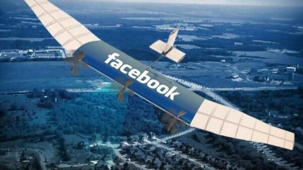
The Aquila drone was touted as a core component of Facebook’s push to increase internet access around the world before work on it was halted in mid-2018 when the social media giant decided to use third-party drones instead. Google initially acquired solar-powered drone company Titan Aerospace to provide UAV-powered internet (similar to Aquila), but the venture proved challenging. It has since pivoted toward a weather balloon-like design called Project Loon that aims to provide internet access from the stratosphere. SoftBank, in collaboration with the drone manufacturer AeroVironment, has its own plans to develop drones that will operate in the stratosphere to serve as “floating cell towers” to provide internet service to customers.
_
Live Entertainment:
Drones have already had an impact on event surveillance and event photography/film, but are also being used more directly to entertain. Disney has been one of the more active companies in this space, and has filed for a number of drone patents focused on entertainment. Synchronized lights shows, floating projection screens, and drone puppeteers have all been considered by the entertainment giant. Verge Aero is one example of a private player creating live, synchronized drone performances for audiences. At Universal Studios’ new Wizarding World of Harry Potter exhibit, a show composed of LED-lit drones and complex projections caps off the “Dark Arts at Hogwarts Castle” show. Utilizing Intel’s Shooting Star technology — which was also used during the 2019 Super Bowl halftime show and during the 2018 Winter Olympics — the drones can be programmed to reflect a number of patterns and synchronize with music and other elements of the live performance.
_
Advertising:
In addition to filming advertisements, drones are being used as physical mediums for marketing. They can power aerial advertising at live events or high traffic locations. DroneCast, for example, has developed services for banner advertising and has delivered Ford-branded knickknacks to patrons at auto conventions.
_
Space:
NASA announced in May 2018 that a drone-like helicopter would be used in the Mars 2020 mission to help look for signs of life on Mars. The helicopter will serve as a scout for the rover, gathering data about the planet’s terrain and surveying areas the rover cannot reach. The space agency is planning another drone mission, this time to Titan — one of Saturn’s moons. The drone is not what would be typically found on Earth. With the mission expected to cost around $1B, the drone will be nuclear-powered and about the size of a small, compact car. Projected to arrive on Titan by 2034, it will autonomously traverse the planet for a period of about 2 years, taking photos and sending data back for analysis.
_
Education:
Drones may soon be popping up in more classrooms, as educators embrace the educational potential of the tech. For instance, students in Colorado Springs School District 11, led by teachers David Steele and Ray Sevits, are already using drones as a part of their curriculum. Participating students fly drones, learn to repair them, and study the physics of how they fly.
______
______
Drone can help protect environment:
There are major ways drones can protect the environment.
-1. Transportation and Delivery
In the intermediate term, drones will be used to quickly deliver products that can be transported between short distances. Think about the average distance for a pizza delivery, for example. These deliveries will soon be made not by exhaust-coughing cars and trucks, but by battery powered drones. This will cut down on the amount of smaller road deliveries, and it will mean there will be fewer trucks on the road. So drones will cut into the pollution caused by trucks. Drones do have relatively small payloads, though, which limits their carrying capacity. It makes them ideal for small deliveries, or for dropping off emergency supplies, but not for bulk transport. Of course, as the technology evolves, drones will be able to carry larger loads over greater distances. This could have a massive impact, given that drones tend to run on battery power. If those batteries are charged with green energy, the substantial amount of carbon emitted from commercial and industrial transportation will be significantly reduced.
-2. Wildlife Conservation
Drones can be used to track animals, particularly dangerous animals, without putting anyone at risk. They can also be used to watch for poachers and trespassers, increasing security in areas where there’s simply too much ground to cover. Additionally, drones can be used to provide aid when natural disasters strike. Whether it’s to comb an area after an earthquake or flood to look for survivors, or fighting fires by delivering payloads, drones are a powerful tool in the fight to keep wildlife, and wild areas, safe.
-3. Monitoring and Inspection of Solar Panels, Wind Turbines & Oil Pipeline
It’s not enough to just build things like wind turbines, oil pipelines, solar panels, or high-voltage power lines. Once those things have been built, they have to be monitored and inspected with a fair bit of regularity. At least, if you want to avoid serious problems, and breakdowns that can have disastrous consequences. The issue we’ve had to deal with until recently is that monitoring and inspecting these structures takes time, and manpower. Getting someone to climb to the top of a wind turbine, and then to inspect it, is a dangerous endeavor. It’s also something that can take a lot of time. The same is true when it comes to walking the full length of an oil pipeline, or getting up near power lines to inspect them for fraying or damage. The job still needs to be done, but with drones it can be done safely, and in a fraction of the time. There’s no need to deploy heavy trucks, and to spend countless man hours in review when a drone can skip along a line, or fly right up to a mechanism, to see whether it needs work. When it does, actual people will still have to come do it, but the sheer amount of time and effort drones can save is rather staggering.
-4. Sustainable Agriculture & Crop Monitoring
Drones are a big boon to farmers who want to try to look at the big picture when it comes to their farms. Because traditional farms tend to cover so much space, it’s hard to get a sense of what’s going on from the ground. Aerial surveying services can help farmers figure out what’s going on with their fields, and it can provide maps that can then be used when making plans for the next growing season. There are many new software tools that accompany drones to help with NDVI mapping. NDVI (Normalized Difference Vegetation Index) is a simple graphical indicator that can be used to analyze remote sensing measurements to assess whether the target being observed contains live green vegetation or not. Healthy vegetation (or chlorophyll) reflects more near-infrared (NIR) and green light compared to other wavelengths. This data is captured using drone cameras and imported into an application such as Drone Deploy to create graphical representations. Farmers and agricultural workers can then simply access the map to determine the overall health of vegetation on a given farm and direct workers to the crops needing the most attention and care. Additionally, drones can be used to deliver important materials to crops. Instead of using planes for crop dusting, for instance, drones can make short runs to leave the necessary additives behind. They’re small, fast, and flexible, which allows them to fulfill a number of different jobs in any agricultural setup.
-5. Land Management
Aerial surveying is a delicate art, and it’s difficult to imagine the finished product when it comes to building, or to altering land. Drones can make this entire process that much easier. When seen from the air, a finished product becomes easier to visualize. Problem areas can be quickly identified, and a drone can be used to create 3D maps, and to record GPS coordinates for easy tracking. There’s no need to deploy a team on-site when much of the work can be done from the air. Especially when drones can handle many of the tasks more quickly, thanks to on-board computers and software.
-6. Reforestation
DroneSeed is a drone company specializing in drone reforestation. They produce their own large UAVs specifically designed to plan trees over large areas efficiently, rapidly, and in ways designed to maximize the survivability and success rate of the seeds. First, DroneSeed sends out one drone to perform a 3D scan of the terrain. Software analyses the terrain data and determines the best locations to place seeds for the optimal survival rate. Flight paths are created, and then another fleet of drones fly autonomously on the flight paths while dispensing DroneSeed’s proprietary seed vessels. The each vessel contains a combination of seeds optimal for the location, fertilizer, and a ghost pepper to deter squirrels, mice, and other rodents from eating the seeds. Using drones to plant seeds has numerous advantages. Drones can plant an area faster than a normal planting crew. Drones are also able to access harsh terrain inaccessible to humans and enable a much faster response time. In areas recently affected by forest fires, planting tree seeds quickly is crucial to preventing tall shrubs from taking over the area.
-7. Drones for conducting environmental research
Drones are revolutionizing environmental research. Using small remote-controlled aerial vehicles, scientists can photograph far-flung places more quickly, easily and cheaply than by conventional surveys done on foot, by car or from balloons, satellites or aircraft. Drones are becoming essential for monitoring forests, rivers, farms and wildlife. They can track the regeneration of woodland and tell farmers where to apply fertilizer or pesticide. They can fly swiftly into disaster zones. For example, in Mozambique they revealed flooding, damage and survivors in the wake of Cyclone Idai. Scientists from the Earth Institute’s Lamont-Doherty Earth Observatory are using drones to expand their research. Most air pollution data come from ground measurements, but drones will enable the scientists to gather data about pollution at different altitudes to study how pollutants disperse in the environment. Without a drone, it would be difficult and dangerous to gather this kind of information.
______
______
Drones and Coronavirus pandemic:
The COVID-19 pandemic has thrust technology innovations ahead at a rapid pace. And while the drone use cases mentioned above all have seen upticks during this global pandemic, there are other use cases that have come to light solely due to coronavirus.
The reports from the media and other available sources have identified three key use cases of drones in response to COVID-19. These include:
-1. lab sample pick-up and delivery and transportation of medical supplies in order to reduce the transportation times and minimize the exposure to infection
-2. aerial spraying of public areas in order to disinfect potentially contaminated places;
-3. public space monitoring and guidance during lockdown and quarantine.
_
Transportation
So far, eighteen countries have deployed drones for delivery and transportation purposes during COVID-19 pandemic. Some of them did it as a part of experimentation and tests, while others maintained their regular drone delivery operations. Three countries in Sub-Saharan Africa, namely Rwanda, Ghana and Malawi reported the use of drones to deliver regular medical commodities, COVID-19 supplies and medical samples since the beginning of the pandemic. All the three countries already had drone operations prior to the COVID-19 pandemic, therefore, drone operations were adapted in all three countries in order to respond to the increased demand of medical commodities and COVID-19 supplies.
Aerial spraying:
There have been several media reports on the use of drones for aerial spraying of disinfectants in public outdoor spaces to contain the spread of the virus. Attempts took place in China, UAE, Spain, South Korea, and other countries. Some companies claim that they managed to cover 3 square km of an area with spraying. However, scientific evidence suggests that this application has little to no evidence for efficiency and effectiveness.
Public Space Monitoring
A number of different public safety and law enforcement agencies or organizations (Sierra Leone, Rwanda, China, United States, Spain, Italy, France, UK, India, and others) across the world have deployed drones to surveil the public spaces by gaining a better situational awareness, and enforce quarantine by sending messages over a loudspeaker and tracking non-compliant citizens. The video surveillance and broadcasting of voice message with a drone is expected to reduce the possibility of responders having a direct contact with potentially infected people. Additionally, some academic groups started experimenting with drones to conduct symptom tracing that is enabled by thermal imagery and artificial intelligence. While the use case of crowd monitoring remains the most-widespread during the COVID-19 response, number of human rights activists criticize such use due to potential abuse of civil rights and some of these drone programs even were suspended.
_
The biggest use case has been the deployment of drones to enforce social distancing and monitor crowds. Morocco has launched a fleet of drones to combat the coronavirus. The country has rapidly expanded its fleet of drones for aerial surveillance, public service announcements, and sanitation. As lockdown orders were ignored by some, drones were dispersed to monitor and identify suspicious gatherings and relay warnings. The aeronautics department of the International University of Rabat (UIR) offered its facilities, expertise and prototypes to authorities in March, deploying drones with loudspeakers or infrared cameras able to detect movement at night. In France, India, and the US, drones have also been deployed to monitor crowds for social distancing. China has used drones to issue orders to people that are not following pandemic rules.
Another coronavirus-related use case comes from Canadian drone maker Draganfly, and its collaboration with the Australian Department of Defense and the University of South Australia. The new drone will be part of a camera system to spot signs of illness, such as coughing and elevated temperatures. The drone is part of a bigger system to collect real-time data about the possible spread of the disease. The project will initially focus on “hot zones” to gauge infection rates. The infrared cameras will also be able to spot individuals with high temperatures.
______
______
Drone services:
The Unmanned aerial vehicle (UAV) industry proceeds to expand as drone technology utilization becomes widespread worldwide. Businesses employ aerial inspections, drone surveys, drone images, and drone videos as a vital tool for maintenance and marketing. There are countless Drone Companies, delivering their services to numerous industries such as Construction, Railways, Agriculture, etc. However, it is necessary to hire an operator that accomplishes your vision.
_
The key stakeholders in the drone services market ecosystem are the platform manufacturers, subsystem manufacturers, service providers, software providers, and miscellaneous (insurance companies) as well as the end users. The following figure lists some global platform manufacturers, subsystem providers, service providers, and software providers.
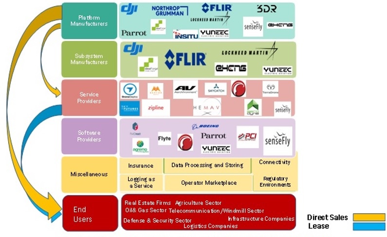
_
Drone Supply Chain Landscape:
Drone supply chain fall under one of the four technology areas:
|
Platform Manufacturers |
Software & Data Solutions Providers |
Component & Payload Suppliers |
Service Providers |
|||
|
Consumer: low-cost solutions |
Operating System: enable autonomous UAVs and command & control capabilities |
Processing: hardware executing specific functions |
Drone-as-a-Service: UAV control & analytics service |
|||
|
Hybrid: consumer/commercial applications |
Data Analytics & Processing: image processing, mapping, & measuring solutions |
Structural: parts that improve efficiency or design of the drone |
Cloud/Data Storage: data hosting for UAVs |
|||
|
Niche: specific market applications (e.g., agriculture or oil/gas) |
Applications: enhance the functionality of drones |
Imaging: additional sensor types (multispectral, thermal, etc.) |
Fleet Support: services to sustain and maintain drone operations |
|||
A diverse, market-specific drone ecosystem is emerging; companies are providing drones and software designed for specific drone applications.
_
What Drones-as-a-Service can do for Your Business:
To understand the power of drones for your business focus on these ideas:
-1. First, drones in the business context are not weapons or toys but advanced data capture devices, which have as a main purpose building high fidelity, digital twins of your business landscape.
-2. Second, drones are going to arrive in a productized state, with the analytics and models ready to use the data to solve specific problems. Your job will be to adapt these starting points to make them solve the unique problems of your business.
-3. Third, drones will arrive using the “as-a-service” model, dramatically reducing the time to value
_
Drone technology is particularly primed for take-off in the commercial sector right now due to regulations that were passed in August 2016 by the Federal Aviation Administration. Referred to as Part 107, these new rules explicitly outline how to operate a commercial drone. The three main changes that Part 107 made were:
-While flying a drone, it has to remain in the operator’s line of sight
-Drones must be flown below 400 feet
-Operators must have a pilot’s license for unmanned vehicles
This last rule is particularly important, because prior to the regulatory change, operators had to have a full pilot’s license (as in being able to fly a plane) to operate a drone. There is a one person to one drone ratio that must be maintained, but the new regulations allow companies like Kespry to automate flight fully and expand the use cases of drones. Industries like mining, architecture, engineering, construction, energy, and insurance are all set up for employing drones.
______
______
Drone industry & market:
For years, the drone market was in a nascent phase and had yet to break into the mainstream. Then, in 2016, drone industry growth took flight when the Federal Aviation Administration (FAA) granted hundreds of new exemptions for companies to operate drones in the U.S. through FAA Part 107. These exemptions included several new use cases in multiple industries, such as insurance, construction, and agriculture — each of which demonstrates the broad range of commercial drone applications. The FAA helped push commercial drone market growth forward by formulating a regulatory framework with its consumer drone registry. Now, drone manufacturers and tech suppliers are doing all they can to capitalize on this and turn drones into a full-fledged industry.
_
The global market has become a hotbed of activity for drones. The global UAV market will reach US$ 21.47 billion, with the Indian market touching the US$ 885.7 million mark, by 2021. The drone services market size is expected to grow to $63.6 billion by 2025, and Insider Intelligence predicts consumer drone shipments will hit 29 million by 2021. One research firm predicts sales of drones will exceed $12 billion by 2021. Another says the market for drone-based business services is worth more than $127 billion. And the Association for Unmanned Vehicle Systems International (AUVSI) predicts that by 2025 the U.S. drone industry will create more than 100,000 jobs and add $82 billion to the economy. BCC research finds that global market for drone technology is expected to grow from $30.0 billion in 2020 to $54.6 billion by 2025 with a compound annual growth rate (CAGR) of 12.7% for the period of 2020-2025. Application of commercial drones cuts across various sectors construction, education, law enforcement, media and entertainment, precision agriculture, surveying and mapping, and inspection and monitoring. The market value of drone-powered solutions in addressable industries is depicted below:
Value of drone powered solutions addressable industries ($bn)
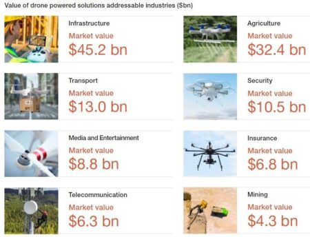
_
Drone Application Report, 2021:
-By 2025, the commercial market is expected to generate over 40.5 billion USD growing at a CAGR of 15.0%.
-The most popular application methods are: Mapping & Surveying, Inspection and Photography & Filming.
-Inspection is the top application of drones in Energy (Utilities) and in Real Estate, Rental & Leasing, and Industrial Parts.
-The biggest vertical, Energy (Utilities), shows a great variety of use cases. Like in all other verticals, drones help reduce time and costs while improving result quality and worker safety.
______
______
Section-9
Drone and safety concerns:
One of the main reasons that companies choose to use drone services is to improve safety for both their assets and their employees. From monitoring and inspections to material transportation and planning projects, drones can make an organization’s operations safer in multiple ways. On the other hand, number of drones have been flown dangerously close to commercial aircraft, violating federal rules about their operation. Drones have also crashed injuring people and damaging property.
_
Drones can do serious damage to airplanes:
Even a small drone crashing into an airplane can do major damage, a test video shows. Kevin Poormon, a University of Dayton engineer who has performed numerous bird strike tests on airplanes, mimicked a midair collision between a 2.1-pound DJI Phantom 2 quadcopter and a Mooney M20 airplane. The drone bore into the plane much farther than a similarly weighted gel “bird” and damaged the plane’s main spar, which carries the weight of the wing. Debris spewed from the aircraft. Adam Lisberg, a spokesperson for DJI, said the stunt featured a drone that the company no longer manufactures and the video shows a “very rare worst case perfect hit.” He also said the company offers drones that include built-in geofencing and altitude limitations. A study by a Federal Aviation Administration research center made similar findings, saying drones’ more rigid materials allow them to cause greater damage than birds. That research team evaluated potential impacts of two quadcopters and two fixed-wing drones on a single-aisle commercial transport jet and a business jet.
The first drone collision with a commercial plane happened in 2017 over Canada’s Quebec City, causing minor damage to the plane. Canadian transport minister Marc Garneau told the Canadian Broadcasting Corp. that the crash “could have been much more serious,” even “catastrophic.” There have been other reports of crashes since. Pilot John Marking said his helicopter was struck by a DJI Inspire 2 drone with a camera attached while traveling about 35 miles east of Ensenada, Mexico. The drone, estimated at 11 pounds, did about $104,000 in damage. The hit to the helicopter’s tail boom and vertical tail fin were so bad that Markling doubts it would have stayed in the air much longer, he said. Luckily, he was able to get it on the ground before anything came apart. The increasing number of drones in the sky is causing aviation officials to worry more about such crashes. The FAA reports receiving more than 100 drone sightings each month. Researchers conducting FAA studies have proposed manufacturers adopt “detect and avoid” and “geo-fencing” technology to avoid collisions. Poormon, the Dayton engineer, suggests drones that are manufactured to shatter on impact to avoid deep damage.
______
Injury and damage caused by civilian drone:
Indoor flying differs from outdoor flying. The drone is constantly near people and objects when used indoors and the chances of it striking someone or something are much higher than outdoors. Outside the military domain, civilian drones/UAVs can also malfunction and crash into a nearby house or a group of people, causing property/material damage, and human injuries/fatalities, ranging from trauma/blunt force trauma, deep cut injuries (caused by drone blades) and laceration. On August 9th, 2016, a young woman lost her life in a car crash in the first non-military related drone incident after reports of a drone being flown near Wandsworth Prison in London. On November 2016, an 18-month old toddler from Stourport-on-Severn, Worcester UK, sliced his eyeball in half by the propeller of an out-of-control drone.
Three areas need to be considered:
-1. Injury to the drone operator
The risk to the operator and assistants is the highest, due to their constant proximity to the drone during take-off, landing, flight trimming and changing batteries.
-2. Injury to the public
The “public” includes private individuals and staff sharing the same space as the drone. This can be the intended audience or observers or oblivious passers-by. Onlookers and passers-by should never be allowed underneath the drone. A kilogram weight does not need to fall from very high to cause serious injury.
-3. General damage to property
This includes the infrastructure that the drone is flying within, the goods, light, windows and the drone itself. There are also other risks such as fire and the drone becoming stranded in high places.
_
-Operator Protection:
Drone operator specific safety equipment
-1. Head protection in the form of a hard-hat to protect the operator from falling drones.
-2. Eye protection to protect the operator from shattered propellers. Propellers spin at thousands of RPM with high energy and can break at any time.
-3. Visible and clearly labelled reflective clothing to allow the operator to be seen by forklift drivers and to be easily identified as the drone operator.
-Public Protection:
-1. Clearly demarcated areas
The area that the drone is flying within should be contained and clearly demarcated. Drones should not fly arbitrarily throughout all available space.
-2. Signage
Clear signs showing that there is a drone flying on the area should be placed on the perimeter of the demarcated zone. The sign should tell onlookers to “Look Up” and to proceed with caution.
-3. Physical restraints
Drone nets might be required in crowded public spaces however the netting must be tightly rigged to prevent the propellers from becoming entangled and possible fires from a stalled motor. Generally though, all that may be required is a chain or barrier tape to demarcate the area where the drone is being operated and to prevent people from entering unintentionally.
-General Damage protection:
-1. Propellers
Carbon fiber propellers should never be used. They cause deep cuts and lacerations if they strike people. Plastic propellers should be the only propellers used as they don’t have the rigidity to do more than scratch someone. They are also less likely to break a window or slice protective packaging and coverings.
-2. Battery
Lipo batteries used in drones seldom (if ever) explode however they do produce a high unlimited current. That is where the danger lies. Check the local laws that pertain to “exposed” batteries and it may be advisable to have the battery enclosed.
-3. Sparks
The drone itself uses brushless motors, which are spark free. However when the battery is connected, a small spark is produced due to the current drawn by the onboard electronics. Precaution must be taken in areas with volatile gasses such as oil refineries.
-4. Drone design
Care has been taken in the design of the drones. Mechanical features such as propeller guards are fitted to reduce the risk of damage. Electronic safety measures such as fuses and emergency cut-off switches are recommended to prevent electrical fires when a drone motor stalls or draws a high current after crashing.
_________
Drone safety rules:
Whether you’re a business owner seeking to make drone deliveries or a photographer who wants to take thrilling, bird’s-eye snaps, it’s important to remember that drone operators are in fact remote pilots, with all the safety implications that entails. Being a remote pilot requires that you do your due diligence in terms of understanding how to operate safely within shared airspace. You must only fly one drone at a time. The FAA has issued a list of safety precautions drone operators should consider.
These include the following:
-1. Do not fly above 400 feet
-2. Never allow your drone to fly outside visual sightlines
-3. Do not fly over groups of people, stadiums or within five miles of an airport
-4. Never fly near emergency response sites
-5. Do not fly near other aircraft
-6. Never fly under the influence of alcohol or drugs
Here is a summary of the CAA drone safety rules you need to follow if you are flying a drone in the U.K.
-1. Line of Sight – Always keep your drone in sight so you can see and avoid other things when flying
-2. Always fly below 400ft (120m) – this reduces the risk of any conflict with a manned aircraft or helicopter
-3. Follow the drone Manufacturer’s instructions – both pre-flight and in-flight checks keep your drone and people around you safe.
-4. Always fly a safe distance from people and Property – rule is 150ft (50m) from people and property, 500ft (150m) from crowds and built-up areas
-5. You are legally responsible for each flight – Failure to fly responsibly could result in a criminal prosecution.
-6. Stay away from airports and aircraft – If your drone endangers an aircraft it is a criminal offence with a five year prison sentence.
-7. Drone School UK has a module in every drone training course covering all aspects of flying drones safely.
_
These rules form the core of smart safety protocol for drone pilots. It’s also important to remember that the FAA also has airspace restrictions that vary locally. For example, much of Washington D.C.’s airspace is restricted due to the presence of military bases and federal buildings. The FAA has helpfully created a smartphone app (B4UFLY) that allows you to determine if there are any restrictions in place in the area where you’d like to fly. This greatly reduces the amount of effort needed to determine if you’re able to fly safely.
Other safety tips:
Along with following federal safety guidelines and airspace regulations, drone owners should also observe some fundamental flying rules designed to minimize the risk of crashes. These include flying in good weather, watching out for electronic signal interference, not flying over roads and not operating drones with other pilots who are poorly-trained.
Additionally, there are peripheral considerations that must be considered. One example: Taking drone photography in restricted areas or places where there is an expectation of privacy. Just like a property-damaging crash, violating privacy laws may open you up to legal or civil action.
Ultimately, safely flying a drone boils down to two elements: Employing common sense safety protocols and checking to ensure your flight plan doesn’t violate restricted airspace. While malfunctions are possible with any high-end electronic equipment, following this strategy can help minimize the risk of a mishap. Consulting your insurance agent about drone coverage is another smart idea.
__
Why is the limit 400 feet?
The Part 107 rule limits drones to 400 feet to allow for a 100-foot safety buffer between remote aerial drones and the 500-foot minimum cruising altitude of crewed aircraft. This altitude cap is particularly vital in regions of dense helicopter traffic. However, minimum cruising altitudes for crewed aircraft vary depending on the topographical changes. When flying over mountainous regions or cities with skyscraper buildings, pilots must set a minimum cruising altitude 500 feet above the tallest object in their flight path. Sectional charts indicate topography in the flight path, allowing pilots to adjust cruising altitude accordingly. Commercial drone pilots may fly above 400 feet to accommodate topographical changes, as long as they remain 400 feet or less above the tallest object on the landscape below. Hobbyists may not take advantage of this exception, however, and must keep drones below 400 feet at all times.
When you fly a drone above 400 feet, you risk a dangerous in-flight collision that can damage equipment and lead to unwanted consequences. Most near-miss events between aircraft occur above 400 feet. You may risk losing your drone at great heights. Your drone should always be in your line of sight, and it can be hard to see your drone at altitudes above 400 feet. Depending on how high above 400 feet you are flying, you may receive a fine or face arrest. Although drones may seem insignificant in comparison to larger crewed aircraft, piloting a drone requires accountability. FAA restrictions protect you, other aircraft, and the people on the ground from unfortunate mishaps due to negligence or misuse. Responsible drone pilots owe it to other pilots and the grounded public to abide by Part 107, the 400-foot altitude cap, and all FAA regulations.
______
Drone Safety Tips:
Here are the top safety tips that will ensure you fly your drone safely without endangering life or crashing. They include:
-1. Check Regulations
As you prepare to fly your drone, the first drone safety precaution is ensuring you adhere to the local regulations governing the use of drones in your area. Many states and municipalities have enacted rules and policies that govern the use of drones.
-2. Determine the right environment
Another safety tip that drone owners should take into account is choosing the right environment to fly. Areas that have few or no obstacles are best because they minimize signal interference and reduce the chances of your drone crashing. To avoid collisions with objects like buildings and vegetation, fly your drone in an environment that is free of objects. The situation where you fly your drone will determine the possibility of your drone crashing.
-3. Take an insurance cover your drone
Even when you are extra careful with your drone, an accident could occur, resulting in a crash that leads to losses. To ensure that you are safe from potential damages, insure your drone as a safety precaution.
-4. Practice and practice
Just like in any new hobby or activity, you will need to take time to learn how to fly the drone to ensure that you can do it safely without the risk of a crash that might endanger lives. You should dedicate a significant amount of your time navigating through the drone’s controls to ensure that you are more conversant with its use to enhance drone safety. When practicing, go to an open space where there are no obstacles, such as buildings, trees, power lines, and other things that could obstruct your drone. Practicing is the key to ensuring that you can fly, hover, track, and control your drone. It will also ensure you get the experience you need to fly it safely, which makes it a major safety tip.
-5. Ensure your battery is fully charged before flying it
When using a drone, its battery needs to be fully charged to minimize the possibility of crashing. If the drone drains the battery when airborne, it will crash hence the need to charge it fully. If you have not used your drone for a long time, there is a possibility that its battery will degrade. If this is the case, consider replacing the battery to avoid crashing.
-6. Inspect your drone before flying
Another safety measure that drone owners should be aware of is inspecting their devices before flying them. The inspection is intended to ensure that your drone is mechanically fit to operate and unlikely to cause avoidable accidents. During the examination, you should check whether the propellers are in good condition and confirm that the battery has a full charge. Propellers are vital because they help create the thrust necessary for your drone to fly. When your drone’s propellers have cracks, dints, and dirt, you should fix them before you fly it.
-7. Calibrate the compass
When it comes to your drone, its compass dictates the flight orientation hence a drone safety consideration. Before any flight, you must calibrate your compass to avoid issues such as ‘toilet bowling,’ which makes your drone swirl in circles when you try to hover or ‘dog-running,’ which is flying sideways.
-8. Ensure your drone achieves a GPS lock before flying
Most drones today are equipped with GPS capabilities. Before you start flying, you should ensure your drone has a GPS lock. The GPS lock tells your drone where your take-off and landing location is using GPS coordinates. This is critical in case you lose connection with your drone, regardless of whether you lose connection because the drone is flying out of range or some other communication failure occurs. With the GPS lock set, the drone should return to the GPS locked location. This feature is fantastic in the event you do lose communication with your drone. Without a GPS lock, the drone flies until it runs out of juice or collides with something. Be warned that some drones do not forget their GPS lock. This means that you must be sure to reset the GPS lock every time you fly your drone if you are flying in different locations. Otherwise if your drone goes out of range, it may try to return to a different location entirely because of the GPS lock.
A significant cause of drone crashes is flying it before it achieves a GPS lock. After you have your battery in place and you have turned the drone on, give it a few minutes so that it can pick and lock the GPS signals. If you switch the drone on and start flying it immediately, you risk crashing it once it achieves a GPS lock. If you choose to fly under the ATT mode, however, you do not need to allow your drone to obtain a GPS lock.
______
Safety concerns due to misuse of civilian drone:
The drone characteristics (small size, low cost, and ease of manoeuvrability and maintenance) made them a preferred choice for criminals. Also, terrorists started to divert their attention towards using these drones to carry out terrorist attacks mainly due to the nature of drones that makes them less prone to detection. UAVs could be loaded with dangerous payloads, and crashed into vulnerable targets. Payloads could include explosives, chemical, radiological or biological hazards. UAVs with generally non-lethal payloads could possibly be hacked and put to malicious purposes. Anti-UAV systems are being developed by states to counter this threat. This is, however, proving difficult. There is a big debate out there at the moment about what the best way is to counter these small UAVs, whether they are used by hobbyists causing a bit of a nuisance or in a more sinister manner by a terrorist actor”.
______
______
Technologies to improve Drone Safety:
With increasing public unrest and more advanced drone flights on the horizon, now is time to look at some of the technologies being applied and developed within the industry to help keep operations safe.
-1. Parachutes
Parachutes have been a part of the aviation world for decades. They embody a relatively simple concept that has stood the test of time. Usually, the most precious cargo an aircraft carries is its pilot. That’s why parachutes are most often associated with ejector seats and emergency bail-outs. In the case of a commercial drone, the emphasis switches to the safety of people and structures below, as well as the preservation of valuable payloads.
A drone parachute is an emergency recovery system for any Unmanned Aerial System, including multicopters, fixed wing, and VTOL UAV’s. It is generally deployed via ballistic or passive air extraction and always uses a parachute to descend to the ground.
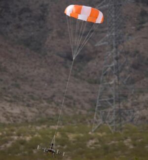
In recent weeks two companies have made progress and helped to push drone parachutes into the mainstream. Airobotics announced it had been granted a waiver from the FAA for BVLOS flights over people with the adoption of ParaZero’s safety systems. Around the same time, Indemnis and DJI announced that the Nexus parachute system for the Inspire 2 drone has been validated as compliant with the new international standard for drone parachutes. Drone parachutes have made it safer (and legal) for drones to fly over crowds.
-2. Geofencing
Geofencing means restricting the movement of drone within a defined airspace. Geofencing is a feature that uses a drone’s GPS receivers to automatically enforce warnings or restrictions based on where the drone is flying. The system is typically integrated with a digital airspace chart that specifies no-fly zones and areas where there are active drone restrictions. Geofencing in drones has been around in a significant capacity since the early 2010s. Leading drone brand DJI has been at the forefront of pushing for the adoption of this feature, in collaboration with location data partners Airmap and Precision Hawk. Users will then need to secure authorization to unlock the restrictions of a built-in geofencing feature. This could involve providing info about the drone’s serial number as well as the identity of the drone pilot. Once approved, the drone can then operate within the area subject to certain altitude or geographical limitations. Effectively, geofencing tech creates virtual, location-based barriers that prevent drone flights and take-offs in sensitive areas: usually around airports and one-off locations where crowds will be present, like festivals and sporting events. Although the feature seems great on paper, it does complicate a lot of things that drone pilots have come to take for granted. Geofencing can also have cascading effects on several professional uses of drone pilots, including life-saving operations such as emergency response.
You could argue that Remote ID is another part of this equation: By requiring manufacturers to build-in software that effectively broadcasts identifying information for the drone and its pilot in real time, officials are kept in the loop.
-3. Computer Vision with AI:
One technology leads the way when we’re talking about drone safety: Computer vision with AI. This sector of AI has allowed companies like Movidius, DJI, Intel and Skydio to provide drones with the visual awareness required to avoid obstacles and, in some cases, navigate around them completely. The first major obstacle avoidance systems came to the fore in 2016, with the launch of the DJI Phantom 4 and the Yuneec Typhoon H – Intel’s RealSense technology helped with that. Since then, we’ve come a long way; arguably culminating in the launch of the Skydio R1 at the start of 2018. Without the ability to spot obstacles and stop short of crashing into them, you can bet that drone-related accidents would be a lot more common. It’s also safe to assume that drone technology would not have seen the amount of commercial adoption that it has. As soon as you take the pilot out of the equation, advanced computer vision is a must-have. Which is why its continued advancement is central to any major roll-outs of drone delivery services or aerial taxis in the future.
-4. Lighting
One often overlooked safety feature for drones is adequate lighting. The standard lights that come with consumer models are rarely bright enough to meet the night flight requirements of national aviation bodies. They can also be tough for pilots to spot in gloomy conditions. More powerful lighting accessories are needed in many circumstances. Lume Cube is one company that offers seriously bright 1,500-lumen lighting attachments; DJI’s new dual, 2,400-lumen M2E Spotlight for the Mavic 2 Enterprise is another great example. Both can be used to improve vision in low-light areas and make drones more conspicuous when operating after dark. They can also be great creative tools.
-5. DJI AirSense
DJI announced AirSense, a feature in the DJI Pilot application that displays warnings to Mavic 2 Enterprise or Matrice 200 Series pilots when a signal from a nearby aeroplane or helicopter is detected as seen in the figure below.
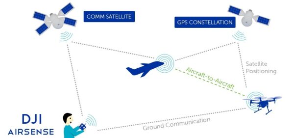
AirSense alerts drone pilots of Automatic Dependent Surveillance-Broadcast (ADS-B) signals to lower the risk of collisions and disruption, providing an extra level of safety in congested airspace.
______
______
Mitigate risks:
Safety best practice put into action for UAS operations involves the operator (remote pilot) to analyze and measure internal/external factors and the potential risk that those factors could pose to the operation. As commercial operators, recognizing and mitigating risk is key to maintaining safe and quality company practices.
One way this can be done is utilizing a Flight Risk Assessment Tool (FRAT), for each operation that takes place. The risk assessment categorizes risk based upon internal and external factors to an operation. These contributing factors are numerous, but could include weather, remote pilot experience, new technology reliability/updates, operational complexity, and/or proximity to an airport. It does not matter how big or small your particular operation is since you are operating within the National Airspace. A risk assessment is conducted not only to protect you, your crew and your aircraft, but also the people, property and other aircraft affected by your operation. In other words, you could be an incredible remote pilot, but if external factors (such as a bad firmware update, intermittent communications, congested operating area, gusting winds) have not been considered in a risk assessment prior to operating, it is only a matter of time before compounding risk categories result in an injury or accident.
Once risk has been identified, analyzed, and briefed prior to flight, ways to mitigate medium or high risk values are necessary. There are many ways to accept or mitigate risk and remote pilots that are on the lookout for threats to the flight, will maintain a risk averse operating environment. Different operations, both big and small, will have differing complexities of operational threats.
For example:
-1. Winds that are hazardous to one UA platform may be well within the limits of another.
-2. There could be congestion on the selected bandwidth for command and control, but another company’s UA has the option for more than one bandwidth selection.
-3. Cold temperature may reduce the endurance of a battery powered UA, however, a fuel powered UA may have no reduction in endurance.
-4. One company may utilize experienced UAS operators with FAA certificates, whereas another company may choose to use FAA certified pilots with very little UAS experience.
The above operating differences will make the risk profile for each company extremely diverse. The FRAT is a valuable and scalable utility to help any size or experience of a company. Utilizing a FRAT will help level the playing field, when measuring how much risk a certain company poses for each flight.
Mitigating risk is what makes an average remote pilot great. The ability to identify hazards to an operation and then shift or change the operating profile or plan to bring the risk level down is a talent that is necessary to safety in this industry. Operating safely requires a joint effort by the company and remote pilot to make safety a priority and actively promoting risk awareness, no matter how big or small the operation might be.
______
______
Section-10
Drone security concerns & drone hacking:
Security vulnerabilities:
Drones are remote controlled. The pilots operating the drone can be thousands of miles away at Ground Control stations. The control link is the satellite transmitted datalink by which the pilot controls the plane. By jamming or intercepting the datalink, one can interfere with the drones controls. The data link can be encrypted but often is not. Once the drone has been located, a hacker can potentially take control of the drone, or downlink video or other images which the drone is broadcasting to its base station. Hacking a drone isn’t technically very difficult, and many drone operators leave their drones wide open to attack. The interest in UAVs cyber security has been raised greatly after the Predator UAV video stream hijacking incident in 2009, where Islamic militants used cheap, off-the-shelf equipment to stream video feeds from a UAV. Another risk is the possibility of hijacking or jamming a UAV in flight. Several security researchers have made public some vulnerabilities in commercial UAVs, in some cases even providing full source code or tools to reproduce their attacks. At a workshop on UAVs and privacy in October 2016, researchers from the Federal Trade Commission showed they were able to hack into three different consumer quadcopters and noted that UAV manufacturers can make their UAVs more secure by the basic security measures of encrypting the Wi-Fi signal and adding password protection.
_
The use of drones offered advantages on so many levels, from commercial to personal. However, drone systems suffer from different security, safety, and privacy issues. The breaches of security and privacy led by drones should be addressed by the highest national level. Moreover, there should exist a very strict approach to limit the drones’ ability to gather images and record videos of people and properties without authorized permission. From the perspective of security and threat analysis, drone-assisted public safety network is different from traditional wireless networks such as Wireless Sensor Networks (WSNs) and Mobile Ad-hoc Networks (MANETs). This is attributed to carrying less information and requiring less power compared to a drone-assisted public safety network. Moreover, the drone’s coverage area is broader and wider than WSNs and MANETs. Therefore, security challenges are primary related to the resources constraints along with the delay constraints of UAVs. Moreover, it is essential to ensure that confidentiality, integrity, availability, authentication, and non-repudiation properties over communication channels are fulfilled. This is done in accordance to the AAA process and guidelines:
- Authorisation: by assigning privileges to the personnel controlling the UAV.
- Authentication: by ensuring a multi-factor authentication using something you know (strong constantly changing password), something you have (username), something you are (biometric) properties.
- Auditing/Accounting: by tracking down and/or arresting drone/UAV legitimate owners in case of criminal/ malicious activities.
_____
_____
Existing threats & vulnerabilities of drones:
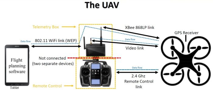
UAVs and drones are being perceived as viable and vital threats to information security. Many UAVs have serious design flaws, and most of them are designed without wireless security protection and footage encryption.
- Prone to Spoofing: analysis of the configuration and flight controllers of UAV models, with multiple rotors, revealed many weaknesses. These are associated with both the telemetry links streaming data to/from a drone via serial port connections, especially due to its weak communication nature, which is in most cases not encrypted. The experiments done in showed that, through GPS spoofing, the information can be easily captured, modified, or injected. Small, portable GPS transmitters can send fake GPS signals and disrupt the Drones navigation systems. This vulnerability in the data link enables the interception and spoofing, giving hackers complete control of the drone. This can be used, for example, to steer drones into self-destruction flight paths or even hijack them and land them on a runway.
- Prone to Malware Infection: the communication protocols are enabled within the UAVs to allow users to pilot drones via wireless remote control such as tablets, laptops and mobile phones. However, this technique was found to be insecure; it allows hackers to create a reverse-shell TCP payload, injects it into the drone’s memory, which will covertly install malware on the systems running the ground stations.
- Prone to Data Interference & Interception: telemetry feeds are used to monitor the vehicles and facilitate information transfer through open non-secure wireless transmission, making them vulnerable to various threats. These include data interception, malicious data injection, and alteration of pre-set flight paths. This allows the installation and insertion of many infected digital files (videos, images) from the drone to the ground station. Another vulnerability was revealed in, and related to the UAV’s communication module, which uses wireless communication to exchange both data and commands with the ground station.
- Prone to Manipulation: since drones fly pre-programmed and pre-defined routes, manipulation can occur and could potentially have serious consequences. This ranges from stealing high-value cargo, to redirecting UAVs to deliver explosives, biological weapons, or other terrorist payloads, through RF or GPS spoofing, which allows the attacker to gain control over the drone by sending counterfeit signals, or jamming it with the purpose of crashing it.
- Prone to Technical Issues: many drones suffer from various technical failures. This includes application errors such as connection failure between a user’s device and the drone, causing it to either crash or fly away. Other issues are related to the lack of stable connection, especially under challenging natural causes; the battery life, which results in a very limited flight time before being fit to fly again. Note that in cold weathers, the batteries’ life span is reduced, leading to a shorter flying time, as well as possible malfunctioning.
- Prone to Operational Issues: another major issue is the lack of flying skills by drone owners and the type of drones in use. This can cause serious damage and/or injuries against properties and/or personnel. In fact, drones are sensitively made, so a small accident could bring the drone down. In many cases, if one of the rotaries dysfunctions or stops working, it would cause a serious turbulence with a hard to maintain control of the drone. This, in most cases, would lead to the crashing of the drone. For example, mentioned an incident of an Israeli drone, which broke into the Lebanese airspace and crashed in the south of Lebanon due to technical and operational failure.
- Prone To Natural Issues: in many cases, drones cannot withstand wind due to their lightweight nature. Moreover, extreme heat conditions can lead to engine failure, bringing the drone down. Also, the battery could explode and cause serious damage and harm. Another issue is the inability of drones to fly through rain since they are not equipped with waterproof protection. Usually, when drones crash into lakes, rivers, beaches or even pools, they immediately stop working. Furthermore, during fog, owners are not advised to fly drones due to the limited visibility, which shrinks from few meters to less than a meter leading to the disruption of communications between the drone and the GPS, sending the drone outside its control area till it crashes.
- Prone to Wi-Fi Jamming: drones can also be hijacked by sending a de-authentication process between the access point and the device controlling the drone, which can be done temporarily or permanently, such as jamming the intended drone frequency, and luring it to connect to the hacker’s Wi-Fi as seen in the figure below; this can be done by installing and configuring a raspberry-pi for such a job.
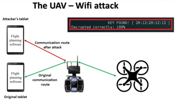
- Man-In-The-Middle Attack: Man-in-the-middle attack places an adversary in between the user and the drone. Figure below represents the implementation of man-in-the-middle attack.
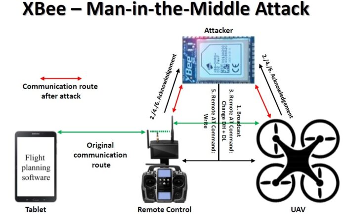
_____
Drone cyber-attacks and counter measures are depicted in the table below:
|
Attack |
Targets |
Security Measures |
||||||
|
Type |
Nature |
Privacy |
Data Confidentiality |
Integrity |
Availability |
Authentication |
Non-Cryptographic |
Cryptographic |
|
Malware |
Infection |
✓ |
✓ |
✓ |
✓ |
✓ |
Hybrid lightweight IDS |
Control access, system integrity solutions and multi-factor authentication |
|
BackDoor Access |
Infection |
✓ |
✓ |
✓ |
✓ |
✓ |
Hybrid lightweight IDS, vulnerability assessment |
Multi-factor robust authentication scheme |
|
Social Engineering |
Exploitation |
✓ |
✓ |
X |
X |
✓ |
Raising awareness, training operators |
N/A |
|
Baiting |
Exploitation |
✓ |
✓ |
✓ |
X |
✓ |
Raising awareness, training operators |
N/A |
|
Injection/Modification |
Exploitation |
✓ |
X |
✓ |
X |
X |
Machine-Learning hybrid IDS, time stamps |
Message authentication or digital signature |
|
Fabrication |
Exploitation |
✓ |
X |
✓ |
X |
✓ |
, Assigning privilege |
Multi-factor authentication, message authentication or digital signature |
|
Reconnaissance |
Information gathering |
✓ |
✓ |
X |
X |
X |
Hybrid lightweight IDS |
Encrypted traffic/stream |
|
Scanning |
Information gathering |
✓ |
✓ |
✓ |
X |
X |
Hybrid lightweight IDS or Honeypot |
Encrypted traffic/stream |
|
Three-Way Handshake |
Interception |
X |
X |
X |
✓ |
✓ |
Traffic filtering, close unused TCP/FTP ports |
X |
|
Eavesdropping |
Interception |
✓ |
✓ |
X |
X |
X |
N/A |
Securing communication/traffic, secure connection |
|
Traffic Analysis |
Interception |
✓ |
X |
X |
X |
X |
N/A |
Securing communication/traffic, secure connection |
|
Man-in-the-Middle |
Authentication |
✓ |
✓ |
✓ |
X |
X |
Lightweight hybrid IDS |
Multi-factor authentication & lightweight strong cryptographic authentication protocol |
|
Password Breaking |
Cracking |
X |
X |
X |
X |
✓ |
Lightweight IDS |
Strong periodic passwords, strong encryption |
|
Wi-Fi Aircrack |
Cracking |
X |
X |
X |
X |
✓ |
Lightweight IDS at the physical layer |
Strong & periodic passwords, strong encryption algorithm |
|
Wi-Fi Jamming |
Jamming |
X |
X |
X |
X |
✓ |
Frequency hopping, frequency range variation |
N/A |
|
De-Authentication |
Jamming |
X |
X |
X |
X |
✓ |
Frequency hopping, frequency range variation |
N/A |
|
Replay |
Jamming |
X |
X |
X |
X |
✓ |
Frequency hopping, time stamps |
N/A |
|
Buffer Overflow |
Jamming |
X |
X |
X |
X |
✓ |
Frequency hopping, frequency range variation |
N/A |
|
Denial of Service |
Jamming |
X |
X |
X |
X |
✓ |
Frequency hopping, frequency range variation |
N/A |
|
ARP Cache Poison |
Jamming |
X |
X |
X |
X |
✓ |
Frequency hopping, frequency range variation |
N/A |
|
Ping-of-Death |
Jamming |
X |
X |
X |
X |
✓ |
Frequency range variation |
N/A |
|
GPS Spoofing |
Jamming |
X |
X |
X |
X |
✓ |
Return-to-base, frequency range variation |
|
______
Drone security tips for your drone:
There are many ways to make any drone more secure against the threat of drone hacking. These drone security tips should help secure your drone:
-1. Update the drone’s firmware regularly. The major drone manufacturers issue patches when new security threats emerge, so regular updating should help keep your drone ahead of the hackers. DJI issued a security patch after hackers accessed the manufacturer’s website, allowing them to access flight logs, videos, photos and map views from drone users in real time. Yet, some clients refused to install it – giving hackers potential access to all their data.
-2. Use a strong password for your base station app. Using a mix of letters, numbers and special characters to create a strong password will deter hackers; most will give up and go after easier prey. This should help avoid a malefactor hacking the drone signal.
-3. If you’re using a smartphone or laptop as your controller, keep it secure and don’t let it get infected by malware. In 2012, several US Army drones were reported to have been infected by malware after an operator used a drone’s computer to download and play a videogame. Use anti-virus software, and don’t download dodgy programs or apps.
-4. Subscribe to a Virtual Private Network (VPN) to stop hackers from accessing your communications when you’re connected to the internet. A VPN acts as a secure gateway to the internet and encrypts your connection, so a hacker can’t get in.
-5. Set a limit of one for the number of devices that can connect to your base station. That will prevent a hacker hijacking your signal to control other devices.
-6. Ensure your drone has a “Return to Home” (RTH) mode. Once you have set the home point, this will enable the drone to return if it loses signal, if your signal is jammed, or if the battery becomes depleted. This will enable you to recover your drone from a hijack situation. However, because RTH depends on GPS to work, it’s not immune to GPS spoofing.
-7. Personal behavior change. Recent drone hacks have taught us at least something about how hackers can gain control of drones. By spoofing fake GPS coordinates, they can crash or re-direct a drone. But to do so, hackers first need to establish some sort of connection with the drone. This is best shown off by Samy Kamkar, who designed a drone he calls SkyJack to hack and control other drones. Essentially the drone seeks out and intercepts your wireless connection to the drone and replaces it with its own. The best way to avoid this, outside of waiting for better drones, is to monitor the location of your own and vary your flight paths. Consistent paths may be used to learn where your drone will be and make it an easy target. Keeping your drone in view will also let you know if something is going wrong.
-8. Protect drone with seL4 OS. While the source code is available, you’ll be hard pressed to actually find a drone with the seL4 operating system. That’s because it’s still largely in development. However, it is poised to be the industry standard for any devices that connect to the net and control functions as part of what has been dubbed the “Internet of Things.” In simple terms, this seL4 kernel, or operating system, isolates the varying functions of the device it is installed on. It is important for drones because it will prevent the entire system from being compromised, even if a hacker manages to get part of the way in. Think of it as locking the cockpit; even if the rest of the plane is taken, the pilot (in this case the basic operating software) is still safe.
_____
The Pentagon says DJI drones pose a threat:
The Department of Homeland Security previously ran tests on the DJI Mavic Pro and Matrice 600 Pro in 2019, and didn’t find evidence of data being sent places it shouldn’t. Another report that looked at three DJI drones, including the Government Editions of the aforementioned drones, came to the same conclusion in early 2020. However, on July 23rd, the Department of Defense (DOD) reiterated its position that DJI’s drones “pose potential threats to national security.” The Pentagon’s report wasn’t an all-clear for DJI’s relationship with the US government, even before the DOD’s statement on July 23rd. As of June 1st’s revision, DJI is still on the Entity List, which prevents US companies from selling any of their technology for DJI to use, and the Pentagon’s report comes as Congress is considering a law that would ban the government from buying Chinese drones for five whole years, starting in 2023. They’d have to rely on other approved drones from companies in the US and France instead; as restrictions have been placed on DJI, others have made drones with hefty price tags to fill the government’s needs. None of the government scrutiny keeps you from buying a DJI drone. Despite all the accusations, DJI has still been able to continue creating and selling its consumer products. In 2020, DJI commanded a massive 77 percent of the consumer drone market. Over the last two months, it has released a pair of key products, the large-sensor Mavic 3 drone and full-frame Ronin 4D cinema camera with a built-in gimbal and LiDAR focus system.
_____
Hackers steal data by using drones:
Traditionally, computer systems have been protected around the perimeter, both in terms of the computer network and physically. However, data has become more mobile as Wi-Fi and the Cloud make it possible to access data from anywhere. Plus, the Internet of Things, together with RFID, enable data flows between smaller devices, such as security cameras, pallet labels, and goods tags in retail stores. Technologies such as Wi-Fi, Bluetooth and RFID generally work only within a limited area, so physical access restrictions can often prevent hacking. But drones give hackers more mobility. For instance, a small computer, such as a Raspberry Pi or ASUS Tinker Board, could be loaded onto a drone and dropped on the roof of an office building. It could then be used to carry out cyberattacks exploiting Wi-Fi, RFID or Bluetooth vulnerabilities. It could mimic a Wi-Fi network in order to steal data from tablets and smartphones, or hijack Bluetooth peripherals, such as mice and keyboards. Keylogging would enable a drone-mounted computer to steal passwords from users.
______
______
Section-11
Drone & Privacy concerns:
People’s privacy is at high risk of being exposed by unwanted flying guests that can record their movement and capture images at any time, without their knowledge or permission. This is an indication of how much our privacy is vulnerable to such an emerging threat. According to the Canadian Public Safety, UAV technologies raised a broad range of issues that relate to the collection of images and videos. This was associated with blackmailing and scamming by threatening the disclosure of personal images or videos captured without the victim’s knowledge from an aerial position. In general, the privacy threats can be divided into three main categories.
- Physical Privacy: is based on flying drones over someone’s property or at their window level. This allows attackers to covertly gather images and record videos of certain people in possibly inappropriate ways, threatening their personal freedom.
- Location Privacy: is based on tracking and detecting people with a drone flying and buzzing above them without them knowing that they are under surveillance.
- Behaviour Privacy: is where the presence of a flying drone can affect the way people act and react, especially when knowing that they are under surveillance. As a consequence, this would also limit their liberty, breach their privacy, and restrict their freedom.
___
Spying by drones:
Sure signs of a Drone spying on You:
Knowing whether a drone is spying on you is harder than you might think. So the very first things to search for would be the apparent signs:
-1. A Drone is constantly flying on or around Your Property:
Drones are loud and may be viewed from quite a distance off and occasionally give the impression they’re nearer than they are. Based on your geographical area and the sort of property you have, a drone may just be flying on its way into the lake beneath your property, or even the freeway through the night or possibly the local country park. These areas are lawful as long as the drone has been abiding by the authorized distancing. But if you become aware of a drone flying out of your property frequently, and it appears to be too close for comfort, perhaps the drone is spying on you. Does this hover out of your windows? Does this seem to appear whenever you’re outside? Is it every moment? Ask yourself, what’s making you feel like that? If you honestly think it can be seeing you, then report it.
-2. You see Photos or Videos of Yourself on social media regularly:
Like the world is indeed connected today via social networking, it is not overly tough to discover photos of your own online. Should you suspect that a neighbor or somebody nearby is spying on you, then look up their profiles and determine what pictures they’re posting; you may be surprised. If you discover a photo of yourself, then you may use google pictures. If you understand where the images are, then you may use the URL. If not, and you also own a duplicate of the photo, Google Reverse Image Search helps you quickly discover visually similar images from around the web. Should you see photos and movies of you and you suspect that a drone continues to be after you, then report it to the authorities along with the FAA.
-3. Everywhere you go, there is a Drone following you:
All drones are prevalent. They don’t dominate the skies. We do not walk from our homes and see lots of these flying about. Consequently, if you find the same drone appearing anyplace you are, that is a fantastic chance you’re to be followed. Though this scenario is alarming and terrifying, fortunately, it is uncommon. You better walk randomly, pick up different avenues, and see whether it follows you. Should it report it to the authorities and FAA.
______
Your response if a drone is spying on you:
-1. Talk to the Drone Operator:
If it is possible to observe the drone’s owner, then approach them in a calm and friendly way. It is far better to be relaxed and agreeable. You can question them, and you ought to find a better answer than if you are irate. Ask them what they’re shooting. They may do a project that just so happens to be about when you’re. If the operator is unhelpful and surprising and will not talk about your concerns, inform them you’ve got reason to think that the drone has been after you. Watch how they respond. Tell them you will report them. You now have a choice. You can either leave it at that and see whether the drone stops after you or move ahead and report it.
-2. Know about Drone Laws:
Should you have some time to read about the fundamental drone legislation, you may understand precisely what is and is not permitted to be achieved using a drone and the intrusion of privacy a part of it. Gain some basic knowledge can make you realize you aren’t being followed. The drone is there as they’re following particular laws. Knowing the fundamentals gives you some confidence if you do choose to approach a drone pilot. It is possible to examine exactly what you do understand, and if they’re misusing their drone, they may think twice before doing this.
-3. Document Everything:
Document everything. Write down dates, times, and places. Collect all of the information that you can. Take photos or a movie if you’re able to. Collecting all this info will make reporting more straightforward and stand more chance of being listened to.
-4. Contact the Police:
Some people do not report these types of problems to the government for various reasons, one being that they dread that the offender knows where they reside. Collect whatever you’ve recorded, such as talking to the operator, and then move it to the authorities: the more proof you can provide, the better.
-5. Report Drone Misuse to the FAA:
The FAA and some other Aviation authorities worldwide will have some method that you make a formal complaint. For example, it is possible to report drone abuse on the FAA’s website in the United States. Drone abuse is taken seriously since it’s a crime under aviation law and might need to be researched. Pass on whatever you’ve documented, telling them you also have spoken to the authorities.
______
Protection against Drones infringing on Your Privacy:
There are several methods of protection against drones:
-1. Anti-Drone Drones
In 2015, Malou Tech gave their first demonstration of an anti-drone drone: a bigger drone equipped with a huge net meant for capturing and disabling smaller drones. It could be an effective method, but in many cases, something more subtle is needed.
-2. Anti-Drone Birds
Eagles have been trained to tackle drones out of the sky. In fact, some of these birds can even snatch drones and carry them all the way back to their trainers. And in case you were worried whether this process is harmful to the birds, rest assured, that the birds are intelligent enough to pull it off without so much as clipping a talon. These birds are only available for authorities in specific locations. But it’s conceivable to expect other countries to follow suit in some form or another.
-3. Anti-Drone Jammers
If you need a method that’s even more subtle than physical interception, then there are ways to jam a drone signal. The Anti-UAV Defense System (AUDS) is one such solution. It scans the skies for drones and jams their control signals using its own high-powered radio signal. Or, if you need a more portable option, you could look into the DroneDefender. This is an accurate anti-drone rifle that uses targeted radio signals to disrupt drone controls. It works much in the same way that the AUDS operates. It currently has a range over 1,300 feet, but may be able to reach even farther in the future. But there’s one good reason not to use these kinds of devices: radar jammers may be illegal where you live.
-4. Drone-Blinding Lasers
Anti-drone lasers are somewhat like anti-drone jammers. Except instead of interfering with a drone’s control signals, they interfere with its camera. Digital cameras use a light sensor to pick up visual information, so if you overload that sensor with too much light, you can blind it. But be careful. It’s not legal to shine lasers into the sky because you might accidentally blind an airplane pilot. You really need to take caution when playing around with lasers like this. You could try a short-range laser if you really want to take this option, but there are still risks involved, and it is not advisable.
-5. Drone Detection Systems
Drone detection systems are employed to track and counter unmanned drones. They work by sending out a signal and receiving back the reflection from the drone. From this, they can calculate the accurate position of the drone. There’s a wide variety of drone detection systems to choose from, all with different features and working methodologies. There are Jammers, as we saw from above, which work by emitting electromagnetic waves that cut off the signals between the drone and its operators. Then, there’s a class of detection systems called Acoustic Sensors, which detect a drone by picking up on the noise produced by them. With a combination of features based on machine learning, image-recognition, and adaptability with third-party sensors, the Dedrone DroneTracker can detect RF, Wi-Fi, and non-Wi-Fi drones easily and make your environment secure. The DroneWatcher APP turns your Android™ smartphone or tablet device into a drone and small UAV detector that detects, tracks, alerts, and records information on ~95% of consumer drones using advanced signals intelligence technology.
-6. Drone Hijacks
One important thing to know about drones is that they’ll never be 100 percent impervious to hacks, much in the same way that computers and mobile devices will never be completely protected. Keep that in mind if you ever plan on buying a drone of your own. The thing is, this kind of weakness can always be exploited, which was proved when a security researcher demonstrated the hijacking of a $35,000 police drone from up to one mile away. If a government drone can be disabled like that, it’s reasonable to assume that most consumer-grade drones won’t stand a chance either. That’s not to say that you should try hijacking drones, but in the future we may see disruption devices that utilize these kinds of vulnerabilities to knock drones out of the sky and maintain the peace.
-7. Drone Surveillance Laws
If all else fails, the last thing you can do is to push for laws that protect the privacy of citizens against drones. In 2019, both the US and the UK brought in new laws about drone flying. In the US, drones must be registered to an owner before they are used if they weigh more than 250 grams. Permission needs to be obtained before drones are flown in controlled airspace. And drone pilots must pass a test before they can fly. This means that it should be easier to trace who a drone belongs to and who was flying it if it causes a problem. In the UK, drones over 250 grams also need to be registered and pilots need to pass a theory test. The good news for privacy advocates is that both sides of US Congress agree and want to “prevent high-tech window-peeping.” Drones with cameras may be covered by laws like the Data Protection Act (DPA). Groups like the Uniform Law Commission (ULC) are working to create laws regarding drones which balance privacy concerns with the potential benefits of drones for search and rescue, delivering medical supplies, and other important functions. These laws are being frequently updated as drones become more popular. Ideally, a middle ground will be found, but until that happens, there’s not a lot you can do about drones threatening your privacy as a private citizen. Laws may end up being the only effective defense.
______
Drone surveillance by the state:
Times have changed. Drones have moved from only military use to our everyday life. Drones can save lives or end them. The main point of concern is the violation of privacy rights through pervasive surveillance. Pervasive surveillance is the process of tracking and cataloguing people’s movements for a long time. By using drones, the government can keep an eye on you when you are exercising your constitutional rights of freedom of movement and association. The government will monitor you while protesting or in political gatherings. The powerful and sophisticated drone models have better surveillance abilities than human-crewed aerial vehicles. For example, the Inspire drone fitted with a DJI Zenmuse Z30 camera with 2.13 megapixels captures clear images of objects more than four miles from its location. Such drones can track a person’s movement for long, identify vehicle details such as the number plates and occupants, and identify individuals with facial recognition. Civil rights groups in many countries have been fighting the use of drones for surveillance. They have been arguing that the metadata collected using drones may open a way to harm the victims. And it’s a valid argument. That is why in several states in the USA, police need to have a warrant to observe you with a drone. It would be nice to live in a world with fewer impositions on privacy, one in which law enforcement did not use small quadcopters and the Department of Homeland Security did not redeploy large Predator drones to surveil protesters.
_____
Hiding from Drones:
Drones are equipped with extremely powerful camera’s which can detect people and vehicles at an altitude of several miles. Most drones are equipped with night vision, and/or infrared vision camera’s, so-called FLIR sensors. These can see human heat signatures from far away, day or night. However there are ways to help hide from drones. Regardless of the methods you might use to hide your heat signature from drones, be aware that in many instances you may be only reducing your thermal heat signature – perhaps enough to be ignored – but never assume it.
-1. The first thing you can do to hide from a drone is to take advantage of the natural and built environment. It’s possible to wait for bad weather, since smaller devices like those used by local police have a hard time flying in high winds, dense fogs and heavy rains. Trees, walls, alcoves and tunnels are more reliable than the weather, and they offer shelter from the high-flying drones used by the Department of Homeland Security.
- Day camouflage: Hide in the shadows of buildings or trees. Use thick forests as natural camouflage or use camouflage nets. Using netting over vehicles and camo patterns for other objects that confuse vision recognition systems. Currently the best such camo pattern is known as A-TACS.
- Night camouflage: Hide inside buildings or under protection of trees or foliage. Do not use flashlights or vehicle spot lights, even at long distances. Drones can easily spot this during night missions.
- Heat camouflage: Emergency blankets (so-called space blankets) made of Mylar can block infrared rays. Wearing a space blanket as a poncho at night will help hide some of your heat signature from infrared detection. Also in summer when the background temperature is between 96°F and 104°F, infrared cameras have more difficulty distinguishing between body temperature (98.6) and its surroundings.
-2. The second thing you can do is minimize your digital footprints. It’s smart to avoid using wireless devices like mobile phones or GPS systems, since they have digital signatures that can reveal your location. This is useful for evading drones, but is also important for avoiding other privacy-invading technologies.
-3. The third thing you can do is confuse a drone. Placing mirrors on the ground, standing over broken glass, and wearing elaborate headgear, machine-readable blankets or sensor-jamming jackets can break up and distort the image a drone sees. Mannequins and other forms of mimicry can confuse both on-board sensors and the analysts charged with monitoring the drone’s video and sensor feeds. Drones equipped with infrared sensors will see right through the mannequin trick, but are confused by tactics that mask the body’s temperature. For example, a space blanket will mask significant amounts of the body’s heat, as will simply hiding in an area that matches the body’s temperature, like a building or sidewalk exhaust vent.
-4. The fourth, and most practical, thing you can do to protect yourself from drone surveillance is to get a disguise. The growth of mass surveillance has led to an explosion in creative experiments meant to mask one’s identity. But some of the smartest ideas are decidedly old-school and low-tech. Clothing is the first choice, because hats, glasses, masks and scarves go a long way toward scrambling drone-based facial-recognition software. Your gait is as unique as your fingerprint. As gait-recognition software evolves, it will be important to also mask the key pivot points used in identifying the walker. It may be that the best response is affecting a limp, using a minor leg brace or wearing extremely loose clothing. Artists and scientists have taken these approaches a step further, developing a hoodie wrap that’s intended to shield the owner’s heat signature and to scramble facial recognition software, and glasses intended to foil facial recognition systems.
-5. Keep an umbrella handy. Above mentioned innovations are alluring, but umbrellas may prove to be the most ubiquitous and robust tactic in this list. They’re affordable, easy to carry, hard to see around and can be disposed of in a hurry. Plus you can build a high-tech one, if you want.
______
______
Section-12
Drone and Weather:
Weather is an important and poorly resolved factor that may affect ambitions to expand drone operations. The drone industry lags behind the aerospace industry in the development and implementation of standards for weather-related testing and tolerances. In an exercise to outline the status of drone technical and performance standards, the American National Standards Institute (ANSI) identified weather robustness as an important gap and high priority. Few published standards or specifications exist specifically targeting weather effects on drone flight performance and safety.
_
Air temperature, wind speed, precipitation, and other atmospheric phenomena have been shown to adversely affect drone endurance, control, aerodynamics, airframe integrity, line-of-sight visibility, airspace monitoring, and sensors for navigation and collision avoidance. There are situations when most drones should not and cannot fly (i.e., ‘severe’ weather hazards)—but understanding where, when, and how adverse and severe weather conditions arise and impact drone operations is complicated. Researchers have documented the current weather resources and tools available to assess weather-related risks for local drone operation. Roseman and Argrow created a risk-based framework to assess safe operations based on weather forecast, population density, structure density, and drone specifications. Lundby et al. compared historical weather data and four drone platforms to determine the percentage of the year when drone operations were possible in two different cities. Their results demonstrate that local weather, relative to specific drone tolerances, can substantially impact drone operations and limit flights to between 53.9 and 95.8% of the year. Risk-based frameworks and high-resolution datasets are imperative for assessing safe operations locally, but the extent to which different drone types are limited by weather in different parts of the world remains unknown.
_
Many drone manufacturers specify safe operating limits or warnings according to weather parameters in their manuals (e.g., “Do not use the aircraft in severe weather conditions including wind speeds exceeding 10 m/s, snow, rain, and fog”). Regulations in some jurisdictions specify that drone operations cannot proceed unless weather conditions at the time of flight permit operation in accordance with the manufacturer’s instructions. To comply with drone legislation, drone operators must maintain flexible deployment schedules to allow for delays or cancellations due to weather conditions outside the manufacturer-specified operating envelope. However, to achieve wider adoption of drones for time-sensitive operations such as emergency response, law enforcement, and package delivery, drones will be more effective if they are not limited by weather. The value of using drones for these applications is diminished if the drones cannot perform with reasonable uptime.
_
Technical and legal limitations to drone flights have material consequences for the economics, utility, and reliability of drones for on-demand commercial operations—particularly if the application has pre-existing service targets. For example, even if package delivery with drones is preferable, delivery companies require on-demand capacity to meet delivery targets on the days when drones cannot fly. Similarly, the use of drones for emergency response or law enforcement is attractive, but a full complement of back-up tools is required if the drones cannot fly due to inclement weather. Are drones a worthwhile investment if uptime is low? Furthermore, unlike hobby or small-scale scientific drone use, these ambitious commercial applications are particularly exposed to the legalities of stretching operations into poor weather. Commercial applications may inherit significant liabilities if flying in conditions outside drone operating envelopes.
__
Types of weather elements that affect drone operations:
Clear skies, low winds, and warm temperatures are your best friend when it comes to flying your drone. However, not every day is going to present with the ideal weather conditions.
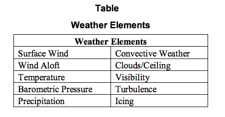
If you’re planning to fly a drone anywhere, you need to be aware of how these different weather events can impact your drone. See table above. You may have to re-route the drone, delay takeoff, or even postpone a flight entirely in the worst weather.
_
We know weather can have a massive impact on flights — whether it’s an airplane, a helicopter, or a drone. But different inclement weather can impact drones in different ways than you might expect, including:
-1. High winds: High winds can blow drones off course, making it impossible to control during takeoff, in-flight or landing, causing a crash
-2. Water damage: Precipitation can get inside a drone and ruin electrical components, making the drone inoperable and causing it to crash. A simple drop of water is enough to create a short circuit between two pins of an integrated circuit to destabilize the best drone. The fairing protects the circuits, of course, but the saturated atmosphere and the fact that the circuits heat up produce condensation. During flight, the drone body generates heat. In order to efficiently release the heat, it is necessary to adopt a structure with many gaps. Furthermore, because drone has a camera, it can be said that camera is also vulnerable to water. The camera function is still good, but the worst case can be expected if rain enters the drone during flight. After all, flying on a rainy day seems very dangerous.
-3. Cold temperatures: Colder temperatures can reduce battery life drastically, impacting drone range and flying times
-4. Low visibility: Flying in low visibility from fog can reduce a drone cameras ability to gather visual data, wasting time and money on unsuccessful flights
_
Weather constraints on global drone flyability, a 2021 study:
A new study suggests the weather may be a roadblock to drone delivery schemes. A new study published in Nature Scientific Reports looked at how rain and snow, wind, and temperature affect drone flyability around the world. Precipitation damages electronics, high winds can cause loss of control, and cold weather can reduce battery life. The study says most drones used for commercial applications should never fly in rain or snow but can tolerate temperatures between 0 deg C and 40 deg C and winds up to 36 km/h. It then looked at the weather in 100 of the world’s most populous cities. It found on average that there are only 10 hours a day when the weather lets up sufficiently to let drones fly safely. There are regional differences, of course. If you live in sunny Johannesburg, your drone-delivered pizza will likely make it hot and on time. If you live in Glasgow, where it rains a 170 days year, make backup arrangements if you’re expecting a donor kidney. Median global flyability for common drones is low: 5.7 h/day or 2.0 h/day if restricted to daylight hours. Weather-resistant drones have higher flyability (20.4 and 12.3 h/day, respectively). But on average, the high hopes for mass drone deliveries hang on just 10 hours a day of decent weather. The study says that for time-sensitive or emergency drone delivery, those 10 hours are problematic. Waiting for the weather to clear is not an option. The authors say just upgrading drone weatherproofing could be a partial answer. Increasing precipitation tolerances to 1 mm/hr from o mm/hr and wind speed tolerance to 15 m/s from 10m/s would improve average flyability from 40 to 87%, but the authors found a critical lack of weather-related standards for drone components and performance testing. It says the drone industry advances without the rigorous checks and balances found in the piloted aerospace industry. The report’s authors found safely scaling drone deliveries in urban areas requires a defensible and standard set of weather performance tests.
_
Can Drones fly in the Rain?
You can fly your drone in rainy weather, depending on the drone you are flying and how rainy it is. While some drones are resistant to moisture, most drones are not waterproof or water-resistant. So, it is vital to be familiar with your specific drone and what its capabilities are. There is something called “Wet Suit” and it is used to protect the drone in the rain. Drones with good water-resistance are probably the most expensive models. If you own any drone from the DJI Mavic line, ground at the first sign of rain. Water getting into your drone can penetrate the drone’s electric parts, which will cause it to short out. If this happens while the drone is in the air, you may lose control of the drone, leading to someone becoming injured. It is also crucial that you consider your landing pad’s moisture if you fly your drone after rain. Landing your drone in the wet grass can lead to a short circuit in the electrical components, or rust to develop over time if water gets into the drone on landing.
_
It is necessary to pay attention not only to rain but also to sand during takeoff and landing. The best way to tell the degree of water-resistance of your drone is by looking at its IP rating. IP stands for Ingress Protection and is an internationally recognized standard that represents how well a device is protected from the ingress of both solids and liquids. An IP rating is denoted by two digits – the first representing the degree of dust protection, and the second representing the level of water-resistance. To cite a few noteworthy examples, the DJI M200 series of drones has an IP43 rating. This means that each of the drones is impervious to ingress by solid particles down to 1 mm in diameter and cannot be damaged by water spraying up to an angle of 60 degrees. In contrast, the DJI Agras T16 drone that is designed for crop spraying has an IP 54 rating. This denotes protection against dust and water splashes from any direction. Completely waterproof drones are a specialty product and are quite rare. The Swellpro brand is one of the few brands that specialize in waterproof drones, as emphasized by the completely buoyant Spry Plus and SplashDrone models. Even with the claims of being waterproof, water ingress in these drones has been reported by a good number of buyers.
_
Can Drones fly when it’s Windy?
Drones can fly with wind speeds not exceeding 10 m/s. As a general rule, a drone can fly in winds up to two-thirds of its maximum speed. This means that if your drone has a top speed of 16 MPH, you can fly in winds up to 10 MPH. Drones are affected by the wind, but each situation requires different considerations. Going through the starting sequence and landing sequence of your flight are the most dangerous situation during strong winds. This is because the turbulence of the wind overlays the ground level turbulence of the drone. In this situation, the drone can be displaced or flipped over. You can prevent this problem by taking off and landing your drone in a protected place from the wind. During your flight sequence, you must be incredibly attentive. The drone will react to the wind with unexpected movements, and you must be able to counter those movements. Keep your drone in sight at all times and avoid flying over people in case you aren’t able to compensate accurately for your drone’s movements. The best is if you also remembered that your drone is going to need more power to fly during windy conditions, so your flight time should be shorter than expected.
_
Can Drones fly in Snow?
Flying your drone in the wintertime can lead to some beautiful photos. However, flying while snowing can damage your drone because snow is water, and water can get into your drone and cause damage. Flying during flurries or after a snowfall is the best time to take your drone out. Cold weather will affect how your drone flies and how your battery functions. It is important to note that cold weather will reduce the amount of time you can fly your drone because the battery will drain faster than it usually would. For this reason, it is not recommended that you fly your drone when the outside temperature is below 32 degrees Fahrenheit.
_
How to keep Batteries Warm?
When you take your drone out for wintertime flying, it is essential to keep your battery warm. Before you even start to take your drone outside, make sure that your batteries are charged to 100. Keep them warm, keep them in a special battery bag that keeps batteries warm, hand warmer, and never place them on the ground. Place them into your drone right before you start flying and hover your drone for about thirty seconds to ensure that your battery is warm before you start flying. When you land your drone, remove the batteries immediately and warm them up with hand warmers again in the special battery bag. Ensure that you charge your batteries back up to 100% within twenty-four hours of being exposed to the cold.
____
Predator drone and weather:
An internal Pentagon report completed in October 2001 concluded that tests conducted in 2000 found that the Predator drone performed well only in daylight and in clear weather. It broke down too often, could not stay over targets as long as expected, often lost communication links in the rain and was hard to operate. According to the Project on Government Oversight, the Predator cannot be launched in adverse weather, including any visible moisture such as rain, snow, ice, frost or fog; nor can it take off or land in crosswinds of greater than 17 knots. Further, PGO concluded, because it cannot evade radar detection, flies slow, is noisy, and must often hover at relatively low altitudes, the Predator is vulnerable to being shot down by enemy fire. In fact, an estimated 11 of the 25 Predators destroyed in crashes reportedly were caused by enemy ground fire or missiles.
_____
Drones can’t use Regular Weather Forecasts:
What’s complex about low altitudes is the severe lack of weather information at 0-1000 meters. In fact, this is the central complicating factor for all drone missions. No matter where they fly, UAVs have limited access to weather information related to visibility and winds, not to mention precipitation. This can lead to drones that are blown off-course, crash because of heavy rain, or are even struck by lightning. And depending on the sophistication of the drone, it could have a huge cost to you as the operator. Whether you’re flying drones for fun or using them to inspect vital operations for your business, drones simply must take the weather into consideration.
______
______
Section-13
Bird strike on drone:
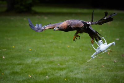
_
Do drones get attacked by birds?
Yes, drones get attacked by birds. The reason that drones get attacked by birds is that the drone is flying in an area where birds are either nesting, hunting, or protecting a territory. It’s common for birds of prey to attack drones by swooping from above. You can stop your drone from being attacked by a bird by making it bright and look less like prey and avoiding natural bird habitats where they may be nesting or feeding. Birds attacking drones are surprisingly common and occur all over the world. Interestingly it is only the largest of birds of prey that commonly take on drones – it may be because of their size that they feel more comfortable tackling such a strange flying object. When a drone does come into contact with a bird there is a high potential for either drone damage or for the bird to become injured! Luckily there are no reported incidences of drones causing the death of a bird. And majority of the time the drone ends up worse off than the bird does.
_
In Australia, large wedge-tail eagles are common attackers of drones and in the US eagles like to take on an unsuspecting drone. Hunting birds such as eagles and hawks are particularly dangerous to drones as they treat any flying object as potential prey – your hovering drone looks like the perfect slow-moving catch of the day for them! However, downing drones is not exclusive to birds of prey. There are videos online of drones being taken down by geese and seagulls chasing a drone out to sea! You don’t need to worry however, about the safety of the eagle or bird – there’s been no reporting of a drone hurting a bird – but that doesn’t mean that drones don’t interrupt important bird activities. Although most birds will be scared away by the presence of a drone (it’s noise and movement) it doesn’t mean that your drone can’t come under attack if you get near birds and their nests. You must always fly with the goal of minimizing your impact on the environment that you are flying in.
_
Protection of drones from birds:
There are a couple of easy methods for you protect your drone and the birds in the area while flying or before taking off.
While flying:
If you notice a large population of birds nearby or you notice that your drones is causing significant distress to the local wildlife, you land your drone immediately and find another place to fly. However, if you find that your drone is under attack from a particularly large bird and you want to make sure that the drone and the bird survive unscathed here what you can do:
Pull up – if your drone is under attack the recommended mode of immediate action is you increase your altitude. This may seem counter-intuitive but attacking birds of prey will normally swoop from above. They are used to birds flying away from them. Flying towards them may help them recognize the drone as an unnatural addition to their environment and not something worth pursuing.
Pull out – If not immediately under attack your first priority should be to land safely. Landing either at your take-off point of a position that you can easily reach the drone later.
Although these two approaches will help with the immediate dangers that are presented by a swooping bird you are able to make some modifications to your drone or your flight plan to minimize the chances of your drone becoming attacked.
_
Prevention of birds attacking drones:
If you are noticing that bird attacks are becoming increasingly common while you are out flying, there are a couple of things that you can do.
Avoid nesting areas:
It’s quite likely that your preferred flying area is a nesting or mating area for birds. Google the local bird watching organizations in your area and work out if there are spots that they recommend. It’s likely that the area is a high activity area. If in doubt bird watchers would happily recommend some places where you could fly and not be in any danger of upsetting a strong bird population!
Make your drone stand out:
Another method of minimizing the chances of a bird attack is to make sure that your drone doesn’t look like another bird! Drones are quite often dark colors and made of plastic and metal. Even to a bird with good eyesight a drone looks like another bird – after all, they have no expectations that a futuristic device would be roaming the sky. You can either paint your drone a different color or buy brightly colored and reflective tape for the arms and body of the drone. The goal with both is to make the drone look as unnatural as possible! If you are adding stuff to the drone be sure not to unbalance the drone or add too much weight. This could cause your battery life to decrease and also make your drone unstable and harder to fly!
Fly early in the morning:
Bigger birds (the sort that would happily take on your drone) like to use warm air to lift them as they are flying. This is to conserve energy while hunting and flying. By flying in the early morning the birds are a little less active as they are waiting for the air to warm up a little and produce updrafts. this doesn’t mean that there will be no birds ready to attack your drone but it may reduce the risk for you.
Stay ways from feeding areas:
Some commercial drone pilots say they often scan the area with google maps to look for chicken farms – a place for birds of prey to get an easy meal!
_____
Do drones scare birds?
Yes, drones can quite easily scare birds and they are used often as a way to scare birds away from airports and farms. In fact, bird damage is a huge problem around the world, and the total loss to horticulture in Australia is estimated at $300 million annually with $200 million extra spent on systems to get rid of them. A drone that is used to scare birds typically has a speaker attached and will play sounds that the birds do not like to hear. Such as a preditor or loud sound. One example of this type of drone is the Avian scout bird-scaring drone. The drones have a random flight pattern to protect against the birds getting used to the drone and its path. This particular drone carries what it aptly, called “the screecher”. The screecher is a high powered drone that outputs a range of different sounds which, when combined, work together to ensure birds are frightened away from the crop and off your property. This is designed for the Australian Market and so it keeps away local wildlife like Rosellas, Cockatoos and other Parrots that can quite easily arrive in large numbers and destroy a crop!
____
Drones and animal stress:
Unmanned aircraft systems provide new opportunities for data collection in ecology, wildlife biology, and conservation. Yet, several studies have documented changes in animal behavior near close-proximity drone flights. Drones may disturb animals more than other aerial survey methods due to their ability to fly and hover at low altitudes. Indeed, numerous studies have observed responses of wildlife to drones. These studies indicated that animals behave fearfully or show a stress response near drone flights. Close-proximity drone flights near wildlife should be avoided without a valid purpose.
______
______
Section-14
Drone crash:
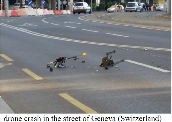
Figure above shows drone crashed in the middle of a street in Geneva Switzerland, raised public debate about safety issues.
_
Currently there exists no publicly available site recording the various civil and military drone crash accidents that occurred in the past decades. The first attempt to analyse recently declassified US military data was made in an article published by the Washington Post, after consultation of over 50’000 pages of declassified documents of military investigative reports and other records and the conclusions can therefore be considered as reliable and correct. The Washington Post article reported that 400 large US military drones have crashed in major accidents since 2001. The annual number of crashes has risen over the past decade as the military has expanded the frequency of drone missions. They record 26 crashes in 2012 and 21 in 2013. On the war crash location, for example, nearly one third of all crashes were located in Afghanistan and Iraq. However, crashes also occur outside military operating zones: 47 in training in the USA, 2 in Seychelles and one in Italy. In 18 cases, the details of the drone crashes were so sensitive that the military classified both the names of the countries where they occurred and the details of what happened. The crash data about the different drone types gives the following numbers: 102 (Predator); 22 (Reaper); 26 (Hunter); 22 (Grey Eagle), 9 (Phantom); 5 (Black Hawk).
The accidents can be grouped into two main categories:
-1. Class A accidents: complete destruction of the UAV and 2 million US dollars damage caused by 192 crashes.
-2. Class B accidents: complete or partial destruction of the UAV and between 2 million and 5 million US dollars damage caused by 224 crashes
Since the drone use began, the USAF has acquired 269 Predators, of which 40% have crashed in Class A accidents and 8 % in class B accidents. USAF acknowledged that Predators crash more frequently than regular military aircraft (which in turn crash more frequently than civil aviation). Recently the drones’ safety has improved, as shown by accident statistic data: the mishap rate for Predators from 2009 to 2014 dropped from 13.7 to 4.79 Class A/100’000 flight hours. The data for the Reaper drone are 3.17 Class A/100’000 flight hours.
The Washington Post’s analysis of a list of accident records shows that the drone manufacturers have to overcome the following fundamental safety gaps:
-A limited ability to detect and avoid inanimate objects (cameras cannot replace a pilot eyes and navigation sense of feeling in the cockpit, the human anti-collision ways to prevent mid-air disasters)
-Pilot errors: particularly during landings
-Persistent mechanical defects: insufficient years of testing before bringing drone models into war operations, mostly basic electric malfunctions caused by bad weather
-Unreliable communication links leading to fragility of connections. Drones are extremely dependent on wireless transmissions to relay commands and navigational information, usually via satellite. Satellite connections can be lost when a drone banks too sharply or drops in altitude too quickly, whilst electrical problems on the ground can also disrupt links
Other publications give the following statistical data:
-UAV mishaps rate is 100 times higher than manned aircraft: 1 mishap for every 1000 flight hours
-50% of these mishaps are attributed to aircraft failure (relaxed design methods and system reliability)
-Unreliable communication links: dependence on wireless transmissions to relay commands and navigational information via satellite
-Component failure patterns linked to software
_
The assessment of accident records shows that the military and drone manufacturers have yet to overcome some fundamental safety hurdles: a limited ability to detect and avoid trouble; pilot error; persistent mechanical defects; unreliable communications links. Military drones have crashed into homes, farms, runways, highways, waterways and in one case into a military transport plane (C-130 Hercules); in another case a drone crashed next to an elementary school playground in Pennsylvania.
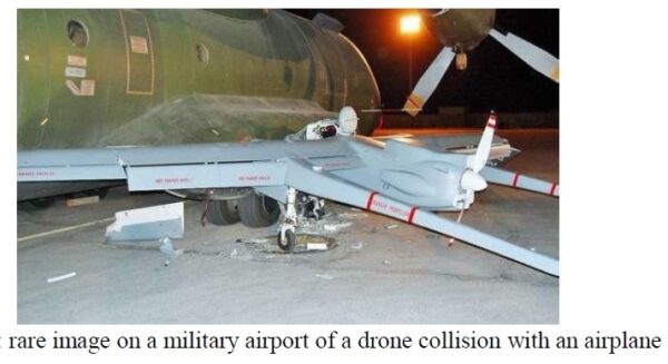
_
Currently we are witnessing a process of transition from manual control to fully automatic mode of vehicle and machinery operations. Automated systems are gradually replacing humans, and the reliability of technology is increasing. And the main reason of accidents is the human factor, although equipment failure is often the main cause of accidents for budgetary drones. In today’s unmanned aircrafts, it is impossible to single out the main problem leading to accidents, since in different segments the key reasons are different factors. For example, if we look at cheapest drones worth up to $4000, then we will immediately find out a whole bunch of problems affecting flight safety. Among them are:
-1) The lack of even the most elementary training of drone operators to comply with safety requirements;
-2) Extremely low reliability of hardware, low stability of the software.
In many cases accidents in this segment take place due to an ordinary impact of rain, electromagnetic interference, freezing or high temperatures. And the lack of basic technical training for operators does not allow preflight preparation, the assessment of the weather conditions, system condition of the vehicle, correct planning of the route and its time and, most importantly, to evaluate residual life of the components of the drone, if the flight hours are recorded at all. However, such drones are usually small and can’t cause serious harm, although they can cause death or serious injury when falling on a person.
_
For professional devices with an expensive payload and a mass of up to 55 lb (25 kg), the situation changes radically. Requirements for insurance companies to ensure the safety of insured equipment and training of pilots, as well as the supervision of personnel by companies that regularly use such drones, significantly reduce the risk of an accident. Preflight procedures are carefully performed and documented. However, the restriction on the maximum take-off weight of drones (25 kg) forces the machinery to operate on the verge of its capabilities, and any operator’s error often leads to an accident. Vehicles in this segment in most cases are already equipped with obstacle/proximity sensors that works quite reliably and efficiently, and all drones are equipped with parachute rescue systems. But due to the specifics of commercial usage quite often such vehicles operate at low altitudes and in the areas with no communication with the ground station, which does not allow monitoring the state of the drone and timely intervening to correct the unexpected situation. That’s why in this segment, accidents usually occur due to impossibility of constant monitoring of the drones and low flight altitudes over the rugged terrain with a large number of industrial facilities. In addition, long time of monitoring the flight of the drone makes operators tired and reduces their attention.
_
For heavy drones, usually all standard norms and rules are the same as for manned flights and airborne equipment. Flights are carried out by specially trained personnel, when ground equipment and aerial vehicles undergo a full cycle of services and checks, communication is mandatory reserved, including satellite channels, all equipment is checked and serviced in a timely manner. Drone missions are subject to mandatory coordination with air traffic control. Functions of the operator and all drone systems are usually duplicated and the flights are carried out at high altitudes sufficient to activate rescue systems. For heavy drones the main cause of accidents remains to be software failures, since this part of the UAV is the newest control system that is difficult to test. And it takes some time to improve it and increase its reliability based on the results of flights in different conditions. Obviously, heavy professional drones are least likely to fall into emergency situations due to a systematic approach to the safety insurance and control of the equipment.
_____
_____
Drones Crash and Fly Away:
If you just crashed your drone or had a frustrating fly away experience, you might be wondering how often these kinds of things happen. Rest assured, you’re not the only one to experience this, and unfortunately, it may not be the last time this happens to you, either. Over 60% of drone pilots report that they have crashed a drone, with many of those pilots experiencing a drone crash more than once. Drone fly aways are much less frequent, with nearly 75% of drone pilots reporting that they have never had a drone fly away from them. Some other experts estimate that one-third of all drone owners will at some point crash their drones. For some people, for example, a crash can happen once every 3 years or even 5 years. Inexperienced pilots may crash their drones much more frequently than this. It all depends on the quality of the drone and the precautions the pilot takes to prevent the drone from crashing. There are drones of all price ranges, and these come with corresponding levels of durability and flight features to prevent crash situations. Some of these drones, especially the cheaply priced ones, will crash more often than the rest, which usually has to do with the quality of the drone itself. In the case of reliable drones from well-known and trusted manufacturers (for example, DJI), the units themselves are quite reliable, and crashes are therefore much less likely to happen to you unless you’re being unusually reckless.
_
Common causes of drone crashes include:
-1. Poor weather
Heavy rain/sleet/ice/snow can damage the internal parts of your drone, causing it to crash. Also, flying your drone against high winds drains the batteries faster, not to mention fast winds can wipe your drone from the air. All these can result in a crash.
-2. Flying past your line of sight
Not being able to see your drone while flying can be disorienting and cause confusion. Your drone may end up flying into an obstacle, be it tall trees, buildings, etc. Most advanced drones have an operating range of up to 7 kilometers. However, the FAA requires drone pilots to fly within a visual line-of-sight, which is usually less than one mile. Flying too far can lead to a loss of signal due to interferences such as buildings, cell towers, and power lines. Flying too far away also drains the batteries since the drone will have to travel a very long distance when returning home. Some drones are designed to calculate and warn you when you’re going too far. However, they can’t really consider issues like strong winds which drain the batteries even faster. As a result, the batteries die mid-flight, causing the drone to crash.
-3. Pilot error
Even the most experienced drone pilots can make errors. These errors can often result in drone crashes. So to avoid this, it’s best to practice studiously until you are confident in your flying skills.
-4. Skipping pre-flight checkup procedures
Before any flight, it’s important to ensure the drone is in top condition. You need to make sure the battery is secure, the compass is calibrated correctly, the firmware is updated, checking the motors and propellers, selecting the correct flight mode. and you are receiving a proper signal. If you skip doing all these, then your drone may end up crashing. Another step that most people skip is the GPS lock. The drone has to orient itself and pick the coordinates of the base station so that it will quickly return home in case of any issues. If it doesn’t lock the GPS, it may end up crashing in other places when attempting to return home.
-5. Disconnected transmission
If the signal on your drone drops and you either stop receiving video feeds or the controller stops responding for whatever reason, you may end up flying your drone into obstacles or tall structures, causing a crash.
-6. Distractions
This is the most straightforward case. And unfortunately, it often happens, even to experienced pilots. You may be flying your drone when talking to a friend. Or without paying attention to any obstacles close to the drone.
There are instances where you need to move backwards a bit to take better shots, and you’re not aware of obstacles behind the drone. Always make sure you have your drone in sight at all times. If that’s not possible, you can have a friend help by alerting you when you’re close to obstacles.
-7. Flying FPV
Flying FPV (First-person view) is similar to flying backwards. It gives a real-time video feed of the drone’s camera. You can even purchase the goggles so that you can view the feed in 3D. However, you will most likely to run into obstacles since you’re not aware of the drone’s surroundings. It is like when flying backwards, fly the drone in open areas or have someone to alert you when you’re close to an obstacle.
-8. Interference
There are many factors that could interfere with the drone’s connection. For instance, if you have a smartphone, or a smartwatch, they send Wi-Fi signals which may interfere with the drones. Industrial machines, power lines, and cell towers also have magnetic fields that may interfere with electronic devices, including drones. These interferences make it challenging to control the drone, causing it to crash. Other sources of interference include a boat’s radar, cars, concrete and metal buildings.
-9. Flying indoors
Flying a drone indoors can be very risky, especially if you’re doing it for the first time. You are “hidden” from GPS satellites so you can’t rely on GPS when flying indoors. The sensors may also not work as they should since you may not be close to the ground. The lack of these two features makes it challenging to maintain a stable hover. There are several obstacles within buildings too, so the obstacle-detection mechanism may not be very useful. The drone will often stop when it senses a barrier, making it very challenging to fly it. When a drone loses connection, it may attempt to return home. The return home function causes the drone to go higher, crashing into the ceiling or other objects. Still, drone pilots who can fly indoors are in demand. With practice, you can comfortably do it. But don’t purchase a new drone and start testing it within your house.
-10. Birds
You do not want to get into a fight with a bird, especially predatory birds. They move fast, and they can easily maneuver in the air. Predatory birds like eagles can attack you drone or even snatch it and fly away with it.
-11. Dead batteries
When you push your drone too far, you may drain the battery before it starts its journey back. Most drones are designed to return home at 30%, and they will automatically land at 15% battery levels. Factors like wind can cause the drone to consume more battery power. It may end up landing in trees, in the ocean, on rocks, or other unsuitable places.
-12. Automatic fly modes
Auto-fly modes like Return-to-home, ActiveTrack, and automatic take-off are some of the best things that have happened in drone technology. But they are the leading causes of crashing since it’s not the same as flying the drone manually. During automatic take-off or RTH, the drone tends to move to a higher altitude. There’s no telling what the drone will bump into during these flight modes.
-13. Low flying.
This is one of the most common mistakes drone pilots make. Flying too close to the ground might seem appealing and safer because you think that you are reducing the risk of a big crash, especially if you are still new to flying. This is actually the opposite—you should avoid flying too low to the ground if you are still new to flying, as it is much harder to control the drone when it is flying closer to the ground. When the drone propellers spin, they push air downwards in order to create thrust to push the drone off the ground and take it higher and higher. When you fly too close to the ground, the air that is pushed down is bounced off the ground and back at the drone which will make it a lot harder to fly because it will be unstable, and this can cause you to lose control and even flip the drone.
-14. Too much throttle.
If you are new to any sort of hobby or sport, going too fast too soon is never a good idea. When you are new to flying it is best that you keep a medium speed at most to ensure that you always in full control of the drone. Of course, when you are more experienced you can go faster, but it is never a good idea to have too much throttle.
-15. Vortex ring state
The air that is forced down through your propellers is called downwash. If your drone descends to quickly, it will descend into its downwash which will cause it to lose lift at an increasingly rapid pace. This condition is called a vortex ring state, and if it is not corrected quickly, your drone will come crashing down. You can avoid VRS simply by controlling your rate of descent. Refer to your user manual to learn a safe rate of descent for your particular drone.
_
One of the most frightening and heartbreaking things is watching your drone fly away while you can’t do anything about it. Despite advancements made in transmission technologies, drone fly aways still continue to happen. When it does happen, it inevitably leads to your drone crashing somewhere, maybe a few miles away from you or even more if you are unlucky. A drone flyaway is essentially anytime you cannot fly your drone back to where you took off. This may mean you are forced to land the drone in an unknown location, or you may lose contact with your drone completely and not know where it has gone. As is the case with drone crashes, it is difficult to tell exactly how often drone fly aways occur. Genuine fly aways aren’t that common, with some pilots saying they flew for 5 years before experiencing their first flyaway. Most of the time, drone fly aways are due to pilot errors and faulty systems. The best thing you can do to avoid a flyaway is to make sure you do your due diligence as a pilot. Make sure you avoid making any mistakes that would cause your drone to fly away. Also, investing in a quality drone from a known and trusted manufacturer such as DJI will ensure there is a much lower chance that your drone flies away due to technical difficulties.
_
Some of the things that may cause a drone to fly away include:
-1. GPS error
GPS errors occur as a result of electromagnetic interference, and they can cause drone fly aways. So it’s important to be mindful of any communication towers near where you are flying.
-2. Battery failure
Battery failure resulting from a faulty battery that loses power too quickly can cause drone flyaways. Also, flying your drone too far out without enough power to fly back can cause flyaways.
-3. Bad weather
Bad weather is one of the most common causes of drone flyaways. If your drone is caught in a wind channel, then chances are you will lose it. Torrential rain can also be responsible for flyaways.
-4. Firmware update
A faulty firmware update on your drone or its battery can cause it to fly away. In some instances, the drone may signal that the battery is out of power even if it’s charged, making the drone attempt an emergency landing in an unexpected area.
-5. Pilot error
This is especially common for beginners who push their drones to their limits and fly them too far away so that they experience a fly away. Lack of professional flying skills can cause this.
-6. Magnetic interference
Flying your drone in an area near a power station or where there are electric poles can interfere with the radio signal transmission, and it can cause connection problems. This ultimately leads to flyaways.
-7. Motor failure
Motor failures can also cause the drone to fly away. This makes it difficult to control the drone. It may crash into objects or even fly unattainable.
______
What to do when your drone crashes:
When the drone crashes, the first step is to locate it. Just to emphasize further, you need to fly your drone within your line of sight to make it easier to find when it crashes. The tracking app and compass can also help locate it, especially if it fell in a bushy area, or an area you aren’t very familiar with. FAA also requires pilots to report crashes that amount to more than $500 in damages. Once you retrieve the drone, you can assess the damage to find out if you can fix it yourself or you’ll have to send it to the manufacturer.
______
Drone Crashes Prevention:
Crashes are almost a guarantee with drone flying. There are so many causes for drone crashes that it is almost impossible to plan for and anticipate every scenario. There are, however, several things you can do to reduce the probability of a crash:
-1. Know your environment: Before you get airborne, be sure to scout the area. Look for towers, cables supporting vertical structures, trees, power lines, buildings, and other structures that may block your drone’s flightpath.
-2. Use a spotter: If you are flying with a first person view device, consider using a spotter to watch your drone. A spotter is a second person that keeps an eye on your drone. First person views are restricted to the view of the camera that is streaming your flight. A spotter can help keep you from danger as long as you remain in sight.
-3. Use a level and stable take-off and landing location: Your drone will automatically calibrate before taking off. Make sure you have a stable, level location for taking off and landing so that your drone can calibrate accurately.
-4. Fly in good weather: Good weather means no wind, mild temperatures, and no precipitation.
-5. Battery life: If your drone’s battery is running low, you need to bring your drone home. If you don’t think you have enough juice to bring it back, slowly bring the drone back to earth and then go pick up your drone.
-6. The DJI Phantom had a known bug that would cause Phantoms to fly away upon arming. The device would think that it was out of range, and it would automatically take off in the direction of the previous GPS lock. DJI has provided a software update to fix this bug, it’s still a good idea to be aware of this in the event you’re ever flying a drone that behaves in this manner.
-7. You should never rely on a GPS lock; it is only a backup to be used in the event of an emergency.
-8. Various drone types are now equipped with crash avoidance systems, to navigate around objects and to return back to base on a programmed route.
Even if you take all of the items above into consideration, there are several other factors that can contribute to the loss of control of your drone and a subsequent crash such as random mechanical or computer failure, battery failure, unanticipated collision with wildlife, or a run-in with a zealous anti-drone advocate.
_____
______
Section-15
Drone detection:
Arial space is a resource that can be used in many different ways and ever since people have invented the first aircraft, they came up with ways that bring profit such as: means of transport for people or even objects (using planes), military activities (using fighter jets, bombers, unmanned aerial vehicles – UAVs etc.), mass media, corporate and recreational use (using UAVs). Due to the low-cost, there is a fast evolution regarding UAVs that have great capabilities, thus some threats have appeared. The first challenge is to detect these UAVs: because some UAVs are small, they can be detected very hard or they might not even be detected. Once detected, the next step is to determine whether counter measures are necessary or not. Radar surveillance remains the primary source of information in the predictable future. Other means such as optical, acoustic and laser sensors will appear depending on technology development. Most of the UAVs after being detected are vulnerable to a variety of different air defense systems: anti-aircraft artillery, shoulder-fired man portable systems and radar directed low medium and high altitude surface to air missile systems. UAVs have tactical advantages in military activities such as: being able to carry payloads, being able to record in real time during reconnaissance (this method saves more lives), being able to thermal scan using heat vision cameras or even being used for target practice for different missile systems. Due to the cost of some equipment, the UAVs have not been typically equipped with sophisticated electronic countermeasures suits and/or radar warning systems. For some of the smaller UAVs, their small size and quiet engines is an advantage because it reduces the probability of detection but for other UAVs that are bigger, it does not reduce the probability of detection. Incorporated stealth technology might help in that domain. UAVs can be used in regions where the air defense threats have already been eliminated almost completely, due to vulnerability of air defense. There are also situations, even if the air defense threats still exist, where using UAVs have more advantages, such as: providing extended surveillance in denied areas prior to conflict and/or operating early in a conflict in a tactical reconnaissance role.
_
The growing popularity of drones among consumers and commercial users provides both benefits and threats. One of the threats is the collision of drones and manned aircraft. Investigation of the damage posed by drones on aircraft shows that drones pose a greater level of threat than what existing regulations allow, as well as more serious damage than that of flying birds. It has been reported that a majority of the total incidents involving drones and aircraft took place within five miles of an airport, which is likewise prohibited airspace for all drones, regardless of the altitude at which they are flying. Most of the drones identified in reports are multirotors (e.g., quadcopters, hexacopters). Therefore, there is an urgent need to detect multirotor drones in order to adopting countermeasures. Radar is the most powerful tool that can remotely sense flying drones in the vicinity of airports. Compared with optical and infrared detection, radar can extend observational capabilities to around the-clock operations and expand spatial coverage in both distance and altitude, despite interference by bad weather such as rain, fog, and darkness, when vision is impaired.
______
Drone detection aids you:
-1. Identify pilot and drone action
-2. Alert safety staff to the drone, version, elevation, pilot and drone GPS place
-3. Improve reaction time by providing advanced warning and alarms
-4. Provide real-time observation of drone action to permit actionable intervention
-5. Document and keep data to use as proof
_____
_____
Drone detection and monitoring methods:
The rise of UAVs/drones, led to many detection techniques being developed and used as early warning signs. In fact, some of these techniques were presented and classified by Ganti et al. including their advantages, drawbacks and accuracy levels.
Analytical review of drone/UAV detection methods.
|
Method |
Operational |
Description |
||||
|
Type |
Range |
Field |
Characteristics |
Accuracy |
Advantages |
Limitations |
|
Audio-based |
25–30 ft |
Open fields |
Multi-directional microphone array |
Variable |
Detects drones /UAVs buzzing sound waves |
Short range, noise interference |
|
Video-based |
350 ft |
Urban/rural areas |
High distance image capture |
Moderate/low |
Good resolution image capture |
High detection failure, non-distinguish between birds & drones |
|
Motion-based |
50–150 ft |
Open fields |
Motion & speed detection |
Acceptable |
Successful drone detection among flying Objects |
Short range |
|
Thermal-based |
350 ft |
Urban/rural areas, Open fields |
Heat detection |
High/low |
Accurate at detecting fixed-wing drones |
Inaccurate at detecting smaller quad-copters |
|
Radar-based |
150–1500+ ft |
Urban/rural Areas, Open fields |
Heat, motion & noise detection |
High/moderate |
Highly accurate at detecting/locating large/medium drones/UAVs |
Inaccurate at detecting/locating small/tiny drones/UAVs |
|
RF-based |
200–1400 ft |
Urban/rural area, open fields |
RF signal detection/interception |
High/moderate |
Successful at detecting/intercepting signals & locating drones |
Prone to signal interference, unable to detect higher/lower frequencies |
_______
Drone detection and monitoring equipment can be passive (simply looking or listening) or active (sending a signal out and analysing what comes back) and can perform several functions, including:
-1. Detection
-2. Classification or Identification
-3. Locating and Tracking
-4. Alerting
You should be aware that not all equipment performs all of the above functionality at the same time. Detection means the technology is able to detect drones. Detection alone usually isn’t enough though. A radar that detects drones may also detect birds, for example. That’s why classification is useful. Technology that classifies drones will usually be able to separate drones from other types of objects – like planes, trains, and automobiles, for example. One step further is identification. Some equipment can identify a particular model of drone, or even identify the drone’s or controller’s digital fingerprint, like a MAC address for example. This level of identification can be handy for prosecution purposes. Being alerted that a drone is present somewhere in the vicinity is already useful. But your situational awareness, and ability to deploy countermeasures is greatly enhanced if you know the drone’s (and/or the controller’s) exact location. Some equipment will even allow you to track the drone location in real-time.
There are four main types of drone detection and monitoring equipment:
-1. Radio Frequency (RF) Analysers
-2. Radar
-3. Optical Sensors (Cameras)
-4. Acoustic Sensors (Microphones)
__
-1. Drone Detection using Radio Frequency (RF) Technology:
Many drones utilize the radio frequency (RF) spectrum to communicate with their operators. RF Analysers consist of one or more antennas to receive radio waves and a processor to analyse the RF spectrum. They’re used to try to detect radio communication between a drone and its controller. Some systems are able to identify the more common drone makes and models, and some can even identify the MAC addresses of the drone and controller (if the drone uses Wi-Fi for communication). This is especially useful for prosecution purposes – proving that a particular drone and controller were active.
RF drone discovery employs radio frequency (RF) sensors that passively listen to and track 70 MHz to 6 GHz frequencies for broadcasts of this communicating connection between the drone and the pilot (receiver) to ascertain the positioning of their drone and in certain instances, the pilot’s place. RF detection is very effective for long-range drones since RF signals can be detected from a longer distance (between 200 ft and up to 1400 ft). As such Hansen et al. stated that it is highly difficult to detect a drone that escapes RF detection, especially when drones transmit an image to the Ground Control Station (GCS) using an RF signal. However, to ensure a successful detection rate, the transmitter’s power and receiver’s sensitivity must be first evaluated and maintained.
In a radio frequency-based drone detection set-up a passive radio frequency sensor captures activity on select frequencies of the RF spectrum and relays it to a computer where specialized algorithms compare it to a database of drone protocols. The computer detects and matches the telltale frequency peaks of drone/remote communication with a high amount of accuracy, sounding the alert as soon as the drone and its remote are activated. Given that different drones have different protocols, a good radio frequency detection system can in some cases even identify the flying device’s make and model. With radio frequency detection, even if multiple drones intrude into airspace at a given moment, they can all be detected and tracked as long as they communicate with their pilot over the RF spectrum – which is the case with nearly every consumer-grade drone. A particular advantage of RF technology is that certain sensor configurations allow an administrator to discover and track the location of both the drone and its pilot. Given the restrictions placed on drone interception methods, apprehension of the pilot is probably the safest, least complicated and most effective method of neutralizing drone threats at their source.
Despite all the advantages of a radio frequency anti-drone solution, like any technology it has its limitations. Autonomous drones pose perhaps the biggest challenge to an RF-based system since an utter lack of communication between the drone and its controller would eliminate all opportunities to detect it on the spectrum. But a truly autonomous attack – involving a drone able to navigate by GNSS without even sending back its video stream or telemetry information, spontaneously adapting to changes in the environment and avoiding unexpected obstacles – is extremely complex to orchestrate and therefore unlikely. Barring any sudden technological breakthroughs, RF-piloted drones are likely to remain the device of choice for the majority of operators for the foreseeable future.
_
-2. Drone Detection using Radar:
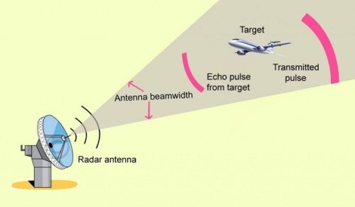
Radar systems work by emitting short pulses of signal (Radio Frequency waves). If there is an object in the way of the signal, the echoes or reflections of the signal are captured by the radar antenna and algorithms convert them into a visual on-screen format that gives an idea of encountered object’s shape, size and density. Judging by the time it takes for the signal to return the distance between the radar and the object is calculated. Radars continuously scan the sky looking for reflections and changes to detect movement and size. Reflected signals can be compared to a database for object characterization.
_
Radar waves and frequency ranges:
The spectrum of the electric magnetic waves shows frequencies up to 10^24 Hz. This range is subdivided because of different physical qualities in different sub ranges. The Institute for Electrical and Electronic Engineers (IEEE) has defined a system of IEEE frequency bands for electromagnetic frequencies used for radio and radar. The terminology is used extensively for radar, especially in civilian systems. The IEEE starts at 1 GHz, the designations below for the lower frequencies come from the International Telecommunication Union frequency bands. The IEEE frequency classification is presented in Table below:
|
Frequency range |
Wavelength |
IEEE band |
|
300 kHz – 3 MHz |
1 km – 100 m |
MF (Medium Frequency) |
|
3 – 30 MHz |
100 m – 10 m |
HF (High Frequency) |
|
30 – 300 MHz |
10 m – 1 m |
VHF (Very High Frequency) |
|
300 MHz – 1 GHz |
1 m – 10 cm |
UHF (Ultra-High Frequency) |
|
1 – 2 GHz |
30 cm – 15 cm |
L band |
|
2 – 4 GHz |
15 cm – 5 cm |
S band |
|
4 -8 GHz |
5 cm – 3.75 cm |
C band |
|
8 – 12 GHz |
3.75 cm – 2.5 cm |
X band |
|
12 – 18 GHz |
2.5 cm – 1.6 cm |
Ku band |
|
18 – 26 GHz |
1.6 cm – 1.2 cm |
K band |
|
26 – 40 GHz |
1.2 cm – 750 mm |
Ka band |
|
40 – 75 GHz |
750 mm – 40 mm |
V band |
|
75 – 111 GHz |
40 mm – 28 mm |
W band |
|
Above 111 GHz |
Millimeter wave |
|
_
Radar systems work in a wide band of transmitted frequencies. The higher the frequency of a radar system is, the more it is affected by weather conditions such as rain or clouds. The higher the transmitted frequency is, the better the accuracy of the radar system is. The higher the frequency of the transmitted signal, the higher the resolution of the radar. Radars that can run on a higher resolution consume more power but can provide a lot more accurate and detailed detection. High-resolution radars are specially created for drone discovery and monitoring. Radars constantly scan the skies, searching for changes and reflections to detect size and movement. Reflected signals could be compared to a database for drone characterization. The stored signatures may also be employed to remove objects that aren’t drone-like, similar to how radars are utilized to discover birds. This signal processing considerably improves detection functionality and allows for fewer false positives. Radar can provide effective detection of drone presence over a long range. It can be successfully paired with other technologies, such as RF or optics, to provide more thorough coverage if desired.
_
The waves and frequency ranges used by radars are illustrated in figure below:
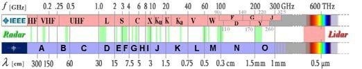
Most airports use a mix of radars on the Long Range or “L” band and Short Range or S” band in their air traffic control operations. But since drones are far smaller than any airplane or helicopter, they require a different approach. K and X Band radars are often used for low aerial surveillance, including drone detection, with X being preferable as its shorter wavelengths (8.0 to 12.0 GHz) provide higher level visibility and are more adapted to detecting small targets.
_
Radar technology has served us great for locating manned, larger, or long-distance aircraft flying within traditional airspaces. These aircrafts have a big RCS (radar cross section). But with commercial drones having an RCS the size of a bird, high resolution radars need to be specifically designed for drone detection. Some radar systems can detect objects (and drones) that have a radar cross-section (RCS) of just 0.01 m². Some of the more popularly used drones usually have an average RCS of about 0.01 to 0.02 m². For comparison, birds, in general, have a radar cross-section of about 0.01 to 0.001 m². The biggest problem when detecting such a small object is whether or not it is a drone or a bird.
_
Radar Cross Section (RCS):
Radar Cross Section (RCS) is a measure of how detectable an object is by radar. The signal sent by the radar is reflected off the surface of the detected object, and captured by the radar receiver. The more of the signal that is reflected back from the object, the more accurately a radar can detect an object. The reflectability of an object is determined by several factors, the most important of which are size of the drone and the amount of reflective materials and components. Usually radar signals pass through materials like plastic, but are reflected off materials like metals. In the case of commercial drones, the RCS is low as the only reflective components are the batteries and motors of the blades. RCS does not necessarily correlate with the actual size of the object; it simply measures how much signal does it reflect back to the radar. For example, a B-2 stealth bomber is considered to have less RCS than a drone.
_
If radars are being used for target detection in aerial space, it is important to take into consideration two aspects: the target and the radar itself. When the radar is used for Low Slow and Small (LSS) target detection, the most important factor is the Radar Cross Section (RCS) of the target. The limits of the radar lie in its carrier frequency f, or wavelength λ. The additional influences (internal and external) are inquiries of particular radar technical solution, tactical employment within the terrain and combat formation, atmospheric condition, proficiency of crews etc. For a particular target to be detected, a proper wavelength which corresponds to the appropriate RCS, must be selected. The radar usability of certain wavelengths in view of the expected target range detection is illustrated in figure below:
Radar Band versus Target Distance:
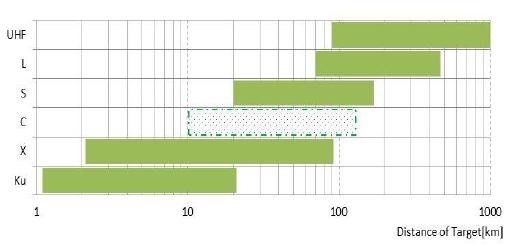
Using the figure above it is not viable to say in which band it is possible, or impossible to detect a certain object. Explicit influence of atmosphere to the high frequency energy propagation is taken into account. The standard requested parameters of the output signal (accuracy) needed for further processing and following engagement by active air defense means is considered.
_
Pulse-Doppler Radar:
An object moving closer or farther away from the radar transmitter creates a “Doppler Effect” – a distortion or bend in the radio wave. A Pulse-Doppler radar drone detection system emits periodic bursts of radio waves and measures the bends in the returning radar signal to estimate the distance, speed and characteristics of a detected object. Drones however are mostly made of plastic which is invisible to radar and only their metal cameras, batteries and motors provide a platform for the radar signals to bounce off.
Here’s where Micro-Pulse Doppler, an even more precise system, comes in – emitting a series of pulses very close together to get a more accurate picture of the monitored target, a necessary feature when attempting to identify objects as tiny as a drone camera or motor. By using this technique, radar can identify drones easily, and, most importantly, distinguish drones from birds.
_
Can traditional radar detect drone?
Traditional radar technology is very good at picking up objects with a large radar cross-section (RCS), like manned long-distance aircraft. But it can struggle to detect increasingly miniaturized commercial drones, many of which have the RCS the size of a bird. Even if a traditional radar system can detect very small objects, most only tell you that an object is there, not what it is. A target with the RCS of a bird could easily be confused with an actual bird. Radars that can’t automatically classify whether an object is a bird or a drone could cause confusion and waste time. Drones are also capable of flying in huge swarms. Most radars simply can’t keep track of that many fast-moving small targets at the same time.
Can high resolution radar detect a drone?
Yes, High-resolution radars are specifically designed for drone detection and tracking. Reflected signals are analyzed and compared to a database for drone characterization. The stored signatures can also be used to eliminate objects that are not drone-like much like how radars are used to detect birds. This signal processing greatly improves detection performance and allows for fewer false positives. Advanced technologies like Machine Learning and AI, can further improve radar detection of drones and decrease the number of false positives. Radar can also provide real-time tracking by providing the GPS location of the drone detected. The GPS location is calculated based on the GPS location of radar sensor, and distance and angle at which object is detected from the radar sensor.
How far can a radar detect a drone?
The range for each drone threat will vary based on the RCS. Radar can detect drones with a larger RCS at a greater distance that a drone with a small RCS. Typically, radar systems can detect drones up to 1 mile away for a Phantom 4 Size drone. The range is affected by Drone size. Radar detection range is also slightly affected by weather conditions like rain and fog.
Can a radar detect all types of drones?
Yes, radar can detect all types of drones regardless of whether it uses RF communication, GPS preprogramming or Wi-Fi/Cellular communication. The only limit to radar detection is the size of the drone. A radar won’t be able to detect very small toy drones, but these drones won’t pose a significant threat since they can’t carry a payload.
Does a radar give false positive while detecting drones?
Yes, a radar can give a false positive while detecting drones. Initially a radar does not know whether an object is a drone. The reflections from the objects captured by the radar receiver is compared with a database of drone signatures and if the signatures match then the object is classified as a drone. There can be instances where an object with a RCS that seems like a drone is detected and categorized as a drone, when it might actually be something else. For this reason, it is important to layer radar drone detection with RF & Visual detection, so that security teams can confirm whether an alert is a real threat or a false positive.
Will one radar sensor give full visibility and detect all drones in an area?
It depends on each radar sensor. Some sensors only have a 90 degree field of vision, some have 120 degrees field of vision. Some radar systems are set up to rotate where they analyze the environment in 90 degree angles but achieve 360 degree coverage by rotating and sending signals in all directions.
Do drones appear on Air Traffic Control radars?
Many ATC radars are designed to ignore smaller objects. Hence a drone is most likely not going to appear on an ATC radar. Many ATC radars are designed to detect larger objects and planes with transponders. However, airports can be equipped with different types of radar systems that may be able to locate a drone that is flying in their area. With that being said, airports are one of the restricted areas where drones should not be used. Flying a drone over a restricted area can result in legal repercussions, and it should be avoided.
Do Military Drones appear on radar?
Military drones do appear on radars. Although the smaller radar cross-section and lower speed of military drones are a well-known problem, certain radars can be adjusted to look for military drones and ignore other flying objects.
Do drones appear on a Ship’s radar?
A whole different ballpark can be ship radars because ship radars are frequently designed to detect almost everything. Many fishermen use their boat radars to locate birds (as this leads them to fish). However, these radars may not always have the necessary resolution to detect a single bird. On the other side, drones are definitely not small feathery animals. Larger-scale drones like the DJI Matrice are big enough to be detected by radars, while smaller models like the DJI Mavic PRO may be harder even impossible to detect.
_
Where Radar Falls Short:
Drones are smaller than manned aircraft and tend to fly close to the ground which makes them very difficult for all but the most specialized radar to detect. Such systems do exist, but they often present additional issues such as cost, high-false alarm rate and potential interference:
Cost – The most effective drone detection radar systems are more specialized X band Micro-Pulse Doppler models. The initial outlay can be quite costly for a security administrator. But other costs are a result of the very nature of radar. Since it is an “active” or emitting detection technology, the only way for it to work is to be constantly on. Thus, it consumes considerably more energy than a passive system. This also means that radar coverage can knocked out completely if its power supply is disabled by weather, sabotage or malfunction.
False Alarm Rates – Due to their comparable size and flying patterns, birds tend to create a lot of false alarms when entering the radar coverage.
Potential Interference – Radar’s active nature and the fact that some communications use the same frequencies may mean unintended interference with local broadcasts and the need to obtain a license to operate the system
_
Detection of small drones with mm wave radar:
Radar systems in the millimeter wave range are ideal for surveillance tasks in the immediate environment, particularly when visibility is poor. In comparison to the optical and IR spectrum, millimeter waves have good penetration characteristics in the presence of fog, smoke or dust. Moreover, radars are active sensors that operate independently of external lighting and the time of day. Their large bandwidths allow high, distance-independent resolution, which not only facilitates the detection and tracking of moving objects but also their classification. Hence, the systems are well suited for the tracking of air drones: the skyward alignment of the sensor and the associated reduction in disturbing clutter also facilitates the detection of smaller unmanned aircraft systems (UAS). These include the multicopters, ranging from bi/tricopters with a very low load capacity and quad/hexacopters to octocopters with a payload of 10 kg and more. The growing popularity of these aircraft, which can also be purchased by private individuals, causes growing problems in air traffic and entails considerable risk potential as utilization for criminal or terrorist purposes cannot be excluded.
From a radar perspective, the small drones can be characterized with regard to their radar backscatter cross section (RCS). The smallest nano UAS have an RCS of less than 0.01 m². These, however, do not pose a great threat. Drones with an RCS from 0.01 m² or 0.1 m² upwards (based on a reference frequency of 10 GHz) – these are known as micro or mini UAS – are more relevant are easier to detect with radar. A high-precision analysis of the Doppler spectrum also allows a distinction to be made with regard to the number of rotors and the rotor type thus facilitating the determination of the drone class.
In test measurements using mini and micro UAS (quad and hexacopter), the capabilities of the existing millimeter wave radars (Multi Channel Radar for Perimeter Surveillance) and SSRS (Scanning Surveillance Radar System) in terms of their ability to detect and track small drones was investigated. Both sensors use the FMCW principle (Frequency Modulated Continuous Wave) with a medium frequency of 94 GHz and an output power of 100 mW. A radar bandwidth of up to 1 GHz allows a range resolution of 15 cm. The system was designed with a view to achieving the highest possible levels of mobility and flexibility. This applies in particular for the low power requirements; the 12-volt connection in a car is sufficient to operate the system.
The sensors, which were originally designed as active protection systems or for military camp protection, were only modified slightly for the new measurement task. The evaluation of the data revealed that the systems are ideally suitable for the detection and precise location of several drones of both classes (micro and mini UAS) at close range. In addition, the SSRS system offers live tracking for up to four UAS, as the corresponding software algorithms and the required interfaces already exist.
The good results reveal that the further development of the sensors for the purpose of detecting small drones is very much worthwhile. Improvement potential does exist, particularly in the area of signal processing, e.g., localization and classification of objects. An increase of the output power (to a realistic value of 1 W) can also significantly extend the coverage area of the radar systems. Finally, elevation resolution for the SSRS system is an essential requirement.
__
Interference of Radar Detection of Drones by Birds, a 2019 study:
Recently, consumer drones have encroached upon airports and pose a potential threat to aviation safety. Radar is an effective remote sensing tool to detect and track flying drones. Radar echoes from flying birds are assumed to be clutters when a radar is detecting drones. Yet, few studies have reported how radar echoes from flying birds interfere with the detection of drones, how similar radar cross section (RCS) and flight feature of birds and drones are, and why the flying birds cause trouble when radar identifies signals from the drone. In this study, authors collected 3900 ×256 of Ku-band radar echoes of flying birds and consumer drones. The targets consist of a pigeon, a crane, waterfowl, and a DJI Phantom 3 Vision drone. Authors compared the maximum detectable range of birds and drones, the time series and the Doppler spectrum of radar echoes from the birds and the drone, considering oncoming and outgoing radar data with respect to radar location. The statistical results indicate that flying birds have similar RCS, same velocity range, similar signal fluctuation, and approximate signal amplitude. The results of radar automatic target recognition (ATR) illuminate that the identification probability of airborne drones will be lower due to the interference of the radar signal by flying birds. Above all, these facts confirm that flying birds are the main cause of interference when a radar is detecting and identifying airborne drones.
__
-3. Drone detection using Optics (Camera):
Optics allow visual and/or infrared thermal imaging detection and characterization of approaching drones and drone payloads. Like radar, optics can be successfully combined with RF technology to provide more thorough coverage. Optic detection uses cameras to spot intruding drones. The cameras can be divided into several types including standard visual security cameras, but Electro-Optic Infrared Thermal Imaging (EO/IR) cameras are the most commonly employed for CUAS. They work by using mid-wave Infrared Radiation (MWIR) or long-wave Infrared Radiation (LW IR)) to scan the protected space and specialized algorithms to spot heat differences between drones and their environment. The plastic casing protecting a drone’s inner workings is not a heat conductor and the drone’s motor produces far less heat than one might imagine. However, the lithium battery that powers most consumer UAS generates a sufficient amount of heat to be spotted by a human operator using an infrared camera. Infrared cameras are useful from the moment there’s a difference in temperature and can “see” in total darkness without supplemental illumination, which makes them ideal to use at night or in missions where staying inconspicuous is imperative.
The chief issues confronting an optic anti-drone system are high false alarm rates and weather-related issues. Cameras employing visual scans have shown consistent issues with false alarms due to the difficulty of differentiating between COTS drones and similarly sized airborne objects like birds, or even leaves. To avoid this, a very large database against which the algorithm can compare the detected object is necessary along with heavy processing power. Some of these challenges may be mitigated by the complementary use of infrared thermal technology to ferret out drones by detecting their heat signatures. But thermal drone detection can be adversely affected by weather conditions. High humidity, rain or dense fog can severely reduce the effectiveness of infrared thermal drone detection as the infrared radiation is scattered by water particles in the air.
_
-4. Drone detection using Acoustic (microphones):
Acoustic UAV detection sensors pick up vibrations made by the propellers and motors of drones and can match them to a database of drone acoustic signatures. It works by capturing vibrations which drone propellers and motors emit during flight, on a preset noise frequency band. Composed of arrays of multiple microphones, the acoustic drone detection sensors transmit the vibration to a database which uses algorithms to calculate azimuth, thus locating the sector in which the drone is operating and sometimes even the make and model of the drone. If the system is fitted with a large enough and regularly updated database, a large majority of drone models on the market can be identified. Acoustic technology is lightweight, easy to install and can be used in mountainous or highly urbanized areas where the presence of hillsides or tall buildings might block some other detection methods. It is entirely passive and thus doesn’t interfere with ambient communications and uses little in the way of electric power.
While acoustic detection technology’s advantages: lightweight, low power use and passive nature, make it an attractive option, it’s reliance on acoustic signatures is actually its biggest flaw. Drones are becoming ever more silent as the technology evolves and market pressures demand a quieter device. And a homemade drone, constructed from spare parts, may not show up at all since it might not match anything in the database. In addition, acoustic sensors can often detect drones, particularly in noisy environments, only at relatively close distances (less than 1KM in many instances), which isn’t enough to avert an attack or collision. Given these flaws, an acoustic system might be better suited as a backup to more reliable radiofrequency-based technologies like RF or Radar detection.
_
No “Perfect” Solution:
Each technology has pros and cons and experience has taught us that there is no single “foolproof” choice. Nevertheless, it is possible to find an extremely effective solution and set-up adapted to your particular situation, particularly if you opt to mix complementary primary technologies (i.e., radio frequency for detection/geolocation and radar to detect autonomous drones) to assure maximum coverage and if the budget permits, secondary technologies (optic and acoustic) to fill in any potential gaps. As a stand-alone option, nothing beats the effectiveness and cost-to-benefit ratio of radio frequency, which remains the solid foundation of the vast majority of drone detection solutions and for good reasons.
______
______
Section-16
Anti-drone measures:
The air defense systems that have traditionally been used to protect airspace are mostly designed with inhabited aircraft in mind—that is, they are optimized for detecting, tracking, and shooting down large fast-moving objects. As a result, they cannot always pick up small, slow, low-flying drones. Even formidable air defense systems have sometimes failed to bring down rudimentary unmanned aircraft; in July 2016, a simple Russian-made fixed-wing drone that flew into Israeli airspace from Syria survived two Patriot missile intercepts, as well as an air-to-air attack from an Israeli fighter jet. In civilian airspace, drones aren’t yet required to carry transponders, so they cannot be detected and tracked with existing air traffic control systems. Relying on visual observation to detect drones is equally ineffective; at a distance of several hundred feet, drones can become all but invisible to the naked eye.
_
The use of drones, by malicious entities to conduct physical and cyber-attacks, threatens the society by breaching the privacy of its residents along with threatening the public’s safety. In fact, various technical and operational drone properties are being exploited and misused for potential attacks. This includes performing critical operations based on offensive reconnaissance, as well as surveillance aimed at tracking specific people and certain properties, causing safety and privacy issues. It is essential to prevent the use of drones above residential areas, which leads to privacy breaches through reckless behaviours, since the captured footage may be used for either scamming and/or blackmailing purposes. Safety breaches may also occur in case a drone malfunctions and crashes into a nearby house, park, parked car or civilians. This would result into material loss/damage and human casualties/ fatalities.
Moreover, drones are predominantly used to target guest Wi-Fi connections and/or short-range Wi-Fi, Bluetooth and other wireless devices, such as Bluetooth-connected keyboards. Such connections are not protected due to current security measures, which assume that no one could get close enough to compromise them or to access internal networks via wireless signals. These assumptions lead to weak single factor authentication and the use of typical passwords that can be easily cracked, especially with the absence of encrypted connection. This makes it as easy to intercept information in a private building and in a public café. An attacker would leverage such vulnerabilities to breach security, safety and/or privacy.
Figure below lists the main drone security threats as well as the corresponding techniques to overcome them.
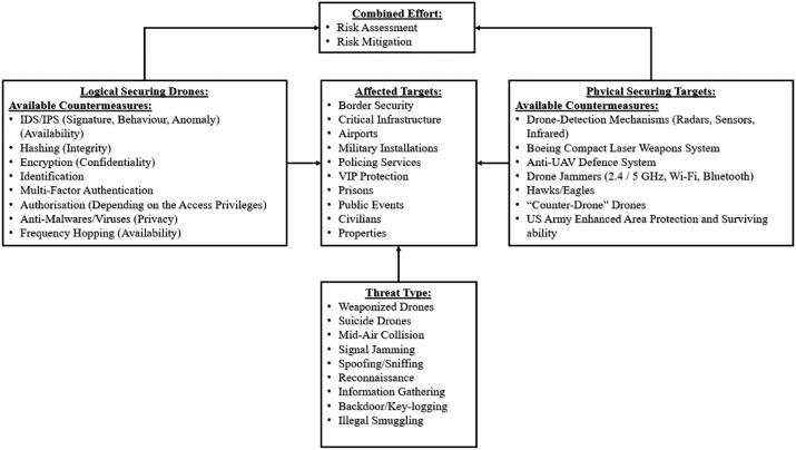
_
Since the number of incidents between drones and airplanes increased from 6 to 93 in 3 years (2014 to 2017), it has become essential to address the security and privacy breaches at the highest national level. This includes adopting very strict approaches that limit the drone’s ability to gather images and record videos of people and properties without a clearly authorized permission. In fact, since many people do not read the manual properly, they are incapable of reacting properly in case of a malfunction. In the UK, for example, if a drone weights more than 250 g, its users are supposed to take safety awareness tests and the police is given the authority to stop any drone when suspected of a criminal activity. Also, the British government announced rules to ban drones from flying within five kilometers of British airports to prevent any possible collisions with airplanes.
_
Anti-Drone Technology and CUAS (Counter-UAS) systems:
Anti-drone systems are used to detect and/or intercept unwanted drones and unmanned aerial vehicles (UAVs). Hostile drones may be used to deploy explosives, smuggle contraband or gather intelligence on sensitive assets, and the proliferation of low-cost UAVs has led to an increase in incidents. Anti-drone technology is deployed to protect areas such as airports, critical infrastructure, large public spaces such as stadiums, and military installations and battlefield sites.
CUAS Drone Detection and Tracking Methods:
The presence of rogue drones can be detected by several different methods. Specific RF transmissions on UAV-specific frequencies can be scanned for, and individual makes of drone can even be identified by their command protocols. RF scanning will not detect all drones, as aircraft that have been programmed to fly autonomously may not be sending or receiving RF transmissions from a pilot or base station. Electro-optical (EO) and infrared (IR) sensors can be used to detect drones based on their visual and heat signatures, respectively. These sensors may need to be paired with machine vision and artificial intelligence algorithms that can reduce the risk of false positives and false negatives. EO/IR gimbals for anti-drone systems are available that combine multiple cameras into one payload and can be mounted on a fixed site or moving vehicle. Acoustic CUAS detection systems compare the noise made by drone propulsion systems to a database of sounds. Their accuracy can be affected by other noise in the vicinity.
Anti-Drone Radar (vide-supra):
Radar detection can also be used to detect UAVs. Traditional military and aviation radar systems, which are designed to pick up large aircraft, may struggle to pick up smaller drones, or to distinguish them from other objects such as birds. They may also find it difficult to deal with drones that move slowly or hover. Modern anti-drone radar systems may use a variety of radar technologies, including ESA (electronically scanned array), staring radar, and micro-Doppler, depending on requirements for range, size of protection zone, number of simultaneous targets to track, and ability to deal with environmental clutter. They provide 3D airspace tracking and use sophisticated signal processing techniques to accurately detect and identify drones.
As each detection method has its advantages and drawbacks, multi-sensor anti-drone systems will combine different sensor types along with sensor fusion algorithms to provide a complete integrated solution.
_
Once a rogue drone has been detected, many counter UAV systems provide the option to neutralize it. Anti-drone weapons systems use guns or missiles in conjunction with a targeting system to shoot down the drone. New military systems are also under development that will use a high-powered laser or microwave to destroy the target drone. These methods cannot be used in built-up or civilian areas, and the debris from a destroyed target must be taken into account. Other physical countermeasures include anti-drone nets and weighted lines, which may be launched with compressed air or propellant from a handheld device or from another UAV. Nets may be used in conjunction with built-in parachutes to capture the drone and neutralize the threat without destroying it, which can result in useful evidence or intelligence.
Kinetic counter UAV devices can be dangerous and as such are mostly limited to remote areas and military applications. Several methods of defeating drones can be utilised that do not result in the destruction or uncontrolled rapid descent of the drone. Signals vital to the operation of the drone can be interrupted by generating other electromagnetic signals in the vicinity of the aircraft. The RF link between drone and pilot can be disrupted in this way, as well as the satellite link used for GNSS/GPS navigation. Depending on the make, drones that have been jammed in this way may hover in place, descend safely to the ground, or return to a set “home” location. Anti-drone jamming systems may be fixed site or vehicle-mounted, and are also available as handheld devices similar in feel and operation to rifles and small arms. CUAS jamming systems can disrupt legitimate transmissions such as air traffic management, so care must be taken in certain environments. Spoofing can be used to take control of a UAV’s GNSS receiver and divert its flight path. Some drones can also be hacked, using malware to exploit security vulnerabilities in the firmware and take control. These counter UAV methods will not work for all drones, as many are fitted with anti-jamming technology and use highly secure embedded systems and encrypted communications.
Anti-drone guns are handheld devices that interfere with RF communications, often disrupting multiple RF bands simultaneously. They may also disrupt GNSS signals, including GPS and GLONASS.
______
______
Ant-drone methods:
It’s important to note that, although the technology is available, current regulations in most countries forbid the use of any of the following technologies to be used for neutralizing drones. Exceptions are made for military or law enforcement agencies.
_
-1. RF Jammers:
An RF Jammer is a static, mobile, or handheld device which transmits a large amount of RF energy towards the drone, masking the controller signal. This results in one of four scenarios, depending on the drone:
-Drone makes a controlled landing in its current position
-Drone returns to user-set home location (which could be set to a target position instead of home)
-Drone falls uncontrolled to the ground
-Drone flies off in a random uncontrolled direction.
_
Advantages:
-Reasonable, medium-level pricing.
-Neutralization that doesn’t involve projectiles.
Potential problems:
-The range is short.
-The signal could jam other types of radio communications.
-Unpredictable drone action could result.
-A drone might proceed to its target, which may result in a disaster.
_
There are plenty of laws and regulations which can overlap with the drone jamming technology and plenty of communication laws which cover the disruption of communication frequencies open to the public:
US code
“No person shall willfully or maliciously interfere with or cause interference to any radio communications of any station licensed or authorized by or under this chapter or operated by the United States Government.”
- 47 U.S. Code § 333 – Willful or malicious interference
This means that the person operating the jammer will have to be licensed and authorised by the federal government. If you were to use a drone jammer on a drone you run the risk of causing the drone to fall out of the sky and therefore cause property damage and personal injury. This could open up the opportunity for people to sue you based on the damage that you are able to cause using a drone jammer.
There are a range of use cases for who may want to use a drone jammer. This includes security personnel, military personnel, homeowners, private property owners, and wildlife or park rangers.
_
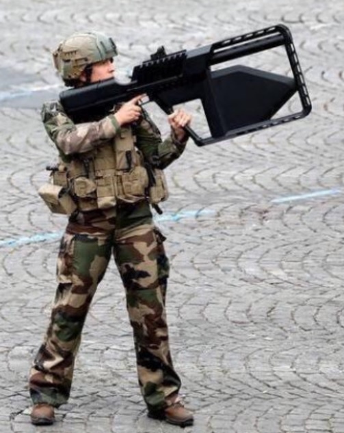
While the photo above might look photoshopped, these are indeed real soldiers with real anti-drone guns. The soldier on the left appears to be wielding a Droneshield DroneGun Mk111. It works by disrupting the connection between the drone and its pilot’s controls at a distance of up to 2.5 km away. DroneGun Tactical provides a safe countermeasure against a wide range of drone models. It allows for controlled management of drone payload such as explosives, with no damage to common drones models or surrounding environment due to the drones generally responding via a vertical controlled landing on the spot, or returning back to the starting point (assisting to track the operator).
_
Can you protect against drone jammers?
If you are a drone pilot there are a number of ways that you can protect your drone against jamming signals. A scientific paper published in 2016 highlights a technique called hardware sandboxing. This technique was inspired by the concept of software sandboxing which targets potentially malicious activity in hardware Internet providers and components. Hardware sandboxing is performed through a combination of checker components and virtual resources which try to counteract the effects of the jamming signal. They created a virtual receiver signal generator to isolate the potentially jammed receiver from the rest of the system which controls the drone. This was effective in detecting and reacting to drone jamming attacks.
_
-2. GPS Spoofers:
GNSS vulnerability extends beyond signal blockage and jamming. Spoofing attacks, in which counterfeit GNSS signals are generated for the purpose of manipulating a target receiver’s reported position, velocity, and time, have been demonstrated with low-cost equipment against a wide variety of GPS receivers. A radio signal sent from a half-mile away deceives the GPS receiver of a UAV into thinking that it was rising straight up. In this way, the UAV’s dependence on civil GPS allowed the spoofer operator to force the UAV vertically downward in dramatic fashion to capture it. The party doing the spoofing can take control of the drone. By dynamically altering the GPS coordinates in real-time, the drone’s position can be controlled by the spoofer. Once control is gained the drone can be directed to a ‘safe zone’, for example.
_
-3. High Power Microwave (HPM) Devices:
High Power Microwave (HPM) devices generate an Electromagnetic Pulse (EMP) capable of disrupting electronic devices. The EMP interferes with radio links and disrupts or even destroys the electronic circuitry in drones (plus any other electronic device within range) due to the damaging voltage and currents it creates. HPM devices may include an antenna to focus the EMP in a certain direction, reducing potential collateral damage.
_
-4. Nets & Net Guns:
Firing a net at a drone, or otherwise bringing a net into contact with a drone stops the drone by prohibiting the rotor blades. There are three main types:
-Net Cannon fired from the ground: can be hand-held, shoulder-launched, or turret-mounted. Anywhere from 20m to 300m effectiveness. Can be used with or without a parachute for controlled descent of the captured drone.
-Net cannon fired from another drone: overcomes the limited range of a net cannon on the ground. Can be difficult to capture another moving drone. Normally used with a parachute for controlled descent of the captured drone.
-Hanging net deployed from a ‘net drone’. The drone is captured by manoeuvring the friendly net carrying drone towards the rogue drone. The ‘net drone’ will normally be capable of either carrying the rogue drone to a safe zone, or if it is too heavy, can release the captured drone with or without a parachute for controlled descent.
The SkyWall 100 is a fantastic piece of kit. They are effectively net-launching bazookas that can take out drones up to 100 meters away. Each unit weighs around 22 pounds (10 kg) and is designed to be fired from the shoulder. They use compressed air to launch their specially designed nets with pretty good accuracy. The unit incorporates predictive algorithm systems to help the operator lock on and hit the target drone with ease. Once the net has successfully enveloped the target drone, it deploys a small parachute to bring the target safely to the ground for capture.
_
-5. High-Energy Lasers:
A high-powered optical device which produces an extremely focused beam of light, or laser beam. The laser defeats the drone by destroying the structure and/or the electronics. Instead of blowing a target to pieces, laser weapons work by burning through its outer layers over a number of seconds. This causes the target to destabilise or weaken, damaging key guidance controls inside. This is hard-kill. The soft-kill anti-drone lasers are somewhat like anti-drone jammers. Except instead of interfering with a drone’s control signals, they interfere with its camera.
_
-6. Birds of Prey:
Eagles have been trained to capture S-UAS and COTS drones. Birds have been used for hunting by man for thousands of years. This solution takes advantage of the natural hunting instincts of the eagles being used. This can be a low-tech solution but requires a lot of manpower for training (at least 1 year per bird) and for maintaining the birds of prey.
Pros: If the birds are available at your location, interception of the drone can be quick and accurate with low risk of collateral damage. There are many similarities with military working dog (MWD) teams and K9 training teams so they could potentially be operationalised for this solution.
Cons: Difficult to scale due to limited amount of birds available, man-power intensive training and maintenance, birds could be a hazard themselves at airports.
_
Integrating All Together:
It’s more than likely that the best counter-drone solution for you is going to be a mix of the above technologies. Good examples of counter-drone C2 systems are ESG’s Taranis, and Operational Solutions’ FACE.
____
Summary of anti-drone measures are depicted in the table below:
|
RF Jamming |
Disrupts the radio frequency link between the drone and its operator by generating large volumes of RF interference. Once the RF link, which can include Wi-Fi links, is severed, a drone will usually either descend to the ground or initiate a “return to home” maneuver. |
|
GNSS Jamming |
Disrupts the drone’s satellite link, such as GPS or GLONASS, which is used for navigation. Drones that lose their satellite link will usually hover in place, land, or return to home. |
|
Spoofing |
Allows one to take control of or misdirect the targeted drone by feeding it a spurious communications or navigation link. (For our purposes, we include within this category a range of measures such as cyber attacks, protocol manipulation, and RF/GNSS Deception). |
|
Dazzling |
Employs a high-intensity light beam or laser to “blind” the camera on a drone. |
|
Laser |
Destroys vital segments of the drone’s airframe using directed energy, causing it to crash to the ground. |
|
High Power Microwave |
Directs pulses of high intensity microwave energy at the drone, disabling the aircraft’s electronic systems. |
|
Nets |
Designed to entangle the targeted drone and/or its rotors. |
|
Projectile |
Employs regular or custom-designed ammunition to destroy incoming unmanned aircraft. |
|
Collision Drone |
A drone designed to collide with the adversary drone. |
|
Combined Interdiction Elements |
A number of C-UAS systems also employ a combination of interdiction elements to increase the likelihood of a successful interdiction. For example, many jamming systems have both RF jamming and GNSS jamming capabilities in the same package. Other systems might employ an electronic system as a first line of defense and a kinetic system as a backup measure. |
______
What if you shoot down a drone?
Sometimes, individuals have shot down UAVs hovering above their properties, a choice that possibly could create severe fiscal woes. Remember, uncrewed aircraft of any dimension are protected by national law. Furthermore, a person accused of shooting a drone could confront local fees too. What can you do about a drone which you believe is your privacy? Sometimes, there might not be much you can do. People do not really understand how restricted their rights to privacy are lawfully. You’ve got a right to privacy only when you’re someplace where you’ve got a reasonable expectation of privacy, by way of instance, within your house rather than out in people. Consequently, if you’re swimming or swimming on your fenced yard, but you’re observable from the atmosphere by airplanes or helicopters, courts have held that you don’t possess a reasonable expectation of privacy. The identical reasoning would apply to drones. Likewise, you do not have a reasonable expectation of privacy if you are facing an open window.
____
____
Military anti-drone countermeasures:
Examples of military techniques to counter drone attacks include the use of old Soviet anti-aircraft weaponry i.e., ZSU-23-4 Shilka, and surface-to-air missiles (SAM S-300/S-400 missiles) to shoot down Turkish drones over Idlib and Syria. Recent studies revealed how terrorists are shifting towards a new asymmetric warfare called drone warfare. For this reason, different military countermeasures were suggested and implemented to overcome the UAV security threats. The Pentagon issued new guidelines allowing the military to bring down any drone flying near or over a US military base. Anti-drone weapons can be categorized into two groups based on their capabilities: “soft kill” and “hard kill.” Hard-kill anti-drone weapons include Kinetic Energy Weapons (KEWs), while soft-kill anti-drone weapons include electronic-warfare measures (e.g., jamming) and Direct Energy Weapons (DEWs) such as lasers. Lasers can be hard-kill weapon too.
_
Military anti-UAV/UAS techniques are depicted in the figure below:
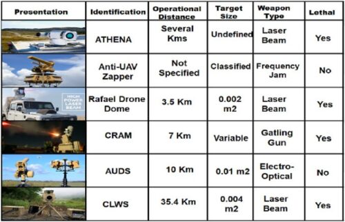
_
Here is a list of most recent real-time highly accurate anti-drone countermeasures used by military:
- SMASH 2000: The SMASH 2000 system is fitted on a rifle and can be used to bring down drones. The Israeli system recognises, tracks and engages targets in the air with precision. The Israeli and US forces are among those who are using the system that can track and hunt down multiple targets. Developed by the Israeli company Sharpshooter, the SMASH system allows any soldier on the ground to be equipped with anti-drone capabilities as the system can be easily mounted on rifles. SMASH 2000 Plus provides an inimitable hard-kill solution against the growing threat of drones, and delivers proven ability to hit any ground or airborne targets and eliminate the threat quickly and effectively.
- ATHENA: or Advanced Test High Energy Asset, is an upgrade to the Area Defense Anti-Munitions (ADAM) system, which is a 30-KW laser weapon system that uses the 30-KW Accelerated Laser Demonstration Initiative (ALADIN) laser, which combines the power of three 10-KW fiber lasers into a single beam. ATHENA can also operate on 10 and 20 KW levels. This system is funded and tested by Lockheed Martin and it can operate over thousands of meters.
- Rafael Drone Dome: is a counter-UAS operational mobile system used to detect, track and eliminate hostile drones (even when maneuvering) as small as 0.002 m2, at a distance of 3.5 km, using a high power laser beam, enabling a soft and hard-kill. Britain became the first customer of Rafael’s anti-drone systems in 2018 when it purchased six Drone Domes, believed to be worth a combined $20m., to protect sensitive military installations and sites on which British armed forces are deployed.
- Boeing Compact Laser Weapons System (CLWS): is used to track and disable UAVs through the use of a laser weapon system to acquire, track, and identify potential targets, or even destroy them. Its main advantages are based on the fact that it is portable and it can be assembled in almost 15 minutes. Moreover, it can destroy a target from 22 miles within 10-seconds, using an energy beam of 2, 5 or 10 KW.
- Anti-UAV Defence System (AUDS): is an anti-UAV system developed by UK defense companies to address the increasing UAV threats. It is classified as a smart-sensor and effector package with the ability to remotely detect small UAVs, track and classify them before providing the option to disrupt their activities. It was used around UK airports and it is now being deployed in New Zealand. Among its characteristics, it contains an electronic-scanning radar aimed at detecting targets, an electro-optical video for target tracking and classification, along with a software known as intelligent directional RF inhibitor. Its detection range is up to 10 km, with a minimum target size of 0.01 m2. Moreover, it is able to operate in various weather conditions, and 24 hours a day.
- Counter-Rocket and Mortar (CRAM): is a missile-based counter rocket, artillery, and mortar defense system developed as part of the US Army Enhanced Area Protection and Surviving (EAPS) technology, with an expansion including threats from unmanned aircraft systems or drones. In fact, CRAM is the land version of Phalanx CIWS. Among its characteristics is the use of a 20mm HEIT-SD (highly explosive incendiary tracer, self-destruct), 30, 50 or 76mm Driven Ammunition Reduced Time (DART) of flight, cannon to launch command guided interceptors using a precise tracking radar interfero-meter as a sensor, a fire Control Computer (CC), along with an RF transceiver to launch the projectile into an engagement ’basket’. Computations are then made on the ground, and the RF sends the information back to the CC.
- Non-kinetic Methods: other countermeasures include non-kinetic methods such as the use of radio waves to disrupt drone flights. However, due to the rules of engagement being classified, it is hard to tell under what options and weapons the army might use them.
- Anti-UAV Zappers: were sent and used by the British forces on the frontline in Iraq and Syria to protect Western and American forces against drone attacks emanating from the Islamic State of Iraq and Syria (ISIS). By 2017, Zapper was responsible for downing more than 500 drones through radar jamming.
- ELI-4030 Drone Guard: ELI-4030 Drone Guard, developed by ELTA Systems, is yet another high-tech solution to the potential security threats offered by drones. Drone Guard employs a multi-layered approach where the sensors perform designated functionalities. The detection and classification layers include: a state-of-the-art Active Electronically Scanning Phased Array (AESA), multi-mission 3D X-band radar; COMINT/jammer to exploit UAV data link communication; and a high-performance day/night electro-optical (EO)/ infrared (IR) sensor to support enhanced classification and target acquisition, The interception layers include soft-kill measures such as jamming or take-over to land the hostile drone in a safe zone and hard-kill measures such as a rifle installed smart sight connected to the system by a tactical data-link, targeted rocket or a drone-kill-drone (DKD) solution.
- HELMD: Developed by Boeing, their High Energy Laser Mobile Demonstrator (HELMD) takes anti-drone weaponry to its logical conclusion; “Anti-Drone Death Rays.” Utilizing high energy lasers, the system is so large, it needs to be mounted on the back of a truck. It can be controlled using an Xbox controller, and it is able to knock out drones in any weather conditions. The technology was not primarily developed as a counter-drone system and is capable of dealing with projectiles like missiles and other airborne threats.
- ADS-ZJU: ADS-ZJU stands for Anti-Drone System at Zhejiang University; it was developed by Shi et al. in and tested on a DJI Phantom 4 drone. The authors combined three detection and surveillance technologies including audio, video, and RF, and the architecture consists of four units:
-Heterogeneous Sensing Unit: it uses various types of sensors to capture information to detect drones.
-Central Processing Unit: it performs drone feature extraction, drone detection, and drone localization.
-Automatic Jamming Unit: it relies on RF jamming against any drone flying over a sensitive area.
-Real-Time Display Unit: it is based on a liquid crystal display that predicts both acoustic signals and real-time trajectory of a drone.
- SAVAGE – A smart anti-drone missile
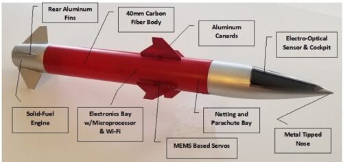
And last, but by no means least, this surface-to-air and air-to-air anti-UAV missile might be the coolest thing you’ve seen today. Dispensing with the notion of simply disrupting UAVs systems, this weapon is hell-bent on utterly obliterating them in the air. Developed by SmartRounds Inc., SAVAGE (Smart Anti-Vehicle Aerial Guided Engagement) is a revolutionary new class of smart “fire and forget” projectiles designed for use by government security and military agencies. Once launched, the mini-rockets travel at 350 mph (563 kph) and are guided to their target using computer vision object detection and target tracking, a form of artificial intelligence AI.
______
______
Technology that counters Drone Swarms:
Drones may be small – some weighing less than five pounds – but they can cause devastating results if they are armed with weapons, and when there are 10…20…100… in close proximity. Drone swarms can be remotely operated from miles away, fly autonomously, or they may accompany ground vehicles and other aircraft that attempt to harm enemy troops. And only one of these remote-controlled weapons needs to get through to be potentially lethal. Terrorists and other militants can operate small, inexpensive drones loaded with weapons to threaten U.S. and allied forces on the ground,” said Daniel Miller, chief engineer for High Energy Laser Integration at Lockheed Martin Skunk Works. “Because of their size, these drones are difficult to see, hard to catch on radar, and hard to shoot at with conventional weapons, particularly in swarms.”
_
One of the biggest threats to U.S. troops abroad isn’t a stealth fighter, a nuclear missile, or a massive cyber-attack. It’s a swarm of cheap drones that can overwhelm the expensive defense systems troops have on hand now. “I’m talking about the [drone] you can go out and buy at Costco right now in the United States for a thousand dollars, four quad, rotorcraft or something like that that can be launched and flown,” Marine Gen. Kenneth McKenzie, the head of U.S. Central Command said. “And with very simple modifications, it can be made into something that can drop a weapon like a hand grenade or something else.” In sufficient numbers, those drones can spy on friendly bases, destroy infrastructure and attack personnel, explained the Air Force Research Laboratory in a recent video. How? Because machine guns don’t have the range or accuracy to destroy the nimble fliers; anti-aircraft missiles are too expensive to use on the cheap devices; and most military bases don’t have enough missiles to destroy an entire swarm.
_
“Although an individual low-cost drone may be powerless against a high-tech system like the F-35 stealth fighter, a swarm of such drones could potentially overwhelm high-tech systems, generating significant cost-savings and potentially rendering some current platforms obsolete,” wrote the Congressional Research Service in a 2020 report. To counter such a threat, the military needs a weapon that can hit the target and won’t run out of ammo as the swarm approaches. Nets or shotguns might be promising options, but those methods are effective only within a range of a few dozen meters, researchers said in a recent report titled Directed Energy Futures 2060.
_
Recently, a Q-53 radar showed it can take on the challenging mission of detecting drones. In a demonstration, the radar system adapted to provide both air surveillance and counter fire target acquisition. The Q-53 system detected and tracked several unmanned aerial systems and provided that data to the command and control post. Operators will be able to detect, track and identify drone threats using a communications and battle management system before calling upon the laser weapon system to defeat the threat.
To eliminate drone threats, three steps are required: Detect. Identify. Defeat.
Detect: First, a radar like the Q-53 system would detect the threat and communicate that data through a battle management system, which would trigger a ‘kill chain’ to begin its execution.
Identify: As part of the kill chain, operators would monitor the progress of the targets, and identify whether they are friendly or unfriendly.
Defeat: To defeat the threats designated as “unfriendly,” troops would activate the laser/microwave weapon system, or choose to use a cyber system like ICARUS, to take down the threat.
_
Responding to a Drone Swarm with Lasers:
ALADIN Laser
The fiber lasers that comprise the 30-kilowatt ALADIN laser are under production at Lockheed Martin’s Bothell, Washington, facility. The modular laser design allows the laser’s power to adapt based on the needs of a specific mission and threat. Lockheed Martin engineers are collaborating with customers and academia to research, develop and implement the technology that will detect and defeat swarms. They are currently developing a 60-kilowatt system that combines multiple fiber lasers to generate the high power weapon beam. Because the system relies on many modular fiber lasers, it is easily scalable to meet different levels of power. With this parallel approach, there is no single point of failure that will compromise the laser’s power and functionality – as long as power exists. The laser weapon system can fire over and over, essentially creating an unlimited magazine of ‘bullets.’ Contrary to popular belief, the laser is actually invisible to the naked eye. Once it starts up, it is steadily sent through a beam control system that ensures it can accurately aim, target and destroy the threat – at the speed of light.
_
Countering Drone swarms through Cyber Technology:
In addition to laser weapon systems, a team of engineers has developed a cyber solution to defeat small drone threats. Built from internal investments, the ICARUS™ system can identify and intercept commercially available drones. Its multi-spectral sensor system detects and characterizes incoming drones within seconds, before using cyber electromagnetic activity to disable it or allowing the operator to take control of the drone and move it to a safe area. ICARUS is part of the full-spectrum cybersecurity environment by acting in a more offensive capacity. The idea is to counter the drone before it becomes a threat to our warfighters and citizens.
_
Countering Drone swarms through microwave weapon, the THOR:
Thor, the Norse god of Thunder, who serves as the namesake to one of the Air Force’s newest weapons. While the Air Force’s Tactical High Power Operational Responder (THOR) may not look like a hero, it could save the day for American troops if their far-flung combat outposts are ever attacked by hundreds of cheap kamikaze-style enemy drones. THOR isn’t much to look at: the weapon consists of a big satellite dish mounted on top of a 20-foot long shipping crate. But simplicity is a virtue, as the weapon can be transported easily aboard a C-130 transport plane and set up within three hours by a crew of two, according to the Air Force Research laboratory, which is leading the development of THOR.
Once THOR is set up, it can detect an incoming threat and silently shoot a beam of energy to knock out drones in a wide target area, exactly like what you might find in a drone swarm. The beam is a high-powered microwave that instantly triggers a counter-electronic effect in the targeted drone. The Air Force has been testing THOR since at least 2019, and now they wants to make it even better. Recently the Air Force Research Laboratory announced that it wants to develop Mjolnir, a weapon that will do the same thing as THOR but at a higher level. In Norse mythology, Mjolnir is Thor’s hammer, with which he slays many a great foe. Mjolnir will use the same technology, but will be more advanced in terms of capability, reliability, and manufacturing readiness. The Air Force lab hopes to deliver a prototype of Mjolnir by 2023, but the sooner the better, since top military thinkers are already ringing alarm bells over America’s adversaries developing drone swarm technology.
THOR’s range remains unclear, but researchers said in the report that counter-drone directed energy weapons have a range of about one kilometer. While THOR is a directed-energy weapon, it’s not the same as a laser. A laser can knock out one drone at a time, but THOR can swat down entire swarms in a single shot. If anti-drone lasers are like sniper rifles, microwave weapons are like shotguns full of birdshot.
______
______
Section-17
Flying drone at night:
_
Can you fly a drone at night?
Simply put, yes you can. Flying a drone at night can produce some outstanding night time photography, but it’s important to be aware of the law and guidance. There are different rules and regulations depending on what your purpose is for flying your drone and where you choose to fly it. The rules for night-time flying have changed over the years and in April 2021, the FAA (the Federal Aviation Administration) revealed the latest guidance on night-time flying that removed some of the extra stipulations there once was, such as additional waivers. This is good news, as it means it should be easier for you to take your drone out in the evening. There are still some rules in place those, although these vary depending on whether or not you’re flying for purely recreational or commercial purposes.
Basic rules for flying a drone at night
-Your drone must be registered with the FAA
-Your drone must be equipped with anti-collision lighting
-You must fly your drone safely and within the FAA’s guidelines
-You must comply with the FAA’s training and testing requirements if you’re flying for commercial purposes
_
Anti-collision lighting:
Alongside a drone that meets FAA’s requirements for safe flight, when it comes to night-time flying, you’ll also need to have anti-collision lighting that’s visible from three miles away. This lighting must be mounted on top of the drone and must also have a sufficient flash rate to avoid a collision.
Training and licenses:
Yes, if you are a commercial pilot, you are required to carry out specific training and testing of the FAA’s exacting standards. If you’re flying for recreational purposes, you don’t need any special training or have to meet any special requirements apart from being equipped with lighting that the FAA states, “allows you to know its location and orientation at all times.” That said, the FAA does recommend that recreational fliers also take the Recreational UAS Safety Test, to get acquainted with some safety basics, then carry round the corresponding certificate when you’re out and about with your drone.
For commercial pilots, the current guidelines state that you need an up-to-date Part 107 Certification, either obtained for the first time through passing an initial knowledge test and then a night flying training module from the renewal exam. Or, if you’ve already got your Part 107 Certification, you need to complete the new recurrent training and exam via the FAAST website. Alongside the training certification, you’ll also need airspace authorization to fly in controlled airspace under 400 feet. For now, this means getting two authorizations from LAANC (Low Altitude Authorization and Notification Capability) – one for daytime and a national one that extends daytime usage into night-time operations. If you’re flying above the ceiling of the UAS Facility Maps, you’ll need to go to the FAA DroneZone for your authorization.
_
Tips for flying drone at night:
-Mark your drone on the outside with the registration number and carry proof of registration with you
-Plan your flying pattern – be sure to check out your flight zone in the daytime so you can understand the area better and assist with navigating it at night-time
-Whilst your drone needs onboard anti-collision lighting, it wouldn’t hurt if you also took additional lighting such as a flashlight to help you set up
-Make sure you stay within the boundaries of the authorization – as mentioned you cannot exceed the ceiling from the LAANC certification, so it’s best to work out what’s within your limitations
-Keep your drone within the visual line of sight – this will be more difficult at night and could help if you have another visual observer co-located physically next to you to keep eyes on the skies
-Be aware of your surroundings and your limitations when operating at night. It’s obviously different to the daytime and requires more vigilance and adjustment for narrowed vision
-Always operate your drone in a safe manner
__
The latest FAA rules allow drones to fly at night. So if you’re in the United States, and happen to see a drone in your neighborhood, probably a filmmaker wants to get some night shots. Law Enforcement officers are also using drones for aerial surveillance, which could happen during the day or at night. There are a range of reasons why people may want to fly their drones at night. There are plenty of opportunities for drones to capture incredible cityscapes and self-illuminated landscapes.
These are the types of activities that occur at night with a drone:
-1. Police – the police use drones for surveilling and honing in on criminal activity. The police drones tend to be much heavier and may have up to 6 propellers.
-2. Security – private security firms can fly over their own property in order to monitor people that shouldn’t be on the property and locating assets to make sure that nothing has been stolen.
-3. Scientists – if you live near a conservation park or wooded area scientists have been known to use drones equipped with thermal cameras for detecting wildlife at night. This could be what is happening if your local area is full of wildlife.
-4. Perverts – we often think about drones being used by people to capture images without their permission. However, it is unlikely that a drone is able to capture identifiable features from a discernible distance at night.
_
What can drones see at night?
In the security world, the most important factor is the number of pixels per foot at a given distance. This can be calculated from the resolution of the camera and the distance at which you are observing an object.
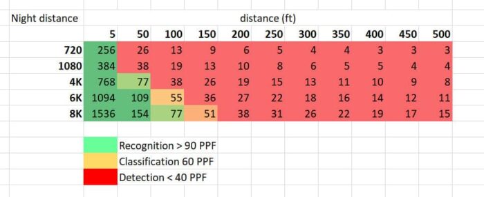
Figure above shows pixels per foot for each camera resolution at various distances at night. The most important aspects of this table are where the recognition, classification, and detection limits are. Given these limits, we can see that for a high definition (1080p) camera it is only able to recognize people from a distance of 5 foot. Past that it is quickly unable to classify or detect people with a pixels perfect of only 38 at a distance of 50 foot. At 4K the detection distance extends to 100 foot and it is able to recognize the up to approximately 60 feet. At this distance, you will certainly be aware of the drone in your local area and you may even be able to identify what type of drone is flying because it is so close. This means that unless you are illuminating your own property or you have brought your own source of light it is unlikely a drone is able to identify anything about your person or property unless it gets very close to you.
This information is only useful if the camera drone is using a regular optical camera. Alternatively, the drone may be carrying a night vision and/or infrared camera but, these are very uncommon and it is unlikely that the drone flying at night has this type of technology unless it is a military or police drone.
_
Drone detection at night:
There are several methods you can use to make out if drones fly around your area at night.
-1. Watch out for the lights
All drones have a system of lights installed. The lights are for navigation and preventing collisions with other drones. The color and regularity of these lights vary, further helping you mark out if a moving object is a drone. Navigation lights are mainly red, white, or green. There is no regulation on using a single color or a mix. Whereas they are visible at night, not all drones have them. Hence, they may not be so much helpful in your spotting endeavors. As a regulation, all drones have anti-collision lights. These lights are straightforward to identify. They are either red or white. So sometimes, that floating object looking like a star in the sky over you may be a drone.
-2. Buzzing Sound
Drones use several propellers to fly. Those propellers make a buzzing sound. There is no doubt that drones make a very specific and identifiable noise. This is dependent on the type of drone being flown. For example, DJI Mavic air sounds like a swarm of bees whilst larger drones have more of a low hum quality to the sound of their flight. The pitch of the same can be used to determine the size and type of the drone which is being flown. At night time it is much quieter so you can typically hear a drone from further away. Another very important identification tool for how to spot a drone at night is now fast the noise moves through the sky. We are very familiar with how quickly a helicopter moves through the sky and its volume combined with its high-altitude travel means that the sound doesn’t move location very fast i.e., the noise stays around for a while. Drones, on the other hand, change location very quickly and their relatively low altitude means that the sound is very different depending on if they are travelling away from you, toward you, or anything in between.
-3. Drone Detecting Android Apps
There is a popular app called drone watcher. The drone watcher app turns your android device into a detector of drones and is able to alert you and track their path. The app detects most commercially available consumer and prosumer drones and records the data including the drone type and ID which can be used to document evidence to be used by local law enforcement. The developers of this app claim that the drone watcher app is able to detect, track, and records information on approximately 95% of commercially available drones using advanced signal intelligence technology. The app alerts users when a drone is detected within half a mile recording the drone type and ID which can be used to document any complaints the person wishes to make against the drone pilot. In additional to personal use for privacy protection the drone watcher app can also be used for drone control and security at public events. If you are not sure if there is a drone in the area you can use this app to quickly determine if it is within half a mile of your current location. Your android phone and drones have something in common. They use Wi-Fi signals to communicate. Therefore, your phone notifies you of this software when a drone gets within a half-mile of it. However, this program is only constrained to detecting unencrypted Wi-Fi signals, making it ineffective with newer versions of drones that use encrypted Wi-Fi signals or none at all.
-4. Motion Detecting Night Vision Cameras
An FAA regulation is that all drones have anti-collision lights, especially if they fly at night. With activity seeing night vision cameras, you can easily spot drones at night around your property. The advantage is you don’t need any technical skills or equipment to install these cameras on your property. Most are plug-and-play devices.
-5. Microwave Motion Sensors
These sensors are inexpensive and the perfect night watchmen for drones. These sensors use a simple technique. They emit microwaves that objects within their field of view deflect back. A moving object such as a drone changes the deflected microwaves’ wavelength due to the Doppler’s effect. The distorted wavelength sets off the sensor.
-6.Thermal detection
If you have a thermal camera you are able to detect the hot electronics of a drone against the coldness of the night sky very easily. As drones fly through the air their circuitry heats up relatively quickly. The quick exchange of energy from the battery to the motors causes a relatively high amount of heat in the circuit boards which means that they are susceptible to being picked up on thermal cameras at night.
-7. Radio Frequency detection
Drones can be detected by monitoring the radio frequencies that they use to communicate between the remote controller and the drone itself. As you are flying a drone there is a continuous two-way data transmission between a drone and the pilot on the ground. The data is sent in various frequency bands which means that there is a lot of opportunity to detect the drone. One of the benefits is that there is no need for signal sending and it can be detected passively.
-8. Radar Detection System
If you feel very threatened by drones at night over your property, you can install a radar detection system. These systems detect incoming drones to your property and make out their make and model. You may have to verify if your state allows for the installation of such systems.
_____
_____
Section-18
Malicious uses of drones:
The UK prison service and the police are investing their resources to stop drone pilots from flying drugs, mobile phones, blades, knives, Subscriber Identity Module (SIM) cards, Universal Serial Bus (USBs) etc. into prisons. These drones were being flown over walls and physical barriers. As a result almost £ 3m may possibly be spent on the newly assigned task force to overcome this problem. In another part of world, drones might act as an Access Point (AP) for a suicide bomber’s detonator, which facilitates the activation and detonation of a bomb. The threat of Drones/UAVs is highly alarming and taking place at an increasing rate with the increasing terrorist and criminal use of drones/UAVs to conduct malicious activities. Drones have been employed in different domains for good purposes, but also for malicious ones. Accordingly, there are new challenges related to several security, safety and privacy concerns when drones/UAVs are employed for malicious goals. The malicious usages of drones include misuse by terrorists and/or criminals to launch malicious attacks such as having drones perform some types of physical or even logical attacks. In general, UAV malicious use can be divided between criminal usage and terrorist usage as described below:
_
-1. Criminal attacks
Such attacks include physical as well as logical attacks:
- Physical Attacks: the main threat is related to the issue of private property surveillance, where drones can be easily used to breach the physical privacy of people. This is a very serious issue whereby drones are able to break through the geo-boundaries. According to BBC News, smuggling drugs, phones, and even blades to prisoners within highly secure prisons, were being carried out while avoiding ground detection. This is typically achieved via an octo-copter that is capable of lifting 20lbs. Moreover, such attacks include crashing drones into certain people intentionally or crashing them into people’s properties, which may cause low to serious damages. Another threat is related to small quad-copters such as the DJI Phantom 3, which can reach an altitude of 1600ft (488 m) and a distance of 16,000ft (4800 m). This imposes a serious problem, similar to bird-related incidents, to cause serious problems to manned airplanes engines.
- Logical Attacks: Logical attacks include, among others, the setup of a fake mobile Wi-Fi network or a rogue Access Point (AP), which leads to the interception of smart-phones traffic by luring users to connect to a nearby Open AP, typically titled as Free Wi-Fi. Thus, an attacker can capture users’ sensitive information like passwords and credit cards credentials. This also includes hijacking other drones by connecting a raspberry-pi device into a drone and programming it to intercept and hijack other nearby drones. This turns the malicious drone into a rogue AP for nearby devices and drones, and injecting malware into connected smartphones through the interception and redirection of user’s data traffic, or through phishing (malicious links, fake advertisement, or false update). In fact, various drone attacks including jamming and spoofing are carried out. Finally, UAV sensor inputs may also be targeted and exploited by an attacker who would manipulate such parameters and trick the sensors.
_
-2. Terrorist & insurgent attacks
After the proliferation of drones, serious threats and challenges emerged since these drones could be used by terrorists for malicious purposes. Having drones in the wrong hands can lead to serious consequences. Actually, drones are being used by insurgents and terrorists alike; drones and UAVs were used by ISIS to drop bombs (i.e., weaponized drones) and to film propaganda videos (i.e., training, battle tactics, simulated attacks, location/geography, reconnaissance etc.) in conflict zones such as the targeting of Iraqi and Syrian military personnel. Also, against the backdrop of its increasing use of attack drones in Iraq and Syria, ISIS has released an informative graphic detailing its attacks in February 2017 using a pro-ISIS channel known by Ninawa Province, to show the footage taken prior to a terrorist attack. This alarmed the whole world about the drones’ serious safety and security threats, and their devastating effects on the moral of both military and civilian personnel. Typically, the use of drones by terrorists is associated with the following purposes:
- Online Propaganda: recently, terrorists have been using drones to film their attacks, training and operations using in some cases drones with High Definition (HD) cameras in an effort to boost the morale of their jihadists and urge sympathisers and world-wide supporters to join them.
- UAV-Surveillance: is a new method used by terrorists to capture live footage (i.e., images/videos) while planning an attack, or potential future attacks.
- UAV-Aided Shelling: is also a new terrorist choice to guide and adjust their (artillery/mortar) shelling against a given military/civilian target (i.e., ISIS/ISIL).
- UAV-Guided & UAV-led Attacks: is a technique that was used between 2016 and late 2017 to target military personnel, convoys and checkpoints or installations using the Vehicle-Borne Improvised Explosive Devices (VBIED); in addition to the old car bomb style, or the dropping of homemade bombs (i.e., bomblets, grenades, 20–40 mm, or modified shells) or leaflets.
- Loitering Munition: the Samad UAV is a family of long-range UAVs built and used by the Iranian armed forces and handed over to Hezbollah in the Middle East, and extensively used by the Houthis in Yemen for reconnaissance purposes, and also as loitering munition to target Saudi Arabia and United Arab Emirates facilities (oil refineries, airports and military installations, i.e. Abqaiq-Khurais attack). It was named after the assassination of Saleh Al-Sammad in a drone strike by the United Arab Emirates in 2018, and includes three models, Samad-1 (wingspan of 3.5 m, 500 Km range, surveillance), Samad-2 (UAV-X, wingspan of 4.5 m, 500 Km+ range, surveillance or explosive payload) and Samad-3 (wingspan of 4.5 m, 1500 Km range, explosive payload).
- Drone Footage Interception: military drones/UAVs were prone to stream/footage interception attempts, many of which were successful. One example is the case of Israeli drone footage being intercepted in 1997 before applying further encryption. Another case occurred during the Iraqi war with insurgents intercepting US predator drones using first, a $26-value software and then, the SkyGrabber software.
- Airstrike Disruption: this technique was adopted by ISIS to disrupt airstrikes against them in Raqqa; they wait on their opponents to fly a drone, then ISIS operators would fly and target the airstrike calling team, tricking their opponents into thinking it’s a friendly drone hovering overhead. Such drones were armed with 40-mm grenade-sized munitions and can hit their target with high accuracy.
- Burning/Incendiary Kites: these were used in March 2018 during the Palestinian protests on the Palestinian-Israeli borders, and included the use of helium balloons, or strapping a kite, or an aerial unmanned device with a bomb, incendiary device, or Molotov cocktail and crashing it on the Israeli side causing a huge wildfire to nearby farmlands.
_______
Drug smugglers turn to drones to smuggle drugs across the U.S.-Mexico border:
Drug smugglers along the U.S.-Mexico border have turned to drones to advance operations and get past border officials at the same time. Border officers sent out a plea to residents in southwestern Arizona to keep an eye out for suspicious activity and drones along the border. Recently drones have been the go-to method of smuggling drugs across the U.S.-Mexico border due to the speed and altitude they can fly at. The main reason cartels have turned to drones is the new border wall being constructed, blocking off commonly used routes. But of course, the new wall isn’t an obstacle for the cartels going down the drone route. The border patrol struggles to track down the drones as it relies on visually spotting them and then reporting them; resulting in almost zero leads coming from investigations. It is also apparent that the agents aren’t able to spot all the drones flying over the border.
_____
Drones smuggling cigarettes, porn, drugs and weapons to prison inmates around the world:
Inmates for years have thought of ingenious — and sometimes very compromising ways — to sneak contraband inside prison walls. They’ve bribed guards, used carrier pigeons, had relatives put the goods in body cavities and, of course, who can forget a classic routine: baking a file into a cake. But modern technology is quickly making life easier for inmates — and less uncomfortable for family and friends — looking to smuggle illicit goods onto prison grounds.
Corrections officials across the U.S. have reported an uptick in the last few years of drones flying over penitentiary walls to deliver everything from cigarettes and pornography to drugs and weapons to inmates. The incident in Michigan was followed by similar instances in Oklahoma, Ohio, South Carolina and Georgia to name a few, and has led some state officials to call for a revamping of prison facilities and tactics to go after these midair menaces. A piece of legislation currently bouncing around Washington state’s capitol building would make flying a drone within 1,000 feet of the perimeter of a correctional facility without permission a Class C felony. Similar legislation has been introduced in Michigan — as Senate Bills 487 and 488 — making it a felony to operate drones within 1,000 feet of a prison.
One of the most popular drones on the market — the DJI Phantom 4 — clocks in at a total weight of 3 pounds and can fly at least 4 miles away from its operator without losing its video stream or remote controls. While the Phantom can carry just over 1 pound while in flight, its brother, the DJI S900, has a maximum payload of just under 7 pounds — meaning that anyone can deliver a sizable care package to their buddies on the inside.
The issue of drones invading prisons isn’t solely a problem in the U.S. Prisons in Canada, Brazil, Russia, Australia, Thailand, Greece and England are all struggling to combat the rise of the relatively inexpensive drones. Canadian officials are draping nets over perimeter fences or walls to thwart drones, while law enforcement in Ireland is going old school with wires and sharp eyes to hunt down any approaching drones. The United Kingdom announced the formation of a “specialist squad” that will be tasked with investigating drone smuggling nationwide and passing that information down to local-level officers to act on.
______
Drone used in attack on US electrical grid:
A US intelligence report has revealed that a drone was used in an attempt to disable an electrical substation in Pennsylvania recently. In the first known attack of its kind modified consumer drone was used in an attack on an electrical substation in the US, according to a report from the FBI, Department of Homeland Security and National Counterterrorism Center. The report, which is being circulated to law enforcement agencies in the US, highlights the incident at a substation in Pennsylvania recently as the first known use of a drone to target energy infrastructure in the US. The location isn’t specifically identified, but the drone crashed without causing damage. The drone was modified with a trailing tether supporting a length of copper wire. If the wire had come into contact with high-voltage equipment it could have caused a short circuit, equipment failures and possibly fires. The device is similar in concept to blackout bombs used by the US Air Force, which have no explosive but scatter masses of conductive filaments over electrical equipment. These were used to shut down 70 per cent of Serbia’s electricity generation capacity in 1999 during the Kosovo war.
Electrical substations are normally protected by fences and other barriers, but these may not be sufficient against drones. Counter-terrorism defences largely assume a ground-based attacker. Hence the fences and bollards everywhere. The defences are obsolete if terrorists can take to the air. Drones are cheap, and easy to use. Critical infrastructure facilities need to worry about attacks from any direction. Counter-drone jammers are deployed at some locations but cannot defend every electrical substation, due to both cost and limitations on where they can be used. While such drones only carry a tiny payload compared to a car bomb, they can cause a disproportionate amount of damage by targeting vulnerable spots. Critical infrastructure owners and operators need to identify critical, sensitive components where small charges can cause significant harm to the facility’s operation.
_____
Countermeasures against malicious drones:
Drones come under the remit of the Federal Aviation Administration (FAA) as Unmanned Aircraft (UAs) or Unmanned Aerial Vehicles (UAVs). That protects them in two important ways:
-1. you cannot shoot them down or interfere with them physically
-2. you must not interfere with signals between the controller and the drone.
So, any defense measures you take must focus on protecting your space and your data. Geofencing is one way of dealing with the drone menace. Using GPS or RFID based software, geofencing creates a virtual border around a specified location. It will generate a response whenever an unauthorized drone enters the area, and controls wired into commercially available drones prevent them flying into (or taking off in) geofenced areas. Big drone makers like DJI and Parrot have installed geofencing for vulnerable sites, such as airports, prisons, and power stations in their drones. However, some hackers have found ways to remove the geofencing software that prevents regular drones flying into restricted areas. Hacks for drones are easy to find on the internet; meanwhile, the simplest way to block geofencing is simply to fold tinfoil around the drone, blocking the GPS signal.
If you can’t block drones, can you detect them? There are a few ways to find out if a drone is coming your way, but all of them have flaws. So far, there’s no 100% reliable way to catch a drone. Radar is one method of drone detection, but it’s not particularly reliable; for instance, it can mistake birds for drones. Acoustic sensors may be a better way to detect unwanted drones, since they can be programmed to recognize the sound signatures of particular drone types. RF scanners can catch drones by checking the electromagnetic spectrum; they recognize drone transmissions. But drones that rely on GPS and don’t use radio signals to navigate will not be caught this way. Finally, thermal imaging detects the heat emitted by objects. This enables drones to be traced by their thermal footprint. However, there’s a high rate of false positives.
Detecting and stopping drones is difficult. So rather than trying to spot malicious drones, most users are better served by stepping up their basic home and wireless security. If you’re worried about drones invading your airspace, then a solution like Kaspersky Antidrone will help you regain that peace of mind. The system detects objects in the air, accurately classifies them and responds to incidents, all while running automatically. Data on the drone and remote control model, and location of the drone pilot is displayed in real time. Sensors, selected specifically for each site in combination with AI-based technology, signal that a drone is approaching the controlled zone and pursue the target. If you’re worried about drones stealing your data, the best way to protect your data is by ensuring you’ve locked down your data securely. Use a VPN if you’re working on Wi-Fi, to ensure your internet communications can’t be hacked. Secure all IoT devices in your home and confine them to a guest network, so a hacker can’t get into your main network through a smart device. Don’t leave your Wi-Fi router with the default username and password. Change the username, so hackers can’t guess the type of router or the network you’re using and have a strong password for access. Don’t use identical passwords for different networks or devices – that makes it much easier for a hacker to gain access to your entire digital life once they’ve got a drone carrying a camera.
______
______
Section-19
Drone regulations:
There are several new potential uses of drones, as we have seen in the previous sections, in the public and in the private sectors, and in the agriculture, commerce, environment, and energy sectors. At the same time, drones pose serious risks of security and safety since they have been spotted close to airports, have injured people and have crashed. It is necessary, therefore, not only to adopt and enforce new legislation, but also to enforce existing legislation. Cooperation between nations in regards to airspace jurisdiction is compulsory, common standards and common regulations must be adopted to ensure the safety of people and property on the ground, and insurance liability is of paramount importance here. An ever-expanding application and misuse of drones can have legal (positive and negative) implications and consequences. One of the aspects of misuse of drones is that private information can be collected by public bodies and private parties without consent. The drone industry can adopt voluntary regulations in order to develop this new technology guaranteeing safety standards; misuse of drones and violation of privacy should be prevented by, for example, prohibiting high-resolution cameras near sensitive areas if it is not necessary; and current privacy legislation can apply to drones and new legislation must be adopted at international level. In addition, the safety of people and property on the ground must be ensured and legislation regarding insurance in the aviation system must be extended to drones. The potential benefits that drones can bring to society and potential harms that misuse of drones can cause to individuals ought to be somehow balanced. New regulations must be created and enforced to provide possible solutions, but also the current law can be interpreted in order to incorporate new emerging uses of the drones. Drones have a big potential in many fields, but an exhaustive legal framework is essential. The American approach regarding legislation on drones is a pragmatic approach of the kind to be expected in common law countries since the FAA grants case by case exceptions. The EU approach is a civil law approach since EU is working on general set of rules regarding all aspects related to drones. Recently new rules have been adopted in the US by the FAA and welcomed by drones’ industry: in this way it will be easier to develop this technology following a risk assessment. Rules are proportionate to the level of risks and from this point of view EU and US approaches are similar.
_
Difficulty in identifying the data controller:
A first, and presumably the most challenging hurdle that a data subject needs to overcome is difficulty in identifying the data controller, who flies the drone and collects, possesses, and processes the personal data. As a result, the data subject cannot exercise his/her right to prevent processing likely to cause substantial damage or substantial distress. In the other words, the data controller is likely to escape his/her legal obligation to inform the data subject of data collecting activities. A real life example of this problem can be seen by Miley Cyrus’s tweet. Miley Cyrus, the America popular singer, was able to spot the drone flying over her house, and tweeted that she had seen a drone flying over her house; nonetheless, she could not identify who was controlling the drone. This is problematic not only because she did not know who controlled the drone but she also did not have knowledge as to whether the personal data had been collected and was likely to be misused. In addition to that, drones can be flown at anytime from anywhere. It is imperative that data subjects are NOT only made aware of the drones’ activities but also data being collected by drones. This point is absolutely crucial, as we cannot lodge a complaint without being able to identify the defendant.
__
Regulatory bodies around the world are developing Unmanned aircraft system traffic management solutions to better integrate UAVs into airspace. The use of unmanned aerial vehicles (UAVs) or Drones, is becoming increasingly regulated by the national aviation authority of individual countries. Regulatory regimes can differ significantly according to drone size and use. The International Civil Aviation Organization (ICAO) began exploring the use of drone technology as far back as 2005, which resulted in a 2011 report. France was among the first countries to set a national framework based on this report and larger aviation bodies such as the FAA and the EASA quickly followed suit. In 2021, the FAA published a rule requiring all commercially-used UAVs and all UAVs regardless of intent weighing 250g or more to participate in Remote ID, which makes drone locations, controller locations, and other information public from takeoff to shutdown; this rule has since been challenged in the pending federal lawsuit RaceDayQuads v. FAA. The export of UAVs or technology capable of carrying a 500 kg payload at least 300 km is restricted in many countries by the Missile Technology Control Regime.
_
Many governments including EU State members, the US, United Kingdom (UK) and South Africa have so far issued a warning for drone owners, urging them to get official licenses in order to fly their photography drones. The statement warned against the threats of flying UAVs over private territories, especially military centers, and sensitive locations without a license issued by the orientation directorate. In Lebanon, the Lebanese Army stated that any drone being flown illegally without meeting the requirements will be brought down whilst its owners will be legally prosecuted, due to the fact that they impose a serious risk to the official institutions, the security, and public safety. As part of a constant reminder, the army’s command of each country reminds all citizens to obtain the legally required certificates and to request a permit in order to use a drone; such requests can be made online using official websites.
_____
Commercial & Recreational Drone Regulations:
At this point, almost every country in the world has developed regulations regarding the use of drones. Most of these regulations can be divided into two categories: work (i.e., commercial drone operations) and fun (i.e., hobbyist drone operations).
If you plan to fly your drone for fun, you must follow a certain set of rules, and if you plan to fly your drone for work, you must fly a different set of rules (in some instances, flying for governmental purposes is a third category, which may also have a separate set of rules).
The rules for operating a drone for work vary from country to country, but often include these basic requirements:
-That the drone pilot hold some kind of certificate or license authenticating their ability to fly a drone commercially.
-That the drone pilot follow certain guidelines while operating their drone, such as keeping it within the operator’s visual line of sight or not flying over crowds.
-That the drone pilot register their drone with the government.
-That the drone pilot hold insurance on each drone they operate.
In the U.S., the FAA’s Part 107 rules establish the guidelines for using drones in commercial settings. These rules require commercial drone pilots to hold a certificate for operations and to follow certain guidelines, such as not flying at night, Beyond the Visual Line of Sight (BVLOS), or in controlled airspace without prior authorization. In Switzerland, drone pilots must abide by the rules and provisions established by the Federal Office for Civil Aviation (FOCA), such as not flying over crowds or within five kilometers of an airport or heliport.
______
Some of the legal and regulatory hurdles facing commercial drone usage are already being overcome. In late 2019 the Federal Aviation Administration (FAA) approved UPS Flight Forward to become the first-ever drone service operating as a commercial airline. Although the drone service can only operate in suburban and rural regions, it has complete autonomy on size and scope of its drone operations. As with the legal and regulatory hurdles, attempts to overcome the societal hurdles are being made. To increase trust in the safety of drones and their operators the FAA has required following for commercial drone:
-all commercial drone pilots to hold a Remote Pilot Certificate and be over the age of 16;
-the drones themselves must weigh less than 55 lb (25 kg), including payload, at takeoff;
-fly up to a maximum of 400 feet (120 m) in Class G airspace;
-at a speed of no greater than 100 miles per hour (160 km/h);
-can only be operated during daytime or civil twilight;
-must yield right of way to manned aircraft;
-all unmanned aircraft systems (UAS) (drones) be equipped with a devise to identify and be registered with the FAA. The drone pilots must register their drones online at faadronezone.faa.gov. Registration costs $5 per drone and lasts for three years. Once registered, pilots must display the FAA-issued registration number on the outside of the drone.
FAA requirement for recreational user:
– For recreational use, only drones that weigh more than 0.55 lbs. require FAA registration. The good news is that recreational pilots only need to go through the drone registration process once, even if they own and operate multiple drones. This means that your registration number can be used across multiple drones. This also means that you only need to pay the $5 registration fee once.
-Operators are also required to take the free recreational UAS safety test. A recreational flyer is someone who uses a drone for “fun or personal enjoyment purposes only,” according to the FAA.
-When flying, drones must stay at or below 400 feet and they must be kept within the operator’s line of sight.
-Operators must also be wary of FAA airspace restrictions. Drones are also not allowed to fly near other aircraft or around major stadiums or sporting events and they must respect other people’s privacy.
-Drones are also not allowed to interfere with wildfire response or hurricane recovery efforts.
-Additionally, fliers should never operate a drone under the influence of drugs or alcohol.
FAA says a drone is an aircraft and you are its pilot.
_____
Drone Remote ID:
Remote ID creates a common and consistent way for authorities to monitor airborne drones and identify who is flying them. Similar to a car license plate, this new method of aerial accountability will make the skies safer, improve public acceptance of drones, and open up new possibilities for drone pilots to routinely fly in ways that have until now been restricted for safety and security reasons – like flying at night or directly over people. Although the “effective date” is April 21, 2021; the FAA’s Remote ID requirements will be implemented over the next three years, and complying with them will likely be as simple as updating your drone software with a free upgrade.
Think of Remote ID as an electronic license plate system for drones, allowing authorities to identify who is flying them. A physical license plate wouldn’t be much use on a small airborne drone, so Remote ID sends license plate information via radio signals to receivers on the ground.
All drones weighing more than 0.55 pounds (about 250 grams) will have to broadcast a signal that includes their position and altitude as well as their serial number. The serial number will be associated with your FAA registration information in the FAA’s system, which means that no personal information will be broadcast by the Remote ID function. Instead, authorized officials who obtain the serial number will be able to look up owner information in the FAA’s system, similar to how authorized agencies check vehicle license plate owner information.
The rules say this information must be sent using a radio protocol that can be received by a common handheld receiver, such as a smartphone or tablet device. Most likely, that means drones will send a Bluetooth or Wi-Fi signal that can be received by a smartphone.
_
FAA Remote ID compliance measure is depicted in figure below:
______
FPV drone laws:
Why are the laws different for FPV drones?
There’s no doubt that FPV flying is an incredibly immersive experience, thanks to the addition of a headset that allows the pilot to see a live video feed from their drone’s forward-facing camera. This means the drone can be flown with a greater degree of precision and accuracy, making it possible to fly them in much more exciting ways than a standard drone. FPV drones are often also faster than consumer and professional drones, and can perform more extreme aerial maneuvers such as flips and rolls, which is why they’re used for drone racing. But now there’s a new beginner-friendly DJI FPV drone available for the masses, it’s important to know exactly what you should and shouldn’t do with them to keep your flying safe and legal.
FPV goggles can be used with most drones – they’re not exclusive to FPV models – but it’s the use of these headsets to view a live feed of the drone’s camera that makes the rules governing their use slightly different. You can, of course, also use a phone or tablet with an FPV drone rather than a pair of FPV goggles, but even in this situation you’d be closely watching the live camera feed on the screen, so you’ll encounter the same problem of not being able to see the drone in the sky during flight.
When flying any drone, it’s a legal requirement in most regions that you fly no higher than 120m/400ft or a distance of 500m/1640ft, and that the aircraft must remain within unaided visual line of sight (VLOS). This means that you must be able to see your drone in the sky at all times within these parameters, without the use of binoculars or any other visual device. This presents an immediate problem for FPV drones and their goggles, because the drone pilot is viewing the live camera feed and therefore cannot maintain VLOS. The use of FPV drones and goggles is legal in both the United Kingdom and the United States, but to fly an FPV drone you’ll need an observer who can maintain visual line of sight with the aircraft and communicate this with the pilot. The rules regarding the use of an observer in the UK and US are practically identical – it’s the exact wording of the rules that differs slightly. In both countries, when using an FPV drone or FPV goggles, a drone pilot must be assisted by an observer to help them keep the drone away from obstacles and other aircraft. This observer must keep the drone within unaided visual line of sight (VLOS) at all times and must be standing next to the drone pilot. Remember, this means the observer can’t use a screen or binoculars to watch the drone, as the line of sight must be ‘unaided’. You don’t need any special qualifications to be an observer, but you must be briefed on what you need to do, and communicate with the pilot to make them aware of any potential risks, so that the pilot can respond accordingly.
There is one exception to all this. If you’re flying an FPV drone in a controlled environment indoors, or within a closed netted structure, where uninvolved people are excluded and the drone cannot escape, an observer isn’t required. This kind of situation is typically where drone racing takes place with FPV drones, and is rarely used by the majority of drone pilots.
The rules we’ve looked at so far are specifically for FPV drones or using FPV goggles. But you do, of course, also need to abide by the laws for drones in general – all other drone laws still apply during flights, so you must be aware of these. Fortunately, they’re pretty straightforward, whether you’re in the US or UK. In both countries, when flying a drone that weighs 250g or more, you must to register with the FAA in the US and the CAA in the UK. Once you’ve done that, it’s then a case of following the basic rules discussed above.
_____
Drone rules in India:
Based on their weight, drones can be divided into five categories — nano (weighing up to 250 g), micro (250 g to 2 kg), small (2-25 kg), medium (25-150 kg), and large (over 150 kg). All drones except nano require a licensed pilot and permit from the Director General of Civil Aviation (DGCA). Altitude and speed restrictions also vary depending on the category of the drone. The Unmanned Aircraft System Rules, 2021, set certain conditions for operating drones. For one, it prohibits the flying of drones in areas surrounding strategic locations notified by the Ministry of Home Affairs, central secretariats in state capitals, and eco-sensitive zones. Operating drones is also barred within 5 km of international airports at Mumbai, Delhi, Chennai, Kolkata, Bengaluru and Hyderabad, and at a distance of 3 km from the perimeter of any civil, private or defence airport. Drones cannot be flown within a distance of 25 km from international borders, which includes the Line of Control, and in the vicinity of military installations or areas where military activities take place (unless clearance is obtained from the local military facility).
About 29,500 drones are now registered in the country as the government has initiated move to create a database of such unmanned flying devices to keep a track of them. Any drones beyond the ones registered would not be part of system and cannot be used as openly as the registered ones. The government had provided an option for drone users to register their drone and generate a drone acknowledgement number, or DAN, by the end of November 2021, 29,459 DANs were issued. Those who want to use their drones for commercial purposes must generate a separate unique identification number (UIN). A drone cannot be used for commercial purposes unless it has UIN. The government’s focus on drones is mainly on using it for the agricultural and other essential item delivery in rural areas as well as for defence forces.
Can drone rules address Rogue Drones in India?
Experts say despite the rules, rogue drones can turn out to be a major security threat, given that they can be used for still photography, video filming, and malicious uses. The drones can be used for vital intel gathering with respect to vital assets and stores. The cameras are so powerful you can be two km away and at a higher altitude but you can zoom in with deadly accuracy and precision. The growing number of people buying and using drones is a major challenge. The new regulations by the government have their limitations and they [drones] are extremely difficult to detect. If someone wants to assemble a drone and fly it in any part of the country, they have the physical capabilities to do so. No liberal or strict policy can address the issue of rogue drones. India need to develop technical capabilities in the counter drone domain where technology is used to either detect, identify or destroy rogue drones.
_____
_____
Section-20
Pros & Cons of Civilian Drones:
Note:
Malicious and military uses of drones are discussed in separate sections:
_
On the one hand, drones undoubtedly have appeal both because of how fun they are to fly and how they have proven to be useful as commercial or industrial tools. On the other hand, there are still a lot of people who are concerned about the unregulated use of drone technology, especially as a means of surveillance. Just as with any form of technology, drones can be good or bad depending on the purpose of the people flying them.
_
Advantages of Using Drones:
-1. Improved Speed
Drones are prized for their ability to speed up time-consuming tasks that take staff away from other jobs. By speeding up inspections and other tasks, drone services allow companies to get more done in the workday and let them take on more projects or give greater attention to other areas that have been neglected. For example, using drones for inspections can greatly speed up the inspection process, especially in areas where the inspection needs to cover a lot of ground and forces the inspector to navigate difficult spaces. A drone can quickly fly across a property, getting a complete picture of every part of the area or assets that the inspector needs to evaluate.
-2. Clear and Useful Data
Drones are inexpensive, quick to deploy, can work rapidly, and can collect accurate data. The new crop of drones has been designed to build on these strengths. They are getting smaller and have better cameras. They avoid obstacles automatically, can be programmed to do customized jobs, and have RTK sensors that can collect location-based data to centimeter-level accuracy. From drones with simple cameras, we now have drones equipped with LiDAR sensors, RTK modules, multispectral sensors, thermal cameras, speakers, and spotlights. Drones can take pictures, record videos and be outfitted with other sensors, making them perfect data gatherers. Many drone models are launched into the market with obstacle avoidance capacities. They can operate quite close to constructions, and this encourages them to seize precise data. They capture high-resolution images or 4K videos that explicitly reveal cracks, damages, displaced wires, and additional defects that we cannot detect through our naked eye. UAVs allow obtaining complete data without endangering inspection crew members of the company. These drones can assist users by getting the lay of the land and identifying crucial points of interest that are relevant to a project. This sort of data is perfect for projects that need to meet strict regulations and specifications, as it lets them get ahead of potential challenges. Besides helping companies react to immediate challenges, drone inspections can help generate a long visual paper trail. Inspectors can reference data from previous inspections and compare it to the most recent data to estimate when a problem first started. Instead of relying on an inspector’s memory, companies will have a vast database of footage to rely on.
-3. Increase Safety
With the support of a Drone, numerous dangers like elevation, wind, weather, and radiation that were earlier suffered by crew members have been replaced with more viable and safer alternatives. Drones facilitate straightforward and secure inspections of towering and complicated constructions like oil and gas refineries, flare stacks, and pipelines. Safety is crucial for any company, and using drones is an excellent way to facilitate that safety. Drones offer safety benefits for the planning, monitoring, inspecting and material transporting processes of a company. No longer will you have to send staff up the side of a skyscraper, putting them in harm’s way, to conduct routine inspections. Instead, a trained pilot can control the drone remotely and capture all of the needed information in comfort and safety. Drones can also accumulate reliable information from natural catastrophes to support safety and recovery efforts.
Though drones can be incredibly helpful in inspections and greatly increase safety, companies should make sure that users operate their drones legally. Improperly trained drone users can crash, damage the environment and even harm workers.
-4. Cost saving technology:
As drone’s applicability becomes more extensive, their prices also drive towards being more pocket-friendly. People now acquire Drones not just for their industrial practices but also to fulfill their tech-savvy gadget’s passion. UAVs are no longer equipped only for the military, law authorities, or the elite. Since UAVs take over several workforces, vehicles, and operation activities in commercial uses, many costs are preserved. For example, Drones are cheaper and easier to deploy than manned aircraft. Drones have taken the place of helicopters in many industries that require air support. Notable examples include police surveillance, news coverage, aerial mapping, and emergency response. Air supports is invaluable in these fields as it allows them to cover a lot of ground quickly and gives them a much wider vantage point than if they were restricted on the ground. Drone inspection costs are usually lower than other inspection solutions. Having inspectors manually inspect assets can be very time-consuming, which costs you more money due to the lengthy inspection process. Using drones allows inspectors to complete their inspection faster, so you aren’t paying for as much of their time.
-5. Drones can fly to areas that would have been difficult or impossible to access:
The ability of drones to fly into areas that would have inaccessible by foot, land vehicles, or even larger aircraft has proven useful time and again. This is especially important in the field of emergency response where every second counts and the speed of response can make the difference between life or death. Law enforcement agencies around the world are some of the more prolific users of drone technology. They have used drones to speed up search and rescue operations, even going as far as using thermal imaging to identify humans in darkness or in conditions with poor visibility. They have also been used to aid in responding to actual crimes. By providing live surveillance, police officers can gain a tactical advantage in any situation. In some search and rescue operations, particularly in the wilderness, immediate rescue may not be possible. For such cases, drones can be used to deliver food and essential supplies so that the stranded parties can survive as they wait for rescue. Firefighters have also used drone technology for similar objectives. By flying a drone over a site of an active fire, firefighters can be more strategic in how they approach the situation. They can also determine the safest routes or identify any small embers that would have been difficult to spot.
All these examples demonstrate that drones are the perfect complement for many services geared towards public safety. This somewhat balances out the safety concerns over drones, although the mileage of negative media is still hard to beat.
-6. Drones can be useful tools for businesses and organizations:
By now, we already know how valuable drones can be in businesses. Shots taken by drones can help real estate agents gain traction for the properties they are selling. Drones can be used to do a rapid inspection of construction sites, power lines, or large-scale industrial equipment. They can be used for aerial mapping of topography, or for preparation in building a road or digging a mine. With the commercial value of drone services, many people have gone the route of being professional drone pilots. For those with the skills, this is a move that makes sense. According to an estimate made by Goldman Sachs in 2019, the commercial drone industry is on pace to reach a value of $13 billion by the end of 2020.
-7. Quality of aerial imaging:
With their high-resolution cameras furnished with top-notch sensors, UAVs can take excellent aerial photographs, aerial videos and accumulate large volumes of accurate data. The data obtained is transformed into detailed 3D Maps and 3D Models for a complete analysis. 3D Mapping is particularly relevant to disclose cracks, damages, or other hazardous elements in disaster areas. Drones, when paired along with high-resolution images or 4K video abilities, is well-known for live streaming significant events such as entertainment, personal, political, and global affairs.
-8. Precision:
Due to UAVs appropriate GPS (the Global Positioning System) in their software, they can be programmed and guided precisely to specific locations. For example, in Precision Agriculture, a Drone Aircraft is employed to perform many farming obligations like pesticide spraying, identification of weeds, monitoring crop health, crop damage, crop assessment, field soil analysis, Irrigation Monitoring etc. This feature of precision through the GPS conserves time and expenses for farmers.
-9. Easily controllable and deployable:
The regular advancement in drone-control technology allows operators to quickly deploy and operate drones even with a relatively minimal technical background. With an extensive range of low-cost drones available for several purposes, drones are open to a broad spectrum of operators. Unmanned aerial vehicles (UAVs) have a more comprehensive range of movement, fly lower in all directions, and can navigate effortlessly when contrasted to a crewed aircraft.
-10. Drones are fun to fly
With the increasing number of drone pilots and drones becoming more mainstream, the “fun” factor of drones is certainly a huge contributing factor to the growth of the industry. Modern drones are remarkably easy to fly and even come with beginner modes that can help a person who has never used a drone before to get them up and flying in just a few minutes. Advances in communication technology have helped drones become more responsive to user input and have increased the range in which drones can maintain connected to the pilot’s handheld controller. With advanced sensors and GPS receivers, drones can maintain stability even in windy conditions and may even have the capability to avoid obstacles automatically. Adding to the entertainment factor is the ever-growing list of automated camera and flight modes of many drones. These features allow drone pilots to capture highly dynamic shots that would have been very difficult to pull off manually. Through a masterful combination of these camera modes, even an amateur drone photographer or filmmaker can create professional-grade photos and clips.
_______
Disadvantages of Using Drones:
-1. Drones can cause damage to property and injury to people:
The small and lightweight design of drones, plus the fact that they are unmanned, has helped in making them a lot less regulated than manned aircraft. However, this does not mean that they do not pose any dangers. Drones crash all the time due to a host of reasons – loss of signal from the controller, dead batteries, bird attacks, or even a sudden change in wind direction can easily cause a drone to plummet to the ground. During the 2015 annual Gay Pride parade in Seattle, a DJI Phantom 3 suddenly crashed just as it was flying over a crowd of people. This resulted in a woman suffering a cut to her forehead which needed treatment at a hospital. Another man who was hit by a drone suffered a small bump in his head. The drone pilot – a professional one – was charged with reckless endangerment and was sentenced with a year in jail and a $5000 fine. There is no shortage of stories that prove that drones can be dangerous. For this reason, effective drone regulation and training is essential in encouraging the social acceptance of drones.
There’s also the possibility of drones crashing into the manned aircraft. Thankfully, this has not happened a lot but “close calls” are reported almost daily. Safety is a primary concern when dealing with unmanned aerial vehicles. To avoid mid-air collisions, UAVs must be programmed with “sense and avoid” capabilities that match those of manned aircraft. This means that drones must be able to detect a potential collision and maneuver to safety. In the event of system failures, falling drones are another serious danger, especially when they are used near large crowds or in highly populated areas.
-2. Drones present privacy issues:
One of the most common concerns from the public about UAVs is privacy. With drone technology originating from drones used for espionage, it’s no secret that modern drones can also be used to intrude on the privacy of people. Perhaps, modern drones are even better because they are smaller and have better cameras. According to a survey done by the Embry-Riddle Aeronautical University, most civilians were wary of drones flying near or above them regardless of who was piloting them, including police officers, professional drone pilots, and hobbyists. They also vehemently opposed the idea of drones flying near them 24/7. These fears are not without basis. To date, there have probably been several hundred documented cases of privacy violations using drones. In 2018, a family having a peaceful stroll along a beach in Adele Island in New Zealand found themselves being recorded by a drone without authorization. In 2016, a man in Orem, Utah was found in possession of a drone that contained photos and videos of several people shot from the windows of their apartments. He pleaded no contest to a charge of voyeurism. Many offenders employ drones as a strategy to target their victims and to maintain a track on them. The blatant propeller noises are no longer a concern and are unnoticeable, enabling criminals to invade someone’s privacy.
Drones can collect data and images without drawing attention, leading many Americans to fear their Fourth Amendment right to privacy may be in jeopardy. This can occur if government entities were to use drones to monitor the public. The way in which the Fourth Amendment is interpreted, and the efforts of privacy rights organizations such as the American Civil Liberties Union (ACLU), continue to influence how this issue of privacy is regulated.
-3. Legislation on drone flight is uncertain and continues to change:
The use of Unmanned Aircraft Systems (UAS) has become widespread; however, the law is still developing, considering it is a novel technology in the industry. Specific practices installed for tiny drones also apply to commercial and recreational applications but are still vague in several dimensions. Rules for the regulation of drone movement and property protection from aerial trespassing are still in the making; thus, UAV technology functions in a judicial gray zone. There are numerous frictions between governmental regulations and any state or city laws to manage airspace property rights, because of which drone operators may violate rules they didn’t know about. In terms of both technology and legislation, the field of drones is still very immature. Thus, there are still a lot of growing pains that continue to this day. It wasn’t so long ago when a community of recreational drone pilots questioned the authority of the FAA to require the registration of drones used for recreation. The win that the pilots got at the time was eventually overturned when the FAA Reauthorization Act came into law, stating in no unclear terms the standards for drone registration, whether for recreational or professional use. Right now, the FAA is undergoing a review of the proposed Remote ID system that seeks to make all drones identifiable via radio frequency. This has been met with a lot of resistance but is the first time that the FAA has made any headway into addressing drone-related privacy issues. As any entrepreneur can tell you, it’s tough to do business in an environment with lots of uncertainty. Drone regulations continue to change year in and year out. As demonstrated in the Remote ID proposal, these changes can alter the economics of running a business based on a commercial drone service.
-4. The sophisticated drone technologies remain very expensive:
As with any technology that pushes the boundary of what’s possible, many of these advanced drones remain firmly beyond the budget of most people or organizations. One of the more egregious examples of this is the DJI Agras MG-1 crop-spraying drone which costs around $15,000. At that price range, it’s not a drone that many farmers would even consider buying. The same can be said of particularly uncommon drones and accessories such as thermal cameras, LiDAR sensors, and RTK modules partnered with ground stations. A drone setup with these components can easily cost anywhere between $5000 to $10,000. Buying advanced equipment can provide a competitive edge, but these are certainly too expensive for a drone pilot who’s still early in their career. As the commercial drone industry becomes more competitive, it becomes apparent that a drone pilot needs to have a somewhat expensive drone to even be noticed by clients. Add to that the costs of Part 107 certification and training and you’re really going to need significant investment to even get started in a professional drone career.
-5. Drones have short Flight Time:
The drone is powered by high-performance lithium polymer batteries. In recent years, although the operation time has increased, frequent battery replacement is required for use in a wide range of sites. Taking DJI’s Phantom 4 series, which is also used for surveying, as an example, it is possible to fly for 30 minutes on a full charge, but in reality it is about 20 minutes considering safety. In headwinds and strong winds, power consumption is further increased and flight times are shortened. This can be considered as one major drawback that drones currently have. Other drones have even less flight time, while batteries lose full capacity after a certain amount of time, reducing the time even more drastically.
-6. Precise Operation is difficult:
In surveys that require accuracy, drones that collect data also require stable flight capabilities. Manual remote control of the drone accurately is difficult even for an excellent pilot with considerable training. Very rarely will you be able to fly outside without encountering wind, which will automatically cause problems when performing its tasks. However, in recent years, it has become possible to automatically acquire data by setting a surveying range and method in advance and using automatic navigation. There is still a lot of room for improvement in this segment.
-7. Vulnerable to birds:
Large flying birds like eagles are regularly attacking and even capturing drones operating in their space to obtain crucial data. Funnily enough, most recently, drone delivery was interrupted by a raven attacking a coffee delivery. This may sound like a hoax but it is indeed a true story.
-8. Easy to hack:
One substantial downside to drone technology’s growth is its vulnerability. Hackers can quickly attack a drone’s central control system and become the drone’s original controller. The primary control system includes significant knowledge crucial for hackers to evade without the initial operator’s awareness. Hackers can acquire private information, corrupt or damage the files, and leak data to unauthorized third parties.
-9. Weather dependent:
Drones are more vulnerable to weather conditions when contrasted to traditional aircraft. For example, if the climatic conditions are unfavorable, the UAV will not maneuver appropriately or gather reliable data or imagery. Drone electronics are very sensitive to moisture, so flying on rainy days is strictly prohibited. In dense fog, the field of view is not good, the fog may hit the drone and cause water droplets, which may cause a malfunction. In addition, strong winds are the enemy of stable flight.
-10. Data transfer speed is slow:
One of the cons in expanding drone technology in precision agriculture is its data transmission speed, which some suppose could be a week. If the time necessitated for data delivery results in a farmers’ unproductivity and damage to fertilizers, crops, or pesticides, the operation of the drone would be a waste in the end. Thus, if data transfer speed is slow, suffering and damage can occur in that period, following all efforts going to waste.
-11. Drones are getting in the way of Firefighters:
Fire officials in Southern California’s San Bernardino National Forest, where the wildfire raged, responded quickly by sending helicopters and more than a thousand firefighters to combat the blaze. Mike Eaton was one of the pilots called upon to help fight the fire. He recalls, they noticed a drone. The aerial attack was immediately called off, out of fear of a midair collision; the three air tankers attacking the Lake Fire were parked the rest of the day. And the fire grew as a result. What Eaton and his fellow firefighters confronted wasn’t uncommon. Many times, aerial firefighting operations have had to be shut down because officials deemed nearby drones a threat to the planes and helicopters that drop water and retardant on fires. Firefighters say that, no matter how tiny these things might be, they can get sucked quite easily into the propeller of a helicopter or an engine of an airplane and cause the aircraft to go down quite quickly. The Federal Aviation Administration says that it, too, prefers to focus on outreach right now, though a spokesman points out that the maximum fine for flying drones too close to fires is $25,000. And now, two California lawmakers have introduced a bill that would allow firefighters to destroy nearby unmanned aircraft.
_____
_____
Section-21
Drone Research:
_
Technology Generation of drone:
Drone technology is constantly evolving, so future drone tech is currently undergoing groundbreaking progressive improvement. Drone technology has seven potential generations, and the majority of current technology sits in the fifth and sixth generations.
Here is the breakdown of the technology generations:
Generation 1: Basic remote control aircraft of all forms
Generation 2: Static design, fixed camera mount, video recording and still photos, manual piloting control
Generation 3: Static design, two-axis gimbals, HD video, basic safety models, assisted piloting
Generation 4: Transformative designs, Three-axis gimbals, 1080P HD video or higher-value instrumentation, improved safety modes, autopilot modes.
Generation 5: Transformative designs, 360° gimbals, 4K video or higher-value instrumentation, intelligent piloting modes.
Generation 6: Commercial suitability, safety and regulatory standards based design, platform and payload adaptability, automated safety modes, intelligent piloting models and full autonomy, airspace awareness
Generation 7: Complete commercial suitability, fully compliant safety and regulatory standards-based design, platform and payload interchangeability, automated safety modes, enhanced intelligent piloting models and full autonomy, full airspace awareness, auto action (takeoff, land, and mission execution)
The next generation of drones, Generation 7, is already underway, as 3DRobotics announced the world’s first all-in-one Smart Drone called Solo. Smart drones with built-in safeguards and compliance tech, smart accurate sensors, and self-monitoring are the next big revolution in drone technology that would provide new opportunities in transport, military, logistics, and commercial sectors. As these technologies continue to evolve and grow, drones will become safer and more dependable. This would allow for their subsequent mass adoption, provided the strict USFAA legislation surrounding drone technology and usage is loosened to some degree.
_______
Drone ‘roads’ in the air:
Ideally, drone traffic should have the same characteristics as road traffic and authorities are now working to define drone ‘roads’ in the air. Airmatrix, a Canadian company specializing in air traffic solutions, is working with Transport Canada to assess aviation routes: detailed maps of specific routes at 400 feet above ground level. With the help of algorithms to assist the autopilot, the UAVs can avoid nearby obstacles and each other. Medicines can be transported from pharmacies to care homes using drones, as successful test flights conducted in Waterloo, Ontario, have shown. Law enforcement/rescue teams should be given temporary authority to land all nearby drones in case of an emergency. Moreover, to decrease the risk of air traffic accidents, safe flying zones could be defined for recreation purposes to keep drones from flying in random locations.
______
Unmanned traffic management (UTM):
The emergence of new aerial vehicles—like drones and flying taxis—and new aircraft operations is changing the way we configure and manage our skies. Unmanned Traffic Management (UTM) is now a critical component to enabling these new aerial vehicles to safely enter and share our airspace. Today’s airspace is busier than ever. According to flight aviation data company FlightAware, over 1.2 million people are airborne around the world at any given moment. And thanks to advanced technologies, new types of aerial vehicles are now being developed—and are entering our skies at record speeds. These vehicles have new shapes and capabilities, and operate at much lower altitudes, all of which current airspace was not designed to handle. For example, small cargo drones are already moving packages faster and more efficiently from ship to shore. And electric vertical take-off and landing (eVTOL) vehicles are showing great promise to eventually transport people from A to B within cities in minutes instead of hours.
_
Today, aircraft are guided safely by air traffic controllers communicating with pilots via radio, a system known as air traffic management (ATM). This direct, point-to-point, line-of-sight communication between an operator and an aircraft is the industry’s standard mode of operation. But estimates show that the growth of commercial air traffic will ultimately exceed the capacity of a human-centered system—and this is just for human-piloted flights. As unmanned and self-piloted operations continue to multiply, ATM systems will need to shift to a more scalable model: a digital system that can monitor and manage increased activity. This system is called Unmanned Traffic Management (UTM), or a networked collection of services that communicate together based on common rules. Rather than relying on centralized control, UTM frameworks around the world will use the principle of distributed authority, which opens up the system to more service providers who can adapt as the market evolves and needs change. In practice, UTM means aircraft will no longer have to speak to a single entity, such as an assigned air traffic controller. Instead, it will be able to communicate freely with multiple service suppliers. These suppliers will be held to relevant safety, security and performance standards by authorities, and will be able to coordinate with the rest of the network to make efficient decisions based on specific flight objectives. The transition will be gradual, but one that is important for the global aviation system’s future viability.
_
Around the world, the underlying principles of and approaches to UTM frameworks in development are very similar. In Europe, that system is provided by U-Space (SESAR). And in the US, NASA is developing a private model known as Unmanned Aircraft Systems Service Suppliers, which are certified by the Federal Aviation Administration (FAA). Airbus UTM, the group within Airbus responsible for developing this digital traffic management infrastructure, is already building solutions to contribute to these UTM frameworks. It is an approved FAA LAANC (Low Altitude Authorisation and Navigation Capability) service provider in the US, which means that Airbus UTM can provide FAA authorisations for unmanned aircraft system flights near airports. The full transition to a UTM system will progress via small steps. This includes implementing small applications and getting feedback on their viability, which will enable the industry to scale up the service over the long term. Today’s airspace is changing and UTM can provide a more digital, interoperable and scalable approach.
______
Drones for Personal Transport:
At CES 2016, Ehang revealed the 184, a personal transport drone that looks like something out of Star Wars. If it seems like nothing more than a giant quadcopter, that’s because it is. The only difference is that there’s a small space inside designed for a passenger. The idea is pretty simple. You order your 184, tell it where you want to go and allow the autonomous flight pilot to whisk you away to your chosen destination. The self-flying vehicle is capable of carrying two passengers or a total of 460 pounds at a time. Ehang 184 also successfully managed to fly at a cruising speed of 80 miles per hour and completed a routed test flight of 9 miles. Recently, air mobility trials were announced by a group called the Single European Sky ATM Research (SESAR). The project will be testing smart city air mobility services over the next two years in several cities across Europe – Santiago de Compostela in Spain, Cranfield in the UK and Amsterdam and Rotterdam in the Netherlands. The trials will include a range of use cases including air taxi operations, cargo transport, delivery of goods and medical equipment, inspection of infrastructures, police surveillance and emergency services support. Air taxi services are said to be “closer than you think.” For example, Uber Air has plans to ferry people from place to place and shows a compelling video on the site with citizens using the same mobile app they currently use for Uber ground services. Needless to say, these people-carrying drones require an air traffic control system and vertiports where they can land, and be charged and stored. But let’s get one thing straight first of all: This kind of drone isn’t going to come cheap. It’s far more likely that if and when they are introduced to the public, it’ll be either as playtoys for the super-rich or as part of an exclusive on demand service. Whether or not the technology is sophisticated enough to transport passengers safely in the near future remains to be seen. But the biggest hurdle facing Ehang’s big project will be one of regulation. Autonomous, beyond-line-of-sight flight is restricted by regulatory bodies around the world, while there are also weight restrictions placed on the use of commercial drones. Another issue is liability. Presuming passengers will relinquish all control to the autonomous flight system, exactly who is responsible in the event of an accident? So, personal transport drones are a long way off, perhaps not in terms of capability, but certainly in terms of regulations.
_______
Sound Waves propel Indoor Camera Drone for a safer, quieter experience:
A drone’s propellers can easily hit speeds of 6,000 RPM, and given the fact that the props are often left fully exposed to reduce the weight of a drone they can cause a lot of damage should they make contact with objects or people even if the propeller is made from lightweight plastic. Drones are an even bigger safety risk when flown indoors, as they’re often used to capture footage from unique angles during sporting events or concerts over large crowds of people. This is why you’ll often see miniature helium-filled blimps used for indoor aerial photography instead, but while there’s less risk of them suddenly falling out of the sky, they still rely on spinning propellers for steering, so they’re not completely safe. NTT Docomo’s solution is to pair a spherical helium balloon with a high-res camera hanging off the bottom, and sets of ultrasonic transducers mounted to either side. Like a speaker, the ultrasonic transducers vibrate to push air, but instead of pumping out music, here they’re designed to generate just enough air movement to maneuver the craft in any direction, even up and down. The transducers are completely safe to touch, so crashes are no longer a safety risk, are much quieter than spinning propellers (making capturing audio from the blimp a possibility), and they require much less energy than electric motors do (the helium is doing most of the work to keep the drone aloft) so flight times can be considerably longer.
_______
Hydrogen fuel drone:
Military drones – typically large aircraft carrying heavy payloads – are getting smaller and lighter, as military operations realize that drones can be used for a wide variety of applications in the field. And industrial drones are developing the technologies required for military applications: long endurance, ability to withstand tough terrain, and customizable payloads. Micromulticopter Aero Technology Co Ltd (MMC) recently launched the MMC HyDrone 1800 – a 2nd generation Hydrogen Fuel Cell drone. This is an upgrade for the HyDrone 1550 which was the world’s first commercial hydrogen fuel cell drone. The HyDrone 1800 has the ability to fly under altitude limits of 4500 m. It can be refueled in less than 40 minutes and has a double back up flight control system. It has a longer flight duration of 2 hours to 4 hours and the ability to fly for about 100 km when combined with MMC tethered technology. This makes it suitable for applications like monitoring, aerial surveillance, reconnaissance, security control, emergency reaction, damage assessment, public security, agricultural inspection and other tasks depending on the payload it carries. This drone is ideal for military applications like intelligence gathering, border patrol, aerial fire support, laser designation, or battle management services to tactical military operators. The HyDrone 1800 has a payload capacity of up to 5 kg which can be interchanged easily and quickly. In fact, there are hundreds of payloads less than 5 kg that users can attach to the drone using its “plug and play” interface and mechanism so that one drone can perform a wide variety of applications. The open development – an important feature for both military and industrial organizations – mean that new tools can be easily adapted to the system to meet specific requirements. As military drones get smaller, lighter, and more nimble for a wider field of applications; industrial drones get stronger, more adaptable, and more resilient. With technology breakthroughs like hydrogen fuel, the two categories are meeting in the middle.
_______
Solar powered drone:
Zephyr’s reputation as the world’s leading solar powered high-altitude long-endurance (HALE) Unmanned Aerial Vehicle (UAV) has been reinforced with a world-beating three and a half day flight at the US Army’s Yuma Proving Ground in Arizona. The solar powered plane flew for 82 hours 37 minutes, exceeding the current official world record for unmanned flight which stands at 30 hours 24 minutes set by Global Hawk in 2001 and Zephyr’s previous longest flight of 54 hours achieved in the past. Launched by hand, Zephyr is an ultra-lightweight carbon-fiber aircraft. By day it flies on solar power generated by amorphous silicon solar arrays no thicker than sheets of paper that cover the aircraft’s wings. By night it is powered by rechargeable lithium-sulphur batteries, supplied by SION Power Inc, which are recharged during the day using solar power. Zephyr was flown on autopilot and via satellite communications to a maximum altitude of more than 60,000ft. The trial included a military utility assessment of a US Government communications payload.
_____
Harnesses Cell Phone Power for Autonomous Drones:
Cell phone technology is now at the heart of new Florida Tech research into autonomous drone landing. Florida Tech mechanical and civil engineering professor Hector Gutierrez leads a research team that has integrated a “photogrammetric embedded sensor” to achieve autonomous landing of drones. The paper, “Performance Characterization of the Smartphone Video Guidance Sensor as Vision-Based Positioning System” was published recently in the journal Sensors.
Smartphone Video Guidance Sensor (SVGS) is a vision-based embedded sensor developed using an Android-based smartphone which enables proximity operations and formation flight in small satellite platforms. SVGS determines the 6-state relative position and orientation of a moving target relative to a coordinate system attached to the camera by capturing an image of a set of illuminated points mounted on the target in a known geometric pattern. In the captured image, SVGS is used as real-time position and attitude sensor to control two Resonant Inductive Near-field Generation Systems (RINGS) ground units in a formation maneuver. Besides spacecraft guidance and control, SVGS can be used as relative position and attitude sensor in a variety of robotic proximity operations such as docking, landing and cooperative maneuvers. When used for autonomous drone landing, SVGS sends position and attitude drone coordinates (relative to the landing target) to a companion computer on board the drone. The companion computer uses SVGS position and attitude information to calculate flight path commands for the drone, enabling guidance to support autonomous landing.
Potential use for this technology is diverse, ranging from landing and docking for human planetary exploration to commercial use for automated management of drone deliveries in both indoor and outdoor environments. The ability to use drones in an autonomous manner would be pivotal for their future use. Drones today rely on human operators. A drone that can be autonomously deployed has great potential in numerous settings, from material handling on manufacturing operations to military applications.
______
A new generation of tiny, agile drones:
If you’ve ever swatted a mosquito away from your face, only to have it return again (and again and again), you know that insects can be remarkably acrobatic and resilient in flight. Those traits help them navigate the aerial world, with all of its wind gusts, obstacles, and general uncertainty. Such traits are also hard to build into flying robots, but MIT Assistant Professor Kevin Yufeng Chen has built a system that approaches insects’ agility. According to Chen, “The challenge of building small aerial robots is immense.” Pint-sized drones require a fundamentally different construction from larger ones. Large drones are usually powered by motors, but motors lose efficiency as you shrink them. Typically, drones require wide open spaces because they’re neither nimble enough to navigate confined spaces nor robust enough to withstand collisions in a crowd. “If we look at most drones today, they’re usually quite big,” says Chen. “Most of their applications involve flying outdoors. The question is: Can you create insect-scale robots that can move around in very complex, cluttered spaces?”
Chen designed a resilient tiny drone using soft actuators. The soft actuators are made of thin rubber cylinders coated in carbon nanotubes. When voltage is applied to the carbon nanotubes, they produce an electrostatic force that squeezes and elongates the rubber cylinder. Repeated elongation and contraction cause the drone’s wings to beat — fast. Chen’s actuators can flap nearly 500 times per second, giving the drone insect-like resilience. “You can hit it when it’s flying, and it can recover,” says Chen. “It can also do aggressive maneuvers like somersaults in the air.” And it weighs in at just 0.6 grams, approximately the mass of a large bumble bee. The drone looks a bit like a tiny cassette tape with wings, though Chen is working on a new prototype shaped like a dragonfly. The technology could boost aerial robots’ repertoire, allowing them to operate in cramped spaces and withstand collisions.
Building insect-like robots can provide a window into the biology and physics of insect flight, a longstanding avenue of inquiry for researchers. Chen’s work addresses these questions through a kind of reverse engineering. “If you want to learn how insects fly, it is very instructive to build a scale robot model,” he says. “You can perturb a few things and see how it affects the kinematics or how the fluid forces change. That will help you understand how those things fly.” But Chen aims to do more than add to entomology textbooks. His drones can also be useful in industry and agriculture. Chen says his mini-aerialists could navigate complex machinery to ensure safety and functionality. “Think about the inspection of a turbine engine. You’d want a drone to move around [an enclosed space] with a small camera to check for cracks on the turbine plates.” Other potential applications include artificial pollination of crops or completing search-and-rescue missions following a disaster. “All those things can be very challenging for existing large-scale robots,” says Chen. Sometimes, bigger isn’t better.
______
Miniaturizing the brain (chip) of a drone:
In recent years, engineers have worked to shrink drone technology, building flying prototypes that are the size of a bumblebee and loaded with even tinier sensors and cameras. Thus far, they have managed to miniaturize almost every part of a drone, except for the brains of the entire operation — the computer chip. Standard computer chips for quadcopters and other similarly sized drones process an enormous amount of streaming data from cameras and sensors, and interpret that data on the fly to autonomously direct a drone’s pitch, speed, and trajectory. To do so, these computers use between 10 and 30 watts of power, supplied by batteries that would weigh down a much smaller, bee-sized drone.
Now, engineers at MIT have taken a first step in designing a computer chip that uses a fraction of the power of larger drone computers and is tailored for a drone as small as a bottlecap. The team, led by Sertac Karaman, the Class of 1948 Career Development Associate Professor of Aeronautics and Astronautics at MIT, and Vivienne Sze, an associate professor in MIT’s Department of Electrical Engineering and Computer Science, developed a low-power algorithm, in tandem with pared-down hardware, to create a specialized computer chip. The key contribution of their work is a new approach for designing the chip hardware and the algorithms that run on the chip. “Traditionally, an algorithm is designed, and you throw it over to a hardware person to figure out how to map the algorithm to hardware,” Sze says. “But we found by designing the hardware and algorithms together, we can achieve more substantial power savings.” “We are finding that this new approach to programming robots, which involves thinking about hardware and algorithms jointly, is key to scaling them down,” Karaman says.
The new chip processes streaming images at 20 frames per second and automatically carries out commands to adjust a drone’s orientation in space. The streamlined chip performs all these computations while using just below 2 watts of power — making it an order of magnitude more efficient than current drone-embedded chips. Karaman, says the team’s design is the first step toward engineering “the smallest intelligent drone that can fly on its own.” He ultimately envisions disaster-response and search-and-rescue missions in which insect-sized drones flit in and out of tight spaces to examine a collapsed structure or look for trapped individuals. Karaman also foresees novel uses in consumer electronics. “Imagine buying a bottlecap-sized drone that can integrate with your phone, and you can take it out and fit it in your palm,” he says. “If you lift your hand up a little, it would sense that, and start to fly around and film you. Then you open your hand again and it would land on your palm, and you could upload that video to your phone and share it with others.”
______
______
Moral of the story:
_
-1. Drone is any vehicle that can travel in air, sea, and land without onboard human pilot/driver. In other words, drone is unmanned or uncrewed vehicle that can be remotely operated or autonomous. However, the term drone is commonly used to refer to remotely or autonomously guided aircraft. So, drone becomes synonymous with unmanned aerial vehicle (UAV) or unmanned aircraft (UA). UAV is defined as a powered, aerial vehicle that does not carry a human operator, uses aerodynamic forces to provide vehicle lift, can fly autonomously or be piloted remotely, can be expendable or recoverable, and can carry a lethal or nonlethal payload. UAS stands for unmanned aerial system that includes a UAV, ground control stations, data links, and other support equipment. UAVs were originally developed through the twentieth century for military missions too “dull, dirty or dangerous” for humans, and by the twenty-first century they had become essential assets to most militaries. Drone is an unmanned aerial vehicle (UAV) that’s primarily used in the military for strikes and surveillance. The US Army owns around 11,000 combat drones. As technologies improved and costs fell, their use expanded to many non-military applications. About thirty per cent of drones across the world have non-military uses in commercial, scientific, recreational, agricultural and other fields.
_
-2. Drone is an aircraft that is flown without a pilot-in-command on-board and is either remotely and fully controlled from another place (ground, ship, another aircraft, space) or programmed and fully autonomous. Essentially, a drone is a flying robot. The aircrafts may be remotely controlled by radio waves or can fly autonomously through software-controlled flight plans in their embedded systems working in conjunction with onboard sensors, computer vision, artificial intelligence and GPS. The creation of smarter algorithms let these UAVs fly, learn, and sense their environments. These algorithms are the brains behind flying autonomous drones.
_
-3. Cruise missile weapons are occasionally confused with UA weapon systems because they are both unmanned. The key discriminators are (1) UA are equipped and intended for recovery at the end of their flight, and cruise missiles are not, and (2) munitions carried by UA are not tailored and integrated into their airframe whereas the cruise missile’s warhead is. Ballistic or semi ballistic vehicles, cruise missiles, and artillery projectiles are not considered unmanned aerial vehicles.
_
-4. ICAO is making a clear distinction between those unmanned aircrafts that can be integrated into airspace by keeping them away from other aircraft and those that can be integrated into airspace together with manned aircraft (i.e., RPAs). RPA stands for Remotely Piloted Aircraft, which requires intensive skills and training over a long period of time (a couple of years) to operate and control these complex flights. RPA is governed by the same rules of separation & navigation as manned aircraft. In other words, RPAs act as manned aircraft and they get the same treatment by ATC. Technically all RPAs are UAVs but UAVs whom we call drones do not act as manned aircrafts and are dealt with separately from manned aircraft.
__
-5. The main differences between drones and radio controlled (RC) aircrafts are in the way they are controlled and the way they are put into use. Radio-controlled aircrafts are primarily used for leisure and sporting activities. A drone is for users who want more than to merely see their device flying as they are more sophisticated in build and design, thereby allowing drones to have multiple applications.
RC helicopter has only one main rotor, and the large main rotor is used to gain lift and ascend. RC helicopters employ a variable pitch mechanism. This is because the angle of the main rotor can be changed freely during the flight, so that you can descend without lowering the rotation speed, or you can fly backwards by setting a negative pitch. RC helicopter moves forward, backward, left and right by tilting the swash plate attached to the main mast with a servo and changing the angle of the main rotor. For RC plane, lift is generated by wings, but in the case of the multicopter, the lift is generated by propellers. Multi-copter drone is designed to float by rotating 4 to 8 propellers. Multi-copter drone often adopts a fixed pitch. The pitch angle of the propeller cannot be changed. Multi-copter drone moves back, forth, left and right by changing the rotation speed of each propeller.
Although a single rotor RC helicopter has been released for a long time in hobby applications, recently the single rotor helicopter has been attracting attention in areas such as disaster relief and transportation of goods. Even RC planes have been used by government, military and scientific organizations use to gather weather readings. Hence the terms drones, RC planes and RC helicopters have become almost synonymous due to similar applications.
_
-6. To most people, the entire purpose of drones is to carry a camera to heights a human could not otherwise reach for various applications. Equipping drones with cameras is now commonplace in commercial photography and videography. This is the result of a merging of radio-controlled (RC) aircraft and smartphone technology. The rapid growth in the usage of smartphones reduced the prices of microcontrollers, accelerometers, and camera sensors, which are ideal for use in fixed-wing hobbyist aircraft. Further advances allowed a drone with 4 or more rotors to be controlled by adjusting the speed of individual rotors. Improving the stability of multirotor aircraft opened up new possibilities for them to be used in a number of ways.
_
-7. The same advancements in microchip technology that created the modern smartphone make it possible for drones to be flying computers. Many of the same chips that can be found in smartphones (Intel, Nvidia, Qualcomm, Arm, etc.) also appear in drones. UAVs are real-time systems that require rapid response to changing sensor data. As a result, UAVs rely on single-board computers for their computational needs. Due to the open-source nature of UAV software, they can be customized to fit specific applications. As drones get smarter, they are becoming capable of taking on more sophisticated tasks with less human control. At present, this means drones can follow predetermined paths without a human pilot or record measurements from an even larger array of sensors. But researchers are learning how to program drones to perform increasingly complex tasks without human help.
_
-8. The different types of drones can be differentiated in terms of the type (fixed-wing, multirotor, etc.), the degree of autonomy, the size and weight, types of application (military, commercial and personal) and the power source. There is no single dimension through which drones can be classified. One way to categorize the types of drones is to divide them into those used primarily by commercial drone pilots, who fly for work; those used primarily by recreational drone pilots, who fly for fun; and those used primarily by military drone pilots, who fly for intelligence, surveillance, reconnaissance (ISR) and strike.
_
-9. Endurance is the amount of time a drone can stay in the air with one load of fuel or full charge of battery. How far a drone can fly from the controller while still maintaining a viable signal is called the drone’s range. It’s worth noting here that for most consumer drones, there are two different ranges to keep in mind: the controller range and the video signal range. The controller usually operates on the 2.4 GHz range and will carry farther than the live video feed signal, which operates on the 5.8 GHz range. That means that you will lose your video feed long before your drone will lose connection with the controller.
While most advanced hobbyist systems are limited to around 20 minutes of flight and an operating distance of no more than a couple of kilometers, midsize commercial and military systems often have an endurance of over an hour at a range of at least 10 kilometers. For example, AeroVironment’s RQ-11B Raven – the most common military UAV in operation – has an endurance of 60 to 90 minutes, depending on operating conditions and payload, and a range of between eight and 10 kilometers. The longest-range drones are called “endurance” UAVs. Types of long endurance drones include HALE (high altitude long endurance) and MALE (medium altitude long endurance). MALE UAVs fly at altitudes of 10,000 to 30,000 feet, while HALE drones can operate even higher and are often capable of faster speeds. General Atomics’ Predator has an endurance of between 18 and 40 hours, flies at altitude of 25,000 ft at speed of 129.6km/h (70kt) and range of 740.8km (400nm). This level of endurance dramatically increases the persistence of the platform, allowing for greater time on target and improved ISR collection. Large military-specific systems offer a number of additional improvements in communications capabilities. Many include wide-band satellite communications (SATCOM) that expand the amount and extend the range of transmittable data, providing distant ground stations with real-time ISR. High-end systems are generally capable of line-of-sight communications with other platforms operating in their area using communications relays. Communications relay enables range extension by 400 to 500 kilometers without relying on SATCOM.
_
-10. UAVs use a radio waves for control and exchange of video and other data. Instead of having separate links for Command & Control, telemetry and video traffic, a broadband link is used to carry all types of data. Data link uses a radio-frequency (RF) transmission to transmit and receive information to and from the UAV. These transmissions can include location, remaining flight time, distance and location to target, distance to the pilot, location of the pilot, payload information, airspeed, altitude, and many other parameters. This data link can also transmit live video from the UAV back to the GCS so the pilot and ground crew can observe what the UAV camera is seeing. There are various frequencies used in the data link system. The frequencies that are used are based on UAV brand as well as functionality of the UAV. For example, the DJI systems use 2.4 Ghz for UAV control and 5.8 Ghz for video transmission. This setup will give the user approximately 4 miles of range. However, if using 900Mhz for UAV control and 1.3Ghz for video, a distance of 20+ miles can be achieved.
Remember, the Data Link portion of the UAS platform happens to be the most vulnerable in drone detection, drone jamming and cyber-attacks.
_
-11. When flying any recreational/commercial drone, it’s a legal requirement in most regions that you fly no higher than 120m/400ft and the aircraft must remain within unaided visual line of sight (VLOS). That means that you must be able to see your drone in the sky at all times without the use of binoculars or any other visual device. Visual contact has four crucial objectives: to determine the location of the drone, to determine its attitude and altitude, to scan the airspace for potential hazards, and to ensure that the drone does not pose a danger to life or property. If you can’t physically see your drone (i.e., it’s not within your visual line of sight), you can’t readily tell whether it’s about to crash into something, or if it is going left when you tell it to go right. An out of control drone is a danger to people, buildings, vehicles and itself. For this reason, the guidelines for safe operation of drones require that you keep the drone within your visual line of sight. How far you can physically keep a clear view on your drone will depend on the terrain, nearby obstacles and air conditions. But realistically with an unobstructed view, you can only really clearly see your drone from about 1,500-2000 feet away. That’s less than half a mile. And at that distance, you’re going to have a hard time telling your drone from a bird. VLOS enforces a maximum range for drone flight that is well below the maximum transmission range of many modern drones.
Please do not confuse between VLOS distance for radio waves for military drones and the FAA guidelines for safe operation of drones for recreational/commercial use requiring you to keep the drone within your VLOS.
Military Drones’ control can be categorized based on their distance from the GCS:
-Visual Line-of-sight (VLOS) Distance: allows control signals to be sent and received via the use of direct radio waves.
-Beyond Visual Line-of-Sight (BVLOS) Distance: allows drones to be controlled via satellite communications or other aircrafts via communication relay
VLOS distance for radio waves for military drone can be 200 to 300 kilometers; and communication relay by another aircraft can increase range by another 400-500 kilometers; while recreational/commercial drone VLOS is less than a kilometer. A licensed drone pilot can apply for a waiver from the FAA to operate BVLOS (beyond visual line of sight) for agriculture, mapping, safety & security, package delivery etc.
_
-12. Traditional piston and jet engines remain in use for drones requiring long range. However, for shorter-range mission electric power has almost entirely taken over. Small drones mostly use lithium-polymer batteries (Li-Po) and energy density of modern Li-Po batteries is far less than gasoline or hydrogen. However electric motors are cheaper, lighter and quieter. The rating of a typical battery is 3000mAh and 4V. These batteries are ‘intelligent’ meaning that they have over-charge protection, temperature data, charge cycle history, and communicate power output to the drone. This is to ensure the battery is safe to use repeatedly so that there are no problems during flight.
_
-13. Multirotor drone is the easiest and cheapest option for getting an ‘eye in the sky’, and because they give you such great control over position and framing, they are perfect for aerial photography/ video recording and aerial surveying work. The downside of multi-rotors is their limited endurance and speed, making them unsuitable for large scale aerial mapping, long endurance monitoring and long distance inspection such as pipelines, roads and power lines. Due to the need for ‘fast and high-precision’ throttle changes to keep them stabilized, it isn’t practical to use a gasoline engine to power multi-rotors, so they are restricted to electric motors. Until a new power source comes along, we can only expect very small gains in flight time.
_
-14. Fixed-wing drones use a wing like a normal aeroplane to provide the lift rather than vertical lift rotors. Because of this they only need to use energy to move forward, not hold themselves up in the air, so they are much more efficient. For this reason they are able to cover longer distances and map much larger areas. In addition to the greater efficiency, it is also possible to use gasoline engines as their power source, and with the greater energy density of fuel, many fixed-wing UAVs can stay aloft for 16 hours or more. Remember a fixed-wing drone is always moving forward and they move a lot quicker than a multi-rotor! The main downside of a fixed-wing aircraft is obviously their inability to hover in one spot, which rules them out for any general aerial photography work. This also makes launching and landing them a lot trickier, as depending on their size you may need a runway or catapult launcher to get them into the air, and either a runway, parachute or net to recover them safely again at the end. Only the smallest fixed-wing drones are suitable for hand launch and ‘belly landing’ in an open field.
_
-15. While a multi-rotor drone has many different rotors to hold it up, a single rotor helicopter drone has just one, plus a tail rotor to control its heading. A single-rotor helicopter has the benefit of much greater efficiency over a multi-rotor, and also that they can be powered by a gasoline motor for even longer endurance. If you need to hover with a heavy payload (e.g., an aerial LIDAR scanner) or have a mixture of hovering with long endurance or fast forward flight, then a single-rotor helicopter is really your best bet. It is ideal for when you want to keep a drone still in the air for an extended period of time. But these drones are often not as stable, and while they can still hover over areas, they can also be more difficult to fly than drones that have multiple rotors to keep them balanced and airborne. The downsides are their complexity, cost, vibration, and also the danger of their large spinning blades.
_
-16. Fixed wing unmanned aircraft is known to be more energy efficient than quadcopters and as a result can cover long distances much faster. But quadcopters do not need that much space for take-off and landing. That is why some manufacturers have decided to combine these characteristics and have developed unmanned aircraft that can take off vertically and then go into horizontal flight using wings i.e., fixed-wing hybrid VTOL Merging the benefits of fixed-wing UAVs with the ability to hover is a new category of hybrids which can also take off and land vertically. There are only a handful of hybrid fixed-wing drones currently on the market, but you can expect this to be a much more popular option in the coming years as the technology is perfected.
_
-17. The propulsion system (motors, electronic speed controllers and propellers) moves the quadcopter UAV into the air and to fly in any direction or hover. Electric Motors provide the thrust necessary to propel an aircraft up and in the direction we wish to fly. Airplanes use angle of attack to create pressure differences around the wings that allow the lift of airplane. It is the hard-hitting air molecules on the lower surface of wings that generate lift and drag. Multirotor VTOL aircraft, on the other hand, use a similar technique but without the use of wings. Instead, they rely on a combination of efficient electric motors with matching propellers to stay airborne. In a fixed-wing aircraft, the angle of attack (the angle of the wing in relation to the relative wind) is important in determining lift. The same is true in a quadcopter drone, where the angle of attack is the angle at which the relative wind meets the chord line of the propeller blade. This angle of attack creates pressure differences around the propeller blades that allow the lift of drone. It is the hard-hitting air molecules on the lower surface of the propeller blades that generate lift and drag. Air flows more slowly at the hub of a blade than at the faster moving tip. So to produce an even amount of lift along the blade, we need higher angle of attack at the hub than at the tip. That’s achieved by making the propeller blade with a twist along its length. Each propeller rotates pushing the air down and hard-hitting air molecules on lower surface of propeller blade lifts the drone up. Typical rotational speeds for the propellers of small multirotor drones are between 4000 and 6000 RPM, and they are typically near 5000 RPM in flight.
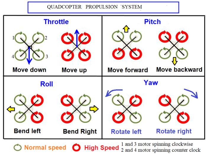
Drones use their rotors—which consist of a propeller attached to a motor—to hover, meaning the upward thrust of the drone is equal to the gravitational pull working against it; climb, when pilots increase the speed until the rotors produce an upward force greater than gravity; and descend, when pilots perform the opposite and decrease speed. To hover, two of a drone’s four rotors move clockwise, while the other two move counter clockwise, ensuring that the sideways momentum of the drone remains balanced. Drones (quadcopters) have two clockwise motors (1 and 3) and two counter clockwise motors (2 and 4) to equalize the turning force produced by the rotating propellers. Each rotor produces both lift and torque about its center of rotation, as well as drag opposite to the vehicle’s direction of flight. Greater the speed of rotor, greater the upward thrust & lift and greater the torque. If all four rotors are spinning at the same angular velocity, with two rotating clockwise and two counter clockwise, the net torque about the yaw axis is zero, which means there is no need for a tail rotor as on conventional helicopters. Flight control is provided by independent variation of the speed and hence lift and torque of each rotor. Pitch and roll are controlled by varying the net center of thrust, and yaw is controlled by varying the net torque. To control a quadcopter (quadrotor), instead of tilting the rotors, the entire vehicle tilts. By spinning one pair rotor (1 and 2) faster and another pair (3 and 4) slower, the quadrotor will tilt in the direction of the slower rotor. And to rotate in place, the quadrotor simply spins one pair of rotors (1and 3) faster and the other counter rotating pair (2 and 4) slower, generating a torque that rotates it about the yaw axis. By adjusting the pitch, your drone will sag down in the front causing it to go forward, or sag in the back causing it to go backwards. While moving forward and backwards—the rotors of the drone must apply thrust while making sure the spin of the rotors keeps the drone balanced.
In order to fly forward, you need a forward component of thrust from the rotors. Below is a side view (with forces) of a drone moving at a constant speed.
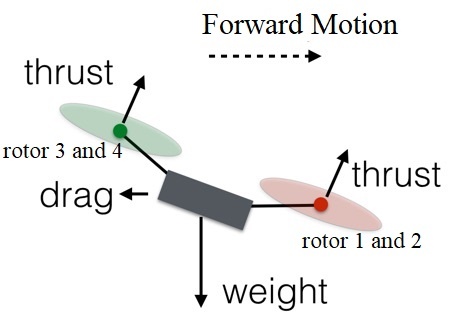
You increase the speed of rotors 3 and 4 (the rear ones) and decrease the speed of rotors 1 and 2. The total thrust force will remain equal to the weight, so the drone will stay at the same vertical level. Also, since one of the rear rotors is spinning counterclockwise and the other clockwise, the increased rotation of those rotors will still produce zero angular momentum. The same holds true for the front rotors, and so the drone does not rotate. However, the greater force in the back of the drone means it will tilt forward. Now a slight increase in thrust for all rotors will produce a net thrust force that has a component to balance the weight along with a forward motion component. So the drone flies forward.
To adjust its yaw, or make it turn left or right, the quadcopter applies more speed to one set of motors and less speed to another set of motors. To rotate the drone, decrease the spin of rotor 1 and 3 and increase the spin for rotors 2 and 4. The angular momentum of the rotors doesn’t add up to zero, so the drone body must rotate. But the total force remains equal to the gravitational force and the drone continues to hover. Since the lower thrust rotors are diagonally opposite from each other, the drone can still stay balanced.
Flying a drone is pretty easy as computer does all the work. But it is better to understand the physics behind it.
_
-18. Electronic Speed Controllers (ESC) is an electronic circuit that controls a motor’s speed and direction. It also acts as a dynamic brake. ESC controls the RPM to maintain the required altitude, speed or flight angle. As ESC receives signals from the flight controller, it changes the amount of power given to each of the motors.
_
-19. Drone Flight Controller is the brain of the drone. Flight controller is nothing more than a circuit board with electronic chips on them. You can compare them to the motherboard and processor in your laptop. The flight controller is a small box filled with intelligent electronics and software, which monitors and controls everything the drone does. The flight controller takes in inputs from the GPS module, compass, obstacle avoidance sensors and the remote controller, and processes it into information that is given out to the ESCs to control the motors. The flight controller is dedicated to provide a stable flight at all times. Systems equipped with GPS antennas can hold altitude and hover at any given position without having to rely on operator commands. An example of this is seen when a drone is hovering during windy conditions. In the past or if you have a cheap drone, it will just drift around as there are no sensors relaying information about the drone’s location and how to correct for these changes. In modern drone however, the drone knows its exact location from the GPS and the downward vision sensors, so even if wind is blowing it will stay in its exact place; this is because the flight controller sends the proper instructions to the ESCs and intern the motors to compensate for the wind factor. Just like how the human body uses a complex network of senses and nerves to balance itself when walking, multirotor drones use an impressive set of sensors and feedback mechanisms to stay in the air. Combining a mix of gyroscopic sensors and accelerometers, tilt sensors are tied into feedback loops with the drone’s motors through flight controller. Drones can also employ a variety of other sensors to monitor their internal systems and the world around them. The DJI Mavic 2 Pro and Mavic 2 Zoom have obstacle sensing sensors on all 6 sides. The Mavic 2 uses both Vision and Infrared sensors fused into a vision system known as omni-directional Obstacle Sensing. The Mavic 2 will sense objects, then fly around obstacles in front. It can do the same when flying backwards. Or hover if it is not possible to fly around the obstacle. This technology is known as APAS (Advanced Pilot Assistance System) on the DJI Mavic 2 and Mavic Air drones.
_
-20. There are a wide range of variables which determine how far a drone digital camera can see but, ultimately, it comes down to the number of pixels per foot the drone camera is able to detect at different distances. The standard measurement for the size of an object on a recorded video is pixels per foot (PPF). The higher the resolution of the camera the higher the number of pixels in the image; and the higher the resolution of the camera the further it can recognize individuals from a scene. For example, an 8K camera can identify people at approximately 150 feet in distance; whereas a 1080p camera cannot pick out any identifying features past 100 feet from the subject. Other factors besides camera resolution include zoom feature, field of view, and type of camera. How far a drone can see not only depends on the number of pixels per foot of the image but it also depends on the type of camera it is carrying. This can include thermal imaging and night-time cameras as well as lidar for 3D imaging and cloud point imaging of objects and infrastructure. We are most familiar with drones carrying an optical camera but it is not limited to this.
Because military drone cameras are incredibly high resolution it is likely they are able to see and recognize people from a much greater distance than civilian drones. Military drones have of 1-2 gigapixels cameras with frame rates of the order of 25 -100 frames per second and can resolve details as small as six inches from an altitude of 20,000 feet (6 km).
_
-21. A 1080p camera drone operating at night can recognize you from a distance of 5 foot only and with 4K camera drone at night can recognize you up to approximately 60 feet. At this distance, you will certainly be aware of the drone in your local area. That means that unless you are illuminating your own property or you have brought your own source of light, it is unlikely a drone with regular optical camera can identify anything about you or your property at night unless it gets very close to you.
_
-22. Gimbal technology is vital to capture quality aerial photos, film or 3D imagery. This is how drone footage is kept so still and stabilized. A motor is placed on the 3 different axes around the camera. When the sensors detect motion on any of these axes, the motors counteract the motion to cancel it. This happens almost instantly as thousands of calculations are executed to provide smooth footage.
_
-23. Modern drones are integrated with dual Global Navigational Satellite Systems or GNSS, which includes GPS and GLONASS. These drones can fly in GNSS as well as non-satellite modes. Radar positioning helps in accurate drone navigation and also displays the current position of the drone in relation to the controller. The Return to Home feature guides the drone back to the controller. All drones are designed to be remotely piloted from the ground using GPS. They can also fly autonomously if programmed to do so.
GPS navigation is not enough to solve the problem of collision avoidance. Here, the drone needs to be trained with a huge amount of data sets to make it learn and detect a wide variety of objects and obstacles, both static and in motion, and avoid them when moving at a high speed. Computer vision and AI in drones helps to track the objects while working for self-navigation and detect the obstacles to avoid a collision from such objects. Object tracking drone captures the real-time data during the flight, processes it with an on-board intelligence system in real-time, and makes a human-independent decision based on the processed data.
_
-24. The advancement in sensors has two primary impacts: data quality and automation. Better visual and thermal sensors capture ever-higher resolution images, which means drone data is more accurate and easier to use. The future of drone technology depends on sensors in many ways. From multispectral camera sensors for agriculture to thermal sensors for search and rescue, we have seen this technology changing. Further, chemical sensors can be attached to find out information about the chemical composition of an environment.
_
-25. FPV means “First Person View”. A video camera is mounted on the unmanned aerial vehicle and this camera broadcasts the live video to the user on the ground. The first person view (FPV) gives the user an ultimate feeling as if the user is flying. Nearly every camera drone out there lets you monitor a live view from its camera on a mobile device or controller with a built-in screen. While watching your camera feed on a smartphone can technically be referred to as FPV flying, drone enthusiasts generally consider true FPV to be flying with FPV goggles: video goggles that strap to your head for enhanced flight immersion and interactive 3D view experience. FPV allows the unmanned aircraft to fly much higher and further than you can from looking at the aircraft from the ground. FPV allows for more precise flying especially around obstacles. FPV allows unmanned aerial vehicles to fly very easily indoors, or through forests and around buildings. The exceptionally fast growth and development of the drone racing league would not be possible without FPV live video transmission technology. FPV aircraft are frequently used for aerial photography and videography. When using an FPV drone, a drone pilot must be assisted by an observer/spotter to keep the drone within unaided visual line of sight (VLOS) at all times and must be standing next to the drone pilot.
_
-26. UAV ground control station (GCS) will control the launch, flight, and recovery of the UAV. It also processes the data from the internal and external sensors of the payload. These stations can be as large as a desk with multiple views in a building to as small as a handheld controller or even an app on smartphone. The GCS can be user (remote pilot) controlled (user on the ground/ship/another aircraft) or operated via satellites and is capable of controlling flight, controlling payload sensors, providing status readouts, mission planning and tethering the data link system. Please do not confuse between drone controller and drone flight controller. Drone controller is separate/away from drone for controlling drone by human operator while drone flight controller is the brain of drone (chip + software) inside drone for controlling flight of drone. Drone controller communicates with drone flight controller via radio waves.
_
-27. Drones emit a buzzing sound, which is caused by motors and propellers that produce it during rotation. One of the flaws we can say that today’s drones have is their buzzing noise, which can sometimes get on nerves and can often be quite loud and annoying. They can bother other people in the area where you’re flying and are sometimes troublesome for the pilot themselves. Being exposed to the buzzing sound of a drone for a while is not detrimental to our ears, but exposure to that kind of sound all day can be detrimental. The sound of a drone in flight is about 75 decibels on average. The U.S. Environmental Protection Agency (EPA) and the World Health Organization (WHO) recommend maintaining environmental noises below 70 dB over 24-hours (75 dB over 8-hours) to prevent noise-induced hearing loss. Drones can’t be completely silent. A quiet drone is usually considered to be a drone that makes 65-70 decibels of sound from a distance of three to five feet away from you. The only way drones can reduce their noise by several decibels is by adding the appropriate type of silent propellers and propeller shrouds. The silent propellers are better than the classic ones because they are made with a new aerodynamic design and reduce the noise by about 3.5 dB. A shroud reduces the noise of the propeller by absorbing the sound and then reflects any residual noise up and away from people that are on the ground below. Other features that reduce noise include brushless motors and careful construction to reduce as much friction as possible with the motors, and specially designed insulator materials on its body to keep vibrations and shaking down.
The role of silent drones can be very important factor for the police, the military, animal monitoring situations and filming industry. When we talk about the police, they are increasingly using drones as a means of tracking suspects or in crisis situations where they send a drone to survey a hostage situation. Monitoring animals in the wild is one of the great advantages of drones but drones that make noise scare the same animals and thus cannot be monitored. As for the military, they also aim to keep the drones as quiet as possible for espionage and unnoticed shooting. When it comes to filmmaking, drones that make too much noise can spoil the recording with sound, and movie scenes must be recorded and assembled separately, which takes a lot of time and money.
_
-28. Most of the consumer drones available in the market are not able to record sound as most of them do not carry microphones and if you were to simply put a microphone on a drone it is likely that the microphone will pick up noise generated by motors and propellers, and wash out anything that could be heard in the distance. However, with special microphones and audio software, drones are able to listen to your conversations.
_
-29. Drones and artificial intelligence (AI) go hand in hand. What exactly AI offer to drones is autonomy, meaning systems that require no human input in the operation, and degree of autonomy varies from system to system. There are obvious goals to achieve: a flight path, an obstacle to avoid, a point of interest to survey. But aside from getting off the ground and the basic functions of today’s flying cameras, artificial intelligence is proving useful when it comes to the analysis of drone data. The goal of drones and artificial intelligence is to make efficient use of large data sets (such as aerial images) as automated and seamless as possible. Thanks to artificial intelligence software, drones can, for instance, map up to 2.7 million square miles (an area roughly as large as the contiguous 48 U.S. states). AI-based drones can continually identify and assess their surroundings and react accordingly. These capabilities are crucial for search and rescue, natural disaster response, agriculture, security, construction as well as military and defense applications.
_
-30. AI enabled drone can be remotely operated, automated or autonomous. An autonomous drone is able to conduct a safe flight without the intervention of a remote human pilot. It does so with the help of Artificial Intelligence (AI)-powered navigation and operational software, enabling it to cope with all kinds of unforeseen and unpredictable emergency situations. This is different from automatic operations, where the drone flies pre-determined routes using GPS navigation defined by the drone operator before starting the flight and many are already automated. Current drone technology has limitations. For instance, many functions are automated, but an expert is typically supervising the flight, ready to take control.
_
-31. Relatively speaking, it’s easy to design a UAV that can safely fly itself high over a city between two pre-defined points, or vertiports. But it’s much harder to design one that can deliver pizza to your front door in an urban environment. The most challenging parts of any flight are the approach, landing and takeoff. In an urban area, the pizza bot will need to perform these actions while avoiding houses, pets, people, clothes lines, weather, birds and other objects in the sky. Until an autonomous craft can perform these actions reliably in an urban setting, we have to collect pizza from delivery person.
_
-32. Drone capabilities are becoming key to the militaries in every country with units designed to perform high-speed, long-endurance, more covert, multi-mission intelligence, surveillance and reconnaissance and precision-strike missions over land or sea. Military drones represent the future of the national security presence for every nation. The rise of military drones to indispensability is unsurprising, given their high level of effectiveness, relatively low-price tag, and high degree of deniability they provide on the battlefield.
From military drone pilot’s perspective, drones have several key advantages. First, mission duration can be vastly extended, with rotating crews. No more trying to stay awake for long missions, nor enduring the physical and mental stresses of flying. In addition, drones provide far greater awareness of what’s happening on the ground. They routinely watch targets for prolonged periods—sometimes for months—before a decision is made to launch a missile. From his control station, drone pilot is not only watching the target in real time; he has immediate access to every source of information about it, including a chat line with soldiers on the ground.
Since drones are unmanned and operated remotely, it expels the possibility of losing soldiers by ordering them to enter dangerous terrains. Drones are often used for military purposes because they don’t put a pilot’s life at risk in combat zones. In addition, drones don’t require rest, enabling them to fly as long as there is fuel in the craft and there are no mechanical difficulties.
On the other hand, drones are only effective in attack roles when operating against targets with no air defence capabilities. Unlike a fighter jet pilot, drone operators cannot detect threats to the safety of their aircraft. Surface-to-air missiles therefore pose a much greater threat to drones than to other forms of military aviation. Drones are also ten times more prone to crashing than fighter jets – a problem that can only be overcome through expensive technical upgrades.
In the final analysis, military drones are well-liked because they present a low-cost option for locating and destroying low-tech adversaries.
_
-33. A drone strike is an air strike delivered by one or more unmanned combat aerial vehicles (UCAV) or weaponized commercial unmanned aerial vehicles (UAV). UCAVs may be equipped with such weapons as guided bombs, cluster bombs, incendiary devices, air-to-surface missiles, air-to-air missiles, anti-tank guided missiles or other types of precision-guided munitions, autocannons and machine guns. Commercial unmanned aerial vehicles (UAVs) can be weaponized by being loaded with dangerous explosives and then crashed into vulnerable targets or detonated above them. Payloads could include explosives, shrapnel, chemical, radiological or biological hazards. Multiple drones may attack simultaneously in a drone swarm.
_
-34. Large number of drones flying in coordinated process is known as drone swarm. In other words, drone swarm refers to multiple drones flying similar to flock of birds in order to perform coordinated tasks. The fact that components of the swarm can communicate with one another makes the swarm different from just a group of individual drones. The drone swarm system either can be remotely controlled or they are self-controlled based on automation algorithm built during their development. Applications include defensive and offensive military strategy, stage entertainment, spot spraying during fire outbreaks, hunting thieves, space exploration, Wi-Fi coverage and so on. Drone swarm technology could be used for delivering nuclear, chemical and biological weapons. The rapid proliferation of a new generation of artificial intelligence (AI)-augmented and -enabled autonomous weaponized drones used in swarming tactics, could have a significant impact on deterrence, nuclear security, escalation, and strategic stability in future warfare.
_
-35. Stealth drones are designed to minimize their radar cross-section (RCS) via low-observable features such as stealth coatings that absorb the radio waves of adversary radar and shaping measures that minimize radar reflection. Stealth combat systems, including ISR and armed UCAVs, represent the highest levels of technological sophistication – akin to the most advanced, fifth-generation fighter aircraft.
_
-36. Those who conclude that drones are effective in counterterrorism and counterinsurgency argue that they are more efficient and cost-effective in accurately targeting adversaries than alternative uses of force such as inhabited aircraft or teams of soldiers on the ground. The ability of drones to loiter for long periods of time over a target means that the attacker can gain better intelligence on the target and surrounding area, making a more accurate strike more likely. This reduces the risk of civilian casualties. From a purely military perspective, drone strikes may also decrease the capacity of militant groups to conduct subsequent attack. Johnston & Sarbahi (2016) use data on US drone strikes in Pakistan between 2007 and 2011 to show that drones reduce the risk of subsequent terrorist attacks.
An alternative line of argument suggests that drones are ineffective and lead to blowback that degrades the effectiveness of counterterrorism and counterinsurgency operations in many cases. Because its aim can never be perfect, can only be as good as the intelligence that guides it, from time to time it kills the wrong people. Investigative Journalism suggest that civilians made up between 7.27% to 15.47% of deaths in U.S. drone strikes. Critics also argue that the public in attacked locations tend to blame the attackers, not militant groups, meaning that attacks generate radicalization in the local population that makes further militant activity more likely.
_
-37. AI may enable autonomous UAS that serve as lethal autonomous weapons (LAWs) that would rely on AI to remove the human from targeting decisions. The only way to make a drone truly secure from hacking is to allow it to make its own decisions without a human controller: if it receives no outside commands, then it cannot be hacked (at least as easily). And that’s where LAWs might be the most attractive. Those who support the development of autonomous military drones also point to their ability to avoid human errors and emotions, freeing current pilots from the moral responsibility of casualties. However, other experts suggest that the refining process of all technology is fraught with errors, and in this case will result in deaths due to software bugs or errors in recognition. The idea that you could solve a crisis with a robotic weapon is dangerous. We cannot delegate life and death decisions to machines.
_
-38. Military drones – typically large aircraft carrying heavy payloads – are getting smaller and lighter, as military operations realize that drones can be used for a wide variety of applications in the field. And industrial drones are developing the technologies required for military applications: long endurance, ability to withstand tough terrain, and customizable payloads.
_
-39. Many commercial off-the-shelf (COTS) drones – including the best-selling model, the DJI Phantom – are now equipped with GPS and waypoint navigation systems. These systems enable the drone to accurately determine and hold its position, in turn removing the need for line-of-sight communications and allowing for autonomous flight. In the event that the operator loses contact with the system, this feature can return the drone to a predetermined location. Operators of pre-assembled systems can also take advantage of smartphone-based control systems, dramatically improving ease of use. Such systems enable the user to navigate the drone simply by selecting a destination on a map or even by merely tilting the user’s phone. Some COTS drones contain firmware that restricts flight in designated “no-fly zones,” such as those around airports and certain national security landmarks. While most are used for recreational purposes, they have also been used for public nuisance – generally in the form of unauthorized surveillance or flights over private property or restricted government areas.
_
-40. A commercial drone is any drone used for work. This means that commercial drones include both those drones that are made for specific types of jobs, and drones that are made for general consumers but can also be used in professional settings. Increasing work efficiency and productivity, decreasing workload and production costs, improving accuracy, refining service and customer relations, and resolving security issues on a vast scale are a few of the top uses drones offer industries globally. Because drones can be controlled remotely and can be flown at varying distances and heights, they make perfect candidates to take on some of the toughest jobs in the world. The most important feature of a drone is its ability to go to places that are difficult for a person to reach and the ability to zoom in and see things in detail. Drones possess the capability of reaching the most remote areas with little to no manpower needed and require the least amount of effort, time, and energy. As drone technology develops, people continue to find new ways to use drones to save money, improve safety, and increase efficiency in their operations. Current commercial off-the-shelf technology enables drones to perform aerial surveillance or deliver payloads of a few kilograms at ranges up to a few kilometers.
_
-41. Today, the application areas of drones are limitless. The technology that was once designed to destroy is now being used for the betterment of mankind. From wildlife conservation to disease control, emergency response, insurance to mapping, UAVs are being used in multiple sectors. The ability to safely and quickly gather data and to access inaccessible locations opens a world of possibilities for drone use. People use drones to collect data for things like surveying, mapping, or even to help investigators find human remains. Drones have become an eye in the sky to give us the view from above. They provide real-time, high-resolution imagery at a very low cost. Drone data is more likely to result in correct measurements in the first time, vastly reducing the time and cost of repeat site visits.
_
-42. Drones have taken the place of helicopters in many industries that require air support. Notable examples include police surveillance, news coverage, aerial mapping, and emergency response. Air supports is invaluable in these fields as it allows them to cover a lot of ground quickly and gives them a much wider vantage point than if they were restricted on the ground.
_
-43. Drones can save lives. Police departments, fire departments, public safety offices and law enforcement agencies of all varieties are using drones to gather intelligence, safely evaluate threats, assist in accident investigations, monitor large crowds, apprehend criminals, find lost hikers, even diagnose industrial accidents and explosions. Law enforcement and public safety agencies are significantly benefiting from using drones as first responders. In natural and manmade disasters, UAVs can be positioned to survey damage, locate stranded and injured victims, and assess ongoing threats without risking the safety of rescue teams and first-responders. Using sturdier industrial drones, with higher thresholds for temperature, wind and navigation loss; could lead to fewer human ventures into extreme situations like: hurricanes, tornadoes, floods, earthquakes, hail, volcanic eruptions, etc. UAVs are being deployed for disaster control and assessments ever since the Katrina hurricane in 2005, where roads were blocked by fallen trees, cars, road signs, etc. This helped in assessing the disaster consequences and in checking for missing, injured and trapped survivors. UAVs can be used for the purpose of searching for lost, scattered or stranded people, especially when human presence is deemed dangerous or limited. In case of a terrorist attack or a natural disaster (earthquake, floods), UAVs can act as hot spots or base stations, which allows for the collection of short messages sent by affected people, or used to alert response teams. In other cases, it helps in locating people based on their GPS location or MAC addresses. The UAV integrated with thermal imaging provides the ability to see through smoke, dust, light fog, and foliage. This technology allows the user to find persons even in total darkness – see much farther than with other low-light night vision goggles and cameras. Police, firefighters, rescue squads, and bystanders have used drones to save people from danger. In 2019, the Department of Defense made an official request for drones that can be deployed during a natural disaster to distribute food and water to affected areas.
_
-44. Dangerous jobs typically done by humans are slowly being replaced by drones. Drones present a powerful tool for collecting data remotely. In inspection scenarios, using a drone to collect data instead of a person can make a big impact on safety since it reduces the exposure of personnel to potentially dangerous scenarios, such as climbing a cell tower or walking along scaffolding inside a giant tank to collect visual data.
_
-45. Drones in agriculture are used for soil and field analysis, planting, crop spraying, crop monitoring, irrigation and plant health assessment.
_
-46. Weather forecasting maybe one of the use cases for drones with the highest payoffs, yet requires extensive expertise. The payoff being the reduction of human interaction with extreme weather. However, this is a highly complex use case where the weather could impact the performance of the drone. Using drones to capture important meteorology metrics like: temperature, wind speed & vector, humidity, and UV levels can help improve forecasting models and predictions.
_
-47. Drones can serve as flying mobile hot-spots for broadband wireless access. The main goal is to serve a massive number of users in a specific area.
_
-48. In developing nations and in areas with mountains, deserts, or forests, roads are impassable and take long-distance travel. Lack of access to roads is critical for medical supplies such as vaccines and drugs. Air transport like a helicopter is the only alternative so far, but it is expensive and not affordable to the patients or the health system. While medical supplies can be delivered by traditional means, certain circumstances call for quick access to drugs, blood, vaccines, anti-venom and medical technology — a need drones could fulfil.
_
-49. Coronavirus pandemic has helped countries around the world imagine the potential that drones hold for society. Uses of drones in response to COVID-19 include:
-1. lab sample pick-up and delivery and transportation of medical supplies in order to reduce the transportation times and minimize the exposure to infection
-2. aerial spraying of public areas in order to disinfect potentially contaminated places;
-3. public space monitoring and guidance during lockdown and quarantine. The biggest use case has been the deployment of drones to enforce social distancing and monitor crowds.
_
-50. Because satellites are easier to operate, work well in remote locations, and offer more consistency, it’s no surprise that they’re often the preferred solution for imaging large areas. Satellites are also better suited for customers interested in change detection, which requires the ongoing capture of images for comparison. Satellites tend to constantly map the entire planet and any changes can be analyzed. This is useful in the case of looking at things being built, being buried or being transported. Satellite imagery has played a pivotal role for almost two decades now. But it has several limitations concerning cost, data sharing and time. In contrast, drones can capture aerial imagery at a far higher resolution, more quickly and at a much lower cost. UAVs also have real-time streaming capabilities that enable quick decision-making. And unlike satellites, people can own drones. Drones are great to get the ‘micro’ view of fields but in certain cases, the satellite-provided ‘macro’ view can be more than enough for a given task. It all depends on the goals of the end user and what they want to accomplish. UAVs are cheaper so long as you want to cover a limited area and/or for a limited time, satellites are cheaper if you want to cover larger area and for longer time.
_
-51. The global market for drone technology is expected to grow from $30 billion in 2020 to $54.6 billion by 2025. By 2025 the U.S. drone industry will create more than 100,000 jobs and add $82 billion to the economy.
_
-52. With drones’ capability to move to any location and their incredible picture quality, citizens believe that UAVs violate individual privacy. No one wants drones peeking into their windows. It is essential to prevent the use of drones above residential areas, which leads to privacy breaches through reckless behaviours, since the captured footage may be used for either scamming and/or blackmailing purposes. To date, there have been several hundred documented cases of privacy violations using drones. People may approve of law enforcement using drones to track down fleeing suspects, but they worry about government agencies using drones to spy on innocent citizens. We need laws regarding drones which balance privacy concerns with the potential benefits of drones for search and rescue, delivering medical supplies, and other important functions.
_
-53. The assessment of accident records shows that the military and drone manufacturers have yet to overcome some fundamental safety hurdles: a limited ability to detect and avoid trouble; pilot error; persistent mechanical defects; and unreliable communications links. The public will not accept drone delivery if there is a substantial risk of drones falling from the sky. Companies such as Amazon, who are attempting to launch their delivery drone, are worried about the unmanned aircrafts crashing and hitting someone or something, in which they would be liable. Common causes of drone crash include weather, pilot error, flying beyond VLOS, no pre-flight check-up, interference, birds, poor battery etc. Civilian drones/UAVs can malfunction and crash into a nearby house or a group of people, causing property/material damage, and human injuries/fatalities, ranging from blunt force trauma, deep cut injuries (caused by drone blades) and laceration. Remote pilot of drone has not only to protect himself, and his aircraft, but also the people, property and other aircraft affected by his operation. About 400 large US military drones have crashed in major accidents since 2001. Predator drone crash occur more frequently than regular military aircraft which in turn crash more frequently than civil aviation. Military drones have crashed into homes, farms, runways, highways, waterways and in one case into a military transport plane (C-130 Hercules); in another case a drone crashed next to an elementary school playground in Pennsylvania.
_
-54. Overheating — and subsequent engine failure — is the most common cause of drone failure. This can be especially dangerous in military-grade drones, in which failure may cause a UAV to fall in a hostile territory, giving them access to sensitive information. Plus, losing a military drone can come with a price tag of millions of dollars. Even in civilian applications, drones are expensive pieces of equipment. Losing a drone can come with serious consequences, and may even result in injuries or property damage. Proper UAV thermal management, therefore, is imperative. In fact, adequate cooling is the key to long rotary engine life.
_
-55. One of the most frightening and heart-breaking things is watching your drone flyaway while you can’t do anything about it. Despite advancements made in transmission technologies, drone flyaways still continue to happen. A drone flyaway happens when your controller’s link to the drone is interrupted or completely lost thus making it difficult or impossible to control the drone. Other common causes include low battery, flying in poor weather conditions, GPS error, pilot error, and flying the drone too high or too far from your position.
_
-56. The reason that drones get attacked by birds is that the drone is flying in an area where birds are either nesting, hunting, or protecting a territory. Large birds of prey attack your drone because it looks like another bird. You can stop your drone from being attacked by a bird by making it bright and look less like prey, and avoiding natural bird habitats where they may be nesting or feeding.
_
-57. Air temperature, wind speed, precipitation, and other atmospheric phenomena have been shown to adversely affect drone endurance, control, aerodynamics, airframe integrity, line-of-sight visibility, airspace monitoring, and sensors for navigation and collision avoidance. There are weather situations when most drones should not and cannot fly. Precipitation damages electronics, high winds can cause loss of control, and cold weather can reduce battery life. On average there are only 10 hours a day when the weather lets up sufficiently to let drones fly safely. To achieve wider adoption of drones for time-sensitive operations such as emergency response, law enforcement, and package delivery, drones will be more effective if they are not limited by weather. The value of using drones for these applications is diminished if the drones cannot perform with reasonable uptime.
Remember, drones can’t use Regular Weather Forecasts. What’s complex about low altitudes is the severe lack of weather information at 0-1000 meters. In fact, this is the central complicating factor for all drone missions. No matter where they fly, UAVs have limited access to weather information related to visibility and winds, not to mention precipitation. This can lead to drones that are blown off-course, crash because of heavy rain, or are even struck by lightning.
_
-58. Drone operators must be aware of restricted airspace (such as near airports), temporary flight restrictions (for a special event), and any helicopters or small planes operating in the vicinity. Number of drones have been flown dangerously close to commercial aircraft, violating federal rules about their operation. During drone and manned aircraft collision, drones’ more rigid materials allow them to cause greater damage than birds. Small drone can get sucked quite easily into the propeller of a helicopter or an engine of an airplane and cause the aircraft to go down quite quickly. Regardless of their negligent use, drones have difficulty recognizing, communicating and avoiding other aircrafts or objects with the same degree of safety as manned aircrafts. There are simple technical solutions and tools for ensuring that drones don’t pose hazards to manned aircraft. FAA studies have proposed drone manufacturers adopt “detect and avoid” using computer vision & AI, and “geofencing” technology to avoid collisions. Always fly your drone below 400ft (120m) – this reduces the risk of any conflict with a manned aircraft or helicopter. Additionally safe flying zones could be defined for recreation purposes to keep drones from flying in random locations.
_
-59. Drones are being perceived as viable and vital threats to information security. Many UAVs have serious design flaws, and most of them are designed without wireless security protection and footage encryption. A hacker can potentially take control of the drone, or downlink video or other images which the drone is broadcasting to its base station. By jamming or intercepting the datalink, one can interfere with the drone’s controls. Moreover, drones are predominantly used to target guest Wi-Fi connections and/or short-range Wi-Fi, Bluetooth and other wireless devices, such as Bluetooth-connected keyboards. This makes it easy to intercept information in a private building and in a public café. An attacker would leverage such vulnerabilities to breach security, safety and/or privacy. It is essential to ensure that confidentiality, integrity, availability, authentication, and non-repudiation properties over communication channels are fulfilled. UAV manufacturers can make their UAVs more secure by the basic security measures of encrypting the Wi-Fi signal and adding password protection. Of course, you should not leave your home/office Wi-Fi router with the default username and password.
_
-60. National regulators protect drones in two important ways: (1) you cannot shoot them down or interfere with them physically (2) you must not interfere with signals between the controller and the drone. Malicious non-state actors take advantage of these protections. Malicious usages of drones include misuse by terrorists and/or criminals to launch malicious attacks such as having drones perform some types of physical or even logical attacks. Hobbyist drones are growing increasingly sophisticated – offering autonomous flight, high-end ISR capabilities, and ever-expanding payload capacity, range, and endurance. They are also widely accessible to potentially disruptive actors and due to their size, construction material, and flight altitude, hobbyist drones are difficult to defend against if their presence in a particular area is unknown or unexpected. These factors could in turn increase the likelihood that hobbyist drones could be weaponized and autonomously deployed in a terrorist attack against civilians or in an IED-like capacity against patrolling military personnel. Drones are also used to smuggle cigarettes, porn, drugs, mobile phones, blades, knives, SIM cards, USBs and weapons to prison inmates around the world.
_
-61. The presence of rogue drones can be detected by several different methods including Radio Frequency (RF) Analysers, Radars, Optical Sensors (Cameras) and Acoustic Sensors (Microphones). Each technology has pros and cons and experience has taught us that there is no single “fool proof” choice. As each detection method has its advantages and drawbacks, multi-sensor anti-drone systems will combine different sensor types along with sensor fusion algorithms to provide a complete integrated solution.
Once a rogue drone has been detected, many counter UAV systems provide the option to neutralize it. Anti-drone weapons can be categorized into two groups based on their capabilities: “soft kill” and “hard kill.” Anti-drone weapons systems use guns or missiles in conjunction with a targeting system to shoot down the drone. These are hard-kill anti-drone weapons. New military systems are also under development that will use a high-powered laser or microwave to destroy the target drone. These methods cannot be used in built-up or civilian areas as debris from a destroyed target may harm civilian population or their property.
Several methods of defeating drones can be utilised that do not result in the destruction or uncontrolled rapid descent of the drone. These are soft-kill anti-drone measures. Signals vital to the operation of the drone can be interrupted by generating other electromagnetic signals in the vicinity of the aircraft. The RF link between drone and pilot can be disrupted in this way, as well as the satellite link used for GNSS/GPS navigation. Anti-drone guns are handheld devices that interfere with RF communications, often disrupting multiple RF bands simultaneously. They may also disrupt GNSS signals, including GPS and GLONASS. Depending on the make, drones that have been jammed in this way may hover in place, descend safely to the ground, or return to a set “home” location. Some drones can also be hacked, using malware to exploit security vulnerabilities in the firmware and take control. These counter UAV methods will not work for all drones, as many are fitted with anti-jamming technology and use highly secure embedded systems and encrypted communications.
Anti-drone technology is deployed to protect areas such as airports, critical infrastructure, large public spaces such as stadiums, and military installations and battlefield sites. Although the technology is available, current regulations in most countries forbid the use of anti-drone technologies by public to be used for neutralizing drones. Exceptions are made for military or law enforcement agencies. You cannot shoot down UAVs hovering above your properties. Remember, uncrewed aircraft of any dimension are protected by national law. You also cannot use anti-drone gun or drone jammer against a rogue drone over your property. That means that the person operating the jammer will have to be licensed and authorised by the federal government.
_
-62. Traditional military and civil aviation radar systems, which are designed to pick up large aircraft, may struggle to pick up smaller drones, or to distinguish them from other objects such as birds. They may also find it difficult to deal with drones that move slowly or hover. Drones are smaller than manned aircraft and tend to fly close to the ground which makes them very difficult for all but the most specialized radar to detect. Drones are mostly made of plastic which is invisible to radar and only their metal cameras, batteries and motors provide a platform for the radar signals to bounce off. High-resolution radars are specifically designed for drone detection and tracking. Reflected signals are analyzed and compared to a database for drone characterization. Radar can also provide real-time tracking by providing the GPS location of the drone detected.
_
-63. One of the biggest threats to troops is a swarm of cheap drones that can overwhelm the expensive defense systems troops have on hand now. A swarm of such drones could potentially overwhelm high-tech systems, generating significant cost-savings and potentially rendering some current platforms obsolete. To counter such a threat, the military needs a weapon that can hit the target and won’t run out of ammo as the swarm approaches. Troops can activate the laser/microwave weapon system, or choose to use a cyber system like ICARUS, to take down the threat of drone swarms. The laser/microwave weapon system can fire over and over, essentially creating an unlimited magazine of ‘bullets.’
_
-64. In many cases today, technology has evolved quicker than its corresponding regulation; drones are no exception. Affordable, high-efficiency drones entered the market and began to be widely used before regulators could react. Although great efforts have been made in many cases, there is still a lack of comprehensive and useful regulation framework that safely regulates the use of drones while not hampering their integration. The potential benefits that drones can bring to society and potential harms that misuse of drones can cause to society ought to be somehow balanced. New regulations must be created and enforced to provide possible solutions, but also the current law can be interpreted in order to incorporate new emerging uses of the drones. Cooperation between nations in regards to airspace jurisdiction is compulsory, common standards and common regulations must be adopted to ensure the safety of people and property on the ground.
_______
_______
Dr Rajiv Desai. MD.
December 20, 2021
______
Postscript:
Drones are providing users with a bird’s eye that can be activated and used almost anywhere and at any time. As world witnessed a significant increase in the number of drones uses, the malicious use of drones began to emerge among criminals and cyber-criminals alike. The probability and frequency of these attacks are high and their impact can be very dangerous with devastating effects. Therefore, detective, protective and preventive counter-measures are highly required.
_______
71 comments on “DRONE”
Leave a Reply

Everything is very open with a very clear clarification of the challenges. It was really informative. Your website is extremely helpful. Many thanks for sharing!
This guide will help you to take your business as well as individual abilities to the following degree!
Phenomenal is a time administration tool that will certainly help you be extra productive than ever.
Sensational is the only performance tool you need.
I’m amazed, I must say. Rarely do I encounter a blog that’s equally educative and interesting, and without a doubt, you’ve hit the nail on the head. The issue is an issue that too few folks are speaking intelligently about. Now i’m very happy that I found this during my search for something concerning this.
My brother suggested I might like this blog.He was totally right. This post actually made my day. You can not imagine simply how muchtime I had spent for this info! Thanks!
Hello! This is my first visit to your blog! We are a collection of volunteers and starting a new project in a community in the same niche. Your blog provided us beneficial information to work on. You have done a marvellous job!
woww.. your article is good. its helpful me.. keep posting buddy
Awesome article.Really looking forward to read more.
Has anyone ever tried Ruthless eJuice on Ice E-Juice?
I blog quite often and I seriously appreciate your content. This article has really peaked my interest. I will book mark your website and keep checking for new details about once per week. I subscribed to your RSS feed as well.
Thank you for helping out, great info. “It does not do to dwell on dreams and forget to live.” by J. K. Rowling.
I’m not sure here you’re getting your information, but good topic.I needs too spend some time learning much more or understanding more.Thanks for great informmation I was looking for this information formy mission.
I truly appreciate this article post.Much thanks again.
Hi my loved one! I wish to say that this post is awesome, great written and include almost all significant infos. I would like to see more posts like this.
I appreciate, cause I discovered exactly what I used to be having a look for.You’ve ended my four day long hunt! God Bless you man. Have a niceday. Bye
Hi there, just wanted to mention, I loved this post. It was practical.Keep on posting!
You made some really good points there. I checked on the internet for additional information about the issue and found most individuals will go along with your views on this web site.
I blog often and I really appreciate your information. The article has really peaked my interest. I’m going to book mark your website and keep checking for new details about once per week. I subscribed to your Feed too.
I could not refrain from commenting. Well written!
Major thanks for the post.Really thank you! Will read on…
Thanks , Ihage just been looking for info about thissubject for a while and yours is the greatest I have found outttill now. But, what concerning the conclusion? Are you sure in regards tto the source?
You are so cool! I do not believe I’ve truly read through anything like this before. So wonderful to find another person with a few unique thoughts on this subject matter. Really.. thank you for starting this up. This web site is one thing that’s needed on the internet, someone with some originality.
Saved as a favorite, I really like your blog!
I would like to thank you for the efforts you have put in writing this blog. I really hope to view the same high-grade blog posts by you later on as well. In fact, your creative writing abilities has inspired me to get my own blog now 😉
I cannot thank you enough for the article post.Really thank you! Keep writing.
I’m a housewife significado de decacordio en la biblia Appearing at the Cheltenham Literature Festival to speak about her last novel, A Commonplace Killing, he said he still finds himself asking her advice in a “challenging situation”.
I value the blog article. Keep writing.
I really liked your blog article. Want more.
Enjoyed every bit of your post.Really looking forward to read more. Really Cool.
Hello! I just want to give you a huge thumbs up for the excellent information you have right here on this post. I am returning to your site for more soon.
A motivating discussion is definitely worth comment. I think that you need to publish more about this subject matter, it might not be a taboo subject but typically people do not talk about these topics. To the next! All the best!
Very interesting subject, thank you for posting.
Saved as a favorite, I love your blog.
You can certainly see your skills in the article you write.The world hopes for more passionate writers such as you whoare not afraid to say how they believe. At all times go after your heart.
Im thankful for the blog post.Really looking forward to read more. Fantastic.
This is a good tip especially to those fresh to the blogosphere. Simple but very precise infoÖ Thank you for sharing this one. A must read post!
You made some decent points there. I looked on the internet for more info about the issue and found most people will go along with your views on this site.
Very good post. I will be dealing with a few of these issues as well..
Por lo general, tu erección comenzará a desinflarse en un par de minutos.
May I simply say what a relief to discover somebody that genuinely knows what they’re talking about online. You certainly know how to bring an issue to light and make it important. More and more people should check this out and understand this side of your story. I was surprised that you aren’t more popular because you certainly possess the gift.
Right here is the right blog for anybody who really wants to find out about this topic. You know a whole lot its almost hard to argue with you (not that I actually would want to…HaHa). You definitely put a fresh spin on a subject which has been discussed for a long time. Wonderful stuff, just excellent.
I think this is a real great article.Much thanks again. Really Cool.
This is one awesome article post.Really looking forward to read more. Want more.
I am extremely impressed with your writing abilities as neatly as with the layout to your blog.Is this a paid theme or did you modify it yourself?Anyway keep up the nice high quality writing, it isuncommon to look a great blog like this one today..
Greetings! Very helpful advice in this particular post! It is the little changes which will make the greatest changes. Thanks for sharing!
Very good blog post.Really thank you! Will read on…
Muchos Gracias for your blog. Keep writing.
I think this is a real great blog post.Really thank you! Keep writing.
I think this is a real great post.Really looking forward to read more. Cool.